
Birm-166’s Freshwater Window31603 BCE
31,603 BCE is not a recoverable Irish historical year but falls within Marine Isotope Stage 3, a climatically unstable Late Pleistocene period. At Derryvree, Fermanagh, freshwater silts and organic beds between two tills show that ice retreated locally, allowing tundra wetlands, pools, sparse vegetation and fauna before renewed glaciation. Greenagho and Crag Cave support episodic ice-free or milder conditions. Southern caves indicate reindeer, mammoth, hyaena and wolves, though dates and deposits are uncertain. A tool-marked reindeer bone from Castlepook may suggest a brief human visit, but cannot demonstrate settlement. Later ice sheets buried or destroyed much evidence, requiring cautious interpretation.
Dateline
“31,603 BCE” is a modern chronological label, not a recoverable Irish calendar year. No written record, annually resolved archaeological layer or dated settlement sequence can tell us what happened in Ireland in that particular year. Counted mechanically from the conventional radiocarbon baseline of AD 1950, it falls around 33,552 years before present (cal BP). The responsible subject is therefore a broad Late Pleistocene window within Marine Isotope Stage 3 (MIS 3), not an event, ruler or community identifiable to a single year. Ireland’s evidence consists chiefly of deposits beneath later glacial sediments, cave-bone assemblages and the landforms left by ice.
A Date Range, Not a Dateline
Radiocarbon measurements are not calendar dates waiting to be read straight from a specimen. Atmospheric carbon-14 changed through time, and a laboratory result must be calibrated against independently dated records. At more than 30,000 years ago, even good calibration produces wide probability ranges rather than a precise year. The most useful near-contemporary Irish result is from Derryvree near Maguiresbridge, County Fermanagh: organic sediments there gave a conventional age of 30,500 radiocarbon years BP, with a substantial uncertainty. Published calibration places that material broadly between about 36,900 and 31,700 cal BP. Thus 31,603 BCE lies within the possible age range of the deposit, but neither at a demonstrable beginning nor end of the environment it records.
This distinction matters. A nominal BCE year is useful for arranging an archive, but it must not create a false picture of precision. The Derryvree date could represent organic matter accumulated over a span of time; the exposed section records local conditions rather than an island-wide weather report. Its importance is nevertheless considerable. It is one of the rare Irish sequences which preserves a landscape from before the great late-glacial expansion of the Irish sector of the British–Irish Ice Sheet.
Freshwater Between Two Glaciers
Derryvree was revealed in road excavations through a drumlin, a streamlined hill later shaped by glacier ice. The section showed two distinct layers of till, debris deposited directly by ice, with freshwater silts and fine sands between them. That simple arrangement supplies a powerful relative sequence: an earlier ice advance deposited the lower till; ice had withdrawn sufficiently for water, sediment, plants and small animals to occupy the site; a later advance covered the deposit with fresh till and preserved it beneath the drumlin. The landscape around Maguiresbridge was therefore not continuously sealed under ice throughout the last cold stage.
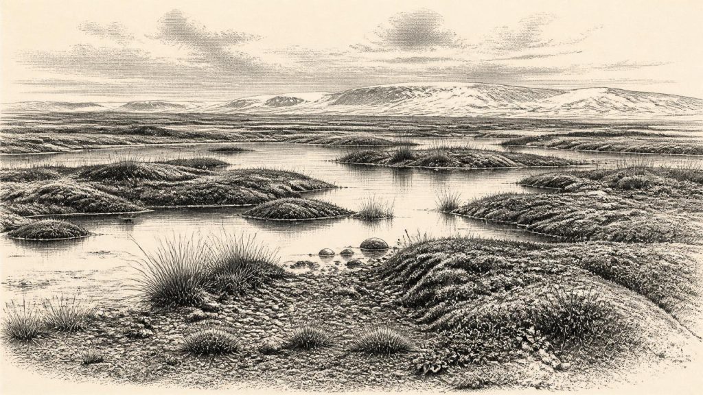
The organic beds yielded pollen, plant remains and insects described as having a full-glacial character. Their combined evidence indicates open tundra or muskeg: wet, largely treeless ground, with pools and saturated margins amid sedges, mosses, herbs and low vegetation. Frost was an active force in soil and drainage. This was not the later wooded Ireland of hazel, oak and ash, nor a featureless white desert. It was a cold, exposed mosaic in which shallow water, marshy ground, gravel and sparsely vegetated surfaces could lie close together. Such habitats could alter markedly with season, drainage and the shifting position of nearby ice.
Greenagho, also in Fermanagh, offers supporting but earlier evidence. Organic material from lake deposits below till was dated to roughly 37,200–35,700 cal BP. Together, Greenagho and Derryvree demonstrate that north-central Ireland contained ice-free freshwater environments during portions of MIS 3. They do not prove that every coast, upland or river basin was simultaneously open. The island’s relief, Atlantic exposure and changing glacier margins ensured regional variation.
Before the Last Maximum
This period came before the climatic and glacial culmination generally called the Last Glacial Maximum. Globally, maximum ice volume and lowest sea level are commonly placed around 26,500–19,000 years ago, although individual ice sheets reached their greatest limits at different times. In Ireland, the later ice sheet profoundly reworked older landscapes, carrying debris, gouging basins and depositing the tills that now conceal the Derryvree sediments. The freshwater record is therefore valuable partly because such evidence is unusual: the processes that made the modern landscape also destroyed or buried much of the evidence for what preceded them.
MIS 3 itself was climatically unstable. Greenland ice cores and North Atlantic records show repeated abrupt shifts between colder stadials and relatively milder interstadials. Irish deposits cannot be matched to every one of these oscillations with certainty, but they belong to the same volatile climatic world. Calcite growth in Crag Cave, County Kerry, provides an additional regional indication that episodes sufficiently mild for liquid water and cave-drip formation punctuated the longer cold phase. The evidence supports variability, not a fixed national climate.
Animals in Cave Country
Southern Irish caves add a different kind of evidence. Castlepook Cave near Doneraile, County Cork, produced remains attributed to reindeer, mammoth, spotted hyaena, wolf and other Pleistocene animals. The Irish Quaternary Fauna Project concluded that a varied mammal fauna reached Ireland sometime between at least 45,000 and 20,000 years ago. That broad conclusion makes an Ireland inhabited by large, cold-adapted mammals entirely credible around the chronological horizon represented by 31,603 BCE.
Yet cave assemblages require caution. Many Irish cave bones were excavated long ago, often from complex deposits with limited recorded stratigraphy. Carnivores could drag carcass portions into caves, gnaw and scatter them; water, collapse and earlier digging could mix materials of different ages. Modern re-dating has shown that some earlier radiocarbon determinations for MIS 3 bones from southern Ireland were significantly too young, by roughly 5,000 to 12,000 radiocarbon years. Castlepook is thus strong evidence for a Pleistocene faunal world, but weak evidence for reconstructing one simultaneous animal community or a particular year’s hunt.
The Human Question at Castlepook
The most tantalising human question concerns a reindeer femur from Castlepook. A deep mark on the bone has been interpreted by zoologist Ruth Carden as an incision made by a sharp stone tool during carcass processing. County Cork heritage material presents the object as Palaeolithic and approximately 31,000 BC, and suggests that the animal may have been butchered outside the cave before remains were scavenged or carried inside by carnivores. If that interpretation is correct, it would indicate a human visit to Ireland far earlier than the securely evidenced late-glacial and early-Holocene occupations usually discussed in Irish prehistory.
It must remain an interpretation rather than a foundation myth. No stone tool securely associated with the femur has been recovered; nor is there a hearth, dwelling surface, burial, human bone, art assemblage or repeated processing area of comparable age in Ireland. The marked bone cannot tell us whether people killed the reindeer, found a carcass, removed meat, hide or sinew, or stayed for hours rather than days. It may signal a brief Upper Palaeolithic encounter, but it does not establish a settled population, a named culture or continuous habitation.
What Cannot Be Written
Accordingly, political affairs, diplomacy and organised warfare cannot responsibly be described for Ireland at this date. There were no states, kingdoms, documented territories or identifiable leaders. Nor is there evidence for an Irish religion, language, artistic tradition, trade system or formal learning. Even everyday human life is unknown, because a human presence at this depth of time is presently represented by a disputedly interpreted mark rather than a settlement. The absence of such evidence should not be confused with proof that nobody ever crossed the landscape; it defines the limit of what the surviving record can show.
If people did reach Ireland during this phase, the wider European comparison suggests small, mobile hunter-gatherer groups able to exploit seasonal animal and plant resources. But that is an inference from the Upper Palaeolithic world beyond Ireland, not a demonstrated social description of people at Derryvree or Doneraile. Reindeer and other mammals may have moved through open country in seasonal patterns, but Irish evidence does not reconstruct their routes, herd sizes or human hunting strategies. Trade, seafaring and enduring exchange networks are likewise unproven.
A Fragile Window
The central historical development near this notional date was environmental: an unstable cold-phase Ireland still capable, in some districts, of sustaining freshwater wetlands, tundra vegetation and substantial animal life before later ice expansion transformed the island. Derryvree’s value lies in that narrow window between tills. It shows that Ireland’s Ice Age history was neither a simple tale of permanent ice nor a settled human past awaiting names and events. Around 31,603 BCE, the evidence permits a careful picture of water, frost, open ground, animals and changing ice margins—and requires intellectual restraint about almost everything else.
Primary Sources
- A Middle Midlandian Freshwater Series at Derryvree, Maguiresbridge, County Fermanagh, Northern Ireland
- Middle Midlandian Interstadial Deposits at Greenagho, Near Belcoo, County Fermanagh, Northern Ireland
- Trimlines, Blockfields and the Vertical Extent of the Last Ice Sheet in Southern Ireland
- A Reconsideration of the Radiocarbon Dating of the Marine Isotope Stage 3 Fauna from Southern Ireland
- The Irish Quaternary Fauna Project
- Freshwater Organic Deposits and Stratified Sediments between Early and Late Midlandian (Devensian) Till Sheets, at Aghnadarragh, County Antrim, Northern Ireland
- Episodic Speleothem Deposition Tracks the Terrestrial Impact of Millennial-Scale Last Glacial Climate Variability in SW Ireland
- Growth and Retreat of the Last British–Irish Ice Sheet, 31,000 to 15,000 Years Ago: The BRITICE-CHRONO Reconstruction
- Behavioural Tendencies of the Last British–Irish Ice Sheet Revealed by Data–Model Comparison
- Late Pleistocene Chronostratigraphy and Ice Sheet Limits, Southern Ireland
- The IntCal20 Northern Hemisphere Radiocarbon Age Calibration Curve (0–55 cal kBP)
- IntCal Publications
- The Last Glacial Maximum
- The Nature of MIS 3 Stadial–Interstadial Transitions in Europe: New Insights from Model–Data Comparisons
- Heritage Artefacts of County Cork
- Irish Quaternary Association Guide 17: Irish Pleistocene Biostratigraphy
- Quaternary Site Descriptions
- Quaternary
- Aghnadarragh
- New Insights on the Fauna of Ireland’s Younger Dryas and Early Holocene from Alice & Gwendoline Cave