
Mammoth Cave’s Narrow Window30160 BCE
Around 30,160 BCE, Ireland experienced unstable Late Pleistocene conditions during Marine Isotope Stage 3, rather than a datable historical year. Derryvree, County Fermanagh, records a cold freshwater interval between glacial advances, with tundra vegetation, wetlands and sparse treeless terrain. Crag Cave speleothems indicate intermittent milder phases. Castlepook Cave, County Cork, preserves fauna including mammoth, reindeer, giant deer and carnivores, though its disturbed deposits limit precision. A cut-marked reindeer femur may suggest an early human visit, but cannot prove permanent settlement. Changing ice, sea levels and landscapes allowed occasional animal movement, while evidence remains fragmentary and regionally specific in character overall.
Dateline
30,160 BCE is a modern label for a point in deep time, not a year that anybody in Ireland could have named, recorded or commemorated. No Irish calendar, settlement sequence or historical narrative can be resolved to this degree of precision. In calendar terms the label falls roughly 32,100 years before AD 1950, during the Late Pleistocene, within Marine Isotope Stage 3 (MIS 3), an exceptionally changeable phase of the last Ice Age. The responsible approach is therefore to describe a broad archaeological and environmental horizon around the date, using calibrated ranges where they exist, rather than to invent an event for one nominal year.
The strongest evidence places this horizon before the fullest expansion of the last British–Irish Ice Sheet, but amid a period of severe cold and advancing or fluctuating ice. Ireland was not a stable, familiar island landscape. Glaciers, permafrost, lowered sea level, shifting rivers and sparse vegetation continually altered the ground on which animals—and perhaps people—could move. What survives is fragmentary because subsequent ice repeatedly eroded, transported and buried older deposits.
A Date Beyond Annual History
The nearest unusually informative Irish environmental record comes from Derryvree, near Maguiresbridge in County Fermanagh. Roadworks in 1969 cut through a drumlin and exposed a remarkable succession: a lower glacial till, freshwater silts and fine sands containing organic material, and a later upper till. Till is sediment deposited directly by glacier ice. The sequence demonstrates a local order of events: ice had occupied the site; a period followed in which open water, sediment and plants accumulated; then ice returned and sealed the deposit.
Organic material from the freshwater layer produced the radiocarbon determination BIRM-166, conventionally reported as 30,500 radiocarbon years BP with a substantial uncertainty. This is not a calendar date. Atmospheric carbon-14 levels varied in the past, and the older the sample, the broader and more complex calibration becomes. Modern calibration and Bayesian modelling have been used to place the relevant ice-free or ice-marginal phase at approximately 33.5 ± 1.2 thousand calibrated years BP. That range can encompass the modern label 30,160 BCE, but it cannot identify a particular day, season, generation or episode at Derryvree.
Nor can one Fermanagh road cutting stand for the entire island. It is direct evidence for a particular locality and interval, not proof that all Ireland was simultaneously free of ice. Its value lies precisely in showing that the simple image of a uniformly ice-covered Ireland throughout the last cold stage is wrong. Conditions varied sharply by region and through time.
A Treeless Freshwater Landscape
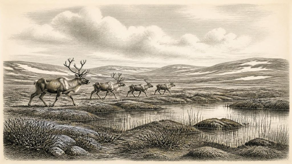
The plants, insects and sediments at Derryvree indicate a cold, open, periglacial environment. Periglacial means land affected by freezing and thawing at the margins of glaciers or beneath very cold climates, rather than necessarily lying under ice. The organic beds contain evidence of freshwater and wet ground: mosses, sedges and aquatic plants including water-milfoil and bogbean. Dwarf willow, mountain avens and lesser clubmoss belong to a low-growing flora well suited to exposed, cold conditions.
This was not a forested Ireland. Trees could not form the dense cover associated with later post-glacial landscapes. Instead, the evidence supports a mosaic of shallow water, saturated ground, herb-rich tundra and bare or seasonally unstable surfaces. In a landscape with short growing seasons, protected wet margins could be ecologically valuable: plant growth, invertebrates and fresh water would have been concentrated there. But it would be misleading to picture a benign oasis. Frost, snow, wind and abrupt climatic shifts shaped everyday conditions for every living thing.
Crag Cave in County Kerry adds a separate kind of evidence. U-series dating of cave calcite shows that speleothems in south-west Ireland grew episodically during the last glacial period. Because calcite deposition in a shallow cave requires liquid water and conditions generally above freezing, these growth phases signal intervals of relative climatic improvement rather than a permanently frozen country. They reinforce the picture of an Ireland responsive to rapid North Atlantic climate oscillations. They do not, however, provide a detailed weather report for 30,160 BCE or establish that all regions shared the same conditions.
Animals at Castlepook
County Cork provides the principal faunal counterpart to Derryvree. Castlepook Cave, near Doneraile and also known historically as Mammoth Cave, produced one of Ireland’s most important Late Pleistocene animal collections. It includes remains attributed to woolly mammoth, reindeer, giant deer, brown bear, wolf, fox, Arctic fox, spotted hyaena, lemmings and mountain hare. The combination evokes open cold-country habitats and a food web unlike that of modern Ireland.
Yet the cave assemblage requires care. Many bones were recovered during early twentieth-century excavations, when recording standards differed greatly from modern practice. Caves are also complex places: carnivores may drag in prey; water and collapse can move bones; and remains from different centuries or millennia may become mixed. Recent radiocarbon reassessment has shown that some older Irish cave dates needed revision, while confirming the importance of MIS 3 fauna at Castlepook. The animals demonstrate that such species reached or lived in parts of Ireland during the wider period; they do not prove that every species shared the same valley at one moment.
For people, such animals would have represented both opportunity and danger. Reindeer and large deer could supply meat, fat, hide, sinew and bone; carnivores competed for carcasses and used caves as dens. But this is an ecological inference, not direct evidence for a human camp in Cork at this exact horizon.
The Reindeer Femur Question
The most consequential possible trace of people is a reindeer femur from Castlepook. Zooarchaeologist Ruth Carden identified a deep linear mark interpreted as damage from a sharp stone implement applied while the bone was fresh. Public heritage material places the object broadly around 31,000 BC, while reports of its radiocarbon result commonly describe it as about 33,000 years old. If the mark is confirmed as a butchery cut, it would indicate that people reached Ireland much earlier than the long-established evidence for post-glacial settlement.
The implication must be stated narrowly. A marked bone is not a house, hearth, tool kit, burial ground or village. It does not reveal the hunters’ language, ancestry, group size, route, length of stay or whether they killed the animal themselves. No securely associated occupation surface or stone-tool assemblage of comparable age has yet been recovered from Castlepook. The cave’s disturbed antiquarian collection also makes original context difficult to reconstruct. Thus the femur is best treated as important proposed evidence for a brief human encounter with a reindeer, not proof of permanent occupation or a continuous Irish population.
Society Without States
There is no evidence for political institutions, named communities, leaders, diplomacy, warfare, territorial boundaries or organised religion in Ireland at this time. There were no farms, fields, monuments, metalwork, writing or trade networks documented on the island. To describe chiefs negotiating alliances or clans fighting over hunting grounds would be fiction.
If people did make short visits, comparisons with Upper Palaeolithic communities elsewhere in north-west Europe suggest practical capacities rather than specific Irish customs: collaborative hunting or scavenging, knowledge of animal movement, stone-working, fire, clothing and the sharing of food in dangerous weather. These are reasonable possibilities derived from the wider European record, but none is demonstrated directly in Ireland around 30,160 BCE. There is likewise no local evidence for art, ritual, formal burial or teaching traditions, although learning must have been essential wherever people survived in cold environments.
Movement, Coasts and Isolation
Lower global sea levels changed the shape of the Irish Sea basin, but did not automatically create a simple, permanent walking route between Ireland, Britain and continental Europe. Ice margins, sea level, rivers and coastlines all changed through MIS 3. Any human arrival would have depended on the conditions prevailing at the time: exposed terrain may have eased some journeys, while ice, cold water, marshes and broad channels obstructed others. The exact geography of a route to County Cork or Fermanagh cannot be reconstructed for this single nominal year.
Animal evidence nevertheless demonstrates that Ireland was not biologically isolated in an absolute sense. Mammals entered during suitable phases, whether across changing land, ice-marginal or coastal corridors. Their presence helps explain why human exploration is plausible. It does not show that people followed the same route, nor that movement amounted to regular exchange or trade.
An Archive of Limits
The most important development around 30,160 BCE was environmental instability. Derryvree preserves a cold freshwater interval between episodes of glaciation; Castlepook preserves a rare glimpse of Ice Age fauna; Crag Cave registers intermittent conditions capable of sustaining liquid water underground. Together these archives show an Ireland in transition, with habitable patches and animal movement possible in some places, but with renewed extensive glaciation approaching in the following millennia.
This is a history of evidence rather than certainty. It supports a treeless, cold and regionally varied landscape, rich enough in particular habitats to sustain specialised plants and animals. It supports the possibility—perhaps the first currently proposed possibility—of a human visit. It does not support an annual narrative, a settled society or a national story in the modern sense. At this depth of time, Ireland’s past is recovered not from chronicles but from silts beneath a drumlin, calcite in a cave and a single contested mark on reindeer bone.
Primary Sources
- A Middle Midlandian Freshwater Series at Derryvree, Maguiresbridge, County Fermanagh, Northern Ireland
- The IntCal20 Northern Hemisphere Radiocarbon Age Calibration Curve (0–55 cal kBP)
- Growth and retreat of the last British–Irish Ice Sheet, 31,000 to 15,000 years ago: the BRITICE-CHRONO reconstruction
- Spatio-temporal dynamics of speleothem growth and glaciation in the British Isles
- Episodic speleothem deposition tracks the terrestrial impact of millennial-scale last glacial climate variability in SW Ireland
- A reconsideration of the radiocarbon dating of the Marine Isotope Stage 3 fauna from southern Ireland
- Occurrence of mammalia relicts at site Castlepook Cave
- The Irish Quaternary Fauna Project
- Pleistocene vertebrates in the British Isles
- Pleistocene glaciations in Ireland
- Pattern and timing of retreat of the last British-Irish Ice Sheet
- Exploring controls of the early and stepped deglaciation on the western margin of the British Irish Ice Sheet
- 32564 – CASTLEPOOK CAVE, Castlepook South, Cork
- Heritage Artefacts of County Cork
- The Mesolithic in Ireland: when was it?
- The Ice Age in Ireland
- Periglacial wedge-casts and patterned ground in the midlands of Ireland
- Proceedings: Postglacial Colonisation Conference
- Rapid response of climatic conditions during the last glacial: evidence from U-series dated Irish speleothems
- The Last British-Irish Ice Sheet in Northeast Ireland
