
The Derryvree–Castlepook Interval31566 BCE
31,566 BCE is best understood as a broad late Pleistocene interval rather than a dated Irish event. Freshwater sediments at Derryvree, Fermanagh, show episodically ice-free, cold, treeless wetlands between glacial advances, while Castlepook Cave, Cork, preserves fauna including reindeer, mammoth, giant deer, bear, wolf, Arctic fox and hyaena. These records indicate a changing Atlantic landscape, with intermittent milder conditions and uncertain animal routes. A possibly cut-marked reindeer bone hints at Upper Palaeolithic human activity, but proves neither settlement nor society. Subsequently, the British–Irish Ice Sheet expanded, covering much of Ireland and obscuring this fragile Ice Age world over later millennia.
Dateline
The label 31,566 BCE is useful as a point on a modern timeline, but it cannot identify an event in Ireland in the way that it might for a medieval battle or an Act of Parliament. No community then used a calendar that can be translated into that year, and neither radiocarbon dating nor glacial sediments normally supplies annual precision at a distance of more than 33,000 years. In radiocarbon terms, this notional date falls at roughly 33,500 calendar years before present, within the later Pleistocene and Marine Isotope Stage 3. The responsible subject is therefore an interval: a changing Ice Age Ireland, reconstructed from sediment, plant remains, cave bones and the physical traces of advancing ice.
Two places give this interval an unusually Irish focus. At Derryvree near Maguiresbridge, County Fermanagh, freshwater deposits survived beneath a drumlin. At Castlepook Cave near Doneraile, County Cork, a remarkable assemblage of animal bones records a cold-stage fauna. Neither site is an annual diary, and their dates have wide margins. Taken together, however, they show that parts of Ireland supported plants and animals before the last great expansion of the British–Irish Ice Sheet transformed much of the island.
Dating a Landscape, Not a Year
Derryvree was exposed during roadworks in 1969. Beneath a later glacial deposit, and above an older one, lay organic silts and fine sands formed in freshwater conditions. This sequence is important because the tills above and below it were laid down by ice. Between two phases of glaciation, there had been an interval in which water pooled, sediments accumulated, plants grew and insects lived. A conventional radiocarbon determination of 30,500 ± 1,100 radiocarbon years before present has been calibrated broadly to about 36,900–31,700 calendar years before present: approximately 34,950–29,750 BCE.
That range includes 31,566 BCE, but it does not prove that a particular Derryvree pool, sedge clump or animal existed in that numbered year. Calibration converts radiocarbon measurements into probability ranges, rather than producing a precise anniversary. The uncertainty matters especially during the unstable climate of Marine Isotope Stage 3, when northern Atlantic conditions changed sharply over centuries and millennia. A historical article for this date must therefore distinguish securely observed deposits from wider reconstructions based on them.
The Derryvree evidence does support a major conclusion: north-central Ireland was not continuously buried beneath the last ice sheet throughout this earlier part of the cold stage. Other Fermanagh evidence, including organic material at Greenagho, also points to ice-free conditions during portions of the period before the main ice-sheet build-up. This did not mean a settled, temperate island. It means that the history of Irish glaciation was episodic and regional, with ice advances separated by environments capable of supporting freshwater life.
Wet Ground in a Treeless Country
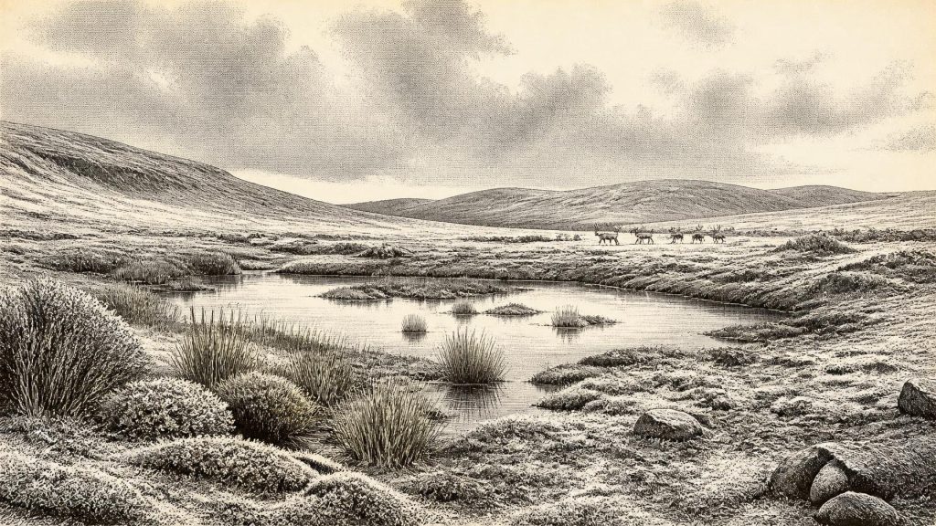
The plants and insects in the Derryvree deposits indicate a cold, open and largely treeless landscape, often described as tundra or muskeg. Mosses, sedges and other wet-ground plants grew around shallow water. Such evidence evokes neither a modern Irish pasture nor an unbroken white desert. Rather, it suggests a mosaic of wet hollows, silty pools, stream margins, exposed mineral ground and low vegetation. Frost, short growing seasons and seasonal snow would have shaped drainage and plant cover. In sheltered places during relatively milder episodes, liquid water and biological productivity could return surprisingly quickly.
Crag Cave in County Kerry adds a different kind of environmental archive. Calcite formations in caves grow only when liquid water can percolate through ground above them. Uranium-thorium dating of broken and redeposited speleothems there records intermittent phases favourable to cave-calcite growth during the last glacial period. This does not provide a weather report for Derryvree or Castlepook, and it cannot turn 31,566 BCE into an exact warm spell. It does reinforce the larger picture of a climatically volatile island at the Atlantic edge, where milder interstadial conditions periodically interrupted severe cold.
The physical geography familiar today was also incomplete. Rivers and valleys existed, but later ice would scour, deepen, bury and rearrange many landscapes. Sea level was lower globally than today, altering coastlines and the size of the surrounding shelf. Yet it is unsafe to imagine a simple, permanent land bridge linking Ireland to Britain. The Irish Sea basin, local ice margins, changing sea level and seasonal marine conditions created a complicated set of possible routes. The arrival of animals proves that movement occurred; it does not specify a single corridor or date of crossing.
Castlepook’s Cold-Stage Fauna
Castlepook Cave is Ireland’s richest known site for vertebrate remains from before the Last Glacial Maximum. Its historic excavations recovered bones of reindeer, woolly mammoth, giant deer, brown bear, wolf, Arctic fox, hare, lemmings and spotted hyaena. Dates from its complicated cave deposits range across a long span, not a single occupation episode. The cave was a natural trap, shelter and carnivore space as well as a place where water and later disturbance could move bones. It is consequently a record of an ecosystem assembled over time, rather than a snapshot of animals standing together outside the entrance.
Even so, several species are highly relevant to the world around this date. Reindeer, including specimens dated in the broader pre-Last Glacial Maximum period, were well adapted to open northern habitats. Their presence accords with the treeless ground indicated at Derryvree. Woolly mammoth and giant deer testify to a fauna now absent from Ireland; brown bear, wolf and hyaena reveal a predator guild far more varied than that of later historic centuries. A spotted-hyaena skull from Castlepook is especially striking, because the species is now African in distribution, yet was then part of north-west European cold-stage ecology.
Faunal lists must still be read cautiously. A dated bone establishes that an animal, or its remains, was in Ireland within a dated range. It cannot demonstrate herd size, seasonal migration, abundance across every region or coexistence with every other specimen in a cave. Nor should absence from the small surviving record be confused with absence from the island. The cave collections were excavated largely in the early twentieth century, their original stratigraphic information is limited, and many recovered bones did not survive in museum collections. Modern re-dating and renewed fieldwork have improved the picture, but have also shown why older assumptions require testing.
The Human Question
The possibility of people in Ireland at this depth of time is important but unresolved. A fragment of reindeer femur from Castlepook has been interpreted by zooarchaeologist Ruth Carden as bearing a deep fresh-bone cut or chop made with a sharp stone implement. County Cork heritage material presents the object as evidence with the potential to push Irish human activity back to around 33,000 years ago. If the interpretation and its chronological association are sustained, it would indicate that one or more Upper Palaeolithic people handled a reindeer carcass during the wider period illuminated by this article.
That is not the same as evidence for a permanent population, a named people or a settlement. Ireland has not produced a securely associated hearth, dwelling floor, stone-tool assemblage, burial, cave art or food-processing deposit of this age at Castlepook. The bone’s date measures the age of the animal, while identifying its mark as humanly made is a separate taphonomic judgement. A single modified bone could represent a brief visit, scavenging or butchery elsewhere before the bone entered the cave. It cannot establish the size, language, kinship system or cultural tradition of the people potentially involved.
This restraint rules out most familiar headings of political history. There is no evidence for Irish kingdoms, chiefs, diplomacy, warfare, borders, law or institutions in 31,566 BCE. There is no evidence for farming, trade in cultivated produce, metalwork, writing, formal religious monuments or organised learning. If people did reach Ireland, they were mobile hunter-gatherers dependent on knowledge of weather, animals, stone and terrain. Such skills can be inferred from comparable Upper Palaeolithic societies elsewhere in Europe, but they cannot responsibly be assigned in detail to Ireland without an Irish assemblage to demonstrate them.
Economy, Culture and Movement
The best-supported economy is ecological rather than social: grazing animals converted sparse vegetation into meat, fat, hides, antler and bone; predators and scavengers followed them; freshwater margins supported plant and insect communities. Reindeer would have been a valuable animal to any human hunter, but Castlepook does not show which parts of a carcass were used, whether a hunt occurred, or whether its reindeer bone was brought into the cave by people. Likewise, mammoth remains demonstrate that mammoths reached Ireland, not that people hunted them there.
There is no direct evidence for trade or diplomacy, but animal dispersal shows that Ireland was not biologically isolated. During windows of suitable geography and climate, mammals moved between Ireland and neighbouring lands. Any human crossing, if it occurred, would also have depended on routes across a changing western European landscape. This is a regional story, not yet an Irish cultural history in the later sense. The land that would become Ireland was part of an Atlantic, cold-stage environment whose coastlines, ice limits and habitable patches repeatedly altered.
Before the Great Ice Expansion
The long-term change deserves the greatest emphasis. Evidence from Derryvree and other dated sites indicates ice-free ground in parts of Ireland until at least about 34,000 years ago, while reconstructions show the British–Irish Ice Sheet expanding substantially afterwards. Its maximum volume was reached much later, around 23,000 years ago, but the growth phase was neither instantaneous nor uniform. In the millennia after the broad interval represented by 31,566 BCE, much of Ireland and its adjacent shelf would come under extensive ice.
Thus the historically responsible portrait is one of possibility bounded by evidence. Around this point in the late Pleistocene, Ireland contained or had recently contained cold, open, locally wet habitats; reindeer, mammoth, giant deer and formidable carnivores formed part of its wider fauna; and the island was moving towards a more heavily glaciated future. A possible humanly modified reindeer bone makes Castlepook a site of exceptional promise, but not proof of an enduring settlement. The real history of this date lies in the survival of fragile clues beneath tills and inside caves: evidence that a living Ice Age landscape existed before ice and time obscured it.
Primary Sources
- A Middle Midlandian Freshwater Series at Derryvree, Maguiresbridge, County Fermanagh, Northern Ireland
- The Irish Quaternary Fauna Project
- A Reconsideration of the Radiocarbon Dating of the Marine Isotope Stage 3 Fauna from Southern Ireland
- Ancient Hybridization and an Irish Origin for the Modern Polar Bear Matriline
- Episodic Speleothem Deposition Tracks the Terrestrial Impact of Millennial-Scale Last Glacial Climate Variability in SW Ireland
- Trimlines, Blockfields and the Vertical Extent of the Last Ice Sheet in Southern Ireland
- Late Pleistocene Chronostratigraphy and Ice Sheet Limits, Southern Ireland
- Growth and Retreat of the Last British–Irish Ice Sheet, 31,000 to 15,000 Years Ago: the BRITICE-CHRONO Reconstruction
- Timing and Pace of Ice-Sheet Withdrawal Across the Marine–Terrestrial Transition West of Ireland During the Last Glaciation
- Maximum Extent and Readvance Dynamics of the Irish Sea Ice Stream and Irish Sea Glacier Since the Last Glacial Maximum
- Exploring the Chronology of the Last British–Irish Ice Sheet: a Review of the Evidence from Land and Sea
- The IntCal20 Northern Hemisphere Radiocarbon Age Calibration Curve (0–55 cal kBP)
- The Subdivision of the Quaternary Period in Ireland
- Irish Association for Quaternary Studies Field Guide 13
- Aghnadarragh
- Spotted Hyena Skull
- Castlepook Cave: County Geological Site Report
- Heritage Artefacts of County Cork
- Castlepook Cave, Castlepook South, County Cork: Excavation Report 2022
- Castlepook South, County Cork: Excavation Report 2018
- Occurrence of Mammalia Relicts at Site Castlepook Cave
- The Exploration of Castlepook Cave, County Cork
