
Castlepook’s Unresolved Reindeer31601 BCE
Approximately 31,601 BCE, Ireland lay in an unstable pre-maximum glacial phase, not beneath continuous ice. Evidence from Derryvree’s sediments indicates cold, treeless, waterlogged tundra supporting mosses, sedges, insects and patchy seasonal productivity between glacial advances. Castlepook Cave’s fauna, including mammoth, reindeer, giant deer and predators, demonstrates links with wider north-west European ecosystems, although cave deposits accumulated over long periods. A roughly 33,000-year-old reindeer femur possibly bears a stone-tool cut mark, suggesting brief human carcass processing. However, no secure settlement, tools or associated occupation survives. Changing ice, sea levels and later erosion obscured routes and evidence, leaving possible human presence unresolved.
Dateline
The label 31,601 BCE is a modern chronological convenience, not a year that anybody in Ireland could have named, recorded or commemorated. At this depth of time, calendar-year precision is unavailable. The date converts approximately to 33,550 years before AD 1950, placing it in the later part of Marine Isotope Stage 3, within the Last Glacial period. Ireland’s evidence is exceptionally fragmentary: buried wetland sediments in Fermanagh, cave deposits in Cork and Kerry, animal bones, pollen, insects, spores, calcite and the landforms left by ice. These sources can illuminate a broad environmental interval, but they cannot supply an event-by-event history.
This was not yet the Last Glacial Maximum, when the Irish Ice Sheet expanded to cover the island and much of its surrounding shelf. Instead, 31,601 BCE belongs to a long, unstable pre-maximum phase in which cold climates were repeatedly interrupted by less severe interstadial episodes. Greenland ice cores record abrupt shifts on the scale of decades and centuries. One such warming, Greenland Interstadial 6, began at about 33,740 years before AD 2000, with a stated chronological uncertainty. That places this modern calendar label broadly near its beginning. Yet it would be unsafe to declare that a particular Irish valley experienced precisely the same climatic turn in this exact year: correlations between Greenland, Irish caves and Irish sedimentary sequences remain matters of chronological comparison, not annual synchronisation.
A Country Not Yet Under Its Maximum Ice
Recent reconstructions of the British–Irish Ice Sheet have altered the older image of an Ireland continuously smothered by ice throughout the last cold stage. The best available evidence indicates that the bulk of the last Irish Ice Sheet grew from more limited, initially ice-free conditions around 34,000 years ago, then expanded greatly over the following millennia. Its maximum extent came much later, broadly around 27,000–23,000 calibrated years before present. Therefore, around 31,601 BCE some parts of Ireland could support plants, animals and perhaps occasional human visitors, even as glaciers and periglacial conditions shaped other regions.
This was nevertheless a severe world. ‘Ice-free’ did not mean mild, wooded or agriculturally productive in any modern sense. Long winters, frozen ground, sparse vegetation, strong winds and short growing seasons would have governed the landscape. The position of the sea is also difficult to translate into a simple map. Global sea level was lower than today, but Ireland’s coasts, ice margins, local land movement and marine passages were changing. It is not responsible to assume either a permanent dry land bridge to Britain or easy sea crossings at this date. The routes by which animals, and any people, reached Ireland remain unresolved.
Political affairs, diplomacy and organised warfare cannot be recovered for Ireland at this time. There are no settlements, graves, monuments, weapons caches, written records or enduring territorial boundaries from which such matters might be inferred. The appropriate historical subject is instead a changing environment at Europe’s north-western margin, where ecological opportunity could be brief and local.
Derryvree’s Wet, Treeless Ground
The clearest Irish terrestrial evidence relevant to this broad period comes from Derryvree, near Maguiresbridge in County Fermanagh. There, organic-rich silts lie between two layers of glacial till. The lower till shows that ice had previously crossed the locality; the overlying deposits record a time when water, vegetation and invertebrate life returned; the upper deposits testify to later glacial advance. This sequence is invaluable precisely because it records change rather than a timeless ‘Ice Age’ landscape.
A conventional radiocarbon measurement from the Derryvree organic sediments was reported as 30,500 ± 1,100 radiocarbon years BP. Later discussion has expressed the broad calibrated range as roughly 36,900–31,700 calendar years BP. That wide interval encompasses 31,601 BCE approximately, but it does not date an individual season or community. The sample was organic material from a deposit, not a diary entry; its uncertainty is a central part of the evidence.
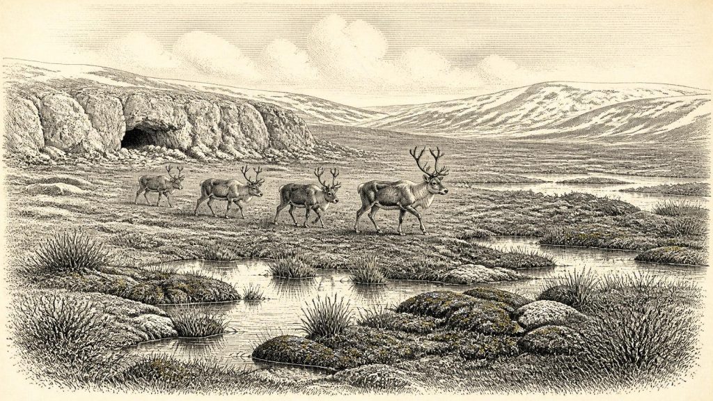
The biological remains suggest open tundra or muskeg: wet, mossy, sedge-rich ground, shallow pools and channels, grasses, herbs and low shrubs rather than closed forest. Fossil evidence includes bogbean and alpine clubmoss, species capable of living in cold, waterlogged settings. Insect evidence likewise indicates wet ground rich in decaying plant matter and open water. Pollen is less decisive than a simple list of species might imply, because grains can travel long distances, be redeposited or survive unevenly. Still, the combined plant, spore and insect record strongly supports a cold, treeless local environment.
Derryvree should not be imagined as a featureless snow desert. In the brief productive season, pools supported aquatic plants, mosses held wet soil together and sedges provided food and cover for small animals. Such places were patchy. A low basin with standing water could be biologically active while nearby exposed ground was wind-scoured, frozen or sparsely vegetated. This mosaic was the setting through which larger animals could move.
Castlepook and the Animal World
In north County Cork, Castlepook Cave near Doneraile preserves a very different kind of archive. Excavations and collecting, especially those associated with Richard J. Ussher in the early twentieth century, recovered a rich Pleistocene fauna. Subsequent re-examination and improved radiocarbon pretreatment have shown that parts of the assemblage are substantially older than earlier dates suggested. Mammoth, reindeer, giant deer, brown bear, wolf, Arctic fox, mountain hare, lemmings and spotted hyaena are among the animals represented. They demonstrate that Ireland formed part of a wider north-west European cold-stage ecological world, not an isolated void.
The species did not necessarily coexist in one herd-filled valley on one day. Cave deposits often accumulate over long periods, and caves can act as dens, traps, shelters, drainage conduits and collectors of material carried in by carnivores. Each radiocarbon date applies to a particular bone, not automatically to every specimen beside it. The fauna nevertheless supports the interpretation of an open landscape capable of sustaining grazing and browsing herbivores, their predators and scavengers.
Reindeer are especially important because a Castlepook hind-limb femur has been reported as approximately 33,000 years old and as bearing a deep mark consistent with cutting or chopping by a sharp stone tool. If the interpretation of that modification is confirmed, it is the most direct indication that a person handled animal tissue in Ireland during the Upper Palaeolithic, far earlier than the long-established evidence for post-glacial settlement. It would be a remarkable discovery.
But its limits must be kept in view. The bone comes from an old collection, not a modern excavation of a sealed occupation floor. No securely associated hearth, stone-tool assemblage, dwelling, human burial, repeated butchery area or stratified camp has been published for this episode. The date concerns the animal’s death, while identifying a mark as a human tool-cut is a separate specialist judgement. The femur may therefore indicate a brief visit or an episode of carcass processing; it cannot establish a permanent population, a named archaeological culture, a migration route or descent into later Irish communities.
People: Possibility Rather Than Population
Across Europe, Homo sapiens communities of this age made sophisticated stone tools, wore tailored clothing in some regions, hunted and scavenged large animals, and maintained social connections over considerable distances. Some groups produced ornaments, figurative objects and cave art. Those facts provide a comparative context, but they are not direct evidence that such practices occurred in Ireland. No Irish artwork, personal ornament, tool industry or built shelter securely dated to around 31,601 BCE has been recovered.
If people reached the Irish landscape during a milder window, they were probably few and mobile. A reindeer carcass could have supplied meat, fat, marrow, hide, sinew and bone, but this is an inference from hunter-gatherer practice elsewhere, not a documented Irish meal. The same caution applies to social life. Small travelling groups would have required knowledge of terrain, weather, animal movements and safe refuges, yet the Irish record cannot reveal their language, kinship, beliefs, ritual practices or political relationships.
Religion, culture and learning consequently leave no direct trace here. Caves should not automatically be treated as sacred places merely because they are caves, nor should animal bones be made into evidence of ritual. Castlepook is first an environmental and palaeontological archive. Its possible humanly modified reindeer femur is historically important because it raises a question, not because it supplies a ready-made story of Ice Age Irish identity.
A Precarious Threshold
There was no farming, no domestic livestock, no fields, no trade network that can be demonstrated within Ireland, and no permanent village known from this date. Economy, if people were present at all, was founded on the immediate possibilities of a cold wild landscape: moving animals, usable stone, fuel, shelter and seasonal water. The later expansion of the Irish Ice Sheet would have repeatedly erased or buried many traces, while lower sea levels mean that potential coastal landscapes now lie beneath water or have been reworked by later marine processes.
That loss helps explain why the evidence is so uneven. Derryvree preserves a wetland interval; Castlepook preserves bones; Crag Cave in County Kerry preserves episodes of calcite growth that show liquid water could periodically circulate underground in south-west Ireland before the maximum glaciation. Together they show a country of shifting habitable pockets rather than a stable homeland. Around 31,601 BCE, Ireland’s story is not one of kings, tribes or borders. It is the story of cold ground, shallow water, grazing animals and a tantalising but unresolved possibility that people briefly stood among them.
Primary Sources
- A reconsideration of the radiocarbon dating of the Marine Isotope Stage 3 fauna from southern Ireland
- Archaeology Research Excavation Grant 2022: Castlepook Cave, Co Cork
- Castlepook Cave, Co. Cork, 2022 excavation report
- The Archaeological Heritage of County Cork
- The Irish Quaternary Fauna Project
- Irish Pleistocene biostratigraphy
- Figure 6: The subdivision of the Quaternary Period in Ireland
- Trimlines, blockfields and the vertical extent of the last ice sheet in southern Ireland
- Growth and retreat of the last British–Irish Ice Sheet, 31,000 to 15,000 years ago: the BRITICE-CHRONO reconstruction
- Character of advance and retreat of the southwest sector of the British-Irish Ice Sheet during the last glaciation
- Maximum extent and dynamic behaviour of the last British–Irish Ice Sheet west of Ireland
- Episodic speleothem deposition tracks the terrestrial impact of millennial-scale last glacial climate variability in SW Ireland
- Spatio-temporal dynamics of speleothem growth and glaciation in the British Isles
- A stratigraphic framework for abrupt climatic changes during the Last Glacial period based on three synchronized Greenland ice-core records
- A 60,000 year Greenland stratigraphic ice core chronology
- The problem of a late Quaternary landbridge between Britain and Ireland
- Deglaciation, Earth crustal behaviour and sea-level changes in the determination of insularity: A perspective from Ireland
- Ireland: Submerged Prehistoric Sites and Landscapes
- The palaeogeography of the Irish Sea and possible land bridges between Ireland and Britain
- BSBI: Menyanthes trifoliata
- BSBI: Selaginella selaginoides
- New insights on the fauna of Ireland's Younger Dryas and Early Holocene from Alice & Gwendoline Cave
- Guide to the National Museum of Ireland