Derryvree’s Winter Mosses31403 BCE
Around 31,403 BCE, Ireland’s past is reconstructed from environmental evidence rather than records. Derryvree, County Fermanagh, preserves freshwater sediments between glacial tills, dated broadly to 36,900–31,700 calendar years BP. Their mosses, plants, insects and pollen indicate an ice-free, treeless, tundra-like wetland during an unstable Late Pleistocene phase. Ice sheets were expanding but had not reached their later maximum. Castlepook Cave’s faunal remains, including reindeer and other cold-adapted animals, show ecological links with north-west Europe. A possibly cut-marked reindeer bone suggests human visitation, but no secure occupation evidence exists. Later glaciation erased much evidence, leaving a fragmentary yet intermittently habitable landscape.
Dateline
The label 31,403 BCE is a modern way of organising deep time, not a date that can be recovered from an Irish calendar or historical record. No written chronology, named community, ruler or event survives from Ireland at this distance. In archaeological terms it falls about 33,350 years before AD 1950, within the later part of the Late Pleistocene and broadly within Marine Isotope Stage 3 (MIS 3), a climatically unstable phase of the last Ice Age. Modern calendar-year precision is not available. The responsible history is therefore one of calibrated ranges, buried sediments, animal remains and cautious inference.
The best Irish evidence relevant to this point comes from a few exceptional sites rather than from a continuous national record. At Derryvree near Maguiresbridge, County Fermanagh, freshwater sediments were preserved beneath a drumlin between two layers of glacial till. Their radiocarbon age, 30,500 +1,170/−1,030 radiocarbon years BP, calibrates broadly to about 36,900–31,700 calendar years BP. That range includes 31,403 BCE, but it does not show what happened in that particular year, or even in a particular century. It establishes something more important: part of northern Ireland supported an ice-free, biologically active wetland during a cold stage before later ice advances.
A Wetland Beneath a Drumlin
Derryvree was exposed during roadworks in 1969, when a cutting passed through a north-east to south-west drumlin roughly two kilometres north-east of Maguiresbridge. Beneath the familiar smooth, elongated hill lay a remarkable sequence. A lower till, deposited by moving glacier ice, was overlain by fine sands, silts and organic material formed in freshwater conditions; these deposits were in turn sealed beneath another thick till. The sequence is a reminder that drumlins are not merely scenic landforms. They can contain fragments of landscapes that existed between glacial episodes and were later buried by ice.
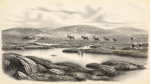
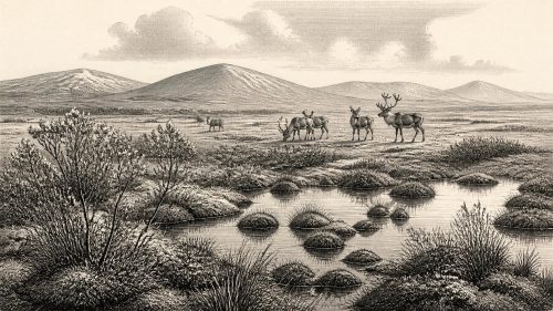
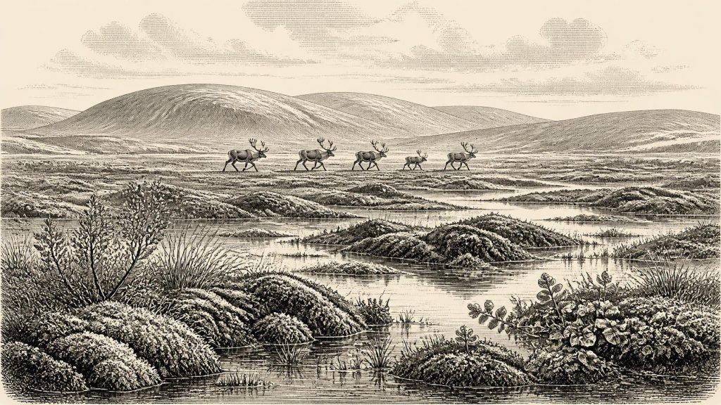
The freshwater layer contained poorly preserved pollen, plant macrofossils, mosses and insects. Taken together, these remains indicate open tundra-like ground and a periglacial climate: not land beneath a glacier, but country profoundly shaped by severe frost, seasonal freezing and thawing, sparse cover and waterlogged hollows. Sedges, grasses, herbs and cold-adapted plants were more significant than trees. Fossil evidence includes mountain avens, dwarf willow and bogbean, plants that point respectively to cold open terrain and wet ground or shallow freshwater. Mosses and insect remains suggest a plant-rich marsh or muskeg-like setting, with pools, saturated margins and organic debris.
This was not the wooded island of later prehistory. Oak, hazel and ash woodland belonged to a much warmer and later world. A few grains of tree pollen at a site such as Derryvree cannot securely demonstrate local forest: pollen can travel far, be redeposited, or survive unevenly. The stronger conclusion is that the local landscape was largely treeless, exposed and wet in places. In summer, shallow pools and mossy ground could support specialised plant and invertebrate communities; in winter, deep frost and a short growing season would have imposed sharp limits on growth.
Ice Was Building, Not Yet at Its Height
At 31,403 BCE Ireland was in the long approach to the fullest expansion of the last British–Irish Ice Sheet, not at its best-known maximum. Research on land, continental shelves and ice-marginal deposits places the principal Late Glacial Maximum in Irish sectors substantially later, broadly from about 27,000 to 23,000 calendar years BP, though the precise timing and extent differed around the island. The ice sheet was not a motionless white cap with one clear edge. It grew from regional ice centres, flowed along topographic corridors and marine basins, and changed shape through advances, stagnations and retreats.
Derryvree therefore cannot be used to draw an exact Irish ice margin for 31,403 BCE. Its value is local and chronological: its inter-till freshwater deposits demonstrate that north-central Ireland was ice-free at some point within their broad age range. Other Fermanagh evidence, including organic deposits at Greenagho near Belcoo, also points to episodes of non-glacial conditions before the later major ice-sheet expansion. Crag Cave in County Kerry offers a different kind of clue. Episodes of stalagmite growth there show that liquid water was intermittently available in south-west Ireland during milder pulses of the last glacial period. Such records underline variability rather than a single, island-wide climate.
Sea level was much lower than today because vast amounts of water were held in continental ice sheets. Yet it would be unsafe to picture an uncomplicated land bridge from Ireland to Britain at this exact moment. The changing Irish Sea basin, coastlines, ice margins and possible routes across exposed shelf terrain remain difficult to reconstruct in detail. What can be said is that Ireland’s relationship with neighbouring lands was environmentally different from the modern island’s, and that animal populations had some means of reaching it during favourable phases.
Reindeer, Carnivores and Open Country
The principal southern archive is Castlepook Cave, near Doneraile in County Cork. Excavations and older collections from the cave have produced an unusually rich Ice Age fauna, though its nineteenth- and early twentieth-century recovery means that many bones lack the secure stratigraphic context expected of modern excavation. Improved radiocarbon methods have nevertheless shown that at least part of the assemblage belongs to MIS 3. The cave is evidence for a sequence of animal occupations and accumulations across a long span, not for one perfectly contemporaneous herd or ecosystem.
Among the animals associated with the wider Castlepook record are reindeer, woolly mammoth, giant deer, brown bear, wolf, Arctic fox, mountain hare, lemmings and spotted hyaena. Their presence makes ecological sense in a mosaic of open cold-country habitats, but each species must be treated according to its own date and context. Reindeer and lemmings are especially compatible with the cold, open conditions suggested by Derryvree. Mammoths and giant deer evoke a landscape with sufficient forage and movement routes for large herbivores; wolves and hyaenas reveal a food web that included capable scavengers and predators.
These remains are not proof that all such animals stood together in County Cork in 31,403 BCE. Nor do they justify imagining an unbroken ‘mammoth-steppe’ across every Irish county. They do show that pre-maximum Ireland could be part of a wider north-west European world of mobile cold-adapted fauna. Caves may have served as shelters, dens, traps, resting places or places where carnivores accumulated carcass remains. The distinction matters: a bone in a cave does not automatically identify the place where the animal lived, died or was eaten.
The Human Question
No securely excavated dwelling, hearth, human burial, stone-tool assemblage or sustained occupation surface in Ireland can be assigned to this horizon. Consequently, there is no evidence from which to reconstruct a resident population, family structure, language, territory or seasonal round. It would be wrong to call any possible visitors Gaelic, Celtic or Irish in a cultural sense. ‘Ireland’, ‘Fermanagh’ and ‘Cork’ are useful modern geographical labels, not ancient identities.
There is, however, one potentially important but unresolved clue. A reindeer femur from the old Castlepook collection has been reported as roughly 33,000 years old and as carrying a deep mark interpreted as a cut or chop made by a sharp stone tool on fresh bone. If that interpretation is confirmed, it could indicate that Upper Palaeolithic people processed a reindeer in Ireland during a broadly comparable pre-Last Glacial Maximum interval. It would be evidence for a visit or brief episode of butchery, not automatically for a permanent settlement.
Caution is essential. The bone derives from an old collection rather than a modernly excavated occupation layer. Dating the animal bone establishes the age of the animal, but does not by itself demonstrate precisely when the surface mark was made, who made it, or how long people remained nearby. Recent fieldwork at Castlepook has confirmed that Pleistocene deposits survive in the cave, making future investigation possible, but it has not yet produced the decisive cultural assemblage that would settle the question. The most defensible conclusion is that a human presence is possible and highly significant, while an established Irish Palaeolithic society remains unproven.
No Politics, Diplomacy or Recorded Religion
For this reason, conventional historical categories largely fall silent. There is no evidence for political institutions, chiefs, warfare, diplomacy, tribute or formal trade in Ireland around this date. There are no known monuments, shrines, artworks, inscriptions or graves from which to infer religion, learning or social rank. Portable possessions, if people briefly visited, would have been especially vulnerable to loss, burial and destruction. Later glaciation also scoured and rearranged much of the older landscape, making short-lived open-air camps extraordinarily hard to find.
That silence is itself historically meaningful. The evidence describes an environmental frontier, not a documented society. If people reached the island, they probably did so within wider networks of highly mobile hunter-gatherers known elsewhere in Upper Palaeolithic Europe, relying on portable knowledge, cooperation and animal resources. But this is an analogy, not direct Irish proof. Archaeology can responsibly identify the constraints under which people might have moved; it cannot supply their stories, beliefs or names.
A Fragmentary Irish Past
Around 31,403 BCE, then, the strongest picture is of a cold and changing Ireland in which locally ice-free wet ground survived between glacial phases. Derryvree’s mosses, sedges, aquatic plants and insects provide the clearest close view: a treeless freshwater landscape beneath the future drumlin. Castlepook’s faunal archive broadens the view to include reindeer and other large mammals moving through a variable Ice Age environment. Later ice-sheet growth would transform the island again and erase much evidence of whatever lay on exposed ground.
These archives are small, scattered and imperfect, but they prevent a blank page. They show that prehistoric Ireland was not simply absent beneath eternal ice. It was an intermittently habitable and ecologically connected place, whose surviving record must be read at the scale of millennia rather than years.
Primary Sources
- A Middle Midlandian Freshwater Series at Derryvree, Maguiresbridge, County Fermanagh, Northern Ireland
- Early Midlandian–Middle Midlandian, Pleistocene, Northern Ireland
- Palaeoecology
- Figure 6.— The Subdivision of the Quaternary Period in Ireland
- Middle Midlandian Interstadial Deposits at Greenagho, Near Belcoo, County Fermanagh, Northern Ireland
- A Reconsideration of the Radiocarbon Dating of the Marine Isotope Stage 3 Fauna from Southern Ireland
- Archaeology Research Excavation Grant 2022: Final Report
- 2022:564 – Castlepook Cave, Castlepook South, Cork
- New Insights on the Fauna of Ireland’s Younger Dryas and Early Holocene Caves
- The Irish Quaternary Fauna Project
- Irish Pleistocene Biostratigraphy
- Pleistocene Vertebrates in the British Isles
- Episodic Speleothem Deposition Tracks the Terrestrial Impact of Millennial-Scale Last Glacial Climate Variability in SW Ireland
- Late Pleistocene Chronostratigraphy and Ice Sheet Limits, Southern Ireland
- Trimlines, Blockfields and the Vertical Extent of the Last Ice Sheet in Southern Ireland
- Growth and Retreat of the Last British–Irish Ice Sheet, 31,000 to 15,000 Years Ago: The BRITICE-CHRONO Reconstruction
- BRITICE Glacial Map, Version 2: A Map and GIS Database of Glacial Landforms of the Last British–Irish Ice Sheet
- Timing and Pace of Ice-Sheet Withdrawal Across the Marine–Terrestrial Transition West of Ireland During the Last Glaciation
- The Timing and Magnitude of the British–Irish Ice Sheet Between Marine Isotope Stages 5d and 2: Implications for Glacio-Isostatic Adjustment, High Relative Sea Levels and ‘Giant Erratic’ Emplacement
- Dynamic Cycles, Ice Streams and Their Impact on the Extent, Chronology and Deglaciation of the British-Irish Ice Sheet
- IntCal20 Northern Hemisphere Radiocarbon Age Calibration Curve (0–55 cal kBP)
- Quaternary