Derryvree’s Menyanthes Marsh31587 BCE
Around 31,587 BCE, Ireland lay in Marine Isotope Stage 3, a climatically variable Late Pleistocene period rather than a uniformly frozen landscape. Derryvree, County Fermanagh, preserves freshwater sediments between tills, indicating an ice-free wetland with open, treeless vegetation, including bogbean. Greenagho and Kerry speleothems similarly show intermittent milder, ice-free conditions. Lower sea levels enlarged surrounding land, though routes remain uncertain. Castlepook Cave fauna include reindeer and mammoth; a possibly cut-marked reindeer bone may indicate brief human activity, not settlement. Later ice-sheet advance erased much evidence. No reliable evidence supports contemporary politics, religion, economy, communities or sustained Palaeolithic occupation in Ireland.
Dateline
The label 31,587 BCE gives a useful place in a modern chronology, but it cannot identify an event, a season or a named generation in prehistoric Ireland. It corresponds very approximately to 33,536 years before AD 1950, the conventional ‘present’ used in radiocarbon reporting. At this depth of time, calendar-year precision is unavailable. Dates are ranges, sometimes wide ones, produced by calibrating radiocarbon measurements or by other methods, and the evidence is patchy. The responsible history of Ireland at this point is therefore not a chronicle of rulers or battles, but a reconstruction from sediments, pollen, plant remains, cave deposits, animal bones and the changing margins of ice.
Ireland lay within the Late Pleistocene, during Marine Isotope Stage 3, a long cold phase punctuated by abrupt climatic shifts. The island’s position on the Atlantic fringe made it highly sensitive to changes in ocean circulation, temperature and ice growth. It would be misleading to picture one fixed ‘Ice Age Ireland’. Conditions changed markedly over centuries and millennia, while the survival of evidence depended on whether later glaciers scraped it away, buried it or left it intact.
A Date Within Broad Ranges
The closest securely relevant terrestrial evidence comes from Derryvree, near Maguiresbridge in County Fermanagh. Roadworks exposed freshwater silts and fine sands trapped between two layers of till: unsorted debris deposited by glacier ice. Organic material from the intervening deposit produced a conventional radiocarbon age of about 30,500 ± 1,200 radiocarbon years before present. When calibrated, the published range is approximately 36,900–31,700 calendar years before present. The modern label 31,587 BCE falls broadly within that span, but it does not mark the beginning, middle or end of the deposit. It certainly cannot be used to date an occurrence at Derryvree to a particular year.
Its stratigraphy nevertheless tells an important sequence. Ice had affected the district; later, an ice-free freshwater environment accumulated sediment and organic remains; then renewed glaciation sealed the record beneath another till. Nearby Greenagho, near Belcoo, preserves organic material beneath till with a calibrated age of roughly 37,200–35,700 years before present. Taken together, the Fermanagh sites demonstrate that north-central Ireland was not continuously buried by the last ice sheet throughout this part of the Late Pleistocene. They do not prove that every region was simultaneously free of ice, nor do they supply a detailed island-wide map.
Wet Ground and Open Vegetation
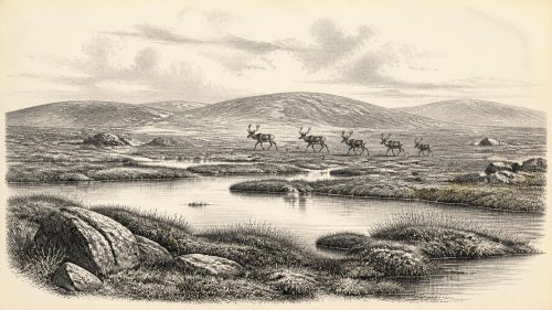
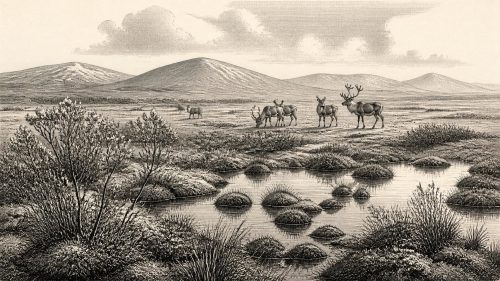
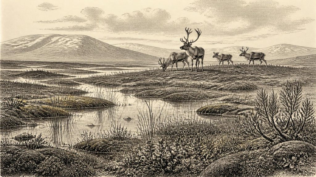
Derryvree is valuable because its pollen, seeds, mosses and invertebrate remains preserve traces of a landscape otherwise largely removed or rearranged by later ice. The evidence indicates open, treeless ground rather than woodland: a cold wetland or muskeg with shallow pools, sedge-rich margins and patches of low-growing vegetation. Plant remains include species suited to cold, open and often waterlogged environments, among them bogbean, Menyanthes trifoliata, from which this episode takes its most vivid local image. Such evidence supports a landscape of wet hollows and low vegetation; it does not permit a painted certainty about the precise appearance of every slope, riverbank or season.
In southern Ireland, broken calcite formations in Crag Cave, County Kerry, add a different kind of evidence. Uranium-thorium dating shows that speleothems grew episodically through much of the last glacial period. Because calcite deposition in this shallow cave required liquid water and conditions above freezing for at least part of the year, the record points to intermittent ameliorations in the Irish climate. These episodes broadly correspond with warmer Greenland interstadials, but the correlation has uncertainties. Crag Cave is not a thermometer for 31,587 BCE, yet it reinforces the conclusion that the island’s climate was variable rather than uniformly frozen.
There was no modern Irish coastline. With large volumes of water held in continental ice sheets, global sea level was much lower, and the shelves now beneath the Celtic Sea and Atlantic formed a far more extensive landscape. The precise arrangement of land, shallow water, ice shelves and crossing routes changed as sea level and ice margins shifted. This matters because an Ireland that appears insular on a modern map could at times have been ecologically connected, or nearly connected, to wider north-west European landscapes. But neither Derryvree nor Castlepook provides evidence for a settled route, ferrying, maritime travel or regular trade.
Animals in a Changing Faunal World
Animal bones from Irish caves show that cold-stage mammals did reach the island during Marine Isotope Stage 3. Castlepook Cave near Doneraile in north County Cork, long known as Mammoth Cave because of its woolly mammoth remains, has produced re-dated fauna that is substantially older than some earlier measurements suggested. The cave evidence includes reindeer and other animals adapted to cold or open habitats; Irish Quaternary faunal research also documents a wider Pleistocene assemblage from cave collections. Caves, however, are not simple snapshots of a living community. Carnivores can drag in carcass parts, water can move bones, excavations may disturb deposits, and nineteenth- and early twentieth-century collections often lack the stratigraphic detail expected today.
At Castlepook, a reindeer femur has been publicly reported as dating to about 33,000 years ago and bearing a deep mark interpreted by zooarchaeologist Ruth Carden as a cut made with a sharp stone tool during butchery. If that interpretation is sustained, it would be extraordinarily important: potential evidence that people processed a reindeer in Ireland during this earlier phase of the Upper Palaeolithic. It should not, however, be inflated into proof of a village, a permanent population or a named cultural group. The bone derives from an old cave collection, not a modern excavation of an intact occupation surface, and no securely associated hearth, stone-tool assemblage, dwelling, burial or food-preparation area of comparable age has yet established the scale or duration of any human presence.
The distinction is crucial. A reindeer limb with a possible human modification may indicate a brief hunting visit, opportunistic carcass processing, or activity whose archaeological setting has been lost. It cannot tell us the language, kinship rules, beliefs, leadership or numbers of those involved. Nor is it evidence that reindeer were domesticated: they were wild animals in a Pleistocene ecosystem. The National Museum of Ireland has long stressed the absence of clear, broadly accepted evidence for sustained Palaeolithic settlement on the island; newer work makes the question more interesting, not settled.
No Polities, No Diplomacy
There is no evidence on which to reconstruct political affairs, diplomacy, warfare, institutions or territorial boundaries in Ireland around this point. There were no literate records, monuments, farms, defended settlements or cemeteries attributable to 31,587 BCE. Even if small parties of Upper Palaeolithic hunter-gatherers did reach the island, their social and political arrangements cannot be recovered from the present evidence. Applying later Irish ideas of tribes, kingdoms, ‘Celtic’ identity or national territory to this period would be an anachronism.
The same restraint applies to religion and learning. Caves elsewhere in Upper Palaeolithic Europe could be places of art, ritual, shelter, animal denning or all of these at different times, but no comparable ritual or artistic use has been demonstrated at Castlepook for this date. The technical knowledge required to make and use stone tools, track animals and survive an unstable cold environment would have been considerable if people were present. Yet that is a general inference from Upper Palaeolithic lifeways in north-west Europe, not direct evidence for an Irish community’s teachings or ceremonies.
Economy Without a Market
There is likewise no basis for describing an Irish economy in the later historical sense. No agricultural fields, livestock herds, pottery, metalwork, currency, markets or exchange networks belong to this horizon. If the Castlepook mark proves anthropogenic, it supports only the modest proposition that animal tissue or bone may have been worked with a sharp tool. Hunting and scavenging are plausible activities within such an environment, especially around mobile herds, but permanence, seasonal scheduling and group size remain unknown.
Later glaciation is itself part of the story. The growing British–Irish Ice Sheet eventually transformed much of the island, advancing to its maximum extent after this period and eroding or burying older land surfaces. Modern reconstructions, built from offshore geophysics, landforms and hundreds of dates, show that ice expansion was neither instantaneous nor uniform. Some regions retained ice-free or less severely glaciated landscapes for a time; others were overwhelmed. This helps explain both why Derryvree’s wetland is precious and why archaeological evidence is so scarce. Much of any record that once existed may have been destroyed, displaced or now lies below sediment and sea.
Thus the most historically meaningful development around 31,587 BCE is environmental, not political: Ireland was a changing northern landscape at the threshold of major ice-sheet expansion, with locally preserved freshwater wetlands in Fermanagh, episodically milder conditions registered in Kerry cave calcite, and Ice Age fauna represented in southern caves. A possible humanly modified reindeer bone raises the prospect of fleeting Upper Palaeolithic activity, but does not yet reveal settlement. The silence is not empty. It is a carefully bounded archive, asking that evidence and interpretation remain separate.
Primary Sources
- A Middle Midlandian Freshwater Series at Derryvree, Maguiresbridge, County Fermanagh, Northern Ireland
- Middle Midlandian Interstadial Deposits at Greenagho, Near Belcoo, County Fermanagh, Northern Ireland
- Early Midlandian–Middle Midlandian, Pleistocene, Northern Ireland
- Aghnadarragh
- Trimlines, Blockfields and the Vertical Extent of the Last Ice Sheet in Southern Ireland
- Late Pleistocene Chronostratigraphy and Ice Sheet Limits, Southern Ireland
- Dimensions and Chronology of the Last Ice Sheet in Western Ireland
- Maximum Extent and Dynamic Behaviour of the Last British–Irish Ice Sheet West of Ireland
- Extent and Deglacial Chronology of the Last British–Irish Ice Sheet: Implications of Exposure Dating Using Cosmogenic Isotopes
- Growth and Retreat of the Last British–Irish Ice Sheet, 31,000 to 15,000 Years Ago: The BRITICE-CHRONO Reconstruction
- Response of the Irish Ice Sheet to Abrupt Climate Change During the Last Deglaciation
- The Deglaciation of the Western Sector of the Irish Ice Sheet from the Inner Continental Shelf to Its Terrestrial Margin
- Episodic Speleothem Deposition Tracks the Terrestrial Impact of Millennial-Scale Last Glacial Climate Variability in SW Ireland
- Spatio-Temporal Dynamics of Speleothem Growth and Glaciation in the British Isles
- A Reconsideration of the Radiocarbon Dating of the Marine Isotope Stage 3 Fauna from Southern Ireland
- The Irish Quaternary Fauna Project
- Occurrence of Mammalia Relicts at Site Castlepook Cave
- Archaeology Research Excavation Grant 2022: Castlepook Cave Final Report
- Castlepook Cave, Co. Cork, 2022
- Prehistoric Details: Mell Flint Flake
- The Mesolithic in Ireland: When Was It?
- The IntCal20 Northern Hemisphere Radiocarbon Age Calibration Curve (0–55 cal kBP)
- The IntCal20 Approach to Radiocarbon Calibration Curve Construction: A New Methodology Using Bayesian Splines and Errors-in-Variables
- New Insights on the Fauna of Ireland’s Younger Dryas and Early Holocene from Alice & Gwendoline Cave