
Derryvree’s Hidden Wetland31416 BCE
At notional 31,416 BCE, Ireland cannot be described through calendar-year history but broad late MIS 3 environmental evidence. Derryvree, County Fermanagh, preserves freshwater organic sediments between glacial tills, indicating a cold, treeless, wet tundra or muskeg interval between ice advances. Plants, insects and pollen suggest sedges, mosses, herbs and shallow pools in a severe periglacial climate. Cave deposits at Castlepook record open-country fauna including reindeer, mammoth, giant deer, predators and lemmings, though not contemporaneous communities. A marked reindeer bone may indicate brief Upper Palaeolithic human activity, but no secure settlement evidence exists. Climatic instability and advancing ice defined this landscape.
Dateline
Modern calendar-year precision is not available for Ireland in 31,416 BCE. No one on the island recorded years, named rulers or dated events in a calendar that can be correlated with ours. At roughly 33,400 calendar years before 1950, even scientific chronologies work in broad ranges rather than individual years. The responsible subject is therefore Ireland during the later part of Marine Isotope Stage 3 (MIS 3), an unstable phase of the last Ice Age, not an invented episode in a single twelve-month period.
The strongest evidence nearest this notional date is environmental rather than historical. It comes from sediments, bones, pollen, insects and glacial deposits: traces that show what conditions could support, but rarely identify a particular season, migration or human visit. Around this time Ireland was a changing northern landscape at the edge of major climatic and glacial shifts. It was neither the green, wooded island familiar from later prehistory nor necessarily one uniform expanse of ice.
A Date Measured in Ranges
“31,416 BCE” is a modern conversion, useful for arranging a year-by-year archive but misleading if treated as a precise prehistoric timestamp. Radiocarbon years are not the same as calendar years, because atmospheric carbon levels have varied through time. Calibration curves convert radiocarbon determinations into probability ranges, and those ranges widen greatly at this depth. Stratigraphy adds another scale of uncertainty: a deposit may represent years, centuries or longer, while its fossils can have been moved before burial.
For that reason, the key Irish records should not be made to say more than they can. The organic deposits at Derryvree, near Maguiresbridge in County Fermanagh, returned a conventional radiocarbon determination of 30,500 +1,170/−1,030 BP. Scholarship has placed this evidence in later MIS 3 and uses it to identify a cold, non-glacial interval between separate episodes of ice advance. It cannot establish that a particular pool, plant or animal existed in 31,416 BCE itself. It nevertheless gives a remarkable window into the kind of northern Irish environment that lay within the broad chronological neighbourhood of this date.
Freshwater Beneath a Drumlin
Road works in 1969 cut through a drumlin at Derryvree, about two kilometres north-east of Maguiresbridge. Beneath one layer of glacial till and above another lay freshwater silts, fine sands and organic material. The sequence matters because till is debris deposited by glacier ice. The lower till records an earlier glaciation; the intervening sediments show that ice had withdrawn or was absent locally long enough for water, sediment, plants and insects to accumulate; the upper till records later renewed glaciation.
This is evidence for environmental succession, not a simple island-wide map. Derryvree proves that this part of Fermanagh included a freshwater, periglacial setting during part of MIS 3. It does not prove that every region of Ireland was ice-free at the same moment, or that the island’s coasts, uplands and river valleys shared identical conditions. Glaciers and ice sheets are dynamic systems, advancing and retreating unevenly. The wider British–Irish Ice Sheet was building towards the much more extensive Last Glacial Maximum, conventionally placed mainly between about 27,000 and 21,000 calendar years BP, though timing differed between sectors.
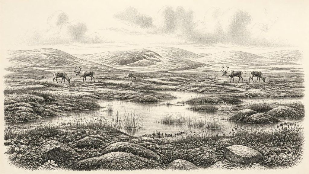
The landscape around Derryvree was cold, open and wet rather than permanently featureless. Pollen, plant macrofossils, mosses and insect remains indicate tundra or muskeg: waterlogged, peaty ground, shallow pools, sedge-rich margins and patches of sparsely vegetated drier terrain. Herb pollen dominates. Juniper and a range of herbs are associated with the assemblage, while the few grains of tree pollen are not secure evidence for local woodland; some may have been reworked from older sediments or travelled long distances. The most defensible reconstruction is of largely treeless ground under a severe periglacial climate.
Short Summers, Hard Winters
Periglacial does not mean that the ground was always buried beneath glacier ice. It describes a climate in which frost, seasonal freezing and thawing, wind and sparse vegetation strongly shaped the land. In summer, long daylight could support mosses, sedges, aquatic plants and herbaceous forage around wet hollows. In winter, frozen ground, snow, wind exposure and scarcity of accessible food would have imposed formidable limits. Pool margins and meltwater channels were therefore important ecological places: they concentrated water, plant growth and insects in a generally harsh terrain.
Such evidence corrects the image of Ice Age Ireland as a blank white void. Derryvree’s freshwater deposits contain signs of life precise enough to identify ecological niches, yet they also demonstrate fragility. The wetland was eventually entombed beneath later ice-derived sediment. Much of the evidence for the landscape that preceded glacial overriding has consequently been destroyed, reworked or remains buried. Survival of this small sequence under a drumlin is exceptional rather than typical.
At the broader scale, sea level was lower than today because large quantities of water were locked in continental ice. Coastlines and the shape of the surrounding shelf differed profoundly from modern ones. But lower sea level alone does not demonstrate a dependable land route into Ireland. Research on late-Quaternary insularity stresses that connections between Ireland and Britain depended on a shifting combination of relative sea level, crustal movement and ice conditions. For this much earlier period, neither a specific crossing route nor the ease of travel can responsibly be reconstructed from the evidence available.
Animals of Open Country
Caves in southern Ireland, especially Castlepook Cave near Doneraile in north County Cork, preserve a striking but complicated record of Ice Age fauna. The Irish Quaternary Fauna Project directly dated material from old cave collections and showed that a range of mammals occupied Ireland between at least about 45,000 and 20,000 years ago. At Castlepook, the dated and attributed fauna includes reindeer, woolly mammoth, giant deer, brown bear, wolf, Arctic fox, lemmings and spotted hyaena. These animals did not necessarily all live together at one instant; cave deposits can combine material introduced over long spans, and nineteenth- and early twentieth-century excavation methods left imperfect contextual records.
Nonetheless, the assemblage supports an image of open-country food webs rather than closed forest. Reindeer were mobile grazers well suited to cold, exposed habitats. Mammoths and giant deer indicate that substantial herbivores could exploit productive patches of grassland, herb-rich ground and wetland margins. Wolves and hyaenas were predators or scavengers, while Arctic foxes and lemmings underline the northern character of parts of the fauna. Caves may have functioned as dens, traps, shelters or places into which carnivores carried bones; they should not be read as ordinary snapshots of the living landscape outside.
This faunal evidence illuminates economy only in the ecological sense. There is no evidence for farming, herding, metalworking, settled villages, markets, property boundaries or long-distance trade networks in Ireland at this date. Reindeer and other large mammals represented potential meat, fat, marrow, hides, sinew, antler and bone for any human group present, but animal bones alone do not prove hunting or human occupation.
The Human Question at Castlepook
A reindeer femur from Castlepook has made the human question unusually important. It has been publicly reported as about 33,000 years old and bears a deep linear mark which palaeozoologist Ruth Carden has interpreted as a cut or chop made by a sharp stone implement while a fresh carcass was being processed. If that interpretation is sustained, it would be evidence of an Upper Palaeolithic human presence in Ireland vastly earlier than the well-established Mesolithic settlement of the early Holocene.
Its implications must remain carefully bounded. No securely associated stone-tool assemblage, hearth, dwelling, burial or repeatedly occupied campsite of this age has yet been identified in Ireland. The bone does not reveal the size, origin, language, kinship system or duration of any visiting group. Nor does it show whether people killed the animal, scavenged it, or processed it elsewhere before carnivores moved the remains into the cave. The safest conclusion is not that Ireland possessed a known resident population in 31,416 BCE, but that the possibility of brief Upper Palaeolithic visits to a habitable, animal-rich Irish landscape deserves serious investigation.
No Polities, No Recorded Religion
Political affairs, diplomacy and organised warfare cannot be recovered for Ireland at this depth of time. There are no states, chiefs, monuments, written traditions or identifiable communities from which to infer them. Equally, no direct evidence permits claims about ritual, formal religion, art, teaching or shared languages. Later prehistoric monuments and myths must not be projected backwards into the Pleistocene.
If people did enter Ireland during this wider period, comparison with Upper Palaeolithic societies elsewhere in north-west Europe suggests small, highly mobile hunter-gatherer groups possessing detailed knowledge of animals, seasons and stone-working. That comparison is interpretation, not Irish proof. Ireland’s own evidence currently supports only a landscape of wet tundra, mobile fauna, changing ice margins and an unresolved trace of possible human butchery.
The defining development around this notional year was therefore environmental instability. Derryvree’s mosses and sedges record a wet, treeless interval between ice advances; Castlepook’s cave bones record animal communities that shifted with climate and habitat; the later growth of the British–Irish Ice Sheet would erase or conceal much that existed. Far from being empty prelude, this was the deep ecological setting from which Ireland’s much later human history eventually emerged.
Primary Sources
- Palaeoecology
- Figure 6.— The Subdivision of the Quaternary Period in Ireland
- Quaternary Deposits and Glacial Stratigraphy in Ireland
- The Irish Quaternary Fauna Project
- Phylogeographic, Ancient DNA, Fossil and Morphometric Analyses Reveal Ancient and Modern Introductions of a Large Mammal: The Complex Case of Red Deer (Cervus elaphus) in Ireland
- First Evidence of a Late Upper Palaeolithic Human Presence in Ireland
- Castlepook Cave, County Geological Site Report
- Heritage Artefacts of County Cork
- Extent and Timing of the Last Glacial Maximum (LGM) in Britain and Ireland: A Review
- The Timing and Magnitude of the British–Irish Ice Sheet Between Marine Isotope Stages 5d and 2
- Pattern, Style and Timing of British–Irish Ice Sheet Advance and Retreat Over the Last 45,000 Years
- Timing and Pace of Ice-Sheet Withdrawal Across the Marine–Terrestrial Transition West of Ireland During the Last Glaciation
- The Deglaciation of the Western Sector of the Irish Ice Sheet From the Inner Continental Shelf to its Terrestrial Margin
- The Problem of a Late Quaternary Landbridge Between Britain and Ireland
- Deglaciation, Earth Crustal Behaviour and Sea-Level Changes in the Determination of Insularity: A Perspective From Ireland
- The IntCal20 Northern Hemisphere Radiocarbon Age Calibration Curve (0–55 kcal BP)
- The Late-Quaternary History of Arctic and Alpine Plants
- Pleistocene Vertebrates in the British Isles
- Ireland: Submerged Prehistoric Sites and Landscapes
- New Insights on the Fauna of Ireland's Younger Dryas and Early Holocene From Alice & Gwendoline Cave
- Castlepook Cave
