

Derryvree’s Mossy Mud30508 BCE
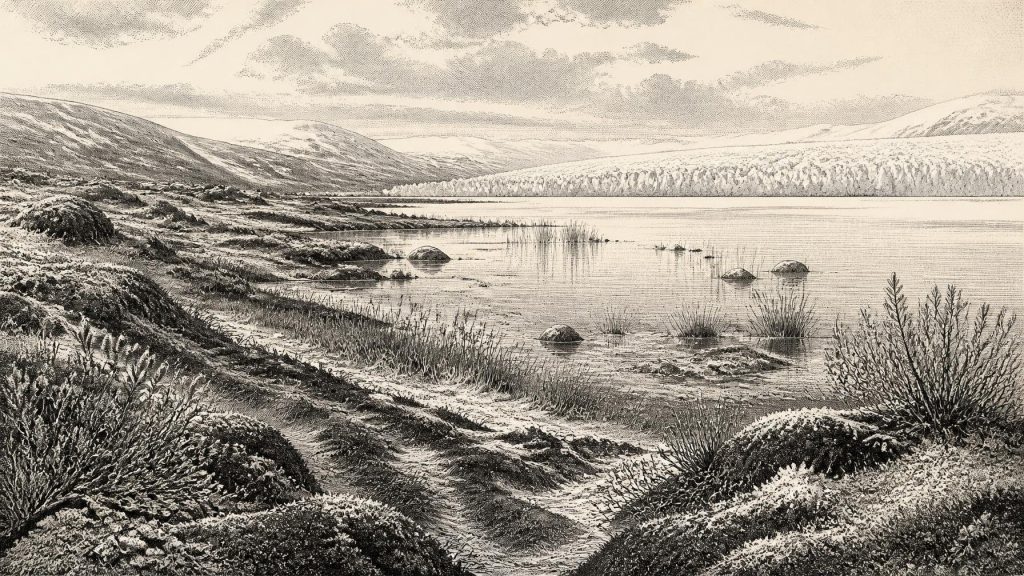
Around 30,508 BCE, Ireland was entering severe Late Pleistocene glaciation, though ice extent and dating remain uncertain. Derryvree, County Fermanagh, preserves moss-rich freshwater sediments between tills, proving an interval of treeless, cold wetland habitat between glacial advances. Its radiocarbon result cannot date a single calendar year. Castlepook Cave, County Cork, produced cold-climate animal remains, including mammoth, reindeer and hyaena, and a possibly butchered reindeer bone suggesting, but not confirming, early human visits. No evidence establishes permanent settlement, politics or culture. Lower seas altered routes without guaranteeing a land bridge. Ireland was a precarious ecological frontier shaped by repeatedly advancing ice.
Dateline
“30,508 BCE” is a useful modern label, not a date that prehistoric Ireland can meet with calendar-year precision. In proleptic calendar arithmetic it lies roughly 32,457 years before AD 1950, the reference point used for radiocarbon ages, but no Irish deposit, animal bone or human trace can securely be assigned to that single year. The responsible history of this moment is therefore a history of intervals, deposits and probabilities. Ireland was in the Late Pleistocene, during the build-up towards the Last Glacial Maximum: a changing world of growing ice, open ground, cold water and mobile animals, rather than a country with recorded peoples or events.
A Landscape in Ice-Sheet Growth
The archaeological period is the Upper Palaeolithic in the broad European sense, but that label should not imply that Ireland has a comparable record of camps, toolkits and burials. For the island itself, the relevant geological framework is the Late Midlandian glaciation, the Irish expression of the Late Devensian. Its chronology remains difficult because advancing ice repeatedly eroded, mixed and buried older ground surfaces. What survives is fragmentary, and much of what once lay along coasts or low-lying routes is now offshore, beneath later sediments, or destroyed by glacial action.
By about 32,500 calibrated years before present, the climate system was moving into a major cold phase. The later global Last Glacial Maximum is commonly placed around 29,000–19,000 years ago, but ice sheets did not expand everywhere at once or in a simple line. Reconstructions of the British–Irish Ice Sheet show growth and shifting flow patterns between roughly 31,000 and 15,000 years ago. At their 30,000-year time slice, northern and central Ireland are reconstructed as receiving advancing ice, while a separate ice mass affected the south-west. Those maps are carefully reasoned reconstructions from landforms, marine cores and dated sediments, not aerial snapshots. At the earlier horizon represented by 30,508 BCE, the exact limits of Irish ice remain less certain.
That uncertainty matters. It would be misleading to imagine either an entirely white island or a wholly ice-free tundra. Conditions varied by region, altitude, season and the behaviour of the ice margin. Some terrain may have been glaciated; other places could have supported exposed sediment, shallow freshwater, sparse vegetation or short-lived habitats at the edge of ice. The dominant historical force was not a kingdom or a war, but the advance and reorganisation of ice, which could erase soils, redirect drainage and close ecological corridors.
The Derryvree Evidence
The most evocative direct Irish environmental archive near this broad period is at Derryvree, near Maguiresbridge in County Fermanagh. There, investigators recorded a sequence in which organic, freshwater sediments lay between tills: deposits left by ice were followed by an interval in which freshwater and waterside organisms existed, before a later glacier overrode and sealed the ground again. This order is secure even where the absolute dating is difficult. It demonstrates that glaciation in the region was episodic rather than a single uninterrupted freeze.
The Derryvree organic layer contained moss-rich mud and fine sediment, with plant and insect evidence indicating a cold, open freshwater setting. The finds include aquatic and wetland plants such as water-milfoil and bogbean, together with sedges, mosses and plants associated with tundra or arctic-alpine conditions, including dwarf willow and mountain avens. This was not woodland Ireland and not a peat bog of the familiar modern kind. It was a treeless, low-productivity mosaic in which shallow water, wet margins, gravelly or silty ground and sparse plant cover could exist amid severe climatic conditions.
A legacy radiocarbon measurement from the Derryvree deposit, BIRM-166, gave 30,500 ± 1,100 radiocarbon years BP. That result is often important in discussions of this era, but it cannot responsibly be converted into a named year such as 30,508 BCE. Radiocarbon years are not calendar years: atmospheric carbon levels changed over time, and the uncertainty on this old determination is substantial. Modern calibration curves turn such a measurement into a broad and non-linear calendar probability range rather than a point date. The stratigraphy is therefore more informative than false precision: Fermanagh held a freshwater habitat between glacial episodes, but the deposit is not a diary entry for one year.
Animals Before the Deepest Cold
County Cork’s Castlepook Cave, near Doneraile, supplies a contrasting record. Its chambers have yielded a remarkable Ice Age fauna: woolly mammoth, reindeer, giant deer, brown bear, wolf, Arctic fox, mountain hare, lemmings and spotted hyaena. These animals do not all prove that they lived together at one instant. Cave deposits accumulate over long spans; carnivores, water, gravity and early excavation can move or mix bones. Nevertheless, the assemblage establishes that Ireland was repeatedly available to a varied cold-climate fauna before the most extensive later ice cover.
Dates obtained from some Castlepook remains fall broadly before the later Last Glacial Maximum. In particular, published work has reported a reindeer femur with a date of around 33,000 radiocarbon years BP and a sharp mark interpreted as a possible butchery cut. This has been presented as evidence of very early human activity in Ireland. It is an important possibility, but not evidence for a settled population at 30,508 BCE. The bone lacks the secure archaeological context of an excavated occupation floor, and no associated hearth, stone-tool assemblage or dwelling has yet demonstrated a contemporaneous camp in the cave.
The careful conclusion is narrower and more valuable. Upper Palaeolithic people may have reached Ireland during favourable windows before ice expansion, perhaps as small and highly mobile groups exploiting large mammals. If the reindeer mark is confirmed as human-made and contemporary with the animal’s death, it records an action rather than a society: the processing of one carcass. It does not identify language, ancestry, group size, territory or duration of residence. Nor does it allow the rich artistic and technological traditions known from continental Europe to be simply transferred across the Irish Sea.
People, Politics and Everyday Survival
No political affairs, diplomacy, chiefs or organised conflict can be recovered for Ireland at this date. There are no written sources, monuments, settlements or securely excavated weapons from which to infer them. Even the question of human presence remains much less firmly answered here than in parts of Britain, France, Iberia or central Europe. The proper historical emphasis is therefore on absence as well as presence: the absence of evidence for permanent Irish communities is significant, though it cannot prove that no person ever crossed the landscape.
If people did visit, their lives would have been structured by mobility, weather and animal movements. Reindeer in particular could offer meat, fat, hide, sinew and bone; yet these potential uses are general Upper Palaeolithic knowledge, not all demonstrated at Castlepook. A visiting party would have required shelter, firewood or fuel, workable stone and dependable routes through a landscape repeatedly transformed by frost, snowmelt and ice. Such practical necessities may have made Ireland an occasional edge of wider north-west European movements rather than a stable homeland. That is an interpretation, not a documented fact.
There is likewise no direct evidence for ritual, formal religion, education, long-distance trade or artistic production in Ireland at this horizon. Humans elsewhere in Upper Palaeolithic Europe possessed social learning, symbolic practices and extensive connections, but Irish evidence does not yet show which, if any, were present here. The closest defensible statement is that any visitors would have carried knowledge and relationships acquired beyond Ireland; the island itself has not yielded material proof of those systems for this interval.
Water, Coasts and Regional Change
Lower global sea levels altered the geography around Ireland, exposing areas now submerged and changing coastal distances. Yet lowered water did not automatically provide an open, dry land bridge to Britain. Geological research has challenged simple pictures of a permanent Irish Sea crossing, while ice, changing relative sea level and marine channels complicated every possible route. At 30,508 BCE, the practical geography of movement may have been as formidable as the climate. The possibility of crossing cannot be treated as proof that it occurred.
In this sense, Derryvree’s mossy mud is a better historical witness than any imagined tribal map. Its plants, insects and sediments record an environment capable of supporting life at a particular kind of cold-water margin. Castlepook’s bones show that large mammals and carnivores entered Irish landscapes during portions of the Late Pleistocene. Ice-sheet reconstructions show that this availability was precarious and diminishing as the glacial system grew. Together, they describe Ireland around the supplied date not as an empty stage before history, but as a changing ecological frontier whose human story, if there was one, survives only in the faintest and most contested traces.
Primary Sources
- A Middle Midlandian Freshwater Series at Derryvree, Maguiresbridge, County Fermanagh, Northern Ireland
- Growth and Retreat of the Last British–Irish Ice Sheet, 31,000 to 15,000 Years Ago: the BRITICE-CHRONO Reconstruction
- Growth, Dynamics and Deglaciation of the Last British-Irish Ice Sheet: the Deep-Sea Ice-Rafted Detritus Record
- Dynamic Cycles, Ice Streams and Their Impact on the Extent, Chronology and Deglaciation of the British–Irish Ice Sheet
- The Deglaciation of the Western Sector of the Irish Ice Sheet from the Inner Continental Shelf to Its Terrestrial Margin
- Radiocarbon Constraints on the Age of the Maximum Advance of the British–Irish Ice Sheet in the Celtic Sea
- The Timing and Magnitude of the British–Irish Ice Sheet Between Marine Isotope Stages 5d and 2: Implications for Glacio-Isostatic Adjustment, High Relative Sea Levels and ‘Giant Erratic’ Emplacement
- The Colonization of Ireland: A Human Ecology Perspective
- First Evidence of a Late Upper Palaeolithic Human Presence in Ireland
- New Insights on the Fauna of Ireland’s Younger Dryas and Early Holocene from Alice & Gwendoline Cave
- The Irish Quaternary Fauna Project
- Irish Quaternary Association Field Guide: References and Recommended Reading
- The IntCal20 Northern Hemisphere Radiocarbon Age Calibration Curve (0–55 cal kBP)
- IntCal Publications
- The Problem of a Late Quaternary Landbridge Between Britain and Ireland
- The Island of Ireland: Drowning the Myth of an Irish Land-Bridge?
- Ireland: Submerged Prehistoric Sites and Landscapes
- Heritage Artefacts of County Cork
- Ireland’s Palaeolithic Archaeology – Fleeting Footprints in a Frozen Land
- Drumlins, Clew Bay





