
Derryvree’s Wetland Witness30281 BCE
Ireland around 30,281 BCE lay within an unstable Late Pleistocene cold phase, not a date permitting annual historical precision. At Derryvree, County Fermanagh, freshwater sediments and organic deposits between two tills show that a local wetland developed during an interval between glacier advances. Radiocarbon evidence places this episode broadly within a calibrated range encompassing the notional year. Treeless vegetation, shifting drainage and cold-adapted fauna characterised varied regional environments. Ice was expanding towards later maximum extent, but Ireland was not demonstrably uniformly ice-covered. Cave finds suggest possible fleeting human visits, yet no settlement is proven. Evidence records environmental change, not societies.
Dateline
The label 30,281 BCE is a modern way of locating a remote part of the Late Pleistocene, not a date that can identify an Irish event, ruler or generation. In the conventional archaeological system it falls roughly 32,230 years before AD 1950, within Marine Isotope Stage 3 (MIS 3), during the last glacial cycle. Calendar-year precision is not available for Ireland at this depth of time. The most responsible account is therefore built from dated ranges, layers of sediment, fossils and the physical traces of moving ice. These sources illuminate changing environments and possible human presence; they do not yield a conventional political or social history.
A Date Inside a Range
The strongest Irish evidence relevant to this point comes from Derryvree, near Maguiresbridge in County Fermanagh. Roadworks cut through a drumlin there in 1969, exposing a remarkable sequence: an older glacial till, freshwater sediments and organic material, then a younger till deposited by returning ice. The order matters more than any single number. It demonstrates that an interval sufficiently free of local glacier ice allowed a freshwater basin to exist between two phases of glacial deposition.
Organic material in this intervening deposit produced the radiocarbon determination BIRM-166, conventionally reported as 30,500 radiocarbon years BP, with a substantial uncertainty of +1,170 and −1,030 years. Radiocarbon years are not calendar years. Calibration, now undertaken with curves such as IntCal20, accounts for past variation in atmospheric carbon-14 but produces probability ranges rather than a pinpoint. Modern treatment places the Derryvree material broadly around 36,900–31,700 calibrated years BP, or approximately 34,950–29,750 BCE. Thus 30,281 BCE lies within the broad calibrated span relevant to the deposit, but cannot be assigned to a particular layer, season or moment in its formation.
The wider North Atlantic chronology offers useful context, not an exact Irish weather forecast. This interval is broadly comparable with Greenland Interstadial 5.2, a relatively milder episode within an otherwise severe and highly unstable glacial period, conventionally dated to about 32.5–32.0 thousand years before AD 2000. Greenland ice cores record abrupt shifts in temperature; Irish cave mineral deposits and inter-till organic beds show that such swings mattered on the Atlantic fringe. But the climatic sequence in an ice core cannot tell us whether a particular Fermanagh pool was frozen on a given day, nor whether all parts of Ireland responded alike.
Freshwater Between Glaciers
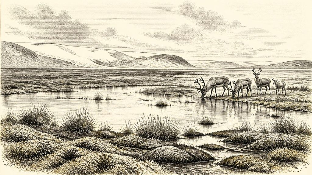
Derryvree is valuable precisely because it is local. Its silts, sands and organic beds preserve evidence of standing or slow-moving freshwater and a wetland margin. Plant macrofossils and pollen point to a treeless, cold-climate setting rather than a forested Ireland. Aquatic and waterside vegetation could grow where water, sediment and a short productive season coincided; sedges, mosses and herbs were better suited to such ground than closed woodland. This was not a benign countryside. It was an open, cold landscape in which snow, frost action, sparse cover and unstable drainage shaped the terrain.
At the same time, Derryvree must not be made to stand for the whole island. A sheltered basin near Maguiresbridge could preserve water and organic matter while higher ground, exposed coasts or areas nearer active ice experienced very different conditions. Nor does the pair of tills establish a single national ice margin for this one notional year. It establishes local succession: ice, a freshwater interval, then ice again. That is enough to overturn any simple image of Ireland as uniformly and continuously buried beneath ice throughout the late glacial cycle.
Other Irish stratigraphic sites reinforce this picture of regional change. Inter-till deposits at Aghnadarragh near Lough Neagh, and records from Greenagho and Hollymount in Fermanagh, preserve episodes in which sediment accumulated away from overriding ice. In south-west Ireland, uranium-series dating of speleothems in Crag Cave shows that dripstone growth responded episodically to climatic amelioration and permafrost decay during MIS 3. These are different archives, with different dating methods and resolutions, but together they show a country experiencing repeated environmental reorganisation rather than one static Ice Age condition.
Ice in Growth, Not Yet at Its Furthest Reach
About 30,281 BCE Ireland was approaching, rather than necessarily already at, the fullest expansion of the last British–Irish Ice Sheet. Modern reconstructions place major ice-sheet growth across the British–Irish region between roughly 31,000 and 26,000 years ago, while maximum positions in different sectors were reached at different times, broadly between 30,000 and 22,000 years ago. The better-defined Last Glacial Maximum is usually placed later, around 27,000–23,000 calibrated years BP in the Irish setting, with some regional advances continuing into the following millennia.
This distinction changes the historical landscape. The familiar drumlins, moraines, scoured rock surfaces and till sheets visible across Ireland chiefly record the cumulative work of ice advances and retreats, not one instant. At Derryvree, younger ice eventually sealed the wetland record beneath till. In southern Ireland, research on the Courtmacsherry Raised Beach and on tills and outwash has substantially revised older claims that wide areas escaped the last glaciation. By the later maximum, much of the island was indeed ice-covered. Yet the evidence does not licence the claim that all of Ireland was under a single, uniform ice cover in 30,281 BCE.
Sea level was far lower than today because large quantities of water were stored in continental ice sheets, altering coasts and the extent of the Irish and Celtic Sea shelves. But the detailed configuration of shorelines, ice streams, seasonal sea ice and crossings changed through time. It is safer to say that Ireland belonged to a wider north-west European environmental zone, connected ecologically by shifting seas, ice and exposed shelf landscapes, than to draw a simple land bridge or a settled migration route for this particular date.
Animals, Caves and a Human Question
Late Pleistocene cave deposits show that Ireland supported, at different times between at least about 45,000 and 20,000 years ago, a much richer large-mammal fauna than the island has today. Castlepook Cave, near Doneraile in County Cork, has yielded remains attributed to reindeer, woolly mammoth, brown bear, wolf, Arctic fox, mountain hare, lemmings and spotted hyaena, among others. Such assemblages evoke an open, cold-adapted mosaic with grazing and browsing animals, predators and scavengers. They do not demonstrate that every listed species shared the same valley, or even the same century; cave collections can combine material accumulated across long periods and disturbed by animals, water and earlier excavation.
Castlepook also raises Ireland’s most difficult early-human question. A reindeer femur from the cave bears an incision interpreted by its investigators as a stone-tool cut mark made while the bone was fresh. The find has been presented as possible evidence of Upper Palaeolithic human activity in Ireland around 33,000 years ago, vastly earlier than the island’s well-established Mesolithic settlement record. The inference is important, but deliberately narrow. A modified bone may record the handling or butchery of one carcass; it is not a hearth, dwelling, tool assemblage, burial, population estimate or proof of continuous occupation.
Its chronology and association must therefore not be stretched to populate Ireland in 30,281 BCE with named communities. The Castlepook date does not identify people at Derryvree, and Derryvree’s wetland sequence contains no demonstrated camp. It remains plausible that small Upper Palaeolithic groups occasionally reached favourable parts of Ireland during milder windows, particularly given human occupation elsewhere in north-west Europe. It is equally clear that the surviving Irish evidence is too slight to reconstruct their numbers, ancestry, language, routes, seasonal rounds or descendants. The strongest statement is that a fleeting human presence is possible, perhaps supported by one significant specimen, not that an inhabited island can yet be described.
No Kingdoms, No Trade Network
For this period there is no evidence for political institutions, diplomacy, territorial rule, organised warfare or any named conflict in Ireland. Nor is there evidence for farming, herding, permanent villages, metalworking, long-distance trade networks, formal religion, writing or learned institutions. These are not missing chapters waiting to be filled with imagination: the available record does not support them. If people did visit, their economy would have depended on immediate knowledge of animals, weather, fuel, shelter and stone, but even this is an inference from Upper Palaeolithic lifeways elsewhere rather than a directly excavated Irish household.
Culture is similarly elusive. No securely dated Irish artwork, ornament, ritual deposit or human grave belongs to this point. Cave spaces in Cork preserve faunal histories and perhaps one trace of carcass processing, not evidence for a local artistic or ceremonial tradition. The meaningful ‘regional change’ is environmental: freshwater habitats could briefly develop; vegetation followed climatic opportunity; animal communities moved through or occupied available landscapes; and advancing ice repeatedly erased or buried traces. The later ice sheet was both a geological force and an archival one, likely destroying many surfaces on which short-lived human activity might otherwise have survived.
What Can Be Said Responsibly
Ireland around this notional year was a glacial-age island in transition. In and around Fermanagh, the Derryvree sequence preserves a freshwater world that existed between advances of ice, dated only within a broad calibrated range. Across the island, cave bones, wetland sediments, raised-shore deposits, speleothems and glacial landforms document ecosystems and climate shifts on scales of centuries to millennia. They offer an unusually deep prehistory, but not an annual chronicle.
The essential historical fact is therefore not a battle, dynasty or settlement foundation. It is the precarious persistence of habitable niches during an unstable cold stage: pools and wet ground where plants grew, open terrain used by animals, caves that accumulated bones, and landscapes increasingly vulnerable to renewed glaciation. Derryvree’s buried freshwater deposits are a witness to that interval. They give Ireland a scientifically dated environmental history near 30,281 BCE, while also marking the boundary between what the evidence demonstrates and what responsible interpretation must leave unknown.
Primary Sources
- A Middle Midlandian Freshwater Series at Derryvree, Maguiresbridge, County Fermanagh, Northern Ireland
- The Late Quaternary History of East-Central Ireland
- Aghnadarragh
- The Irish Quaternary Fauna Project
- A Reconsideration of the Radiocarbon Dating of the Marine Isotope Stage 3 Fauna from Southern Ireland
- First Evidence of a Late Upper Palaeolithic Human Presence in Ireland
- Archaeological Heritage of County Cork
- The Colonization of Ireland: A Human Ecology Perspective
- Episodic Speleothem Deposition Tracks the Terrestrial Impact of Millennial-Scale Last Glacial Climate Variability in SW Ireland
- Late Pleistocene Chronostratigraphy and Ice Sheet Limits, Southern Ireland
- Radiocarbon Constraints on the Age of the Maximum Advance of the British–Irish Ice Sheet in the Celtic Sea
- Pattern and Timing of Retreat of the Last British-Irish Ice Sheet
- Growth and Retreat of the Last British–Irish Ice Sheet, 31,000 to 15,000 Years Ago: the BRITICE-CHRONO Reconstruction
- Response of the Irish Ice Sheet to Abrupt Climate Change During the Last Deglaciation
- Trimlines, Blockfields and the Vertical Extent of the Last Ice Sheet in Southern Ireland
- Dimensions and Chronology of the Last Ice Sheet in Western Ireland
- Deglaciation Chronology of the Donegal Ice Centre, North-West Ireland
- The IntCal20 Northern Hemisphere Radiocarbon Age Calibration Curve (0–55 cal kBP)
- The Greenland Ice Core Chronology 2005, 15–42 ka. Part 1: Constructing the Time Scale
- A Stratigraphic Framework for Abrupt Climatic Changes During the Last Glacial Period Based on Three Synchronized Greenland Ice-Core Records
- Independent Tephrochronological Evidence for Rapid and Synchronous Oceanic and Atmospheric Temperature Rises Over the Greenland Stadial-Interstadial Transitions Between ca. 32 and 40 ka b2k
- New Insights on the Fauna of Ireland’s Younger Dryas and Early Holocene from Alice & Gwendoline Cave
