Derryvree’s Tundra Archive31989 BCE
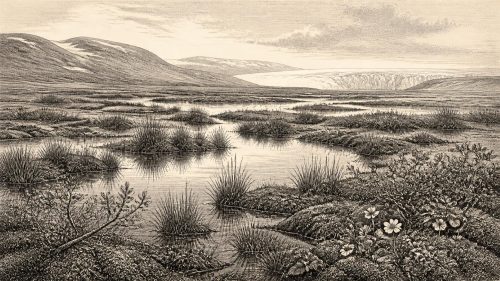
About 31,989 BCE, Ireland lay within Marine Isotope Stage 3, a cold Late Pleistocene interval preceding the last ice sheet’s greatest expansion. Evidence from Fermanagh, notably Derryvree freshwater sediments, indicates locally ice-free, open, treeless tundra or wet muskeg, with sedges, grasses, mosses and pools. Glacial landforms and offshore records show an ice mass developing unevenly, not uniform island-wide cover. Fossils suggest intermittent presence of large mammals, including mammoth and reindeer, but cannot establish contemporaneous communities. Lower sea levels altered coasts and access. No credible evidence demonstrates human occupation. Environmental phase helped create landscapes and conditions encountered by Ireland’s Mesolithic settlers.
Dateline
31,989 BCE is not a date at which Ireland can be described year by year in the ordinary historical sense. It is a modern, proleptic calendar label for a point roughly 33.9 thousand years before present (where ‘present’ in radiocarbon practice is AD 1950). No calendar was in use in Ireland, no written testimony exists, and even the scientific evidence is normally resolved into ranges of centuries or millennia rather than a single year. The responsible question is therefore not ‘what happened in 31,989 BCE?’, but what the archaeological, geological and palaeoenvironmental record can say about Ireland around c. 34,000 years ago.
A Cold-Stage Ireland
This point falls within Marine Isotope Stage 3, during the wider Late Pleistocene cold stage conventionally called the Midlandian in Ireland and the Late Devensian in Britain. It preceded the fullest expansion of the last British–Irish Ice Sheet, but it belongs to the long climatic deterioration from which that ice sheet grew. Recent reconstructions show that the build-up, maximum extent and retreat of ice across Ireland and Britain were highly asynchronous: different sectors advanced and retreated at different times. The greatest ice volume in the most recent reconstruction occurred around 23,000 years ago, while some sectors had advanced earlier. That pattern is a warning against imagining a single, uniform moment when all of Ireland suddenly vanished beneath ice.
For c. 34 ka, the best evidence points to a landscape in transition rather than a securely mapped island-wide ice cover. In north-central Ireland, organic sediments beneath later glacial deposits at Greenagho, County Fermanagh, have been interpreted as showing ice-free conditions until at least about 34 ka. At Derryvree, also in Fermanagh, freshwater silts lying between tills produced a radiocarbon determination whose calibrated range is approximately 36.9–31.7 cal ka BP. These ranges overlap the modern label 31,989 BCE, but they do not identify conditions in that exact year, nor can they be applied uncritically to every part of the island.
What the Ground Records
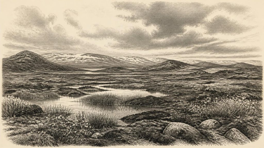
The Derryvree deposit is especially important because it preserves a rare environmental archive from an interval later buried and protected by glacial sediment. Its pollen, plant remains and mosses indicate open, treeless tundra or muskeg: wet ground with pools and sedge- and grass-dominated vegetation, rather than the dense woods commonly associated with modern Ireland. Such evidence describes a local environment near the site, not a photographic panorama of the whole country. Nevertheless, it strongly supports an Ireland in which cold, exposed ground and seasonal extremes shaped life across at least parts of the north-western margin of Europe.
Glacial deposits are themselves historical evidence. Tills, streamlined bedforms, moraines, erratic boulders and meltwater sediments retain the direction and behaviour of ancient ice. Geological Survey Ireland mapping records subglacial lineations, moraines and ice-marginal landforms across the island; these are the eventual products of ice movement, deposition and retreat, not monuments made by people. The familiar drumlins, eskers and many glacially modified valleys of Ireland owe their broad form to repeated Quaternary glaciations, though the precise contribution of each episode remains an active subject of research.
The crucial distinction is chronological. The ice sheet that later reached far onto the continental shelf west and south-west of Ireland achieved its fullest late-glacial extension chiefly between about 28 and 24 cal ka BP in those marine sectors. Offshore cores, submarine ridges and dated glacigenic sediments have transformed understanding of that advance. Around 33.9 ka BP, by contrast, the Irish ice mass was still developing, and evidence from Fermanagh indicates that at least some inland terrain had not yet been overwhelmed. The eventual ice-sheet maximum must not be projected wholesale back onto 31,989 BCE.
Plants, Animals and Uncertainty
The cold-stage landscape was not necessarily a featureless desert. Pollen and macrofossils from Irish deposits indicate herbs, grasses, sedges, mosses and low-growing plants adapted to open ground and wet, periglacial conditions. Sparse vegetation could sustain grazing and browsing animals where snow cover, soils and season permitted. Yet vegetation varied sharply with drainage, altitude, exposure and proximity to ice. It is safer to speak of patchy tundra-like and wetland environments than of one uniform ‘mammoth steppe’ extending across the entire island.
Caves and other fossil deposits add a second, more fragmentary record. Material associated with the Irish Quaternary Fauna Project indicates that large mammals including mammoth, reindeer, giant deer, brown bear and spotted hyaena occurred in Ireland during portions of Marine Isotope Stage 3. Some mammal remains from Castlepook Cave in County Cork have been assigned broadly to c. 34–35 ka. These finds establish that Ireland could form part of wider north-west European animal ranges during suitable cold-stage intervals. They do not prove that every listed species stood together at Castlepook—or anywhere else—on the calendar year 31,989 BCE. Fossil assemblages reflect preservation, transport, predation and dating limits as well as living communities.
Sea level was much lower globally than it is today because vast quantities of water were held in land ice. The continental shelves around Ireland were consequently more extensive, but the configuration of coast, marine channels, glacier fronts and exposed ground altered through time. Ireland’s position at Europe’s north-western edge mattered greatly: climatic shifts, ice flow through the Irish Sea basin and changing marine barriers determined which plants and animals could arrive, survive or disappear. This was regional change on a geological scale, not a stable national landscape with fixed shorelines.
No Demonstrable Human Community
There is no credible evidence for a human settlement, camp, tool-making site, burial or occupation surface in Ireland at c. 34 ka BP. This absence is particularly significant because anatomically modern humans were present elsewhere in Europe in the Upper Palaeolithic. It should not be turned into a claim that humans were incapable of entering Ireland; rather, the present archaeological record does not demonstrate that they did. An object found at Mell, near Drogheda, is an old flint flake, but the National Museum of Ireland explains that it was fashioned elsewhere and transported into Ireland by ice, not evidence for a Palaeolithic Irish settlement.
Accordingly, there were no evidenced Irish political affairs, leaders, alliances, diplomatic encounters or wars to narrate for this date. Nor is there evidence for households, villages, hunting parties, ritual places, languages, teaching traditions, trade networks or an economy within Ireland. These are not subjects hidden in an unwritten indigenous chronicle awaiting recovery: for this particular period they lack the material traces required to support historical reconstruction. A responsible account must leave those categories blank rather than fill them with generic Ice Age people.
This does not make the period irrelevant to Irish history. The absence of a known human population is itself part of the island’s long history, and the physical processes underway were laying down the terrain, sediments, routes and ecological constraints encountered by people much later. Ireland’s first substantial and securely recognised archaeological record belongs to the Mesolithic, thousands of years after the final retreat of the last ice sheets. The National Museum places the earliest Stone Age material in its collections in the Mesolithic, around 7000–4000 BCE, while the Heritage Council describes the earliest known settlement evidence as beginning about 8000 BCE.
Landscape Before Settlement
For people living far to the south and east, Ireland around c. 34 ka was part of the broader environmental geography of Upper Palaeolithic Europe: a cold Atlantic-edge region whose accessibility and habitability shifted with climate. But direct relevance is not direct evidence. The stone industries, art, clothing, social systems and belief worlds of continental Upper Palaeolithic communities cannot simply be transferred across the sea to Ireland. Without Irish artefacts in secure context, interpretations must remain comparative possibilities, not Irish facts.
What can be said with confidence is that the island’s later cultural history would unfold upon a profoundly altered physical foundation. Ice erosion and deposition reshaped drainage, left thick sediments in many lowlands and prepared landforms that later influenced soils, lakes, wetlands and travel. When the ice ultimately withdrew, plants and animals recolonised in constrained sequences, and only much later did human communities establish the camps, tools and domestic traces from which conventional Irish prehistory begins.
Thus 31,989 BCE is best understood as an environmental rather than a human historical horizon: Ireland was cold, locally open and treeless in the best-documented areas, with ice expansion looming but not yet demonstrably at its island-wide maximum. The evidence is strongest in a handful of sedimentary archives, cave deposits, landforms and offshore cores. It allows a cautious picture of climate, terrain and animal possibility. It does not allow named inhabitants, events or institutions—and recognising that limit is the most accurate way to place this remote date in Ireland’s past.
Primary Sources
- Growth and retreat of the last British–Irish Ice Sheet, 31,000 to 15,000 years ago: the BRITICE-CHRONO reconstruction
- Growth and retreat of the last British–Irish Ice Sheet, 31,000 to 15,000 years ago: the BRITICE-CHRONO reconstruction
- Pattern and timing of retreat of the last British-Irish Ice Sheet
- Trimlines, blockfields and the vertical extent of the last ice sheet in southern Ireland
- Maximum extent and dynamic behaviour of the last British–Irish Ice Sheet west of Ireland
- Timing and pace of ice-sheet withdrawal across the marine–terrestrial transition west of Ireland during the last glaciation
- Character of advance and retreat of the southwest sector of the British-Irish Ice Sheet
- Maximum extent and readvance dynamics of the Irish Sea Ice Stream and Irish Sea Glacier since the Last Glacial Maximum
- Glacial geomorphology in the Wicklow Mountains, Ireland
- Quaternary
- Ireland through geological time
- Palaeoecology: Irish Quaternary Association Field Guide
- Figure 6: The subdivision of the Quaternary Period in Ireland
- Introduction to the Late Quaternary and Holocene of Northern Ireland
- Derrylin Complex
- The Irish Quaternary Fauna Project
- Ireland's First Settlers: Time and the Mesolithic
- Stone Age
- Prehistoric Details
- Our Ancient Landscapes: Hunter-Gatherers in Ireland
- Ireland’s Maritime Archaeology: Our Ancient Coastal Landscapes
- Climate change and hunter gatherers in Ireland: problems, potentials and pressing research questions
- The Antiquity of Man in Ireland