
Castlepook’s Lone Reindeer Mark31026 BCE
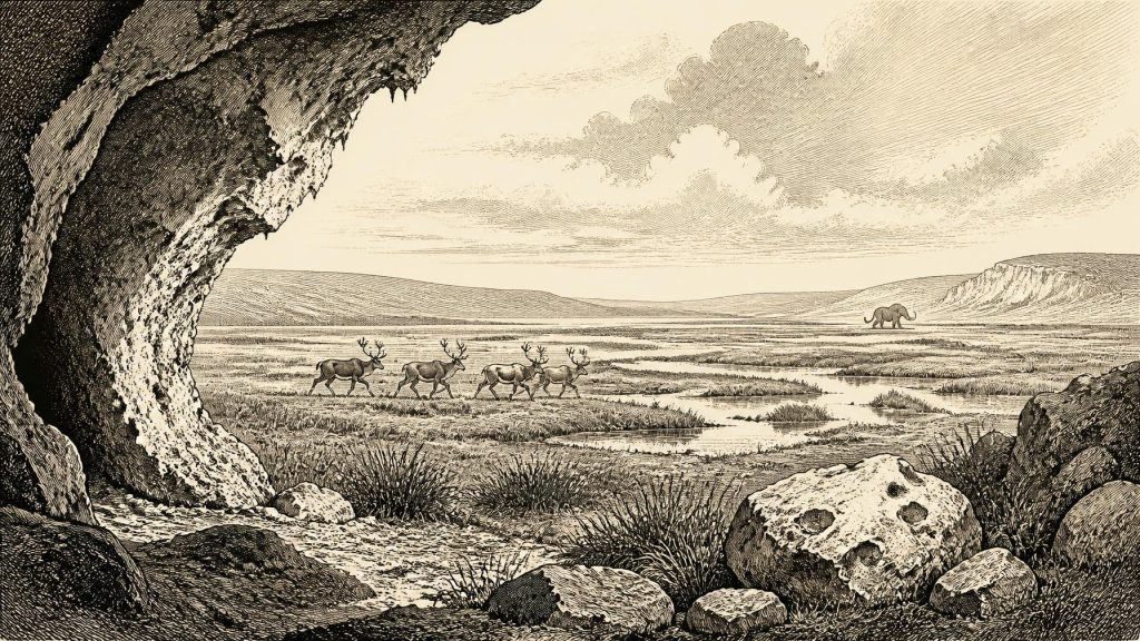
Around 31,026 BCE, Ireland was a cold, environmentally unstable Upper Palaeolithic landscape, not a documented human society. Before the Last Glacial Maximum, shifting ice, low sea levels and changing terrain shaped access and preservation. Castlepook Cave, County Cork, contains remains of reindeer, mammoth, giant deer and predators, indicating open, treeless habitats. A marked reindeer femur may record early human butchery, but its interpretation cannot prove permanent settlement. Derryvree, County Fermanagh, preserves freshwater deposits between glacial tills, showing tundra-like wetlands during an ice-free interval. Together, sites demonstrate changing ecosystems and possible transient human visits, leaving political and cultural history largely unknown.
Dateline
“31,026 BCE” is not a date at which Irish history can be narrated year by year. It is a modern calendar label projected almost 33 millennia into the past, during the Upper Palaeolithic and Marine Isotope Stage 3. No written records, named communities, rulers, settlements or securely dated events survive from Ireland for this notional year. Even radiocarbon results do not provide such precision: they are measurements with uncertainties, expressed conventionally in years before 1950 and then calibrated into broad calendar ranges. The responsible question is therefore not what happened in Ireland in this single year, but what the archaeological and environmental record can say about conditions in the island during the wider period around it.
A Cold Island Before Maximum Ice
This was an interval before the Last Glacial Maximum, when the British–Irish Ice Sheet later reached its greatest extent, broadly between about 27,000 and 23,000 calibrated years before present. Ireland was not yet the entirely ice-covered landscape of that maximum, but neither was it stable or uniformly hospitable. Ice margins advanced and retreated at different times in different regions; climate shifted rapidly; and surviving deposits are patchy. A location that was open ground or wetland during one phase could later be overridden by ice, its surface evidence destroyed or deeply buried beneath till.
Sea level was substantially lower than today because large volumes of water were locked in northern ice sheets. The outlines of coastlines, estuaries and shallow seas differed markedly from modern maps. Yet lower sea level should not be mistaken for proof of an easy land crossing or continuous dry route to Ireland. The configuration of the Irish Sea basin, ice, rivers and coastlines changed repeatedly. For people or animals approaching from Britain or continental Europe, any route westward was shaped by cold, terrain, water and the availability of food, not simply by a single line on a map.
In archaeological terminology, this belongs to the Upper Palaeolithic: the long period in which Homo sapiens populations elsewhere in Europe used sophisticated stone technologies and lived by hunting, gathering and seasonal movement. That continental framework is useful, but it must not be converted into an imagined Irish society. No securely excavated Irish camp, hearth, stone-tool assemblage, dwelling, burial, artwork or ornament can presently be assigned to around 31,026 BCE. There is consequently no evidential basis for describing clans, leaders, languages, religious practices, diplomacy, trade networks or a settled political order in Ireland at this time.
The Castlepook Question
The most arresting evidence relevant to this broad horizon comes from Castlepook Cave, near Doneraile in north County Cork. Excavations there in the early twentieth century recovered a remarkable concentration of Pleistocene animal remains. The cave’s collections include evidence for reindeer, woolly mammoth, giant deer, brown bear, wolf, Arctic fox, lemmings and spotted hyaena. These animals do not all represent one moment or one intact living community. Cave deposits accumulated through natural deaths, carnivore activity, water movement, sediment disturbance and early excavation, over a very long span. Castlepook is therefore an archive of changing Ice Age environments rather than a snapshot of one hunting episode.
A reindeer femur from the cave has been publicly presented as bearing a deep linear mark interpreted as a fresh-bone cut or chop made by a sharp stone implement, and as having an age of roughly 33,000 radiocarbon years. If that interpretation and association are sustained, it would indicate a human visit or butchery event in Ireland far earlier than the previously accepted terminal-Pleistocene evidence. It would not demonstrate a permanent population, a village or repeated occupation. One marked animal bone, especially from an old collection without associated tools, hearths or a modern excavation context, can at most support the possibility of a brief human action.
The distinction matters because cut marks can be difficult to diagnose, and the age of a bone does not itself date the instant when a surface mark was made. The reported reindeer evidence is important enough to deserve continued specialist scrutiny, but it should not be inflated into a foundation story for the Irish people. The more securely published evidence for Palaeolithic human activity remains much later: a cut-marked brown-bear patella from Alice and Gwendoline Cave, County Clare, radiocarbon dated to the opening of the Younger Dryas, about 12,810–12,590 calibrated years before present. That later find shows why direct dating and close zooarchaeological examination can transform old museum collections; it also illustrates how rare Ireland’s evidence is.
Animals, Not an Irish Nation
Castlepook nonetheless gives an unusually vivid indication of the ecological possibilities of pre-maximum-glaciation Ireland. Reindeer imply open, cold-adapted habitats with extensive grazing and browsing opportunities. Mammoth and giant deer point towards broad, largely treeless landscapes rather than closed woodland. Spotted hyaena, represented at Castlepook by bones and other evidence of carnivore use of the cave, was not a tropical animal transplanted into a northern fantasy: Ice Age spotted hyaenas ranged across temperate and cold-steppe environments in Europe. Wolves, foxes and small mammals complete a food web in which carcasses, predators and scavengers all contributed to the fossil record.
This was not the modern Irish fauna in harsher weather. It was a different ecological world, shaped by cold climates, open vegetation and mobility. Some species were local only intermittently; others may have disappeared from Ireland before the later glacial maximum. Re-dating work has shown that several older Irish cave radiocarbon determinations were too young because early methods did not remove contaminants as effectively as modern ultrafiltration techniques. At Castlepook, revised dates have pushed some fauna thousands of radiocarbon years further back. The lesson is methodological as well as historical: apparent certainty about a single Ice Age date can be overturned by better sampling and laboratory practice.
Derryvree’s Buried Wetland
Another essential line of evidence lies far from Cork. At Derryvree near Maguiresbridge in County Fermanagh, roadworks exposed freshwater silts and fine sands enclosed between two thick layers of glacial till inside a drumlin. The sequence records a local order of events: ice deposited the lower till; an interval without ice at that spot allowed freshwater sediment and organic remains to accumulate; then later ice or a renewed advance sealed the deposit beneath upper till. It is not a record of one year, nor proof that all Ireland was ice-free simultaneously, but it is a rare survival from a landscape otherwise repeatedly remodelled by glaciers.
The Derryvree material produced a conventional radiocarbon determination of about 30,500 years before present, with a substantial uncertainty. Modern calibration places the relevant interval broadly in later Marine Isotope Stage 3, approximately 37,000–32,000 calibrated years before present. That wide range overlaps the notional calendar position of 31,026 BCE only in the loosest chronological sense. Its value lies in environmental evidence: pollen, plant macrofossils, mosses and insects indicate open, treeless ground, with grasses, sedges, herbs, juniper and cold-tolerant plants around freshwater pools and wet, peaty ground. Scholars describe such a setting as tundra or muskeg, not as a forested Ireland.
These environmental archives help explain both the attractions and limits of the island. Seasonal wetlands could support plants, birds and grazing animals, while limestone caves offered shelter to animals and perhaps occasional people. But cold temperatures, shifting ice fronts, exposed terrain and thin vegetation would have made long-term living difficult. The evidence supports a landscape capable of sustaining animal populations and perhaps transient human parties; it does not establish a stable human homeland. Any people reaching Ireland may have been highly mobile hunter-gatherers, able to exploit animal movements and short seasonal opportunities. That is an inference from the wider European Upper Palaeolithic and the local fauna, not a directly documented Irish way of life.
What Cannot Be Claimed
There is no basis around this date for political history in the usual sense. No state, chiefdom, territory, treaty, battle or diplomatic relationship can be identified. Nor is there evidence for farming, herding, pottery, metallurgy, monument building, formal trade or permanent settlement. Reindeer were wild, not domestic stock; a possible butchered bone would represent food processing or the use of animal materials, not an agricultural economy. Likewise, no shrine, grave, cave art or symbolic object from Ireland can responsibly be assigned to this horizon, so claims about belief, ceremony, language or learning would be invention.
The most meaningful regional development was environmental instability. Ireland stood on the Atlantic edge of north-west Europe while the climate deteriorated towards full glacial conditions. Ice, permafrost, wind, runoff and sparse plant cover affected which animals could enter or persist and which traces could survive. Later ice erosion almost certainly removed many surface sites. This destructive history is one reason why absence of discovered camps is not proof that no person ever set foot on the island. Equally, erosion cannot serve as permission to assert an undocumented population. The record permits carefully framed possibility, not certainty.
For Ireland around 31,026 BCE, then, Castlepook and Derryvree offer complementary evidence. The Cork cave preserves a faunal archive from an open, cold-stage ecosystem and a provocative possible sign of butchery. The Fermanagh sediments preserve a buried freshwater landscape between phases of glaciation. Together they reveal an island undergoing profound climatic change, inhabited by an Ice Age animal world and potentially visited by small human groups. They do not reveal an Irish society in the later historical sense. Their significance is precisely that they preserve the fragile, contested beginnings of a much deeper human and environmental past.
Primary Sources
- A reconsideration of the radiocarbon dating of the Marine Isotope Stage 3 fauna from southern Ireland
- First evidence of a Late Upper Palaeolithic human presence in Ireland
- New insights on the fauna of Ireland's Younger Dryas and Early Holocene from Alice & Gwendoline Cave
- The Irish Quaternary Fauna Project
- The exploration of Castlepook Cave, County Cork
- Occurrence of mammalia relicts at site Castlepook Cave
- A Middle Midlandian Freshwater Series at Derryvree, Maguiresbridge, County Fermanagh, Northern Ireland
- Late Pleistocene chronostratigraphy and ice sheet limits, southern Ireland
- Pattern and timing of retreat of the last British-Irish Ice Sheet
- Growth and retreat of the last British–Irish Ice Sheet, 31,000 to 15,000 years ago: the BRITICE-CHRONO reconstruction
- The last Irish Ice Sheet: extent and chronology
- The deglaciation of the western sector of the Irish Ice Sheet from the inner continental shelf to its terrestrial margin
- British–Irish Ice Sheet and polar front history of the Goban Spur, offshore southwest Ireland over the last 250,000 years
- Ireland: Submerged Prehistoric Sites and Landscapes
- The IntCal20 Northern Hemisphere Radiocarbon Age Calibration Curve (0–55 cal kBP)
- OxCal
- Geology of Ireland
- Heritage Artefacts of County Cork
- Castlepook Cave, Co. Cork: excavation report 2022
- Revisiting Alice and Gwendoline Cave, Co. Clare: New light on the 1902 excavations
- Palaeoecology
- Figure 6—The subdivision of the Quaternary Period in Ireland
