

The Fermanagh Bogbean Record31027 BCE
Around 31,027 BCE, Ireland’s evidence records broad Late Pleistocene conditions rather than a particular year. At Derryvree, County Fermanagh, freshwater silts between glacial tills preserve bogbean, dwarf willow, mosses, insects and other remains from an open, treeless, tundra-like wetland during MIS 3. Southern caves, especially Castlepook in County Cork, demonstrate the presence of animals including reindeer, mammoth, giant deer and hyaena across extended, uncertain periods. A marked reindeer bone may indicate human butchery, yet no secure Palaeolithic settlement is known. Advancing ice, altered coasts and later erosion restricted habitats and destroyed evidence, leaving a fragmented record of intermittently habitable landscapes.
Dateline
The label 31,027 BCE suggests a precision that the Irish evidence cannot bear. No one in Ireland recorded a year, season, ruler or event at this depth of time, and neither archaeology nor environmental science can isolate a particular calendar year. In radiocarbon terms, the date lies roughly 33,000 calendar years before the conventional present of AD 1950, within the Late Pleistocene and Marine Isotope Stage 3 (MIS 3), a long, cold and unstable phase of the last glacial cycle. The responsible history of Ireland at this point is therefore a history of dated ranges, buried sediments, animal bones and changing ice, rather than an annual chronicle.
The most revealing Irish evidence comes from Derryvree, near Maguiresbridge in County Fermanagh. There, road-cutting in 1969 exposed a rare freshwater series sealed inside a drumlin. Organic silts and fine sands lay between two thick deposits of glacial till: material left by glacier ice. The order matters. Ice had previously crossed the locality and deposited the lower till; later, a non-glacial freshwater environment formed; still later, ice or glacial sediment again covered and preserved it. Derryvree does not describe all Ireland in one moment, but it offers an unusually valuable local window onto a cold interval broadly relevant to this date.
A Date Within a Broad Range
Organic material from the Derryvree deposits produced a conventional radiocarbon determination of 30,500 +1,170/−1,030 years BP. That is a laboratory radiocarbon age, not a calendar date. At such antiquity, calibration against changing atmospheric carbon levels produces a wide probability range spanning several millennia. Consequently, 31,027 BCE can be related cautiously to the deposit’s general chronological horizon, but cannot be assigned to a particular layer, plant, insect, animal or episode at Derryvree. The evidence supports an environmental setting around this broad period; it does not support a claim that a named occurrence happened in Ireland in this individual year.
This distinction is more than technical. Much of Ireland’s Pleistocene record was eroded, reworked or buried during later glaciations. What survives is uneven in both geography and age. A freshwater bed below a Fermanagh drumlin, and faunal material recovered from caves in the south, are precious precisely because they have escaped complete destruction. They must not, however, be turned into a map of every valley, coast or upland. Ireland was not a uniform landscape. Local conditions depended on altitude, exposure, drainage, proximity to ice and the shifting position of the ice-sheet margin.
Freshwater at Derryvree
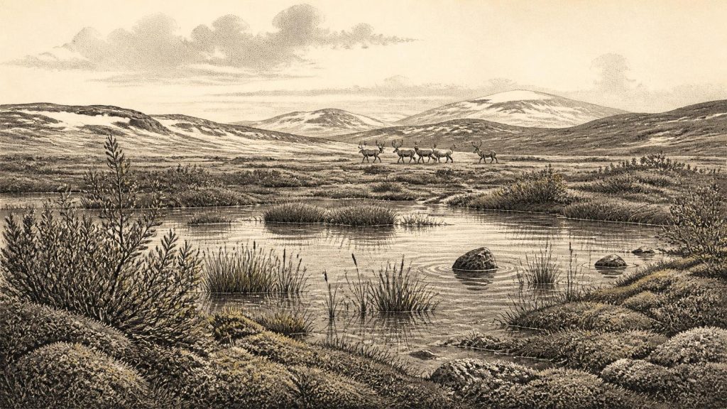
The Derryvree silts preserve the signatures of standing or slowly moving freshwater and wet ground. Pollen, plant macrofossils, mosses and insect remains indicate an open, cold landscape rather than woodland. The flora included hardy wetland and tundra-associated plants. A seed of bogbean (Menyanthes trifoliata) is especially striking: the plant is familiar in modern marshy ground, yet its fossil presence here records a far colder world. Fossil dwarf willow and mountain-avens, together with sedges, mosses and other herbs, point to sparse vegetation around pools, wet hollows and exposed mineral soils.
“Tundra” should not conjure a featureless white waste. The best interpretation is a periglacial mosaic: shallow water, saturated margins, low herbaceous cover, patches of moss and sedge, and more exposed, frost-affected ground. Summer growth could have been rapid where meltwater and light allowed it, while winters were severe and long. Trees were absent locally or extremely scarce. A few pollen grains from trees cannot overturn that conclusion, since pollen may travel great distances or be redeposited. The stronger evidence is the combined ecological character of the assemblage: an open, treeless and cold freshwater landscape.
Such conditions shaped every possibility for life. There was no farming, no managed pasture and no permanent field system. There is no evidence for houses, campsites, hearths, pottery, textiles, boats or built monuments from Derryvree’s horizon. Nor is there material evidence for religious practice, formal learning, political authority, diplomacy or exchange networks in Ireland at this date. These are not missing chapters waiting to be filled with analogy; they are questions for which the surviving Irish record presently gives no answer.
Animals in a Changing Country
Southern Irish caves nevertheless show that parts of the island supported a more varied cold-stage fauna during MIS 3 than the modern landscape would suggest. Castlepook Cave near Doneraile, County Cork, is central to that evidence. Its historic excavations produced remains attributed to reindeer, woolly mammoth, giant deer, brown bear, hare, fox and spotted hyaena, among others. The cave collections are scientifically important but difficult: much of the material was excavated in the early twentieth century, before modern standards of stratigraphic recording, and bones from different periods can be mixed by animal activity, water movement, sediment disturbance and excavation.
Modern radiocarbon re-dating has revised the chronology of several southern Irish cave specimens, demonstrating that some are thousands of radiocarbon years older than earlier measurements indicated. The broad conclusion is secure: mammals entered and lived in Ireland during parts of MIS 3, before the Last Glacial Maximum. The more detailed claim—that every species listed from Castlepook occupied the same landscape at the same time—would be unwarranted. Cave assemblages accumulate over long intervals. They record animal presence and ecological opportunity, not a single living community frozen in time.
Reindeer are particularly relevant to the environmental picture. Their presence is compatible with open country and cold climates, though bones alone cannot tell us whether herds were resident, seasonal or occasional visitors. Mammoth, giant deer and hyaena remains demonstrate that Ireland’s Late Pleistocene fauna included animals now absent from the island, but their discovery does not make the country a simple replica of a continental “mammoth-steppe”. The island setting, variable topography and advancing ice ensured local complexity. Predators, scavengers and herbivores would have followed food, shelter and passable terrain, while seasonal snow cover and frozen ground constrained movement.
The Castlepook Human Question
One Castlepook reindeer femur has acquired exceptional importance because a deep surface mark has been interpreted as a fresh-bone cut or chop made by a sharp stone tool. County Cork heritage material has presented the bone as dating to about 31,000 BCE, and its potential implications are considerable. If the modification is confirmed as human-made and securely connected to the bone’s age, it may indicate that a person or small group processed a reindeer in Ireland during the Upper Palaeolithic, far earlier than the island’s well-established post-glacial settlement record.
Yet the inference must remain limited. A modified bone is not a settlement; it does not establish a resident population, a camp, a language, a kin group or a cultural tradition. No associated lithic assemblage, hearth, dwelling, burial or securely stratified occupation surface of this date has been recovered in Ireland. The National Museum of Ireland accordingly continues to stress that clear Palaeolithic human presence has not been demonstrated. Ongoing work at Castlepook seeks surviving deposits, improved dating and further cultural evidence. For 31,027 BCE, the responsible conclusion is that human activity is a serious possibility under investigation, not an established social history.
Ice, Coasts and Isolation
This was also a world moving towards more extensive glaciation. The Last Glacial Maximum lay later, broadly between about 26,000 and 20,000 years ago, but British–Irish Ice Sheet reconstructions show that ice growth was already an important process during the preceding millennia. It would be misleading to imagine the whole island already sealed beneath ice at the date considered here; Derryvree itself demonstrates a local interval without ice at that site. Equally misleading would be an image of a wholly benign, open Ireland. Ice margins advanced and retreated over long timescales, reshaping drainage, removing sediments and narrowing habitable ecological zones.
Lower global sea levels altered the surrounding seas and exposed parts of today’s continental shelf, but no evidence allows a confident reconstruction of a usable route into Ireland in this particular year. A late-Quaternary land bridge between Britain and Ireland is not established for the relevant deep-time setting, and any animal or possible human arrival cannot simply be explained by drawing a continuous road across the Irish Sea. The sea, tidal channels, ice and changing coastlines remained major constraints. There is no evidence for trade or diplomacy; at most, the broader north-west European setting suggests that any people who reached Ireland would have belonged to highly mobile hunter-gatherer worlds already adapted to cold landscapes.
What Can Be Said Responsibly
Ireland around 31,027 BCE was not yet the familiar island of forests, farms, monuments and recorded peoples. The evidence instead reveals an intermittently habitable Late Pleistocene landscape, shaped above all by climate. At Derryvree, freshwater and tundra plants endured between phases of glacial occupation. In southern caves, animal bones show that large mammals and carnivores entered Ireland during the wider MIS 3 interval. At Castlepook, one marked reindeer bone raises the possibility of an early human encounter with that landscape, but does not yet prove permanent occupation.
That is a modest account, but not an empty one. Bogbean seed, moss fragments, insect remains, cave bones and layers of till show how life persisted at the edge of ice. They also explain why the archive is so thin: later glaciers repeatedly transformed the ground on which any camps or trackways might once have lain. For this notional year, Ireland’s history is best understood not as a story of rulers or battles, but as an archaeological threshold—cold water beneath a drumlin, open tundra beyond it, and a still-unresolved question of whether people briefly entered the scene.
Primary Sources
- A Middle Midlandian Freshwater Series at Derryvree, Maguiresbridge, County Fermanagh, Northern Ireland
- Palaeoecology
- Figure 6.— The Subdivision of the Quaternary Period in Ireland
- Menyanthes trifoliata L.
- Salix herbacea L.
- The Irish Quaternary Fauna Project
- A Reconsideration of the Radiocarbon Dating of the Marine Isotope Stage 3 Fauna from Southern Ireland
- Archaeology Research Excavation Grant 2022
- 2022:564 – Castlepook Cave, Castlepook South, Cork
- Heritage Artefacts of County Cork
- Prehistoric Details
- Who Lived in Ireland Before Neolithic Times?
- The Mesolithic in Ireland: When Was It?
- Growth and Retreat of the Last British–Irish Ice Sheet, 31,000 to 15,000 Years Ago: The BRITICE-CHRONO Reconstruction
- BRITICE-CHRONO Maps and GIS Data of the Last British-Irish Ice Sheet 31 to 15 ka
- Late Pleistocene Chronostratigraphy and Ice Sheet Limits, Southern Ireland
- Last Glacial Maximum Cirque Glaciation in Ireland and Implications for Reconstructions of the Irish Ice Sheet
- The Problem of a Late Quaternary Landbridge Between Britain and Ireland
- Exploring the Last British-Irish Ice Sheet Through the BRITICE-CHRONO Project
- New Insights on the Fauna of Ireland’s Younger Dryas and Early Holocene from Alice & Gwendoline Cave
- Castlepook Cave
- Late Pleistocene Chronostratigraphy and Ice Sheet Limits, Southern Ireland