
The Derryvree Freshwater Bed30968 BCE
30,968 BCE cannot be reconstructed as a specific Irish year, but falls within climatically unstable Marine Isotope Stage 3. Derryvree, County Fermanagh, preserves freshwater sediments between glacial tills, demonstrating a locally ice-free interval before renewed glaciation. Its dated organic bed, uncertain and requiring calibration, indicates cold periglacial wetlands with sedges, mosses and tundra plants. Cave deposits at Castlepook show diverse cold-stage fauna, including mammoth, reindeer and giant deer, although they are not single-time snapshots. A marked reindeer femur may indicate human carcass processing, but remains contested. Subsequent ice-sheet expansion reshaped Ireland, leaving environmental rather than political history in the landscape.
Dateline
30,968 BCE is not a recoverable year in Irish history. No calendar, written record, named community or event can be assigned to it, and neither archaeology nor environmental science can distinguish one Irish year from the next at this distance in time. The date is best treated as a modern reference point within the Late Pleistocene, broadly Marine Isotope Stage 3 (MIS 3), a period of marked climatic instability during the last Ice Age. The evidence relevant to Ireland consists of radiocarbon ranges, layers of sediment, fossil plants, insects and animal bones. It can illuminate landscapes and ecological possibilities; it cannot yield a year-by-year political narrative.
The closest especially informative record is the Derryvree freshwater deposit near Maguiresbridge in County Fermanagh. It was exposed during roadworks in 1969 in a section through a drumlin, one of the streamlined hills moulded by moving glacier ice. Fine sands, silts and organic material lay between two substantial layers of till, the unsorted sediment left by glaciers. This sequence securely establishes a local order: glacial conditions, an interval in which freshwater sediments and living organisms accumulated, then renewed glaciation. It does not establish what happened across every part of the island at the same moment.
A Date Within a Range
Organic material from the Derryvree bed produced the radiocarbon determination BIRM-166: 30,500 radiocarbon years before present, with a large published uncertainty of +1,170 and −1,030 years. “Before present” conventionally means before AD 1950, not before the current year. Radiocarbon years are also not calendar years. Changes in atmospheric radiocarbon over time mean that measurements must be calibrated against independently constructed curves, and uncertainty widens considerably at this depth of time.
Published discussion therefore places Derryvree within a broad Middle Midlandian, or MIS 3, interval rather than at an exact date. Calibrated estimates extend across several millennia, approximately from the mid-thirty-fifth to around the thirtieth millennium BCE depending on the confidence range and calibration approach used. The requested year falls close enough to this window for Derryvree to be highly relevant, but it cannot responsibly be identified as the date of a particular pool, plant, animal or human action. The lesson is methodological as well as historical: a precise-looking BCE number must not be allowed to create false precision.
Cold Water Between Glaciers
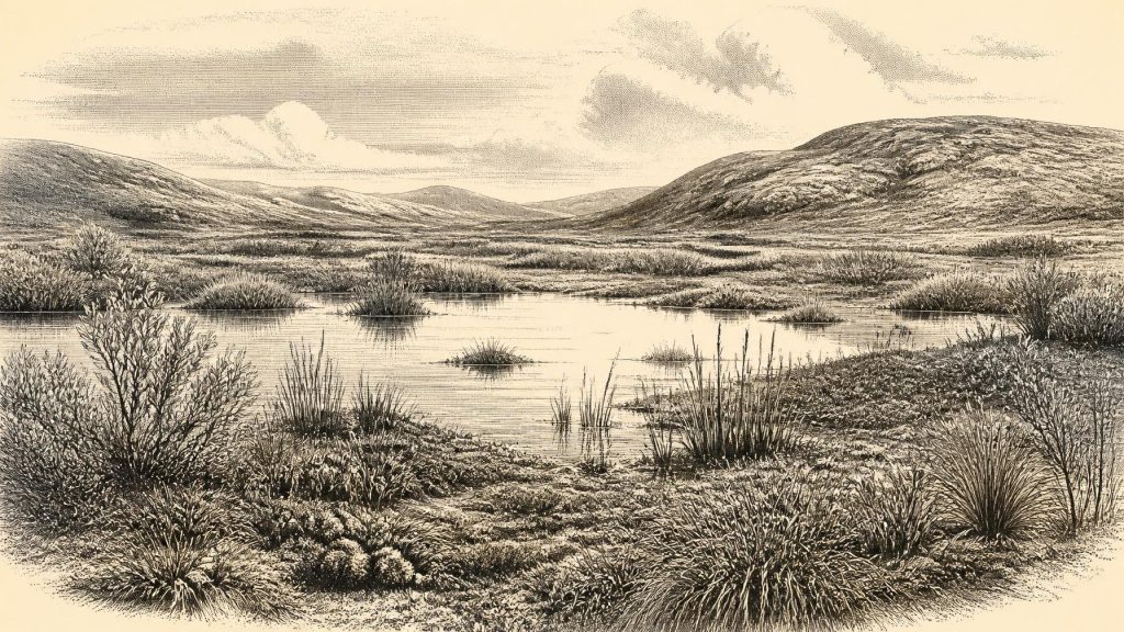
Derryvree offers an unusual glimpse of an Irish landscape that later ice buried. The deposit’s pollen, plant macrofossils, mosses and small-animal remains indicate a cold, open, periglacial environment rather than a forested country. Periglacial means a landscape affected by severe freezing and thawing near an ice margin, whether or not ice lay directly on the ground at that locality. The evidence suggests wet ground, shallow or slow-moving freshwater, and sparse tundra-like vegetation under a treeless sky.
Among the plants identified are sedges, mosses and species with modern arctic-alpine associations. Fossil remains reported from the deposit include mountain avens, dwarf willow and bogbean, while water-milfoil pollen points to freshwater conditions. These finds matter because they show that life persisted locally in a rigorous climate: not an empty white desert, but a mosaic of wetland, exposed mineral ground and low-growing vegetation. Dry-land cover may often have been thin. Short growing seasons, hard winters, frost disturbance and shifts in water level would have governed the rhythm of the landscape.
This was not necessarily the condition of all Ireland. Derryvree is a local archive in present-day Fermanagh, not a national weather station. Yet its position between tills is powerful evidence that this district experienced an ice-free interval before a later advance. It also complicates any simple picture of Ireland as continuously smothered by ice throughout the last Ice Age. During MIS 3, the North Atlantic climate oscillated sharply between colder stadials and comparatively milder interstadials, sometimes on timescales far shorter than traditional historical periods. The island’s habitats, ice margins, drainage and animal opportunities changed accordingly.
Animals in a Changing Country
The best evidence for larger animals comes chiefly from caves and fossil deposits rather than open-air hunting sites. Castlepook Cave, also called Mammoth Cave or Doneraile Cave, near the Ballyhoura foothills in north County Cork is the outstanding Irish archive for pre-Last Glacial Maximum vertebrate fauna. Its deposits have yielded remains attributed to woolly mammoth, giant deer, reindeer, brown bear, wolf, Arctic fox, mountain hare, lemmings and spotted hyaena. The assemblage demonstrates that Ireland, or parts of the landscape now forming Ireland, could support a much richer cold-stage fauna than survives today.
It would nevertheless be wrong to turn this list into a single, perfectly observed herd crossing a single landscape in 30,968 BCE. Cave deposits accumulated through different processes and episodes: carnivores dragged in prey or scavenged carcasses; animals died naturally; water moved bones; and early excavations disturbed contexts that modern archaeologists would have recorded more fully. Radiocarbon redating has shown that some older determinations for southern Irish cave fauna were substantially too young. Castlepook is consequently an exceptional faunal archive, but not a neatly sealed snapshot.
Even so, its mammals help make sense of Derryvree’s open vegetation. Reindeer, mammoth and giant deer were adapted in differing ways to expansive cold-country habitats; predators and scavengers formed part of the same broader food web. Their occurrence indicates ecological links with Britain and north-western Europe during portions of the Late Pleistocene. Lower sea levels altered coastlines and the shape of the Irish Sea basin, but the precise routes by which animals or people reached this western edge of Europe remain uncertain. Evidence does not justify a confident claim that a particular land bridge was available at this particular date.
The Human Question at Castlepook
One object gives this period an exceptional, though unresolved, place in Irish human history: a reindeer femur from Castlepook Cave. The bone has been reported as approximately 33,000 radiocarbon years old and bears a deep linear modification interpreted by zooarchaeologist Ruth Carden as a cut or chopping mark made with a sharp stone implement while the bone was fresh. If that interpretation and its association with the animal’s death are sustained, it may record Upper Palaeolithic people processing a reindeer in Ireland long before the later, better-attested settlement of the island.
That possibility must be expressed carefully. A radiocarbon result dates the animal’s death, not automatically the making of a surface mark. Identifying a mark as human-made requires separate taphonomic judgement: researchers must distinguish tool damage from tooth scoring, trampling, sediment abrasion, breakage and other natural processes. Nor has Castlepook produced a securely contemporary hearth, stone-tool assemblage, dwelling floor, burial, human bone or repeated occupation sequence. The femur may represent a fleeting visit, a single episode of carcass processing, or a process not yet fully understood. It is not evidence for a settled Irish population.
Modern humans were present in western Europe during this broad period, so an occasional movement into Ireland is plausible. But plausibility is not proof. The later expansion of ice across Ireland, erosion, changing coasts, and the complex histories of cave deposits may have destroyed or concealed evidence. Equally, the striking scarcity of indisputable Upper Palaeolithic sites may reflect real limits on human use of the island. Responsible history leaves both possibilities open.
No Polities, No Trade Network
There is no basis for describing political affairs, rulers, diplomacy, warfare, language, religion or formal learning in Ireland at this point. There are no identifiable communities from which kin groups, territories or beliefs can be reconstructed. Terms such as “Ireland”, “Fermanagh” and “Cork” are modern geographical conveniences, not ancient identities. Nor is there evidence for agriculture, domestic animals, pottery, metalworking, monuments, permanent villages or trade in the sense documented in later prehistory.
If people did briefly enter the island, their economy would have depended on immediate knowledge of terrain, weather, animal movement, fuel and shelter. A modified reindeer bone could be consistent with obtaining meat, hide, sinew, marrow or bone from a carcass, but none of those actions can be individually demonstrated. It cannot prove hunting rather than scavenging, nor reveal how many people were present. The sharing of food, making of tools, stories, ritual practice and social negotiation are all imaginable human behaviours; none can be claimed for Ireland from this evidence alone.
Approaching the Ice Maximum
Environmental change was the principal historical force. Derryvree records a life-supporting wetland during an interval when its locality was not overridden by glacier ice. In the millennia after the broad horizon represented by the deposit, the British–Irish Ice Sheet expanded towards its Last Glacial Maximum, which research generally places between about 27,000 and 21,000 years ago. Much of Ireland and its surrounding shelf was subsequently transformed by ice flow. Drumlins, tills and reshaped drainage patterns are among the physical consequences visible in the modern landscape.
For 30,968 BCE, therefore, the most defensible Irish story is neither one of recorded human society nor one of total lifelessness. It is a story of fragile freshwater habitats beneath cold skies; of low tundra plants and mobile mammals; of locally ice-free ground that would later be buried and remodelled; and of one debated reindeer bone that may preserve a brief human encounter. The surviving record is fragmentary, but it replaces a simplistic vision of an empty frozen island with a more compelling and more accurate one: a changing Late Pleistocene country, rich in environmental history and still uncertain at its human edge.
Primary Sources
- A Middle Midlandian Freshwater Series at Derryvree, Maguiresbridge, County Fermanagh, Northern Ireland
- Palaeoecology
- Quaternary Site Descriptions
- Menyanthes trifoliata
- Salix herbacea
- Dryas octopetala
- Myriophyllum alterniflorum
- A Reconsideration of the Radiocarbon Dating of the Marine Isotope Stage 3 Fauna from Southern Ireland
- The Irish Quaternary Fauna Project
- Castlepook Cave: County Geological Site Report
- Mammoth Cave, County Cork
- Occurrence of Mammalia Relicts at Site Castlepook Cave
- Extent and Timing of the Last Glacial Maximum in Britain and Ireland: A Review
- Reconstructing the Last Irish Ice Sheet 2: A Geomorphologically-Driven Model of Ice Sheet Growth, Retreat and Dynamics
- Trimlines, Blockfields and the Vertical Extent of the Last Ice Sheet in Southern Ireland
- Growth and Retreat of the Last British–Irish Ice Sheet, 31,000 to 15,000 Years Ago: The BRITICE-CHRONO Reconstruction
- The IntCal20 Northern Hemisphere Radiocarbon Age Calibration Curve (0–55 cal kBP)
- Dansgaard–Oeschger Events in Climate Models: Review and Baseline Marine Isotope Stage 3 Protocol
- Marine Isotope Stage 3 Sea Level Fluctuations: Data Synthesis and New Outlook
- The Problem of a Late Quaternary Landbridge Between Britain and Ireland
- New Insights on the Fauna of Ireland's Younger Dryas and Early Holocene from Alice & Gwendoline Cave
- New Insights on the Fauna of Ireland's Younger Dryas and Early Holocene from Alice & Gwendoline Cave