
Derryvree’s Unfrozen Basin30841 BCE
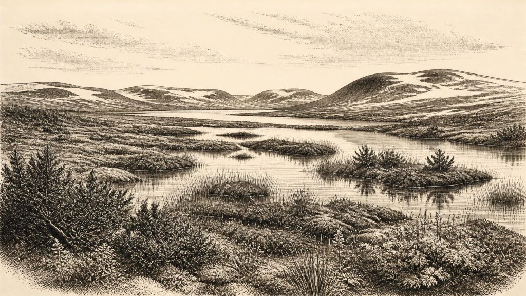
Around 30,841 BCE, Ireland cannot be described through annual events or settled societies, but through broad environmental evidence from Marine Isotope Stage 3. Derryvree, County Fermanagh, preserves freshwater sediments dating broadly to this period, revealing cold, open tundra wetland with mosses, sedges, herbs, insects and pools between glacial advances. Ice cover, drainage, coastlines and possible routes changed markedly, while complete island glaciation came later. Castlepook Cave records mammoth, reindeer, giant deer, predators and scavengers across differing periods. Possible cut marks on reindeer suggest transient human activity, but no secure occupation exists. Ireland was a Pleistocene frontier, not a documented community.
Dateline
30,841 BCE is not a year that can be recovered from Irish evidence in the way a historic date can. No community in Ireland kept an annual calendar, no written record survives, and no archaeological layer can be assigned responsibly to this single twelve-month interval. The label is useful only as a modern point of reference: it falls about 32,790 years before the radiocarbon convention of AD 1950, within the late part of the Pleistocene epoch and Marine Isotope Stage 3 (MIS 3). The closest evidence comes from broad calibrated ranges, environmental sequences and animal remains, not from an event, ruler or settlement of this exact year.
A Date Within Broad Ranges
The best Irish chronological anchor is the freshwater deposit exposed at Derryvree, near Maguiresbridge in County Fermanagh. Organic material in silts and fine sands between two layers of glacial till produced a conventional radiocarbon age of about 30,500 years BP, with a large uncertainty. Later scholarship places this deposit broadly between about 36,900 and 31,700 calibrated years BP: approximately 34,950 to 29,750 BCE. The modern label 30,841 BCE therefore lies within that range, but cannot be pinpointed within it. It is sound to say that the Derryvree evidence illuminates conditions around this notional date; it is not sound to say that its pool, plants or animals existed in that specific year.
This distinction matters because radiocarbon years and calendar years are not interchangeable. Atmospheric carbon concentrations varied over time, and dates must be calibrated against independently dated records. At more than thirty millennia ago, calibration produces intervals measured in centuries or millennia. The archaeological period is consequently better understood as a shifting cold-phase landscape, rather than as an annual chapter in a sequence of political history.
A Country of Ice, Water and Open Ground
Ireland was not simply a white, uniformly ice-covered island. The British–Irish Ice Sheet changed repeatedly in extent and thickness during MIS 3. Recent modelling treats roughly 32,000–23,000 years ago as a build-up phase, while warning that local glaciers, ice caps and ice-free ground varied greatly by region and through time. At around 33,000 years ago, parts of high ground in north-west Ireland may have supported smaller ice masses even as other districts retained open terrain. Western Irish coastal evidence also indicates major earlier ice-sheet fluctuations. The full island-wide ice cover associated with the Last Glacial Maximum belonged mainly to a later interval, conventionally around 26,000–19,000 calibrated years BP.
For Ireland at this depth of time, the principal historical fact is environmental instability. Ice could advance, retreat or reorganise; rivers and meltwater altered local drainage; frozen ground restricted soils and vegetation; and lower global sea level transformed coastlines now hidden beneath the Atlantic and Irish Sea. The outlines of the modern island did not define the lived landscape. Yet neither should a lower sea level be casually converted into a simple, dry land bridge to Britain or continental Europe. The geography of routes was shaped by sea, ice, exposed shelves, river systems and changing ice margins, and remains incompletely resolved.
Derryvree’s Wetland Evidence
The Derryvree sequence is especially valuable because the later ice did not erase everything. A prior glacial advance laid down lower till; an interval without local overriding ice allowed freshwater sands, silts and organic matter to accumulate; and a subsequent ice advance sealed this record below upper till. The sediments were uncovered in a road cutting through a drumlin, one of the streamlined hills that now characterise much of Fermanagh’s glacial landscape.
Plant macrofossils, pollen and insects indicate cold, open and largely treeless ground. Grasses, sedges, herbs, juniper and a varied moss flora point to a tundra or muskeg-like wetland, with pools, saturated margins and plant-rich sediment. The evidence does not recreate a complete landscape map, nor does it prove that every part of Ireland looked alike. It does, however, show that a harsh northern environment could sustain freshwater life and vegetation during an interval between major ice advances. Winters were probably severe and long, while the short growing season supported low vegetation rather than forest.
This was not an empty wasteland. Mosses and sedges fixed the edges of shallow water; herb-rich patches could feed grazers; insects inhabited wet ground and decaying vegetation. Nevertheless, the word “productive” needs care. A wetland capable of supporting a specialised cold-climate ecology was not necessarily a reliable landscape for large, permanent human populations. Its resources were seasonal, patchy and exposed to abrupt climatic reversal.
The Faunal Record of Southern Ireland
Castlepook Cave, near Doneraile in north County Cork, provides the richest Irish archive for vertebrate life leading up to the Last Glacial Maximum. Its collections include woolly mammoth, giant deer, reindeer, brown bear and spotted hyaena; later cold-stage remains include Arctic fox, wolf and lemmings. These species demonstrate that, during suitable phases, Ireland formed part of a wider north-west European world in which large herbivores, predators and scavengers moved through open habitats.
That conclusion must be separated from a misleading picture of all these animals standing together at one place and moment. Castle deposits accumulated over long spans, were affected by water, carnivores, older excavation methods and incomplete recording, and contain material of differing ages. Spotted hyaenas may themselves have transported bones into the cave. A mammoth bone or reindeer antler is firm evidence that the animal occurred in Ireland during a dated broad interval; it is not automatically evidence for a single local herd, a hunting ground or a contemporaneous human camp.
Modern radiocarbon reassessment has also shown why older dates must be treated critically. Improved pretreatment of bone has revised understandings of the age of Castlepook material, including some specimens once used to build post-glacial faunal chronologies. The cave remains extraordinarily important, but it is an archive under active investigation rather than a finished answer to every question about Ice Age Ireland.
People: Possibility, Not Settlement
A reindeer femur from Castlepook has been publicised as approximately 33,000 years old and as bearing a deep mark interpreted as possible butchery with a sharp stone tool. If both the anthropogenic interpretation and its connection with the death of the animal are sustained, it would be striking evidence that people handled a reindeer carcass in Ireland in the broad period relevant to 30,841 BCE. It could represent a brief Upper Palaeolithic visit, perhaps related to the pursuit or exploitation of large game.
But the limits of this claim are decisive. A radiocarbon determination dates the animal’s death, not necessarily the instant at which a surface mark was made. Moreover, the femur came from a complex historic cave collection rather than a modernly excavated, securely stratified occupation floor. No associated hearth, stone-tool assemblage, dwelling, burial, repeated camp surface or food-processing area has established a settled community in Ireland at this date. The better attested published evidence for human activity remains much later: cut marks on a brown-bear patella from Alice and Gwendoline Cave in County Clare, dated to roughly 12,810–12,590 calibrated BP.
No Polities, No Proven Networks
Accordingly, political affairs, diplomacy, warfare, law and named peoples cannot be written for Ireland in 30,841 BCE. There is no evidence for chiefs, territories, tribes or organised conflict, and it would be anachronistic to call any possible visitors “Irish” in an ethnic, linguistic or national sense. Nor is there Irish evidence from this horizon for farming, herding, pottery, monuments, metalwork, formal religion, art, writing or institutional learning.
The same restraint applies to economy and trade. The mammoth-steppe and tundra environments of Europe supported mobile hunter-gatherer societies elsewhere, some of them capable of sophisticated stone technologies, ornament and art. That wider European context makes a human incursion into Ireland conceivable, but it cannot fill the Irish evidential gap. There is no securely identified local exchange network, imported tool kit or harbour at Derryvree or Castlepook. If people did reach the island, the available evidence is compatible only with a small-scale and perhaps short-lived encounter with its changing environment.
What This Year Can Mean
The responsible history of Ireland around 30,841 BCE is therefore one of a landscape rather than a society. Between advances of ice, a Fermanagh basin held cold freshwater, mosses, sedges and open pools. In other favourable intervals, southern Ireland supported large mammals and their predators. Caves preserved fragments of that world while later glaciers destroyed or buried much of the wider record. The possibility of human presence is important, but unresolved. The strongest conclusion is not that Ireland possessed a forgotten Ice Age population, but that it was an environmentally varied Pleistocene frontier whose evidence survives in rare, difficult and still-developing archives.
Primary Sources
- A Middle Midlandian Freshwater Series at Derryvree, Maguiresbridge, County Fermanagh, Northern Ireland
- Episodic speleothem deposition tracks the terrestrial impact of millennial-scale last glacial climate variability in SW Ireland
- A reconsideration of the radiocarbon dating of the Marine Isotope Stage 3 fauna from southern Ireland
- Castlepook Cave
- 2022:564 – Castlepook Cave, Castlepook South, Cork
- On the Cave of Castlepook, Near Doneraile, Co. Cork
- The Irish Quaternary Fauna Project
- New Insights on the Fauna of Ireland’s Younger Dryas and Early Holocene from Alice & Gwendoline Cave
- First Evidence of a Late Upper Palaeolithic Human Presence in Ireland
- The Colonization of Ireland: A Human Ecology Perspective
- Radiocarbon Constraints on the History of the Western Irish Ice Sheet Prior to the Last Glacial Maximum
- Behavioural Tendencies of the Last British–Irish Ice Sheet Revealed by Data–Model Comparison
- Exploring Controls of the Early and Stepped Deglaciation on the Western Margin of the British Irish Ice Sheet
- Radiocarbon Constraints on the Age of the Maximum Advance of the British–Irish Ice Sheet in the Celtic Sea
- Late Pleistocene Chronostratigraphy and Ice Sheet Limits, Southern Ireland
- New Data for the Last Glacial Maximum in Great Britain and Ireland
- Dimensions and Chronology of the Last Ice Sheet in Western Ireland
- Early Deglaciation of the British-Irish Ice Sheet on the Atlantic Shelf Northwest of Ireland Driven by Glacioisostatic Depression and High Relative Sea Level
- Figure 6.— The Subdivision of the Quaternary Period in Ireland
- The Mesolithic in Ireland: When Was It?
- Archaeological Heritage of County Cork
- Anthropogenic Changes to the Holocene Nitrogen Cycle in Ireland
