Fermanagh Silt, Cork Bone31282 BCE
Approximately 31,282 BCE represents a broad Late Pleistocene horizon, not a precise date, within unstable MIS 3 conditions preceding the Last Glacial Maximum. At Derryvree, County Fermanagh, organic freshwater deposits between glacial tills record cold, open tundra-steppe wetlands, although their dated range cannot define island-wide conditions. Lower sea levels connected Ireland ecologically with neighbouring regions, but routes varied. Castlepook Cave, County Cork, preserves diverse Ice Age fauna and a reindeer femur dated near this period, whose possible stone-tool cut mark may indicate human carcass processing. Disturbed contexts prevent certainty. Later ice erased evidence, leaving environmental change and possible human visitation.

Dateline
The label 31,282 BCE gives an illusion of precision that the evidence cannot sustain. No Irish deposit, artefact, animal remain or human action can be dated responsibly to that single modern calendar year. It is better understood as a point roughly 33,230 years before AD 1950, in the Late Pleistocene and Marine Isotope Stage 3 (MIS 3), an unstable interval of the last Ice Age. Radiocarbon measurements of this antiquity produce broad probability ranges after calibration, not annual dates. The historical task is therefore to reconstruct the Ireland of a wider horizon, while being candid about what is observed, what is inferred, and what remains unknown.
A Date Within Ranges
Modern calendar years are especially awkward at this depth in time. Archaeologists conventionally count radiocarbon years ‘before present’, where ‘present’ means AD 1950; those measurements must then be calibrated because atmospheric carbon-14 levels varied. The internationally used IntCal20 curve extends back far enough to calibrate much of this period, but it does not transform an ancient measurement into a diary date. At around 33,000 calendar years ago, its form and the error margins of old assays mean that several centuries, and sometimes millennia, may fall within a quoted range.
The requested year belongs broadly to the later part of MIS 3, before the fullest growth of the last British–Irish Ice Sheet. That does not mean a uniformly ice-free Ireland. Ice sheets expand and contract unevenly, and the evidence from one valley, cave or offshore core cannot simply be spread across the entire island. The best current reconstructions place substantial build-up of the British–Irish Ice Sheet after roughly 35,000–32,000 years ago, with its principal maximum later, around 27,000–21,000 years ago. Around this article’s notional date, Irish landscapes were already being shaped by severe cold, changing ice margins and major shifts in sea level, but regional conditions were varied.
Freshwater Beneath Derryvree
The most illuminating Irish environmental record close to this horizon lies at Derryvree near Maguiresbridge, County Fermanagh. Roadworks in 1969 cut through a drumlin and exposed an extraordinary sequence: freshwater silts, fine sands and organic deposits lay between two distinct tills, the unsorted debris left by glacier ice. Its basic story is secure. An earlier ice advance deposited the lower till; then, during a non-glacial interval, water and organic material accumulated; finally, a later advance covered the deposits with fresh glacial sediment.
The Derryvree organic bed yielded the radiocarbon determination BIRM-166, conventionally about 30,500 ± 1,170 radiocarbon years before present. Published calibrations place it broadly between about 36,900 and 31,700 calibrated years before present, or approximately 34,950–29,750 BCE. Thus 31,282 BCE falls within the wide environmental interval represented by the deposit, but it cannot be assigned to a particular season, water level or living plant. Nor does the deposit prove that every region of Ireland had identical conditions at the same time.
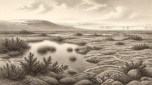
What it does preserve is unusually valuable. Pollen, plant macrofossils, mosses and invertebrate remains indicate freshwater and wet ground within a cold, largely open landscape. The vegetation was not the familiar blanket of oak, elm and hazel woodland associated with later Irish prehistory. Herbaceous pollen and cold-adapted plant evidence point instead towards tundra or tundra-steppe conditions: sedges, mossy ground, sparse dry-land cover and pools or slowly moving water. A few grains of tree pollen should not be made into evidence for nearby forest; at such a site they may have travelled a great distance or been redeposited.
An Open, Severe Island
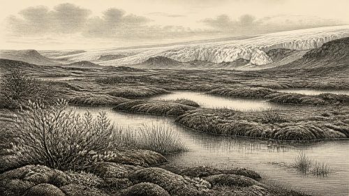
Derryvree makes the Ice Age landscape tangible. In southern Fermanagh, low ground could sustain a waterlogged mosaic despite harsh temperatures: shallow water, silty margins, damp mosses and sedge-rich patches. Elsewhere, exposed ground was likely subject to frost action, powerful winds and a strongly seasonal climate. The word ‘tundra’ should not imply a featureless white wilderness. It describes an open and often productive set of habitats, although their appearance changed with relief, drainage, season and the proximity of ice.
At the scale of the island, Ireland was part of a much larger north-west European land-and-sea world. Global sea level was lower than today because enormous quantities of water were held in continental ice sheets. The present shorelines, islands and shallow seas did not define movement in the way they do now. Yet it would be irresponsible to draw a simple land bridge from Ireland to Britain and call it the route taken by every animal or person. Ice, rivers, lakes, exposed shelves and marine channels changed through time. The evidence supports ecological connection between Ireland and neighbouring regions during parts of the period, not a mapped route for a specific journey in 31,282 BCE.
The later glacial record demonstrates how dramatic the regional change would become. During the Last Glacial Maximum, ice extended widely across Ireland and its surrounding continental shelf, while the Irish Sea Ice Stream reached far south across the Celtic Sea. These later advances are central to understanding why early terrestrial landscapes and campsites are so elusive: advancing ice eroded, mixed, buried or removed deposits. The rarity of Palaeolithic evidence in Ireland is therefore not proof that all earlier human visits were impossible; it is also a consequence of an exceptionally destructive geological archive.
The Castlepook Reindeer Bone
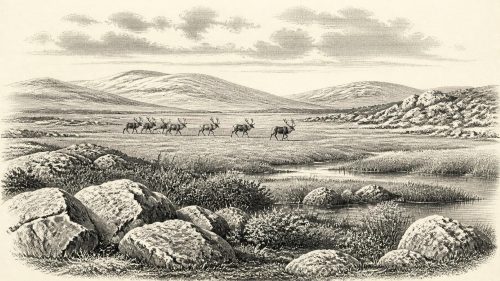
The most direct, though still limited, possible evidence for people near this time comes from Castlepook Cave, also called Mammoth Cave, near Doneraile in north County Cork. Antiquarian excavations there between 1904 and 1908 recovered a remarkable accumulation of Ice Age animal remains. The National Museum of Ireland regards Castlepook as Ireland’s most important site for mammal remains from the last cold stage. Its fauna includes reindeer, woolly mammoth, giant deer, brown bear, wolf, Arctic fox, hares, lemmings and spotted hyena. The cave was not a peaceful living room preserved in time; it was a complex natural trap, shelter and carnivore-affected bone archive.
A reindeer femur from the old Castlepook collection has been dated broadly to about 31,000 BCE and bears a deep surface incision. Zooarchaeologist Ruth Carden has interpreted the mark as damage made by a sharp stone tool during carcass processing. If that interpretation is confirmed, it would indicate that Upper Palaeolithic hunter-gatherers reached Ireland roughly 33,000 years ago, far earlier than the previously accepted late-glacial evidence for human activity. It is a major possibility, not a complete settlement narrative.
The cautions matter. The bone comes from an old collection whose original contexts were disturbed, and the Castlepook deposits were repeatedly re-sorted by water and affected by carnivores. The radiocarbon date measures the death of the animal, not automatically the instant at which any mark was made. No securely associated stone toolkit, hearth, butchered assemblage, human skeleton or occupation surface of this age has yet been recovered in Ireland. Excavation in 2022 sought surviving Pleistocene deposits and demonstrated that sediments remain in parts of the cave, but it did not furnish a complete answer to the question of early human presence.
People as Possibility, Not Polity
If the Castlepook incision is human-made and contemporary, the people behind it were almost certainly highly mobile hunter-gatherers, not inhabitants of villages or members of a named Irish people. Reindeer would have offered meat, fat, hides, sinew, antler and bone; a successful carcass-processing episode could have been economically important. The animal may have been killed or initially butchered in the open before portions were carried, scavenged or washed into the cave. That is a reasoned interpretation of the evidence, not a known story of a hunt.
There is no evidence from Ireland at this date for permanent houses, fields, livestock, pottery, metalwork, monuments, writing, formal political institutions or long-distance trade networks. Nor can political affairs, warfare, diplomacy, law or leadership be recovered from a single possible cut-mark. Predators and scavengers certainly competed with people and herbivores for carcasses and shelter, but this was ecological pressure, not demonstrable human conflict. Ireland had no recorded rulers and no known borders. To impose later ideas of tribe, kingdom or nation upon this interval would be misleading.
Religion, culture and learning are similarly beyond direct recovery. A stone-tool cut could attest skill, anatomical knowledge and a shared practical tradition, but it cannot reveal language, ritual, kinship or belief. The absence of evidence is not evidence that Ice Age visitors lacked social worlds; hunter-gatherer societies elsewhere plainly possessed complex knowledge and relationships. It means only that Ireland has not preserved material evidence which allows those worlds to be described here with confidence.
A Landscape Before the Archive
For 31,282 BCE, the essential Irish development is environmental rather than political: a cold, changing island within the gathering power of the last glaciation. Derryvree gives firm evidence for exposed periglacial wetland and open vegetation during a broad interval that encompasses this notional date. Castlepook gives strong evidence for an Ice Age fauna and a provocative, carefully qualified indication that people may have processed reindeer in Ireland. Together they replace an older picture of a wholly empty, uniformly frozen island with something more complex: habitats capable of supporting animal communities, perhaps visited by human hunters, but repeatedly altered and largely erased by ice.
That incompleteness is itself historical evidence. Ireland’s deep past survives in silts trapped below drumlins, bones from fissured limestone caves, laboratory dates and the re-examination of museum collections. The responsible account of this year is not an invented event. It is a recognition that, long before farming, monuments or written memory, Ireland occupied a precarious Ice Age frontier whose most important witnesses are a Fermanagh freshwater bed and a marked reindeer bone from Cork.
Primary Sources
- A Middle Midlandian Freshwater Series at Derryvree, Maguiresbridge, County Fermanagh, Northern Ireland
- The Irish Quaternary Fauna Project
- Palaeoecology
- The Subdivision of the Quaternary Period in Ireland
- Spotted Hyena Skull
- Heritage Artefacts of County Cork 2021
- 2022:564 – Castlepook Cave, Castlepook South, Cork
- Extent and Timing of the Last Glacial Maximum (LGM) in Britain and Ireland: A Review
- Growth and Retreat of the Last British–Irish Ice Sheet, 31,000 to 15,000 Years Ago: The BRITICE-CHRONO Reconstruction
- Trimlines, Blockfields and the Vertical Extent of the Last Ice Sheet in Southern Ireland
- Radiocarbon Constraints on the History of the Western Irish Ice Sheet Prior to the Last Glacial Maximum
- Advance and Retreat of the Marine-Terminating Irish Sea Ice Stream into the Celtic Sea During the Last Glacial: Timing and Maximum Extent
- Maximum Extent and Readvance Dynamics of the Irish Sea Ice Stream and Irish Sea Glacier Since the Last Glacial Maximum
- Radiocarbon Constraints on the Age of the Maximum Advance of the British-Irish Ice Sheet in the Celtic Sea
- The IntCal20 Northern Hemisphere Radiocarbon Age Calibration Curve (0–55 cal kBP)
- IntCal Publications
- A Stratigraphic Framework for Abrupt Climatic Changes During the Last Glacial Period Based on Three Synchronized Greenland Ice-Core Records: Refining and Extending the INTIMATE Event Stratigraphy
- INTIMATE Publications
- New Insights on the Fauna of Ireland's Younger Dryas and Early Holocene from Alice & Gwendoline Cave
- The Mesolithic in Ireland: When Was It?
- Late Pleistocene Chronostratigraphy and Ice Sheet Limits, Southern Ireland
- The Late Quaternary History of East-Central Ireland