
Derryvree’s Cold-Water Insects30685 BCE
30,685 BCE is a modern label within Marine Isotope Stage 3, not a precisely recoverable Irish date. At Derryvree, County Fermanagh, freshwater sediments between two glacial tills indicate a local ice-free interval before renewed glaciation. Radiocarbon dating broadly encompasses the nominal year. Mosses, sedges and cold-adapted insects describe open, periglacial wetlands with liquid water and vegetation amid severe climate, rather than forest or cultivation. Comparable deposits and Kerry speleothems suggest fluctuating conditions, while cave fauna shows intermittent opportunities for cold-stage animals. No securely dated human settlement or politics is known. Derryvree preserves evidence of environmental change before the ice-sheet maximum.
Dateline
30,685 BCE is a modern label, not a date that can be recovered from the prehistoric record with calendar-year precision. No people in Ireland used a calendar then, and no Irish settlement, burial, tool assemblage or historical event can responsibly be assigned to this particular year. The most useful approach is to place it within a broader Late Pleistocene interval: Marine Isotope Stage 3 (MIS 3), a climatically unstable part of the last Ice Age. In conventional astronomical arithmetic the label falls about 32,634 years before AD 1950, but that calculation is not itself an archaeological date.
The closest securely relevant Irish evidence is a freshwater deposit at Derryvree, near Maguiresbridge in County Fermanagh. Its radiocarbon determination, Birm-166, was reported as 30,500 radiocarbon years before present, with a substantial uncertainty of +1,170 and −1,030 years. Calibration produces a broad range of roughly 36,900–31,700 calibrated years before present, or approximately 34,950–29,750 BCE. The nominal year 30,685 BCE lies within that long range. It does not identify a particular season, generation, animal herd or human visit. Rather, it belongs to an interval over which the deposits accumulated and local environments altered.
A Wetland Between Ice Advances
Derryvree was exposed during road works in February and March 1969, when a cutting passed through a drumlin about two kilometres north-east of Maguiresbridge. The excavation revealed an unusually informative sequence. A thick lower till – the unsorted clay, stones and debris laid down by glacier ice – was overlain by fine sands and organic silts formed in freshwater conditions. Above them lay a second thick till. The stratigraphy is direct evidence for three broad stages at that place: glacial ice deposited the lower till; an interval followed in which ice was absent locally and water, sediment and organic remains accumulated; then a later advance buried the wetland beneath the upper till.
That sequence should not be enlarged into a simple island-wide picture. It proves that Derryvree, in Fermanagh, had an ice-free freshwater setting during part of MIS 3. It does not prove that all Ireland was free of ice at once, or that the boundaries of ice were stable for centuries. Ice sheets expand and thin unevenly; their margins can respond differently in uplands, lowlands, coastlands and marine basins. The later upper till also demonstrates renewed glaciation at Derryvree, but does not date that advance to a precise moment. The bed is valuable precisely because it records change rather than an unchanging Ice-Age landscape.
Mosses, Sedges and Open Ground
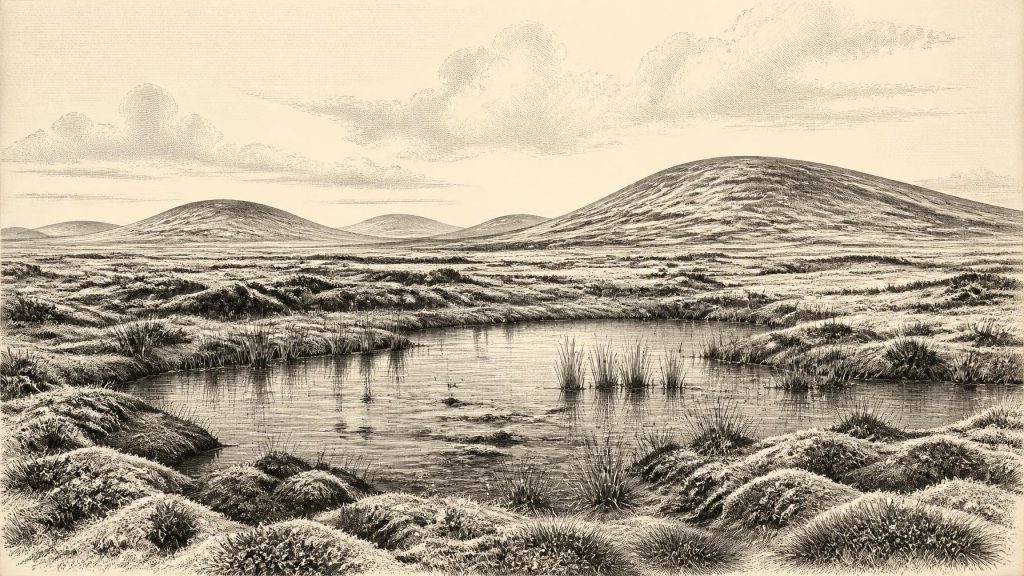
The organic layers preserved a flora of freshwater mosses and sedges, together with an insect fauna of cold northern aspect. These remains support a careful environmental reconstruction. Derryvree was not a forested countryside or a place of cultivation. It was an open, periglacial landscape in which shallow pools, saturated ground and moss-rich vegetation could persist amid severe seasonal cold. Periglacial means shaped by freezing, thawing and frost action outside an ice-sheet margin, rather than necessarily lying beneath ice itself.
The evidence favours wetlands and open tundra-like vegetation, but it cannot supply a photograph of the whole district. Plant remains may have grown in or beside the pool; insects can reveal local habitat and climate, yet neither provides a complete census of surrounding hills and valleys. Pollen preservation in deposits this old is often limited, and the record must be read alongside sediment, landform and fossil evidence. What can be said is that locally available liquid water and organic plant growth existed despite a harsh climate. Such habitats would have been highly significant for insects, small animals and grazing mammals, as well as for any mobile people who may have entered the wider region.
A Patchwork, Not a Single Climate
Derryvree is part of a wider, though fragmentary, Fermanagh record. Inter-till organic deposits at Hollymount near Maguiresbridge and at Greenagho near Belcoo also show that cold, non-glacial environments occurred between phases of ice cover. Their dates and stratigraphic histories are not precise enough to make them simultaneous with Derryvree, and the Greenagho radiocarbon result has been treated cautiously. Nonetheless, they reinforce the important point that the late Midlandian – the Irish name for the last glacial stage – contained interruptions, local variation and environmental shifts rather than one uninterrupted blanket of ice.
South-west Ireland adds another form of evidence. Speleothems in Crag Cave, County Kerry, formed episodically during MIS 3. Because cave calcite needs liquid water, their growth is consistent with intervals when local mean annual conditions rose above freezing. This does not make Ireland mild by modern standards, and it cannot be tied exactly to Derryvree’s freshwater bed. It does, however, support the larger interpretation that millennial-scale climatic swings affected Ireland. Periods of amelioration and deterioration could change the availability of water, vegetation, cave habitat and routes through the landscape.
Animals and Their Limits
Irish caves, especially Castlepook Cave near Doneraile in County Cork, preserve a different archive: bones rather than wetland sediments. Redating programmes show that a range of large mammals reached Ireland during MIS 3, while also demonstrating how precarious older dates can be. Mammoth, reindeer, giant deer, spotted hyaena and other cold-stage animals are part of the wider Irish Pleistocene faunal record. Yet they must not all be placed beside the Derryvree pools in 30,685 BCE. Cave deposits are often mixed, disturbed or accumulated over long periods, and individual species have separate chronologies.
The responsible conclusion is therefore modest but important. Ireland could support cold-adapted animal communities during portions of MIS 3, and Derryvree offers direct evidence of wetland vegetation and insect life in one northern locality. The combination suggests ecological opportunity within a severe climate: water and plant growth in sheltered or low-lying places, open ground for grazers, and predators following prey. It does not reveal a stable, island-wide animal population at any one moment.
No Recoverable Politics or Settlement
There is no evidence from Ireland around this nominal year for political institutions, diplomacy, warfare, named leaders, settlements, trade networks, formal religion or systems of learning. Nor is there a securely dated Irish house, hearth, grave or toolkit from which to describe everyday life. It would be misleading to fill these absences with a story of tribes, chiefs or hunting camps. The absence of evidence is partly archaeological: later ice sheets eroded, transported and buried deposits, while low sea levels placed former coastal landscapes beyond the modern shoreline. It is also possible that human presence was intermittent or absent.
Claims concerning very early human activity require particular restraint. A marked reindeer bone from Castlepook has been interpreted as possible evidence of butchery, but it does not provide a settlement or establish continuous occupation. Even if people did enter Ireland during an MIS 3 interval, they cannot yet be identified as a resident community or linked securely to Derryvree. Their probable social practices, beliefs, languages and exchange relationships remain unknown. Comparisons with Upper Palaeolithic groups elsewhere in north-west Europe can suggest possibilities, but they are not evidence for an Irish society.
Before the Greatest Ice Advance
30,685 BCE preceded the maximum extent of the last British–Irish Ice Sheet, generally placed much later, during roughly 26,000–20,000 years ago. Modern reconstructions indicate that ice growth, extent and flow varied by sector and that the chronology continues to be refined through offshore cores, landforms, radiocarbon dates and cosmogenic exposure dating. Derryvree’s inter-till sediments consequently have a special importance: they preserve a rare glimpse of conditions before later glaciation sealed and, elsewhere, often destroyed comparable environmental records.
For this point in Ireland’s deep past, the history is not an annal of events but a history of evidence. Beneath later glacial deposits in Fermanagh, mosses, sedges and cold-climate insects record an open freshwater landscape during a long, uncertain interval. Around the modern label 30,685 BCE, that is the clearest responsible picture: not a dated human episode, but a changing Ice-Age environment in which water, life and ice repeatedly contested the ground.
Primary Sources
- A Middle Midlandian Freshwater Series at Derryvree, Maguiresbridge, County Fermanagh, Northern Ireland
- Early Midlandian–Middle Midlandian, Pleistocene, Northern Ireland
- Trimlines, Blockfields and the Vertical Extent of the Last Ice Sheet in Southern Ireland
- Dimensions and Chronology of the Last Ice Sheet in Western Ireland
- Growth and Retreat of the Last British–Irish Ice Sheet, 31,000 to 15,000 Years Ago: the BRITICE-CHRONO Reconstruction
- Pattern and Timing of Retreat of the Last British–Irish Ice Sheet
- Reconstructing the Last Irish Ice Sheet 2: a Geomorphologically-Driven Model of Ice Sheet Growth, Retreat and Dynamics
- Late Pleistocene Chronostratigraphy and Ice Sheet Limits, Southern Ireland
- Episodic Speleothem Deposition Tracks the Terrestrial Impact of Millennial-Scale Last Glacial Climate Variability in SW Ireland
- A Reconsideration of the Radiocarbon Dating of the Marine Isotope Stage 3 Fauna from Southern Ireland
- The Irish Quaternary Fauna Project
- Freshwater Organic Deposits and Stratified Sediments Between Early and Late Midlandian (Devensian) Till Sheets, at Aghnadarragh, County Antrim, Northern Ireland
- Middle Midlandian Interstadial Deposits at Greenagho, Near Belcoo, County Fermanagh, Northern Ireland
- The Geology of Northern Ireland: Our Natural Foundation
- The Quaternary History of Ireland
- The IntCal20 Northern Hemisphere Radiocarbon Age Calibration Curve (0–55 cal kBP)
- The Last Glacial Maximum
- New Data for the Last Glacial Maximum in Great Britain and Ireland
- Radiocarbon Constraints on the Age of the Maximum Advance of the British-Irish Ice Sheet in the Celtic Sea
- New Insights on the Fauna of Ireland’s Younger Dryas and Early Holocene from Alice & Gwendoline Cave
