
Bogbean Beneath the Drumlins30632 BCE
Labelled 30,632 BCE retrospectively, this Late Pleistocene period cannot be tied to a recorded Irish event. Derryvree, County Fermanagh, preserves freshwater sediments between glacial tills, radiocarbon dated broadly to 34,950–29,750 BCE, demonstrating a local ice-free interval before renewed glaciation. Bogbean, sedges, mosses, insects and Arctic-alpine plants indicate cold, treeless wetlands. Castlepook Cave in County Cork produced remains of reindeer, mammoth, predators and other cold-stage fauna, although its disturbed deposits span long periods. A possibly cut-marked reindeer bone suggests, but cannot confirm, human visits. No securely dated settlement, tools, hearths or social record exists there; advancing ice later obscured much evidence.
Dateline
30,632 BCE is a modern chronological label, not a recoverable Irish calendar year. Nobody in Ireland could have named or recorded such a date, and neither a settlement nor an event can be tied responsibly to it. In radiocarbon terms, it lies about 32,581 years before AD 1950, within the Late Pleistocene and broadly during Marine Isotope Stage 3. The useful evidence comes instead from dated ranges, layers of sediment, fossil plants, animal bones and the traces of moving ice. Together they illuminate an Ireland on the unstable northern edge of the Ice Age world: cold, largely treeless, environmentally varied, and changing on scales of centuries and millennia rather than recorded years.
A Date Within a Cold Phase
The closest large-scale climatic comparison is Greenland Stadial 6, a cold episode identified in Greenland ice cores. Such stadials were not simply uniform freezes. During Marine Isotope Stage 3, North Atlantic climate repeatedly shifted between cold stadials and comparatively milder interstadials. The Greenland sequence is an important regional framework, but it must not be mistaken for a weather report from Ireland. It identifies a broad North Atlantic climate state; local Irish conditions depended on elevation, exposure, glacier extent, drainage and distance from the sea.
Ireland was also not a single environmental zone. Some ground lay beneath or close to ice; other places could sustain wetland vegetation and grazing animals. Sea level was substantially lower than today, changing coastlines and exposing land now submerged around the island. Yet lower seas do not demonstrate a particular land route or a particular human journey. Ice, water and coastlines were mobile, while subsequent glaciation, erosion and rising seas removed much of the terrain on which people or animals might once have travelled.
Derryvree’s Freshwater Interval
The clearest Irish window onto this general period is Derryvree townland, near Maguiresbridge in County Fermanagh. Roadworks in 1969 cut through a drumlin and exposed an extraordinary sequence. A lower till – the unsorted debris deposited directly by glacier ice – was overlain by freshwater silts, fine sands and organic mud, which were in turn sealed by a second thick till. The order of the deposits is firm: ice had first affected the locality; a period followed in which freshwater and organic material accumulated; and ice later returned or advanced across the area.
Organic material from the freshwater bed produced radiocarbon determination BIRM-166, conventionally reported as 30,500 radiocarbon years BP, with a substantial uncertainty of +1,170 and −1,030 years. Radiocarbon years are not calendar years, because atmospheric carbon-14 levels have varied. Modern calibration gives a broad calendar range, commonly expressed at roughly 36,900–31,700 calibrated years BP, or about 34,950–29,750 BCE. The nominal year considered here falls within that span. Even so, the date is not a timestamp for the formation of every grain of silt, seed or insect remain in the bed; it situates a freshwater episode within a long and changing interval.
Derryvree therefore provides strong evidence for locally ice-free ground in part of Fermanagh at some point during this range. It does not prove that all Ireland was simultaneously free of ice, nor that the exact landscape of 30,632 BCE can be reconstructed. That distinction is central. A buried wetland can show that living conditions existed in one district before the later major expansion of the British–Irish Ice Sheet; it cannot supply an island-wide census or a year-by-year narrative.
Wet Ground, Open Vegetation
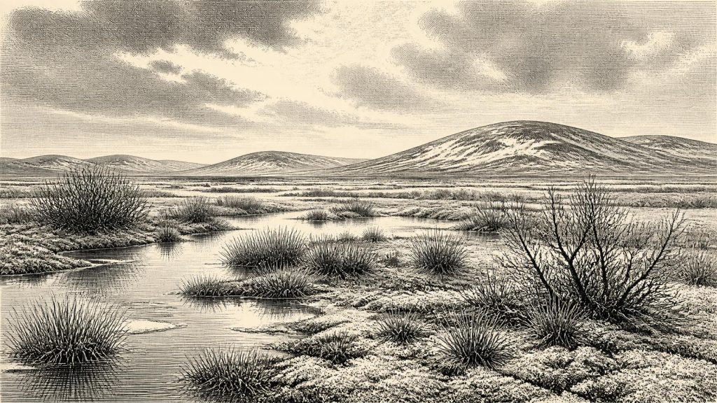
The organic sediments preserve a cold-climate freshwater community. Pollen was poorly preserved, but macrofossils, mosses and insect remains add detail. Evidence includes sedges and aquatic or wetland plants such as bogbean (Menyanthes trifoliata), together with water-milfoil pollen. Dwarf willow and other Arctic-alpine elements indicate low vegetation adapted to cold conditions. The result is not an image of dense forest. It is better understood as a treeless, tundra-like or muskeg landscape: saturated ground, shallow pools, sedgy margins, mossy surfaces and sparse vegetation on drier patches.
Such a place would have been seasonally productive without being benign. Growing seasons were short; winter cold was severe; frost, thaw, waterlogging and shifting channels affected soils. The freshwater remains demonstrate that this was not a lifeless white desert, while the enclosing tills show how vulnerable such habitats were to renewed glaciation. At Derryvree, environmental change was written physically into the ground: water and vegetation occupied a hollow for a time, then later ice buried their record beneath debris.
There is no basis for assigning crops, herds, houses, pottery, metalwork or monuments to this landscape. Agriculture lay many tens of millennia in the future. Nor can archaeology identify political communities, rulers, diplomacy or organised warfare. These are not merely missing details; the surviving evidence is of the wrong kind to support them. At most, the deposits establish the environmental opportunities and constraints that any animals – and possibly people – would have encountered.
The Castlepook Animal World
Southern caves offer a different, complementary record. Castlepook Cave, also known as Mammoth Cave, near Doneraile in north County Cork, has yielded one of Ireland’s most important collections of Pleistocene animal remains. Its historic excavations recovered bones attributed to reindeer, woolly mammoth, giant deer, brown bear, wolf, Arctic fox, spotted hyaena, lemmings and other animals. This is compelling evidence that parts of Ireland were entered by a much richer cold-stage fauna than the modern island supports.
The cave’s evidence must nevertheless be handled carefully. The bones accumulated over long periods, in a complicated cave system, and early excavations disturbed or removed much of their original context. Improved pretreatment and redating have shown that several older radiocarbon determinations underestimated the real ages of specimens. Individual bones from Castlepook do not necessarily belong to one community, one season, or even one millennium. It would be wrong, therefore, to picture every listed species gathered beside a Fermanagh pool in 30,632 BCE.
What can responsibly be inferred is more limited and more valuable. Reindeer and mammoth are consistent with open, cold grazing environments. Arctic foxes and lemmings indicate severe conditions, while wolves and spotted hyaenas represent predators and scavengers within a complex food web. Large herbivores would have depended on scattered patches of forage, and their movement across the region helped connect cave evidence in Cork with wider European ecological patterns. The mammal record shows opportunity for mobile hunters, but it is not itself evidence of human settlement.
The Reindeer Bone Question
Castlepook is important for another reason: a reindeer femur in the National Museum of Ireland collections bears a deep linear mark interpreted by zooarchaeologist Ruth Carden as a possible cut made with a sharp stone tool during carcass processing. Public heritage interpretation has associated the specimen with an age around 33,000 years ago. If that interpretation is sustained, it would suggest that people reached Ireland much earlier than the long-established evidence for terminal-Pleistocene human activity.
But the claim must remain qualified. A radiocarbon date dates the animal’s death, not necessarily the moment a surface mark was made. Identifying a cut mark requires taphonomic judgement: researchers must distinguish damage by stone, teeth, sediment movement, excavation or later handling. The cave collection’s complicated history adds further uncertainty. One possible cut-marked bone cannot demonstrate a permanent population, a settlement, a named cultural group, a migration route or continuous occupation through the ensuing glacial deterioration.
The most defensible wording for this period is therefore that human presence is possible and actively investigated, rather than securely documented as an enduring Irish occupation. If people did visit, comparisons with Upper Palaeolithic groups elsewhere in north-west Europe suggest small, highly mobile foraging parties equipped with close knowledge of animal behaviour, seasonal resources, clothing, shelter and route-finding. That is an informed interpretation from neighbouring regions, not a direct description of a proven camp in Ireland.
Society Without a Settlement Record
No Irish hearth, stone-tool assemblage, dwelling floor, grave or artistic object can presently be assigned securely to 30,632 BCE. Consequently, society, religion, culture and learning remain archaeologically invisible in the direct sense. There is no evidence for shrines, burial rites, cave art, formal exchange institutions or political alliances. The absence of such evidence should not be confused with evidence that people lacked beliefs, social bonds or practical knowledge; it means that the Irish record cannot reveal them for this time.
If short human visits occurred, their economy would have been one of hunting, scavenging and gathering rather than farming or trade in later historical senses. Reindeer carcass processing, if the Castlepook mark proves human-made, would imply skilled use of a sharp implement and the sharing of food or raw materials within a small group. Movement of people, stone and information across north-west Europe is plausible in this broad Upper Palaeolithic setting, but no Irish source identifies where visitors came from, whether they arrived by land or water, or what contacts they maintained.
Before the Ice Maximum
This date preceded the fullest expansion of the last British–Irish Ice Sheet. Recent reconstructions begin their detailed treatment around 31,000 years ago and show major ice growth thereafter, with maximum extent reached later and varying regionally. Derryvree’s buried wetland belongs near this threshold: a record of an earlier local respite from glacier ice before later expansion transformed the landscape again. Many older ground surfaces were eroded, overridden or sealed, which helps explain why Ireland’s evidence is so fragmentary.
Ireland around 30,632 BCE was thus neither a familiar island nor an empty abstraction. It was a dynamic Ice Age margin where cold wetlands could develop between glacial advances, Arctic-alpine plants found footholds, and large mammals entered suitable terrain. The archaeological story is deliberately modest: no recorded event, no known leader and no confirmed settlement. Yet the bogbean seed, freshwater silt, reindeer bone and drumlin till preserve something more fundamental – proof that the island’s deep past was made by alternating water, frost, ice, animals and, perhaps briefly, people.
Primary Sources
- A Middle Midlandian Freshwater Series at Derryvree, Maguiresbridge, County Fermanagh, Northern Ireland
- Palaeoecology: Irish Quaternary Association Field Guide
- Figure 6.— The Subdivision of the Quaternary Period in Ireland
- Exploring Controls of the Early and Stepped Deglaciation on the Western Margin of the British–Irish Ice Sheet
- Growth and Retreat of the Last British–Irish Ice Sheet, 31,000 to 15,000 Years Ago: the BRITICE-CHRONO Reconstruction
- A Reconsideration of the Radiocarbon Dating of the Marine Isotope Stage 3 Fauna from Southern Ireland
- The Irish Quaternary Fauna Project
- Heritage Artefacts of County Cork
- Castlepook Cave, Co. Cork, Excavation Report 2022
- Mammoth Cave, County Cork
- Prehistoric Details
- IntCal Publications
- The IntCal20 Northern Hemisphere Radiocarbon Age Calibration Curve (0–55 cal kBP)
- IntCal History
- A Stratigraphic Framework for Abrupt Climatic Changes During the Last Glacial Period Based on Three Synchronized Greenland Ice-Core Records
- Dating Consortium
- New Insights on the Fauna of Ireland’s Younger Dryas and Early Holocene from Alice & Gwendoline Cave
- First Evidence of a Late Upper Palaeolithic Human Presence in Ireland
- BSBI: Menyanthes trifoliata
- BSBI: Myriophyllum alterniflorum
- BSBI: Salix herbacea
- New Insights on the Fauna of Ireland’s Younger Dryas and Early Holocene from Alice & Gwendoline Cave (Open PDF)
