Fermanagh Between Two Ices30644 BCE
At 30,644 BCE, a modern label within a broad Marine Isotope Stage 3 range, Ireland’s past is reconstructed from environmental evidence rather than records. Derryvree, County Fermanagh, preserves freshwater sediments between two glacial tills, showing a locally ice-free, cold, treeless wetland of pools, sedges, mosses and low plants. Elsewhere, growing British–Irish ice sheets created varied, unstable conditions and lower seas. Southern cave deposits record cold-adapted fauna, including mammoth, reindeer, giant deer and hyaena, but accumulated over long periods. No secure human occupation is known; a possibly butchered reindeer bone remains inconclusive. Deposits reveal changing refuges, animal movement and advancing ice.
Dateline
The label 30,644 BCE is useful only as a modern point on a long prehistoric timescale. It does not identify a recoverable Irish year, season or event. No calendar, written record, named community or securely dated human occupation allows that degree of precision. In radiocarbon terms, the date lies around 32,600 calibrated years before present (cal BP, where “present” is conventionally AD 1950), within Marine Isotope Stage 3: an unstable part of the Late Pleistocene, before the fullest expansion of the last British–Irish Ice Sheet.
The most responsible account of Ireland at this horizon must therefore be built from deposits, fossils and changing landforms rather than a conventional narrative of rulers, wars or settlements. The crucial Irish evidence is not an event from 30,644 BCE itself, but the environmental archive at Derryvree near Maguiresbridge, County Fermanagh, and the broadly contemporary animal-bone record from caves in southern Ireland. Together they show an island undergoing severe climatic change, with locally ice-free wetland landscapes at some times and places, but advancing ice and profound environmental uncertainty close by.
A Date Within a Range
The strongest chronological anchor is the Derryvree freshwater sequence, exposed during roadworks through a drumlin in 1969. A drumlin is a streamlined hill of till: the unsorted clay, stones and debris laid down by glacier ice. At Derryvree, researchers found two distinct till sheets separated by fine sands, silts and organic-rich freshwater deposits. The stratigraphy establishes a clear sequence. Ice first occupied the locality and deposited the lower till; an interval followed in which water, sediments, plants and small animals accumulated; subsequently ice returned or readvanced, burying the wetland beneath a second till.
Organic material from the intervening deposit produced radiocarbon determination BIRM-166, reported as 30,500 radiocarbon years BP, with a substantial uncertainty of roughly 1,100 years. A radiocarbon age is not a calendar age. Atmospheric carbon-14 levels varied through time, and ancient measurements must be calibrated against international reference curves. At this age, calibration produces broad probability ranges, not a precise date. Published treatments place the Derryvree episode broadly within the later part of MIS 3, with a calibrated span extending approximately from 36,900 to 31,700 cal BP. The modern label 30,644 BCE, about 32,600 cal BP, therefore falls within the wide window illuminated by the deposit, but cannot be attached to a particular pool, plant, animal or day of activity.
This distinction matters. Derryvree is direct evidence that this part of Fermanagh was ice-free long enough for a freshwater environment to form between glacial episodes. It is not proof that the whole island was simultaneously free of ice, nor that the conditions documented in one lowland basin prevailed unchanged across Ireland. The island’s climatic geography was fractured, changing and only partly recoverable.
A Treeless Wetland World
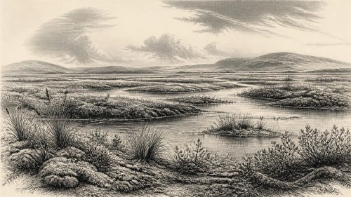
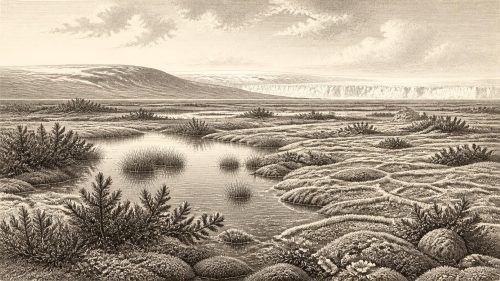
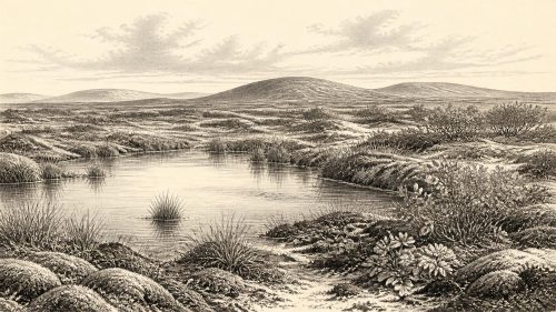
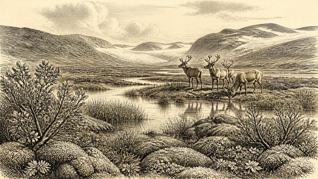
The organic silts at Derryvree offer the closest view of an Irish landscape relevant to this date. Pollen, plant macrofossils and insect remains indicate a cold, open and treeless setting. Freshwater plants and wetland species reveal standing or slow-moving water. Mosses and sedges grew in saturated ground, while remains of plants associated with cold conditions, including dwarf willow, mountain-avens, bogbean and lesser clubmoss, point to low-growing vegetation rather than forest.
Descriptions of this environment as tundra or muskeg are useful comparisons, provided they are not mistaken for photographs of the past. “Muskeg” evokes waterlogged, organic-rich ground patterned by pools, mosses, sedges and stunted vegetation; “tundra” conveys the absence of trees and the severity of climate. Neither means that Fermanagh replicated any one modern Arctic landscape. The evidence supports a patchwork of shallow water, wet sedge-moss ground, mineral sediment and exposed terrain, shaped by cold temperatures and by the legacy of nearby ice.
Such ground was not lifeless. Aquatic and marginal plants imply growing seasons, however brief, and insects preserved in the deposits provide additional evidence for terrestrial and wetland habitats. Yet this was no settled countryside. There is no indication of fields, livestock, houses, roads or managed woodland. The physical processes of frost, seasonal thaw, altered drainage and shifting ice margins mattered more than any human remodelling of land.
Ice Building Across the Region
At roughly 32.6 thousand years ago, Ireland stood close to a major transition in the last glacial cycle. Reconstructions of the British–Irish Ice Sheet indicate that ice was expanding rapidly around 31,000–30,000 years ago, though the chronology and exact extent remain uncertain in many Irish sectors. Some reconstructions depict ice advancing across northern and central Ireland by about 30 ka, while south-west Ireland may have supported a smaller ice cap in the Kerry–Cork region. Other work stresses that evidence before the Last Glacial Maximum remains sparse and that different ice masses did not necessarily grow or join at the same moment.
The important conclusion is not that every part of Ireland lay beneath an ice sheet in 30,644 BCE. It is that the island was subject to a changing glacial regime. Derryvree records an earlier local opening between ice advances; the wider regional evidence points towards renewed growth of ice soon afterwards or already under way in some places. Valleys, uplands, coastlines and lowlands would have experienced these changes differently. Ice could scour bedrock and transport sediment in one zone while meltwater, ponds and cold wetland vegetation developed elsewhere.
Sea level was far lower globally than it is today because large volumes of water were locked in northern ice sheets. The configuration of the Irish Sea basin and adjacent shelves consequently differed greatly from the modern map. Nevertheless, it would be unsafe to draw a single exact coastline, or to assert a simple, continuous land bridge from Ireland to Britain or continental Europe for this numbered year. Local relative sea level was also affected by the weight and movement of ice, and the relevant geological evidence is incomplete.
Caves and Cold-Stage Fauna
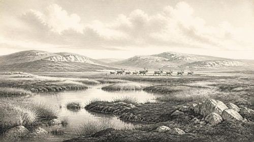
Southern Irish cave deposits extend the picture beyond Fermanagh. Castlepook Cave near Doneraile, County Cork, has yielded a notably varied Late Pleistocene animal assemblage, including mammoth, reindeer, giant deer, brown bear, Arctic fox, hare, lemmings and spotted hyaena. Redating of cave material has shown that some fauna belonged to MIS 3 and that earlier measurements required revision as radiocarbon methods and sample pretreatment improved. The cave record demonstrates that, during favourable intervals before the Last Glacial Maximum, Ireland could support or be reached by a striking cold-adapted and open-country fauna.
It does not, however, form a single snapshot of one living community. Caves accumulate bones over long periods. Carcasses may be brought in by carnivores, animals may die naturally in or near entrances, water and sediment can move material, and antiquarian excavations did not always record context to modern standards. Mammoth remains in a cave, for example, establish the presence of mammoth in the wider regional record, not a herd standing outside the entrance in 30,644 BCE. Similarly, spotted hyaena bones indicate a predator and scavenger capable of using caves, but do not demonstrate a permanent den at every phase of deposition.
Even so, the fauna is significant. Reindeer and lemmings fit a cold, largely open environment; mammoth and giant deer suggest that some landscapes supplied broad grazing or browsing opportunities. Large herbivores, predators and scavengers would have moved through a changing mosaic of exposed ground, wetland, valley shelter and glacial margins. Their presence strengthens the case that parts of pre-maximum Ireland were ecologically connected, intermittently at least, to the wider north-west European world.
People: Possibility, Not History
There is no secure settlement, hearth, stone-tool assemblage, human burial or dwelling in Ireland that can be assigned to around 30,644 BCE. Political affairs, diplomacy, warfare, formal religion, language, art and learning are therefore beyond recovery for this date. So too are everyday social arrangements, whether family groups, seasonal routes, food-sharing customs or beliefs about animals and landscape. Silence in the record is not proof that no person ever entered Ireland, but it prevents responsible historical narration.
A reindeer femur from Castlepook has been reported as around 33,000 years old and as carrying a deep mark interpreted by zooarchaeologist Ruth Carden as stone-tool butchery. If that interpretation is ultimately confirmed through full contextual and taphonomic study, it would be exceptionally important evidence for a human visit during MIS 3, perhaps not far in time from the date considered here. Yet it is a single bone from an old cave collection, rather than a securely excavated occupation surface with tools and associated features. It cannot establish a continuous population, a settlement, or an activity precisely in 30,644 BCE. The more securely published evidence for human presence in Ireland currently belongs much later, in the terminal Pleistocene at Alice and Gwendoline Cave, County Clare.
For the same reason, it is misleading to describe an economy or trade network in Ireland at this point. If people did reach the island, they would have required knowledge of weather, animal movements, stone resources and routes across a markedly different land-and-sea landscape. That is a reasonable inference from the demands of Upper Palaeolithic life elsewhere in north-west Europe, not evidence for a documented Irish trading system or a named cultural group.
What This Moment Represents
Rather than a year of human events, 30,644 BCE represents a precarious environmental interval in Ireland’s deep past. The Derryvree deposits preserve proof of freshwater, plants and small animals between two episodes of glaciation. Castlepook and other caves preserve traces of an Ice Age fauna whose dates, depositional histories and relationships remain under active reassessment. Together they replace an older image of an Ireland simply and uniformly buried beneath ice with a more complex one: an island of local refuges or openings, cold wetlands, mobile animal populations and advancing ice.
The landscape itself was the principal historical force. In time, the growing British–Irish Ice Sheet would overwhelm or transform many of these environments, erase surface traces and leave later researchers dependent on rare sealed deposits. Derryvree’s importance lies precisely in that survival. It is not a record of a specific year, but a narrow window into the ecological conditions from which Ireland’s far later human history would eventually emerge.
Primary Sources
- A Middle Midlandian Freshwater Series at Derryvree, Maguiresbridge, County Fermanagh, Northern Ireland
- A Middle Midlandian Freshwater Series at Derryvree, Maguiresbridge, County Fermanagh, Northern Ireland
- Figure 6.— The Subdivision of the Quaternary Period in Ireland
- Irish Association for Quaternary Studies: Field Guide 13
- References and Recommended Reading
- Irish Quaternary Association Publications
- The Irish Quaternary Fauna Project
- A Reconsideration of the Radiocarbon Dating of the Marine Isotope Stage 3 Fauna from Southern Ireland
- First Evidence of a Late Upper Palaeolithic Human Presence in Ireland
- New Insights on the Fauna of Ireland's Younger Dryas and Early Holocene from Alice & Gwendoline Cave
- The Colonization of Ireland: A Human Ecology Perspective
- Growth and Retreat of the Last British–Irish Ice Sheet, 31,000 to 15,000 Years Ago: the BRITICE-CHRONO Reconstruction
- Growth and Retreat of the Last British–Irish Ice Sheet, 31,000 to 15,000 Years Ago: the BRITICE-CHRONO Reconstruction
- The Timing and Magnitude of the British–Irish Ice Sheet Between Marine Isotope Stages 5d and 2
- Early Deglaciation of the British-Irish Ice Sheet on the Atlantic Shelf Northwest of Ireland Driven by Glacioisostatic Depression and High Relative Sea Level
- Pattern and Timing of Retreat of the Last British-Irish Ice Sheet
- Maximum Extent and Dynamic Behaviour of the Last British–Irish Ice Sheet West of Ireland
- The IntCal20 Northern Hemisphere Radiocarbon Age Calibration Curve (0–55 cal kBP)
- IntCal Publications
- IntCal Data
- The Mesolithic in Ireland: When Was It?
- Archaeological Heritage of County Cork