

Derryvree’s Icebound Pool30389 BCE
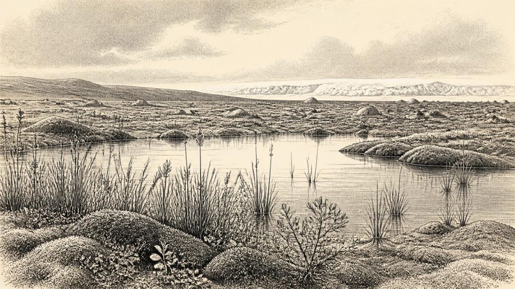
Although 30,389 BCE cannot date a specific Irish event, Derryvree, County Fermanagh, preserves freshwater sediments broadly within this period. Deposited between glacial tills, they reveal a local ice-free interval during Marine Isotope Stage 3, with cold periglacial tundra, pools, mosses, sedges, hardy plants and insects. Cave remains from southern Ireland indicate that mammoth, reindeer, giant deer, predators and other animals occupied or reached suitable landscapes during the wider era. A possibly cut-marked Castlepook reindeer bone may suggest brief human activity, but does not prove settlement. Later glaciation buried or destroyed much evidence, making Derryvree an exceptional environmental record for Ireland.
Dateline
The modern label 30,389 BCE cannot identify a recorded Irish event, season or generation. No community in Ireland then used a calendar that can be correlated with ours, and the surviving evidence cannot be resolved to a single year. The most relevant Irish archive is a freshwater deposit at Derryvree near Maguiresbridge, County Fermanagh. Its radiocarbon result, Birm-166, was 30,500 radiocarbon years before present, with a wide uncertainty; modern calibration places the deposit broadly at about 36,900–31,700 calibrated years BP, roughly 34,950–29,750 BCE. The requested year falls within that broad range, but is not a date assignable to an individual layer, plant, animal or human action.
Ireland was then part of the Late Pleistocene world, in Marine Isotope Stage 3, during the long climatic deterioration before the Last Glacial Maximum. The evidence is therefore primarily environmental rather than historical in the conventional sense. It records changing ice, water, plants, insects and animals. It does not provide kings, communities, frontiers, beliefs or a sequence of political events. That limitation is not a failure of the record: it is the central fact of Ireland’s deep past.
A Wetland Between Glaciers
Derryvree was exposed when road works cut through a drumlin in 1969. The section revealed a thick lower layer of till, then freshwater silts, fine sands and organic-rich sediment, capped by another distinct till. Till is debris deposited directly by glacier ice. The order of deposits is therefore unusually clear: ice had occupied the locality; subsequently, local conditions permitted water, sediment and organic matter to accumulate; later ice or glacial meltwater covered and sealed the older wetland.
This sequence matters because it disproves a simple image of Ireland as either entirely frozen or entirely hospitable throughout the Ice Age. At Derryvree, at least, there was an interval without glacier ice at the site. The surrounding landscape was nevertheless severe. The original investigators described the plant and animal evidence as indicating open tundra vegetation and a periglacial climate: ground influenced by intense seasonal freezing and thawing in the vicinity of ice. The freshwater bed is a local window, not a complete map of the island. It cannot prove that every Irish district was ice-free or ecologically similar at the same moment.
Nor should the modern drumlin be mistaken for an undisturbed scene from 30,389 BCE. The visible landform reflects later glacial processes. What survived is a buried fragment of a much older basin, protected beneath subsequent deposits. Such preservation is rare. Later glaciers eroded, reworked or concealed much of Ireland’s older Pleistocene landscape, making the Derryvree silts disproportionately important for understanding this period.
Cold Water, Living Ground
The Derryvree fossils show that a cold landscape was not a lifeless one. Mosses, sedges and wet-ground plants occupied the margins of fresh water. Plant remains include bogbean (Menyanthes trifoliata), a species associated with shallow wetland settings, alongside water-milfoil and plants characteristic of exposed northern or alpine conditions, including dwarf willow, mountain avens and lesser clubmoss. These finds support the inference of pools or slowly moving water, waterlogged silt, mossy edges and low, open vegetation rather than woodland.
Fossil insects add important detail. Beetles are especially useful environmental indicators because different species respond to moisture, vegetation cover and seasonal warmth. At Derryvree they support the broader picture of open, cold ground around a productive wetland. The evidence does not yield an exact temperature for the modernly numbered year, nor does it recreate an entire food web. It does, however, establish that liquid water, plants and invertebrate habitats could persist locally during a cold-stage interval.
The best reconstruction is consequently a mosaic. Shallow water and saturated margins may have alternated with sedge-rich hollows, patches of moss, sparse low shrubs, bare mineral soil and frost-disturbed ground. Snowmelt and seasonal precipitation would have fed pools and channels. Summers may have allowed a brief flush of growth; winters were likely long and exacting. The old term “tundra” is useful shorthand, but it should not imply a perfectly uniform modern Arctic landscape. Soil, exposure, snow cover, water supply and proximity to ice would have created variation over short distances.
Animals on a Changing Island
For the broader Irish animal world, the key evidence comes from cave deposits, especially Castlepook Cave, also known as Mammoth Cave, near Doneraile in north County Cork. Collections recovered there in early twentieth-century excavations contain remains attributed to woolly mammoth, reindeer, giant deer, spotted hyaena, wolf, bear, fox, hare and smaller animals. Improved radiocarbon work has shown that parts of the southern Irish cave fauna belong to Marine Isotope Stage 3, before the later full expansion of the last ice sheet.
These remains should be used carefully. A cave bone is not necessarily the same age as another bone found beside it, and neither need be contemporary with Derryvree’s wetland. Carnivores could carry prey into caves; scavengers, water, sediment movement, decay and nineteenth- or early twentieth-century collecting all affect what survives and how it can be interpreted. Still, the fauna demonstrates that, during parts of this broad period, Ireland had landscapes capable of sustaining or receiving sizeable grazing animals and their predators or scavengers. Reindeer and mammoth point towards open country with grazing opportunities, while hyaena and wolf imply a more complete animal community than a scattering of isolated visitors.
Sea level was lower than today because much water was locked in continental ice sheets. Ireland’s coastlines and surrounding seas therefore differed markedly from those of the modern island. Yet the evidence does not justify drawing a permanent, uncomplicated land bridge to Britain or continental Europe for precisely 30,389 BCE. Connections changed with sea level, ice extent and local topography. Animal arrivals show that movement into Ireland was possible at some stages; they do not, on their own, reveal the route, frequency or season of travel.
The Castlepook Human Question
One find makes this period particularly important to Irish archaeology: a reindeer femur from Castlepook has been reported as bearing a deep modification interpreted as a stone-tool cut mark made while the bone was fresh. Public heritage material has associated the object with an age of about 31,000 BCE, while media reporting described the animal bone as around 33,000 years old. If the mark was indeed made by people and belongs to the bone’s Pleistocene history, it may be evidence that humans processed a reindeer in Ireland far earlier than the previously secure terminal-Pleistocene evidence.
That is a significant possibility, but not a licence to invent an Irish settlement. The historic Castlepook collections have complex and incompletely documented contexts. Direct dating identifies the age of sampled bone, whereas identifying a surface alteration as a tool mark requires separate taphonomic analysis. A single modified limb bone, even if the interpretation stands, would demonstrate a limited activity: carcass processing. It would not establish the size of a party, the length of a visit, a camp, a hearth, a tool-making place, a dwelling, an ancestral population or uninterrupted habitation.
There is no securely associated house floor, hearth, stone-tool assemblage, burial, food store, art or other occupation surface in Ireland that can be confidently placed at 30,389 BCE. The closest secure published evidence for later human presence remains a cut-marked brown-bear bone from Alice and Gwendoline Cave, County Clare, dated to the terminal Pleistocene, many millennia afterwards. Castlepook therefore remains a compelling research problem, not a complete origin story.
No Polities, No Trade Network
Political affairs, diplomacy and organised conflict cannot responsibly be reconstructed for Ireland at this date. There are no named groups, boundaries, rulers, fortifications or weapons attributable to a human population in the island. Likewise, there is no evidence for trade, farming, herding, pottery, metalworking, permanent settlement, textile production or managed woodland. The economic activity most securely visible is ecological rather than human: plants growing, animals grazing or hunting, water carrying sediment and ice remodelling terrain.
Religion, language, learning and artistic culture are equally beyond the Irish evidence. It would be tempting to infer that any hypothetical visitors shared practices with Upper Palaeolithic people elsewhere in north-west Europe, where caves and burials preserve striking evidence of culture. But that would be analogy, not knowledge of Ireland. Nearby Wales does demonstrate that modern humans occupied parts of the wider region in this broad era, notably at Paviland, but proximity does not prove a journey, cultural affiliation or continuing population in Ireland.
An Environmental History
The most historically meaningful development around 30,389 BCE was environmental instability. Derryvree preserves an interval in which freshwater life developed between episodes of glaciation. Its plants and insects show a cold, open, periglacial wetland rather than featureless ice. Cave fauna from southern Ireland shows that large mammals entered or survived in suitable Irish environments at different times during the same long climatic stage. Later ice expansion would transform and bury much of that world.
Thus the responsible picture is vivid but restrained. Around this modernly assigned year, Ireland was a changing Ice Age landscape, locally capable of supporting pools, sedges, mosses, hardy flowering plants, insects and, elsewhere in the wider period, a distinctive cold-stage fauna. Humans may have briefly reached it, but a permanent population cannot be demonstrated. The buried Derryvree pool is valuable precisely because it preserves what the later ice nearly erased: not a recorded event, but evidence that life endured on exposed Irish ground before the cold deepened again.
Primary Sources
- A Middle Midlandian Freshwater Series at Derryvree, Maguiresbridge, County Fermanagh, Northern Ireland
- A Middle Midlandian Freshwater Series at Derryvree, Maguiresbridge, County Fermanagh, Northern Ireland
- A Reconsideration of the Radiocarbon Dating of the Marine Isotope Stage 3 Fauna from Southern Ireland
- Growth and Retreat of the Last British–Irish Ice Sheet, 31,000 to 15,000 Years Ago: the BRITICE-CHRONO Reconstruction
- Growth and Retreat of the Last British-Irish Ice Sheet, 31,000 to 15,000 Years Ago: the BRITICE-CHRONO Reconstruction
- Pleistocene Glaciations in Ireland
- Trimlines, Blockfields and the Vertical Extent of the Last Ice Sheet in Southern Ireland
- Exploring Controls of the Early and Stepped Deglaciation on the Western Margin of the British Irish Ice Sheet
- Early Deglaciation of the British-Irish Ice Sheet on the Atlantic Margin
- Pattern, Style and Timing of British–Irish Ice Sheet Advance and Retreat over the Last 45,000 Years: Evidence from NW Scotland and the Adjacent Continental Shelf
- Figure 6.—The Subdivision of the Quaternary Period in Ireland
- The Irish Quaternary Fauna Project
- Heritage Artefacts of County Cork
- First Evidence of a Late Upper Palaeolithic Human Presence in Ireland
- New Insights on the Fauna of Ireland's Younger Dryas and Early Holocene from Alice & Gwendoline Cave
- The Mesolithic in Ireland: When Was It?
- Menyanthes trifoliata
- The IntCal20 Northern Hemisphere Radiocarbon Age Calibration Curve (0–55 cal kBP)
- IntCal20
- Prehistoric Wales
- Paviland Cave and the Ice Age Hunters
- Goat’s Hole, Paviland Cave
- Reindeer Bone Found in Cork Cave Shows Human Activity in Ireland 33,000 Years Ago








