
BIRM-166’s Iceward Wetland30587 BCE
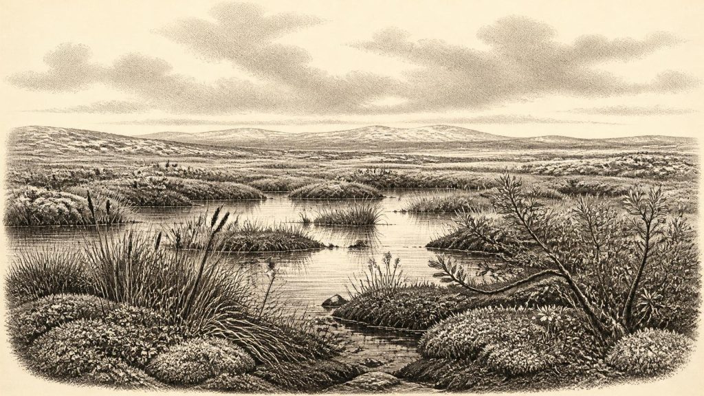
Around 30,587 BCE, a modern label within Marine Isotope Stage 3, Ireland has no historical record. Derryvree, County Fermanagh, preserves organic freshwater sediments between glacial tills, dated broadly enough to include this period. Its pollen, plants, mosses and insects indicate cold, open, wet periglacial terrain with pools, sedges, herbs and sparse scrub, rather than forest. Other Fermanagh deposits reveal variable glacial conditions. The British–Irish Ice Sheet was expanding towards its maximum. Castlepook Cave records cold-stage fauna and a possible cut-marked reindeer bone, but provides no secure evidence of settlement. No claims about peoples, politics, farming or routes can be sustained.
Dateline
“30,587 BCE” is a modern chronological label, not a year for which Ireland preserves an event, a ruler, a battle or a settlement. No prehistoric community used this calendar, and archaeological dating at such depth cannot distinguish one year from the next. The most responsible way to approach this point is as a place within the Late Pleistocene, broadly Marine Isotope Stage 3, when climates in north-west Europe changed sharply and repeatedly. Around the landmass now called Ireland, the evidence is environmental and fragmentary: buried freshwater sediments in County Fermanagh, cave-bone assemblages in the south, and the wider record of a British–Irish Ice Sheet moving towards its later maximum.
The numbered year falls within the broad calibrated range associated with one of Ireland’s most important pre-Last Glacial Maximum deposits: the organic freshwater horizon at Derryvree, near Maguiresbridge in County Fermanagh. Its radiocarbon determination, BIRM-166, was reported as 30,500 radiocarbon years BP, with a large uncertainty. Radiocarbon years are not calendar years; after calibration, the result spans roughly 36,900–31,700 calibrated years BP, or about 34,950–29,750 BCE. Thus 30,587 BCE may lie within the range represented by the deposit, but cannot be assigned to a particular season, plant community, animal generation or human visit.
A Wetland Between Glaciers
Derryvree was exposed during roadworks in 1969, when a cutting through a drumlin revealed a striking sequence. A lower sheet of glacial till lay beneath silts, fine sands and organic sediments; another thick till capped them. Till is unsorted material deposited directly by ice. The sequence therefore supplies a secure relative order: ice affected the locality, an interval followed in which freshwater and organic matter could accumulate, and ice later returned and sealed the deposits. This does not prove that all Ireland was free of ice at once. It does establish that this part of Fermanagh experienced an ice-free or non-glacial phase between separate glacial episodes.
That distinction matters. Later glaciers eroded, buried and mixed much of Ireland’s older Pleistocene record. Derryvree survives because its wetland deposits were protected beneath later material, not because the present drumlin is an untouched landscape from the thirty-first millennium BCE. The archive is local: it records conditions in and around one low-lying basin. Its importance lies in the rare detail it gives to a period otherwise known mainly through landforms and scattered animal bones.
Cold Water, Open Ground
The Derryvree fossils indicate a severe but living environment. Pollen, plant macrofossils, mosses and insects point to open vegetation of northern or Arctic-alpine character rather than woodland. Sedges and freshwater mosses suggest wet margins; aquatic plants, including bogbean and water-milfoil, show that standing or slow-moving water was present. Other remains include plants associated with cold, exposed ground, such as mountain-avens, dwarf willow and lesser clubmoss. These are direct traces of organisms preserved in sediment. The broader reconstruction—a mosaic of shallow pools, mossy ground, sedge-rich edges, sparse herbs and low scrub—is an interpretation, but a well-supported one.
This was not a familiar green Irish countryside. Closed forest is not supported by the assemblage. A few tree pollen grains need not demonstrate local woodland: pollen can travel far or be redeposited from older material. The stronger signal comes from the abundance of herbs, sedges, mosses and cold-adapted plants. Winters were probably long and harsh; growing seasons were short; frost action and seasonal thaw shaped soils and drainage. Yet the freshwater evidence is equally important. Ireland was not simply an unbroken desert of snow or bare ice. At least locally, liquid water, vegetation and small animal life persisted in an exposed periglacial landscape.
Other inter-till deposits in Fermanagh, notably at Hollymount near Maguiresbridge and Greenagho near Belcoo, reinforce the larger conclusion that ice advance was neither simple nor uniform. These sites do not provide a neat annual sequence, and their dates have different strengths and limitations. Together, however, they caution against imagining one island-wide moment of either total ice cover or complete ice-free terrain. Ice margins, local basins, meltwater and topography created varied conditions across time and region.
An Island Approaching Major Glaciation
The date belongs to the long approach to the Last Glacial Maximum, not to the maximum itself. Reviews of the British–Irish Ice Sheet place its major build-up after roughly 35–32 thousand years ago, with its later maximum extent broadly around 27–21 thousand years ago; more recent reconstructions likewise show that different sectors advanced, peaked and retreated at different times. For Ireland around 30,587 BCE, the key point is instability. The island’s landscapes were being remade by an expanding, dynamic ice-sheet system, but neither the exact line of ice nor its thickness can be plotted confidently for every locality in this particular year.
The consequences were profound. Glaciers could scour bedrock, divert drainage, lay down till and later obliterate the soils, campsites and animal traces that might otherwise have survived. Low global sea levels exposed parts of the continental shelves, changing the geography around Ireland and Britain. Lower sea level, however, must not be converted automatically into a convenient land bridge. The Irish Sea contains deep channels, and the exact accessibility of Ireland changed with sea level, ice and local terrain. There is no sound basis for claiming either a proven dry route into Ireland or a demonstrated open-sea crossing in 30,587 BCE.
Caves and the Animal Record
County Cork’s Castlepook Cave, near Doneraile, offers the other major window onto this wider age. Excavated principally in the early twentieth century, it produced remains of Ice Age animals including reindeer, brown bear, spotted hyaena and other mammals. Subsequent radiocarbon reassessment has shown that some specimens long assigned to later phases are substantially older, placing elements of the southern Irish fauna in Marine Isotope Stage 3. The cave demonstrates that, during parts of this long interval, Ireland supported or received a varied cold-stage fauna. It does not show that every recorded species lived together, beside Derryvree, or precisely in 30,587 BCE.
Cave deposits demand particular care. Bones can be brought in by carnivores, water, natural death or human activity; they may be disturbed long after deposition. Castlepook’s early excavations were invaluable, but their recording methods did not provide the controlled stratigraphy expected today. A bone found in a cave is therefore not automatically a hunting discard, a household refuse deposit or proof of a den occupied in a single season. Taphonomy—the study of what happens to remains after death—is essential before historical conclusions are drawn.
One reindeer femur from Castlepook has attracted exceptional attention because a deep mark has been interpreted as a stone-tool cut made while the carcass was fresh. It has been presented as possible evidence for human handling of reindeer in Ireland roughly 33,000 years ago. If that interpretation is sustained, it would extend the island’s possible human story far beyond the traditionally accepted post-glacial record. But it remains a single, highly consequential trace. The age dates the bone, not necessarily the exact moment of marking, and no securely associated hearth, tool assemblage, dwelling floor, burial, artwork or stratified settlement of this age has been published from Ireland.
What Cannot Be Recovered
Accordingly, there is no responsible basis for describing a named people, language, kin group, leader or territory in Ireland at this date. Political affairs, diplomacy and warfare leave no identifiable evidence. Nor can archaeology demonstrate farming, livestock keeping, crop storage, pottery, metalworking, formal trade routes, shrines or organised religious observance. The island’s surviving record does not permit a social history in the usual sense. It records environmental opportunity and constraint, not institutions.
If people did enter Ireland during a milder interval of Marine Isotope Stage 3, they would probably have been highly mobile foragers, drawing on knowledge of animals, shelter, fuel, stone and changing weather. That is an inference from wider Upper Palaeolithic Europe, not a demonstrated description of an Irish community. The possible Castlepook cut mark may imply carcass processing; it does not prove a resident population, a seasonal camp or an economy of exchange. Reindeer and other mammals testify to animal movement through suitable habitats, not to commerce.
The Scale of the Evidence
The best account of Ireland around 30,587 BCE is therefore modest, but not empty. At Derryvree, during a broad interval that includes this modern calendar label, freshwater lay in a cold, open basin between phases of glaciation. Mosses, sedges, herbs, aquatic plants and insects occupied its margins. Across other parts of Ireland, cave deposits preserve an incomplete animal history of a landscape later transformed by ice. The British–Irish Ice Sheet was growing towards a far more extensive glacial phase, changing habitats and erasing much of what had existed before.
That is not a lost year waiting for a king or battle to be discovered. It is a rare environmental horizon: a wetland briefly visible between tills, a handful of fossils in caves, and a reminder that the earliest Irish past is measured in calibrated ranges and changing landscapes rather than annual chronicles. The silence of the record is itself historical evidence—evidence of ice, time and preservation determining what later generations can know.
Primary Sources
- A Middle Midlandian Freshwater Series at Derryvree, Maguiresbridge, County Fermanagh, Northern Ireland
- Early Midlandian–Middle Midlandian, Pleistocene, Northern Ireland
- Palaeoecology: Irish Quaternary Association Field Guide
- Middle Midlandian Interstadial Deposits at Greenagho, Near Belcoo, County Fermanagh, Northern Ireland
- The Irish Quaternary Fauna Project
- A Reconsideration of the Radiocarbon Dating of the Marine Isotope Stage 3 Fauna from Southern Ireland
- The Exploration of Castlepook Cave, County Cork, Being the Third Report from the Committee Appointed to Explore Irish Caves
- Holdings: The Exploration of Castlepook Cave, Co. Cork. With 3 Plates
- Heritage Artefacts of County Cork
- New Insights on the Fauna of Ireland’s Younger Dryas and Early Holocene
- Extent and Timing of the Last Glacial Maximum (LGM) in Britain and Ireland: A Review
- Growth and Retreat of the Last British–Irish Ice Sheet, 31,000 to 15,000 Years Ago: The BRITICE-CHRONO Reconstruction
- Response of the Irish Ice Sheet to Abrupt Climate Change During the Last Deglaciation
- Last Glacial Maximum Cirque Glaciation in Ireland and Implications for Reconstructions of the Irish Ice Sheet
- Trimlines, Blockfields and the Vertical Extent of the Last Ice Sheet in Southern Ireland
- Timing and Pace of Ice-Sheet Withdrawal Across the Marine–Terrestrial Transition West of Ireland During the Last Glaciation
- The Deglaciation of the Western Sector of the Irish Ice Sheet from the Inner Continental Shelf to its Terrestrial Margin
- The Colonization of Ireland: A Human Ecology Perspective
- The IntCal20 Northern Hemisphere Radiocarbon Age Calibration Curve (0–55 cal kBP)
- IntCal Publications
- CV17040 Irish Sea Palaeolandscape Investigation Survey
- The Geology of the Irish Sea: UK Offshore Regional Report
- Could Brown Bears (Ursus arctos) Have Survived in Ireland During the Last Glacial Maximum?
