
Crag Cave Speleothem Growth30338 BCE
About 30,338 BCE, Ireland lay within the unstable Late Pleistocene, not a precisely recoverable calendar year. Derryvree, County Fermanagh, preserves freshwater wetland sediments dated broadly to this period, indicating open, cold, treeless terrain of sedges, mosses, pools and tundra plants. Episodic calcite growth in County Kerry’s Crag Cave shows that southwest Ireland periodically retained circulating water during milder phases. Advancing ice later buried or destroyed landscapes, while Castlepook Cave fauna records mammoth, reindeer and carnivores. A marked reindeer bone may indicate human processing, but proves neither settlement nor culture. Evidence supports a regionally varied Ice Age environment, not year-specific events.
Dateline
30,338 BCE is a modern chronological label, not a date that can be matched to an Irish event, ruler, settlement or season. At this depth of time, archaeology cannot offer calendar-year precision. In simple arithmetic, the label lies about 32,287 years before the conventional radiocarbon reference year of 1950, but the evidence is dated in broad radiocarbon and calibrated ranges, often with substantial uncertainty. The responsible subject is therefore not “Ireland in a year”, but Ireland during a narrow part of the Late Pleistocene, within Marine Isotope Stage 3 and on the approach to the most extensive phase of the last glaciation.
The strongest Irish evidence relevant to this horizon comes from deposits rather than from people: buried wetland sediment at Derryvree near Maguiresbridge in County Fermanagh; calcite formations in Crag Cave, County Kerry; the reshaped landforms of the British–Irish Ice Sheet; and animal remains accumulated in caves, notably Castlepook, or Mammoth Cave, near Doneraile in north Cork. These archives reveal a cold, unstable and regionally varied island-edge landscape. They do not reveal an Irish population, a polity, a campaign, a religion or a trading system.
A Date Range, Not a Year
Derryvree provides the closest important dated environmental sequence. Roadworks in 1969 cut through a drumlin and exposed organic freshwater silts and fine sands trapped between two thick sheets of glacial till. The material produced radiocarbon determination BIRM-166: 30,500 radiocarbon years before present, with a large uncertainty of +1,170 and −1,030 years. When expressed through modern calibration, it falls broadly within about 36,900–31,700 calibrated years before present, or approximately 34,950–29,750 BCE. The label 30,338 BCE lies within that broad interval, but it cannot identify a single day, decade, human generation or environmental episode within the deposit.
This distinction matters. A radiocarbon date measures the age of carbon in a sampled deposit, not the precise moment at which every seed, insect, bone fragment or layer of silt entered it. The Derryvree sediments represent an interval of wetland formation, and later ice sealed them beneath till. They are exceptionally valuable evidence for conditions in part of Fermanagh, but they are not a complete map of Ireland and should not be converted into a confident island-wide weather report.
Derryvree’s Open Wetland
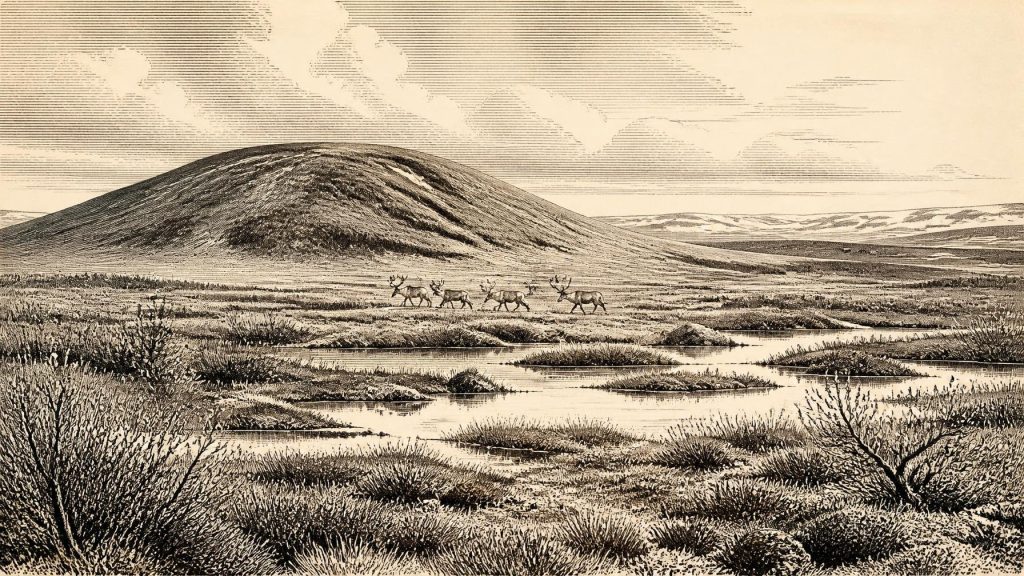
The Derryvree flora and fauna indicate an open tundra or muskeg-like environment under periglacial conditions. Pollen, plant macrofossils, mosses and insect evidence point away from dense woodland and towards cold, treeless ground with wet hollows and shallow freshwater. Grasses and sedges were important; cold-tolerant plants included dwarf willow, mountain avens, juniper and bogbean, while aquatic plants such as water-milfoil indicate standing or slowly moving water. Mosses add another crucial detail: this was not simply bare frozen ground, but a patchwork of damp vegetated surfaces, sedge margins, pools and exposed mineral soil.
Such a landscape would have been strongly seasonal. Snow cover, frozen ground, brief growing seasons, thawwater and waterlogged depressions all shaped the available habitats. The word “tundra” should not suggest one uniform scene. Local shelter, slope, drainage, soil and proximity to ice could have created marked contrasts over short distances. A pool-edge at Derryvree could sustain aquatic vegetation while nearby ridges remained windswept, sparsely planted and subject to repeated freezing and thawing.
The wider climate was not static. Greenland ice-core records show that the middle part of the last glacial period contained abrupt shifts between relatively milder interstadials and colder stadials. Irish cave calcite helps to register this instability. At Crag Cave near Castleisland, uranium-series dates show that speleothem growth occurred episodically during warmer phases when liquid water could percolate through soil and limestone. Growth of cave calcite does not measure outdoor temperature directly, nor does it prove that every district was ice-free; nevertheless, it is compelling evidence that southwest Ireland sometimes had water circulation and ground conditions incompatible with continuous deep permafrost.
Ice Was Advancing, Not Everywhere Identically
Ireland was moving towards the Last Glacial Maximum, but it was not necessarily a uniformly ice-smothered country at this particular broad horizon. The later British–Irish Ice Sheet reached its greatest overall volume around 23,000 years before present, while different sectors advanced and retreated at different times. Reconstructions show that ice-sheet growth was asynchronous: some margins extended early, others later, and local evidence can preserve ice-free or periglacial enclaves amid a wider glacial system.
Derryvree’s freshwater deposit is important precisely because it lies between tills. It demonstrates that, before the later ice advance that formed the upper till, the locality had supported an open wetland landscape. Yet the two enclosing tills also testify to profound regional change. Glaciers later overrode, eroded and buried much of the older land surface. This helps explain why evidence for this era is so scarce. Campsites, hearths, wooden objects, footprints and light scatters of stone tools would be especially vulnerable to removal or disturbance by ice, meltwater and later soil formation.
Lower sea levels exposed broad areas of what is now seabed around Ireland and Britain, altering coastlines and possible routes for animals and people. That does not justify a simple claim that Ireland was joined to Britain by an easy, dry land bridge in 30,338 BCE. The geography of exposed shelves, rivers, marshes, sea ice, glaciers and water channels changed through time, while ice itself could obstruct travel. Any movement to Ireland would have depended on changing local conditions, and neither a route nor a crossing can presently be demonstrated for this particular interval.
Cave Fauna and a Human Question
Irish cave collections establish that large mammals reached the island during the wider Late Pleistocene. The Irish Quaternary Fauna Project concluded that a broad range of mammals colonised Ireland between at least about 45,000 and 20,000 years ago. Castlepook Cave is especially important. Antiquarian excavations there recovered remains of woolly mammoth, reindeer, horse, brown bear, wolf, fox, hare and spotted hyaena, among other animals. The assemblage demonstrates that Ireland could support a much richer and more cold-adapted fauna than the modern island.
But cave bones need careful reading. A cave is not automatically a hunting camp, and a collection assembled over many millennia is not a single living community. Carnivores may have dragged in carcass parts; animals may have died naturally; water may have moved bones; and early excavators did not record deposits to modern standards. Castlepook’s mammoth and hyaena remains are vivid evidence of Ice Age ecosystems, but they cannot be arranged into a year-specific scene of predators, prey and hunters.
A reindeer femur from Castlepook has sharpened the question of human presence. Re-examination identified a deep mark interpreted by Ruth Carden as possible stone-tool damage made while fresh bone was being processed, and the bone has been publicly reported as around 33,000 years old. If that interpretation and chronological association are sustained, it would be extraordinarily early evidence that people handled an animal in Ireland. It could imply the butchery or scavenging of reindeer by a short-lived visiting party during the wider pre-maximum glacial period.
It does not, however, prove a settled population. There is no securely dated house, hearth, lithic workshop, burial, art assemblage or repeated camp sequence from Ireland at this age. Nor can one marked bone identify the makers’ language, ancestry, social organisation, beliefs, numbers, journey or destination. The possibility of a human encounter should be kept distinct from the demonstrated presence of reindeer and other mammals. Further excavation of undisturbed deposits, microscopic taphonomic study, direct dating and ancient-DNA research may strengthen, qualify or overturn present interpretations.
No Politics, No Trade Network
For political affairs, conflict and diplomacy, the evidence is silent. There were no states, kingdoms, named peoples or written agreements that can responsibly be placed in Ireland at this date. It is equally impossible to describe a local economy in the later prehistoric sense: no farming, livestock keeping, fields, metalworking, market exchange or permanent village is evidenced. If people briefly entered Ireland, their most plausible subsistence would have involved highly mobile hunter-gatherer practices centred on wild animal and plant resources, but that is an inference from the wider Upper Palaeolithic world rather than a directly excavated Irish economy.
The same caution applies to culture and religion. Upper Palaeolithic communities elsewhere in Europe made sophisticated stone tools, ornaments, images and funerary places. None of those achievements should be automatically projected onto Ireland. The absence of such finds may partly reflect lost deposits and limited investigation, but absence is not permission to invent cave art, shrines or ceremonies. At present, the material record supports a colder, open and biologically active Ireland, with a possible fleeting trace of human animal-processing, rather than a recoverable cultural history.
An Island of Fragments
The most meaningful development around this modernly labelled year was environmental, not political: the tightening grip of the last ice age on a landscape that still contained wet ground, open vegetation and large mammals in at least some regions. Derryvree preserves the clearest local image—a freshwater fringe of sedges, mosses and cold-adapted plants later sealed by ice. Crag Cave records episodes when water still fed calcite beneath Kerry limestone. Castlepook preserves the bones of animals that moved through or died in Cork’s Ice Age world, and perhaps one trace of human intervention.
That fragmentary record is not a failure of history; it is the history available. Around 30,338 BCE, Ireland was not an empty stage awaiting later settlement, but a changing Pleistocene environment in which ice, water, plants and animals continually remade the possibilities for life. The evidence allows a cautious reconstruction of that world. It does not allow the invention of a year’s events.
Primary Sources
- Middle Midlandian Freshwater Series at Derryvree, Maguiresbridge, County Fermanagh, Northern Ireland
- Middle Midlandian Freshwater Series at Derryvree, Maguiresbridge, County Fermanagh, Northern Ireland
- Exploring Controls of the Early and Stepped Deglaciation on the Western Margin of the British-Irish Ice Sheet
- Figure 6.— The Subdivision of the Quaternary Period in Ireland
- Episodic Speleothem Deposition Tracks the Terrestrial Impact of Millennial-Scale Last Glacial Climate Variability in SW Ireland
- Spatio-Temporal Dynamics of Speleothem Growth and Glaciation in the British Isles
- Growth and Retreat of the Last British–Irish Ice Sheet, 31 000 to 15 000 Years Ago: the BRITICE-CHRONO Reconstruction
- Pattern and Timing of Retreat of the Last British-Irish Ice Sheet
- The Island of Ireland: Drowning the Myth of an Irish Land-bridge?
- The Irish Quaternary Fauna Project
- New Insights on the Fauna of Ireland's Younger Dryas and Early Holocene from Alice & Gwendoline Cave
- New Insights on the Fauna of Ireland's Younger Dryas and Early Holocene from Alice & Gwendoline Cave
- 2022:564 – Castlepook Cave, Castlepook South, Cork
- Heritage Artefacts of County Cork
- Ireland's Palaeolithic Archaeology – Fleeting Footprints in a Frozen Land
- Looking for the Irish Palaeolithic: New Research Projects on Old Animal Bones and Cave Sediments
- Quaternary
- Publications
- Field Guides
- Episodic Speleothem Deposition in Ireland During the Late Quaternary; Implications for Greenland Ice Core Chronology and British-Irish Ice Sheet Dynamics
- The Colonization of Ireland: A Human Ecology Perspective
- The Mesolithic in Ireland: When Was It?
