Maguirebridge Under Two Glaciers30595 BCE
30,595 BCE is a modern label within MIS 3, not a recoverable Irish historical year. At Derryvree near Maguiresbridge, Fermanagh, freshwater silts containing tundra plants and insects lay between glacial tills, proving a local ice-free wetland interval before later ice burial. The deposit indicates cold, treeless, waterlogged conditions and climatic instability, not island-wide conditions. Cave records support episodic environmental change, while faunal remains document Late Pleistocene mammals. A cut-marked reindeer bone may indicate an early human visit, but proves neither settlement nor society. Ireland’s evidence is geological and ecological: shifting ice, wetlands, fauna and traces, rather than events or politics.
Dateline
30,595 BCE is a modern calendar label, not a recoverable Irish year. No inhabitants of Ireland left a written calendar, named event, ruler or settlement sequence that can be tied to it. Indeed, there is no securely dated habitation site from this precise horizon. The responsible subject is therefore Ireland around this point: part of the Late Pleistocene, within Marine Isotope Stage 3 (MIS 3), a long cold interval marked by abrupt climatic shifts well before the fullest expansion of the last British–Irish Ice Sheet.
In the convention used by archaeologists, this date falls about 32,544 years before AD 1950. That conversion must not be confused with a radiocarbon measurement. At this depth in time, radiocarbon determinations require calibration against changing atmospheric carbon-14 levels, producing wide probability ranges rather than year-by-year precision. The nearest exceptionally useful Irish environmental record is the Derryvree deposit near Maguiresbridge, County Fermanagh. Its organic material produced the determination Birm-166, conventionally dated to 30,500 +1,170/−1,030 radiocarbon years BP. Later calibration has placed the deposit broadly at about 36,900–31,700 calibrated years BP, approximately 34,950–29,750 BCE. The nominal date belongs within that broad span, but cannot identify a particular season, pool or generation at Derryvree.
A Wetland Between Ice Advances
Derryvree was exposed during roadworks in 1969, when a cutting passed through a drumlin roughly two kilometres north-east of Maguiresbridge. The discovery was striking because it revealed organic freshwater silts and fine sands caught between two substantial beds of till: unsorted sediment deposited directly by glacier ice. The sequence establishes an order of events. Ice first laid down the lower till; a non-glacial interval then allowed water, mud, plants and insects to accumulate; a later ice advance buried the wetland beneath the upper till. That stratigraphy is strong evidence for local ice-free conditions during part of MIS 3. It is not evidence that every part of Ireland was ice-free at exactly the same time.
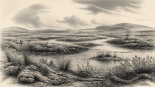
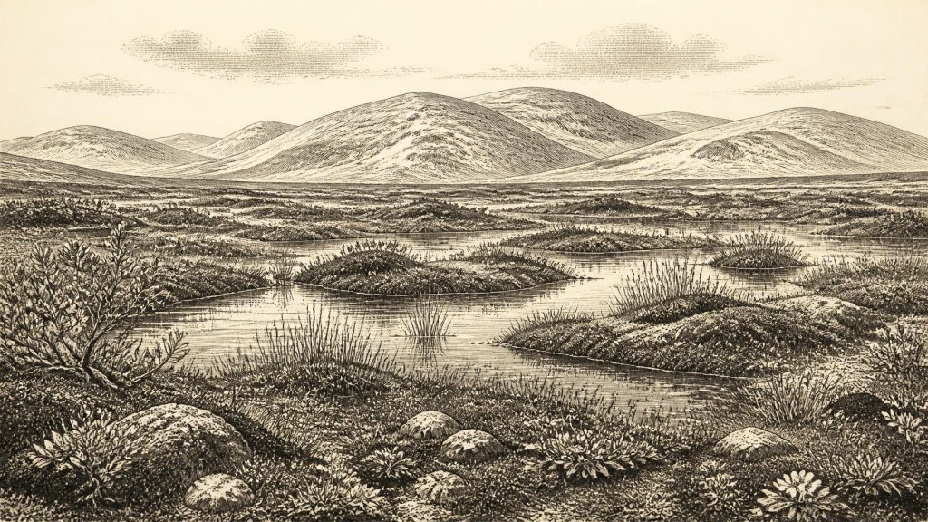
The fossil assemblage gives this buried landscape unusual clarity. It points to treeless, open tundra and a periglacial regime, where deep seasonal frost, short growing seasons and waterlogged ground mattered more than woodland. Plant remains include dwarf willow, mountain-avens, lesser clubmoss, bogbean and other cold-adapted species. Mosses, sedges and aquatic plants grew around shallow water; insect remains indicate organic-rich pools and wet ground. The old term muskeg is useful here: a cold, peaty, mossy wetland with open water rather than a modern Irish bog or a forested lake margin.
This is the most defensible picture of daily environmental change around the date. In summer, exposed ground and pools could support a low cover of herbs, sedges and mosses. In winter, frost and snow imposed far harsher conditions. The record does not supply annual temperatures, nor does it prove that every plant named in the deposit flowered together. It does demonstrate that a freshwater habitat survived long enough for a distinctive tundra community to leave seeds, spores, fragments and insects in accumulating sediment.
An Unstable Island Landscape
Ireland at this time was not the familiar, densely vegetated island of later prehistory. It lay on the Atlantic edge of north-west Europe, where climate responded sharply to North Atlantic change. Evidence from Crag Cave in County Kerry is valuable alongside the Fermanagh silts: speleothem growth occurred episodically during MIS 3, signalling intervals when liquid water could circulate through shallow cave systems. Such cave records do not date Derryvree directly, but support the wider conclusion that glacial Ireland experienced pronounced alternations rather than one unbroken, uniform freeze.
The last ice sheet’s maximum extent still lay ahead. Current reconstructions generally place its last major advance between roughly 27,000 and 23,000 calibrated years BP, although its exact dimensions, timing and regional behaviour remain actively researched. At 30,595 BCE, therefore, ice had already shaped parts of the landscape and would later destroy, bury or rearrange much of what lay on the surface. That later erosion explains why surviving evidence for this phase is so fragmentary. Derryvree is precious precisely because the later glacier sealed rather than entirely removed its small archive.
Lower sea level altered coastlines, but it does not permit a simple claim that Ireland was joined to Britain or continental Europe by a dry, easily traversed land bridge on this particular date. Ice, sea, rivers, sediment and changing relative sea level made the Irish Sea region complicated. The presence of mammals in Ireland proves that animals reached the island during the Late Pleistocene; it does not by itself identify their routes, the duration of any connection or a route available to people at 30,595 BCE.
Animals, Caves and Caution
Irish cave deposits reveal a much richer Ice-Age fauna than the modern island possesses. The Irish Quaternary Fauna Project showed that a range of mammals occurred in Ireland between at least about 45,000 and 20,000 years ago. Cave assemblages and later re-dating associate this broad period with animals including reindeer, brown bear, hare, fox, Arctic lemming, giant deer, spotted hyaena and woolly mammoth. Castlepook Cave, near Doneraile in north County Cork, has long been central to this evidence. Its early excavations recovered bones of mammoth and other mammals, while more recent work has sought surviving undisturbed deposits.
Yet an animal list is not a snapshot. Many Irish cave collections were dug in the nineteenth or early twentieth century, before modern excavation standards, and can contain material accumulated over long intervals or disturbed after deposition. Revised radiocarbon work has shown that some southern Irish MIS 3 animal dates once thought closely grouped were not so simple. Mammoth, reindeer and hyaena should therefore be understood as elements of a long Late Pleistocene record, not automatically as neighbours around one Fermanagh pool in this particular calendar-labelled year.
The date is also close to a highly important, but still limited, claim about people. A reindeer femur from Castlepook has been reported as about 31,000 BCE and bears a deep incision interpreted by zooarchaeologist Ruth Carden as a cut made by a stone tool during carcass processing. If that assessment is sustained, it would be Ireland’s earliest known indication of human activity, vastly older than the island’s well-established post-glacial hunter-gatherer record. It makes a human visit to Late Pleistocene Ireland a serious archaeological possibility.
It does not, however, demonstrate a settlement at Castlepook, Maguiresbridge or elsewhere in 30,595 BCE. The bone is not accompanied by a securely excavated camp floor, hearth, stone-tool assemblage, house, burial, human skeleton, food store or repeated sequence of butchered animals of the same age. Its date is principally the age of the animal’s death, not an exact timestamp for the incision. No named group, language, population size or continuous ancestry can responsibly be inferred. The distinction is crucial: a possible episode of carcass processing is evidence of an action, not proof of a community.
No Politics, but Ecological Pressures
Political affairs, diplomacy and organised conflict cannot be reconstructed for Ireland at this horizon. There are no leaders, territories, treaties, weapons caches or settlements from which to infer them. Likewise, there is no direct Irish evidence for ritual, formal religion, art, learning or exchange networks. It would be misleading to fill these silences with general knowledge about Upper Palaeolithic Europe. People elsewhere in Europe certainly possessed sophisticated social worlds, technologies and symbolic traditions, but Ireland’s evidence does not establish their presence here at this time.
The economy that can be discussed is ecological, not social. The Derryvree wetland captured plant matter and supported insects; larger animals ranged through wider landscapes whose exact shape is lost. If people briefly visited Ireland, reindeer and other game would have been a potential food resource, and a cave could have offered temporary shelter or a place where carnivores accumulated bones. Those are reasonable possibilities, not established facts about livelihood. There is no proof of farming, herding, permanent villages, boats, trade, mining or craft production.
The most important development around 30,595 BCE was thus environmental volatility. Ireland contained places where freshwater and tundra vegetation endured between episodes of glaciation, while the expanding ice system threatened to erase their traces. Derryvree preserves the outcome in reverse order: a wetland’s living debris, locked below till. It allows modern readers to see a real Irish Ice-Age habitat, but it also sets firm limits. We can identify sediments, fossils and changing ground conditions; we cannot turn them into a dated political narrative or confidently populate the landscape with a settled human society.
What This Date Can Mean
For Ireland, 30,595 BCE should be treated as a point within a calibrated range, not as an anniversary. The island’s best evidence describes cold, open, wet and changing environments during MIS 3. The Fermanagh record shows that local glacier-free wetlands existed between ice advances. Southern cave deposits show that Ireland supported a varied Pleistocene fauna and may preserve a fleeting human trace. Together they replace an older picture of a uniformly frozen, lifeless island with a more dynamic one—yet they also demand restraint. The history of this moment is written in silts, seeds, spores, insects, bones and ice, not in events recorded by year.
Primary Sources
- A Middle Midlandian Freshwater Series at Derryvree, Maguiresbridge, County Fermanagh, Northern Ireland
- The Irish Quaternary Fauna Project
- A Reconsideration of the Radiocarbon Dating of the Marine Isotope Stage 3 Fauna from Southern Ireland
- The IntCal20 Northern Hemisphere Radiocarbon Age Calibration Curve (0–55 cal kBP)
- Reconstructing the Last Irish Ice Sheet 2: A Geomorphologically-Driven Model of Ice Sheet Growth, Retreat and Dynamics
- Response of the Irish Ice Sheet to Abrupt Climate Change During the Last Deglaciation
- Last Glacial Maximum Cirque Glaciation in Ireland and Implications for Reconstructions of the Irish Ice Sheet
- Dimensions and Chronology of the Last Ice Sheet in Western Ireland
- Maximum Extent and Dynamic Behaviour of the Last British–Irish Ice Sheet West of Ireland
- Ice Sheet Extension to the Celtic Sea Shelf Edge at the Last Glacial Maximum
- Character of Advance and Retreat of the Southwest Sector of the British-Irish Ice Sheet During the Last Glaciation
- Episodic Speleothem Deposition Tracks the Terrestrial Impact of Millennial-Scale Last Glacial Climate Variability in SW Ireland
- Landscapes and Environments of the Last Glacial-Interglacial Transition: A Time of Amazingly Rapid Change in Ireland
- Palaeoecology
- The Subdivision of the Quaternary Period in Ireland
- New Insights on the Fauna of Ireland's Younger Dryas and Early Holocene from Alice & Gwendoline Cave
- Heritage Artefacts of County Cork
- Ireland's Palaeolithic Archaeology – Fleeting Footprints in a Frozen Land
- Menyanthes trifoliata
- Selaginella selaginoides
- Salix herbacea
- Dryas octopetala
- IntCal
- Spatio-Temporal Dynamics of Speleothem Growth and Glaciation in the British Isles