
BIRM-166 Freshwater Chronology30318 BCE
30,318 BCE is not an identifiable Irish year but falls within a broad Late Pleistocene, MIS 3 interval. The BIRM-166 radiocarbon date from Derryvree, County Fermanagh, indicates freshwater sediments accumulated locally between glacial tills, broadly 36,900–31,700 calibrated years BP. Their plants and insects depict cold, open, treeless wetland, though not all Ireland. Later ice preserved and erased evidence. Castlepook Cave in County Cork records a mixed MIS 3 fauna including mammoth, reindeer, giant deer and predators, demonstrating habitats. No evidence establishes humans, settlements or society in Ireland then; modified bone remains inconclusive. Glaciation strongly shaped environmental evidence across this period.
Dateline
The label 30,318 BCE is a modern point on a deep-time scale, not a year for which Ireland possesses an event record. No Irish calendar, written testimony, named community or archaeological sequence can identify what happened in one particular year so far before the present. At this distance, responsible history works with long calibrated ranges, layers of sediment and fossil assemblages. The nearest useful framework is the Late Pleistocene, within Marine Isotope Stage 3 (MIS 3), an unstable portion of the last glacial cycle. Ireland’s evidence illuminates changing ice, water, vegetation and animal life; it does not permit a story of rulers, battles or villages.
A Broad Chronological Window
In archaeological and geological practice, “before present” means before AD 1950. Thus 30,318 BCE corresponds approximately to 32,267 years before present. Yet even that conversion must not be mistaken for an ancient date written into the ground. Radiocarbon ages are not calendar years, because the amount of radioactive carbon in the atmosphere has varied through time. They require calibration, and beyond roughly 30,000 years ago their uncertainties become especially substantial.
The key Irish datum is BIRM-166, obtained from organic-rich freshwater deposits at Derryvree near Maguiresbridge in County Fermanagh. It produced a conventional radiocarbon age of 30,500 years BP, with a laboratory uncertainty of +1,170 and −1,030 years. Subsequent calibration places the result broadly at about 36,900–31,700 calibrated years BP, approximately 34,950–29,750 BCE. The nominal year considered here falls within that broad interval. It cannot, however, be tied to a particular pool, plant, animal, generation or season at Derryvree.
This distinction is central. The deposit tells us that a freshwater environment existed at that locality during part of a long late-Pleistocene interval. It does not prove that all Ireland looked alike, or that the whole island was ice-free at once. Nor does it settle the exact timing of every advance of the British–Irish Ice Sheet. Ireland’s glacial history was regional and dynamic: ice masses changed extent, uplands and basins responded differently, and later glaciers repeatedly destroyed or buried older evidence.
A Wetland Between Glaciers
Derryvree is unusually important because road excavations in 1969 cut through a drumlin and exposed an intelligible sequence. A lower till, deposited by glacier ice, was overlain by fine sands, silts and organic muds; these freshwater layers were themselves sealed beneath a later thick till. The order of the layers offers firm relative evidence. Ice had occupied the locality. A period then followed in which glacier ice was absent locally long enough for water, mineral sediment and organic material to accumulate. Later glacial activity overrode or covered the site, preserving the wetland record beneath fresh deposits.
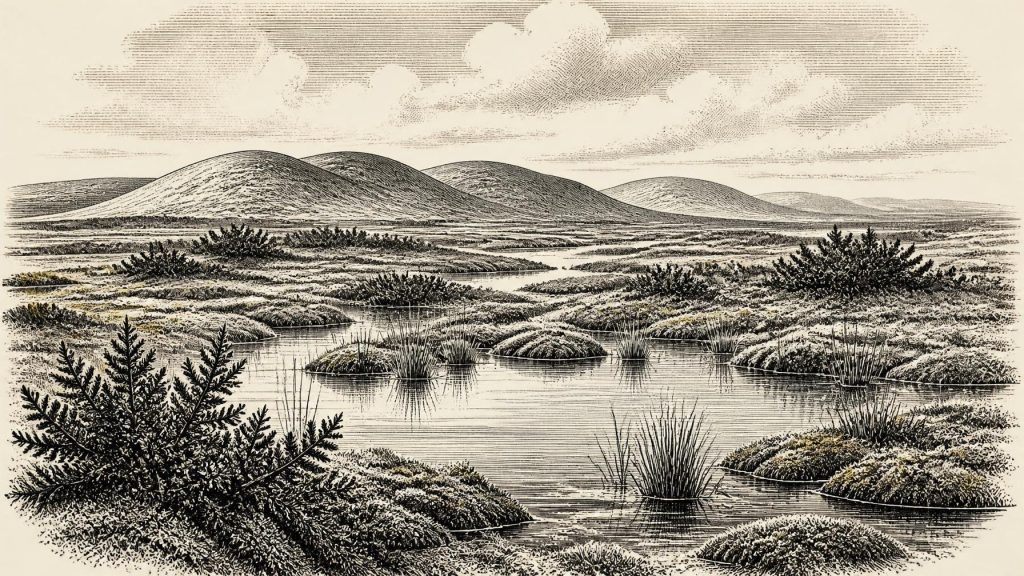
The original investigators described a flora and fauna of full-glacial aspect. Plant evidence points to open, treeless vegetation: grasses and sedges, juniper and other herbs, mosses, and hardy arctic-alpine plants. Fossil remains also include aquatic or wet-ground indicators, among them bogbean and water-milfoil. Insect assemblages were interpreted as evidence for mossy, plant-rich water with open pools. The older word muskeg, used in descriptions of the site, conveys saturated ground, shallow water and mossy margins rather than a forested bog of the modern Irish imagination.
Interpretation must remain proportionate to this evidence. Derryvree supports a picture of a cold, periglacial wetland in Fermanagh, with a short growing season and severe winters. It does not yield a complete temperature record, a dependable annual rainfall figure or a landscape map for every province. The absence of trees in this assemblage is strong evidence for openness around the site, but it is not proof that no sheltered scrub or woodland survived anywhere in Ireland. A buried wetland is a local archive, not a satellite image of the island.
Ice, Ground and Water
Thirty millennia ago, the island was approaching a more severe phase of the last glaciation, but the fullest Late Pleistocene ice expansion lay later. Recent reconstructions of the British–Irish Ice Sheet place important ice growth and expansion after this general horizon, with maximum extent in many sectors occurring during the succeeding millennia. At Derryvree, the freshwater sediments are particularly valuable because they demonstrate that the locality was not continuously buried by ice throughout the wider Midlandian cold stage.
The landscape would have been unlike later Ireland. No blanket of mature oak woodland, enclosed fields, peat-cutting settlements or familiar coastline can be projected backwards. Much water was locked in global ice sheets, lowering sea level and enlarging exposed shelf landscapes around north-west Europe. But the geography of possible movement between Ireland, Britain and continental Europe remains difficult to reconstruct in practical terms. Lower seas did not automatically make every route easy: glaciers, marine channels, seasonal ice, exposed plains and shifting river systems all shaped access. The archaeological record offers no direct evidence for regular travel or exchange routes into Ireland at this time.
In Fermanagh, frost action, seasonal thaw and waterlogging probably made the ground varied at a very small scale. A visitor could have passed from firmer, wind-exposed terrain to sedge-rich margins, shallow pools and muddy moss beds within a short distance. Such mosaics matter because they explain how plants and insects survived in a cold landscape. They also created habitat for animals, though Derryvree itself is not a large-mammal bone deposit and cannot supply a local wildlife census.
Castlepook and the Animal World
For the broader animal world, the principal Irish site is Castlepook Cave, also known as Mammoth Cave or Doneraile Cave, near the Awbeg valley in north County Cork. Historic excavations recovered an extraordinary but complicated collection of late-Pleistocene remains. Mammoth, reindeer, giant deer, wolf, fox, Arctic fox, bear, spotted hyaena, mountain hare and lemmings are among the animals reported. Revised radiocarbon work has reinforced the importance of a MIS 3 fauna in southern Ireland, while also showing why the old assemblage must be handled cautiously.
A cave deposit is not a photograph of one day. Bones can be brought in by carnivores, scavengers, water or people; they can be displaced by later digging; and specimens from different centuries or millennia can become mixed. Castlepook was investigated largely in the early twentieth century, before modern excavation standards, and some material has uncertain original context. Its fauna therefore establishes that parts of Ireland were entered by striking cold-stage mammals during the broader period. It does not prove that every listed species stood together in one Cork valley in 30,318 BCE, still less that the same animals ranged beside the Derryvree pools.
Even with those cautions, the ecological implication is powerful. Reindeer and mammoth are consistent with extensive open vegetation, while lemmings and Arctic fox indicate cold conditions. Wolves and spotted hyaenas reveal a food web containing predators and scavengers as well as large herbivores. Giant deer add a reminder that Ireland’s Pleistocene fauna included animals far removed from its later historic ecology. Their presence depended on repeated windows of suitable habitat and connection, not on a stable, isolated island ecosystem.
The Human Question
There is no securely excavated dwelling, hearth, stone-tool assemblage, burial, artwork or human skeleton in Ireland that can responsibly be assigned to this date. Consequently, there is no direct Irish evidence for a settled population, household organisation, language, religious practice, formal learning, trade, political authority, diplomacy or warfare around 30,318 BCE. These are not merely details lost to time: they are subjects on which the surviving evidence is presently silent.
A reindeer femur from the historic Castlepook collection has attracted attention because a deep mark has been interpreted as a possible cut or chop made with a sharp stone tool during carcass processing. If that interpretation and its chronological association are confirmed, it could indicate a brief human encounter with an animal in Ireland during the wider MIS 3 period. It would be an important discovery, but it would still not demonstrate a resident community. One modified bone from an old collection cannot establish continuous occupation, a hunting economy, a camp site or a cultural tradition.
This uncertainty should not obscure the achievement of the evidence. By this time, Homo sapiens elsewhere in north-west Europe possessed sophisticated hunting knowledge, stone technologies and symbolic traditions. That broader European context explains what may have been possible for mobile people reaching an Irish landscape. It cannot be used as a substitute for Irish finds. The responsible conclusion is narrower: human presence in Ireland at this depth of time remains unproven as a securely documented archaeological fact, although Castlepook makes the question worth continued investigation.
What Can Be Said of Society?
The closest truthful answer is that no society can yet be described for Ireland at this date. There were no demonstrable Irish polities, no evidence of conflict or diplomacy, and no known ritual monuments or exchange networks. Neither should the lack of evidence be read as a claim that humans could never have visited. Later ice sheets were destructive, and many Pleistocene landscapes now lie submerged offshore or have been heavily reworked. The archaeological silence may partly reflect preservation and discovery as well as past absence.
What can be recovered is a living environment. Fresh water persisted locally in Fermanagh between episodes of glaciation. Mosses, sedges and cold-tolerant plants grew at its margins. Insects inhabited the pools and wet ground. In southern Ireland, large mammals and predators occupied or reached suitable landscapes at various points during MIS 3. These records reveal ecological opportunity bounded by climatic volatility. They also show why Ireland’s earliest possible human history cannot be separated from glacial geology: ice both governed where life could flourish and erased much of the evidence left behind.
For this nominal year, then, Ireland’s history is not a human chronicle but a carefully limited environmental reconstruction. BIRM-166 at Derryvree offers the clearest witness: a thin body of freshwater sediment, preserved between tills, recording open tundra vegetation and cold wet ground during an interval before later ice advanced. It is modest evidence in quantity, but invaluable in significance. Rather than inventing a lost event for 30,318 BCE, it allows a more compelling truth: parts of Ireland had complex, changing Ice Age landscapes whose traces remain just legible beneath the terrain shaped by glaciers.
Primary Sources
- Middle Midlandian Freshwater Series at Derryvree, Maguiresbridge, County Fermanagh, Northern Ireland
- Middle Midlandian Interstadial Deposits at Greenagho, Near Belcoo, County Fermanagh, Northern Ireland
- Exploring Controls of the Early and Stepped Deglaciation on the Western Margin of the British-Irish Ice Sheet
- Growth and Retreat of the Last British–Irish Ice Sheet, 31,000 to 15,000 Years Ago: the BRITICE-CHRONO Reconstruction
- BRITICE Glacial Map, Version 2: A Map and GIS Database of Glacial Landforms of the Last British–Irish Ice Sheet
- Trimlines, Blockfields and the Vertical Extent of the Last Ice Sheet in Southern Ireland
- The Timing and Magnitude of the British–Irish Ice Sheet Between Marine Isotope Stages 5d and 2
- Pleistocene Glaciations in Ireland
- A Reconsideration of the Radiocarbon Dating of the Marine Isotope Stage 3 Fauna from Southern Ireland
- Occurrence of Mammalia Relicts at Site Castlepook Cave
- The Exploration of Castlepook Cave, County Cork
- Pleistocene Vertebrates in the British Isles
- The Irish Quaternary Fauna Project
- Freshwater Organic Deposits and Stratified Sediments Between Early and Late Midlandian (Devensian) Till Sheets, at Aghnadarragh, County Antrim, Northern Ireland
- An Inter-Till Freshwater Deposit at Hollymount, Maguiresbridge, County Fermanagh
- Landscapes and Environments of the Last Glacial-Interglacial Transition: A Time of Amazingly Rapid Change in Ireland
- Irish Pleistocene Biostratigraphy
- Figure 6: The Subdivision of the Quaternary Period in Ireland
- New Insights on the Fauna of Ireland’s Younger Dryas and Early Holocene from Alice & Gwendoline Cave
- The Glacial Legacy of County Leitrim
- The Geological Heritage of County Leitrim
