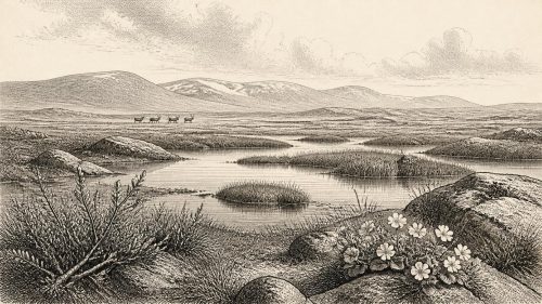
Derryvree’s Proglacial Sands30326 BCE
The label 30,326 BCE is approximate, as Ireland’s evidence consists of dated deposits rather than year-specific events. At Derryvree, Fermanagh, organic silts and sands between glacial tills record an ice-free interval, broadly 36,900–31,700 years before present, with treeless tundra wetlands, freshwater, sedges, mosses and periglacial ground. Castlepook Cave, County Cork, preserves remains of mammoth, reindeer, giant deer, predators and other cold-adapted fauna, demonstrating intermittent animal occupation. A possibly butchered reindeer bone suggests a brief early human visit, but remains contested. No settlements, institutions, language or sustained human community are evidenced; climate, ice and shifting habitats fundamentally shaped Ireland’s prehistoric environment.

Dateline
“30,326 BCE” is a useful modern label, not a date that could be recognised by anyone then living in Ireland. There was no written calendar, no named year, and no evidence from which to reconstruct an event in a particular season or generation. In calendar terms the label falls about 32,275 years before AD 1950, the conventional reference point for radiocarbon dating. Yet even that conversion should not be mistaken for precision. For this depth of time, the responsible history is one of calibrated ranges, layers of sediment and fossil assemblages rather than a chronicle of happenings.
Ireland lay within the later Pleistocene, during Marine Isotope Stage 3, a long and climatically unstable part of the Last Glacial Period. The island’s best evidence for conditions broadly relevant to this notional year comes from two very different places: the freshwater deposits buried beneath a Fermanagh drumlin at Derryvree, near Maguiresbridge, and the animal-bearing cave deposits at Castlepook near Doneraile in north County Cork. Neither is a diary of 30,326 BCE. Together, however, they show that parts of Ireland could support a treeless, cold-adapted world of wetlands, open ground and large mammals before the ice sheet reached its fullest later extent.
A Date of Ranges
The key Fermanagh determination is BIRM-166, obtained from organic material in the Derryvree deposit. It produced a conventional radiocarbon age of 30,500 years BP, with a large uncertainty: roughly 1,030 years younger to 1,170 years older. Radiocarbon years are not calendar years. Atmospheric carbon-14 has varied through time, especially during the glacial period, so results must be calibrated against independently dated records. Modern calibration curves extend to 55,000 calendar years before present, but at this age a single laboratory result commonly corresponds to a broad calendar interval rather than a neat answer.
Later discussion has placed the Derryvree organic horizon broadly within a calibrated range of about 36,900 to 31,700 years before present. The modern label 30,326 BCE lies near the younger part of that wide bracket, not at a securely identifiable point within it. Derryvree can therefore illuminate the kind of environment that survived during a pre-Last Glacial Maximum interval; it cannot establish what happened there in one calendar year. Nor should its date be imposed upon Castlepook fossils merely because both belong to the changing Ice Age world of Ireland.
A Fen Beneath a Drumlin
Derryvree was exposed by roadworks in 1969. Investigators found fine sands and organic silts trapped between two thick sheets of till, the stony sediment left by glacier ice. The lower till recorded an earlier glacial episode. Above it, the freshwater and wet-ground deposits preserved a period in which the locality was ice-free. Proglacial sands and a later till then showed that ice or meltwater conditions returned, burying and protecting the older landscape beneath the drumlin.
This stratigraphy is the most important evidence for Ireland around the stated date. It demonstrates that the island was not simply and continuously entombed beneath the ice cover associated with the later Last Glacial Maximum. At least in north-central Ireland there was exposed terrain, standing or slowly moving freshwater, sediment-forming vegetation and seasonal thaw. That is an archaeological and environmental conclusion from a particular locality, however, not proof that every Irish region was similarly open. Ice margins shifted, and uplands, western coasts and the Irish Sea basin need not have shared Fermanagh’s conditions.
The plant and animal remains in the organic deposit indicate open tundra or tundra-like wetland rather than woodland. Mosses, sedges and cold-tolerant herbs were important components of the vegetation. Finds including bogbean, water-milfoil, dwarf willow, mountain avens and other plants point to shallow water, wet margins and patches of low vegetation. The old term “muskeg” used by the original investigators conveys a mossy, waterlogged terrain, though it should not suggest a modern landscape reproduced exactly. The evidence is botanical and sedimentary: it establishes habitats and climate signals, not the colour, density or full seasonal appearance of every slope.
Cold Ground, Living Water
Derryvree’s landscape was cold enough for periglacial processes. Frost action affected exposed soils; the growing season was short; trees were absent. But “periglacial” does not mean lifeless. The buried silts preserve a landscape with water, plants and small invertebrate communities, making it clear that a cold phase could contain sheltered and productive niches. In summer, shallow pools and sedge margins would have offered food and cover to insects and birds, while the surrounding open ground could sustain grazing animals.
Climate was not stable. Greenland ice cores show that the North Atlantic glacial world repeatedly switched between colder stadials and relatively milder interstadials on millennial timescales. The exact alignment of an Irish terrestrial bed with a numbered Greenland event remains an interpretation, not a direct observation: Greenland’s sequence is a record of snowfall on an ice sheet, whereas Derryvree is a local freshwater deposit. Still, both demonstrate why no simple image of an unchanging “Ice Age Ireland” is adequate. Habitable intervals could be interrupted by renewed cold and advancing ice.
At 30,326 BCE, Ireland’s geography was also unlike that of the present. Global sea level was substantially lower than today because enormous quantities of water were locked in northern ice sheets. Coastlines and channels were therefore altered, but the precise configuration and accessibility of routes into Ireland remain matters for reconstruction. Lower sea level cannot, by itself, prove a permanent land connection, a particular crossing route or regular movement by people. The island’s fossil record shows that animals arrived during suitable intervals; it does not supply a map of every migration.
Castlepook’s Animal World
In north Cork, Castlepook Cave—historically also called Mammoth Cave—holds Ireland’s most important assemblage of mammals from this portion of the last cold stage. Excavations, many undertaken in the early twentieth century, recovered bones of woolly mammoth, reindeer, giant deer, brown bear, wolf, Arctic fox, hare, lemmings and spotted hyaena. The National Museum of Ireland notes that Castlepook is the country’s principal site for such remains, while the Irish Quaternary Fauna Project showed that large mammals entered and inhabited Ireland intermittently between at least about 45,000 and 20,000 years ago.
The assemblage should not be imagined as one herd encountered on one day. Cave deposits accumulate through natural deaths, carnivore activity, water movement, disturbance and nineteenth- and twentieth-century excavation. Individual bones have different histories and dates. The presence of spotted hyaena is especially evocative: its denning and scavenging behaviour may help explain why bones were concentrated in caves. Mammoth and reindeer show that Ireland could form part of a wider north-west European mosaic of cold, open habitats. They do not demonstrate that these species were present simultaneously at every location or throughout the entire Derryvree date range.
A reindeer femur from Castlepook has attracted particular attention because a mark on it has been interpreted as damage made during butchery with a stone tool. Public reporting associated the bone with human activity around 33,000 years ago. If that interpretation and dating are sustained, it would offer remarkable evidence of a very early, probably brief, human visit to Ireland. It remains a single and exceptional item, not a settlement. There are no securely excavated houses, hearths, toolkits, burials or occupation surfaces in Ireland that can describe a resident human community at 30,326 BCE.
No Polities, No Proven Camp
Accordingly, political affairs, diplomacy and warfare cannot responsibly be supplied for this year. There is no evidence for chiefs, territories, alliances, raids or formal institutions. Equally, nothing in the Irish record identifies a language, ethnic name, religion or social hierarchy. Palaeolithic hunter-gatherers elsewhere in Europe made sophisticated tools, ornaments and art, but such wider comparisons are context, not evidence that those practices occurred in Ireland at this date.
The same caution applies to everyday life and economy. If people did reach Castlepook’s landscape, they may have been highly mobile foragers following animal movements or exploiting short-lived opportunities in an exposed cold environment. That is a reasonable archaeological possibility, not a demonstrated description of Irish households. Farming, permanent villages, domesticated animals, metalwork and organised long-distance trade lay many millennia in the future. No Irish artefact of 30,326 BCE establishes an exchange network, boat technology or a regular route across the surrounding seas.
What Can Be Said
The Ireland of this distant date was shaped less by human institutions than by climate, ice, water and animal movement. Derryvree preserves a freshwater interval in a landscape later sealed by glacial deposits: a treeless wetland with mosses, sedges, aquatic plants and periglacial ground. Castlepook preserves the bones of large mammals adapted to, or able to exploit, the open habitats of Ice Age Ireland. Together they overturn any notion that the island was invariably sterile beneath ice before the Holocene.
But they also set firm limits. The evidence records ecological possibility and intermittent occupation by animals; it offers, at most, a contested glimpse of human activity. For 30,326 BCE, Ireland has no year-specific history in the usual sense. Its history is a buried one: freshwater mud beneath a Fermanagh drumlin, bones in a Cork cave, and the carefully calibrated recognition that both belong to a changing prehistoric world far older than calendars.
Primary Sources
- Middle Midlandian Freshwater Series at Derryvree, Maguiresbridge, County Fermanagh, Northern Ireland
- Middle Midlandian Freshwater Series at Derryvree, Maguiresbridge, County Fermanagh, Northern Ireland
- The Irish Quaternary Fauna Project
- A Reconsideration of the Radiocarbon Dating of the Marine Isotope Stage 3 Fauna from Southern Ireland
- First Evidence of a Late Upper Palaeolithic Human Presence in Ireland
- The Colonization of Ireland: A Human Ecology Perspective
- New Insights on the Fauna of Ireland's Younger Dryas and Early Holocene from Alice & Gwendoline Cave
- Spotted Hyena Skull
- Ice Age Ireland
- Guide to the National Museum of Ireland
- Archaeological Heritage of County Cork
- Figure 6—The Subdivision of the Quaternary Period in Ireland
- Deglacial Rates and Controls for the British-Irish Ice Sheet Western Margin
- Dimensions and Chronology of the Last Ice Sheet in Western Ireland
- Last Glacial Maximum Cirque Glaciation in Ireland and Implications for Reconstructions of the Irish Ice Sheet
- Trimlines, Blockfields and the Vertical Extent of the Last Ice Sheet in Southern Ireland
- The IntCal20 Northern Hemisphere Radiocarbon Age Calibration Curve (0–55 cal kBP)
- IntCal Publications
- IntCal Data
- A Stratigraphic Framework for Abrupt Climatic Changes During the Last Glacial Period Based on Three Synchronized Greenland Ice-Core Records
- A Stratigraphic Framework for Abrupt Climatic Changes During the Last Glacial Period Based on Three Synchronized Greenland Ice-Core Records
- Radiocarbon Dates from the Oxford AMS System: Archaeometry Datelist 31