
Awbeg–Derryvree Tundra Mosaic30213 BCE
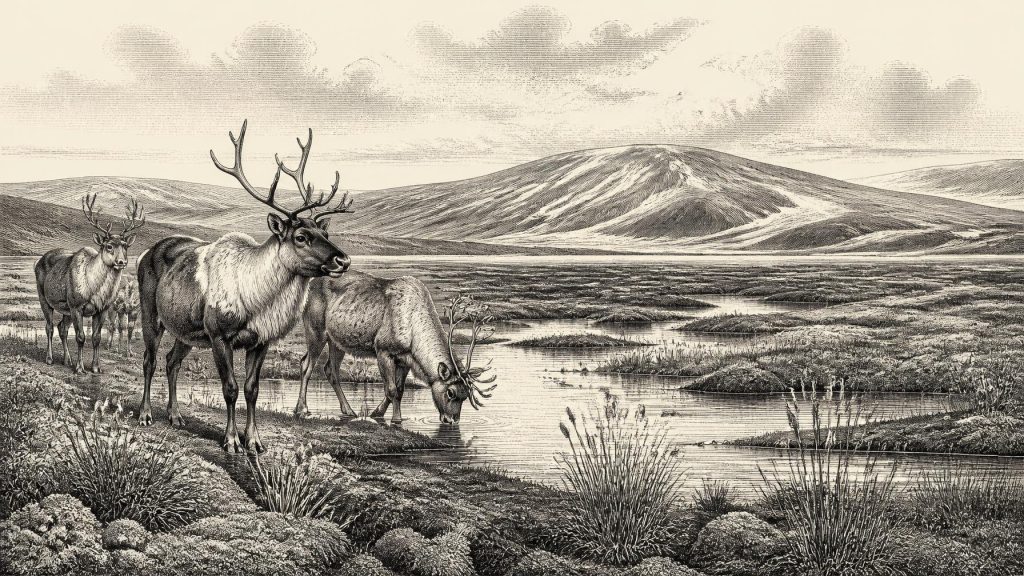
Around 30,213 BCE, Ireland lay in the unstable Late Pleistocene cold stage, but evidence cannot identify conditions in a single calendar year. At Derryvree, County Fermanagh, an organic freshwater deposit between glacial tills records an ice-free interval of open, treeless tundra and waterlogged muskeg, with herbs, mosses, bogbean and insects adapted to severe seasonal conditions. Ice-sheet growth, shifting sea levels and local geography produced changing habitats and uncertain animal routes. Castlepook Cave in County Cork preserves remains of mammoth, hyaena, reindeer and fauna. A contested cut mark suggests possible human visits, but no evidence supports permanent settlement or organised society.
Dateline
Modern calendar-year precision cannot be recovered for Ireland in 30,213 BCE. There were no written records, dated settlements or annual environmental sequences from which to identify an event in that particular year. The number is therefore best treated as a modern chronological marker, approximately 32,162 years before AD 1950, rather than as a date contemporary people could have recognised. Ireland was then in the Late Pleistocene, within Marine Isotope Stage 3 and the Irish Midlandian cold stage: a long, unstable part of the last Ice Age before the fullest expansion of the British–Irish Ice Sheet.
The evidence appropriate to this horizon is geological and palaeoecological, not political or biographical. Sediment layers, fossil pollen, seeds, mosses, insects, animal bones, cave deposits and the forms left by ice provide fragments of a changing landscape. They can establish broad sequences and environments, but they cannot tell us what happened on an individual day, season or calendar year. The most responsible picture for around 30,213 BCE is consequently one of cold, open country, local freshwater habitats, intermittently available animal resources and a rapidly changing relationship between land, ice and sea.
Dating a Deep Past
At this depth of time, dates must be handled with particular care. A radiocarbon result is not automatically a calendar date: it measures the remaining carbon-14 in once-living material and must be calibrated against changing atmospheric carbon levels. Calibration produces ranges, often broad ones, rather than a single secure year. The internationally used IntCal20 curve extends to 55,000 calibrated years before present, but it does not turn an Irish Ice Age deposit into an annual chronicle.
The key local reference point is a freshwater and organic deposit at Derryvree, near Maguiresbridge in County Fermanagh. Roadworks exposed the deposit within a drumlin in 1969. It lay between two tills, compact sediments laid down by glacier ice. The sequence supplies a powerful relative story: ice affected the locality; a period followed in which freshwater sediment and organic matter accumulated; then later ice overran and sealed the deposit beneath another till. A conventional radiocarbon determination from the Derryvree organic material was 30,500 BP, with a substantial uncertainty of +1,170/−1,030 years. Calibrated estimates place its formation broadly within a window that includes approximately 34,950–29,750 BCE. Thus 30,213 BCE falls within a relevant range, but cannot be assigned to a particular layer, weather episode or human generation.
A Wetland Under Future Ice
Derryvree is the most illuminating Irish environmental archive close to this notional date. Its silts and fine sands preserve a freshwater setting rather than an unbroken snowfield. Pollen was poorly preserved, yet the surviving grains were chiefly from herbs. Plant macrofossils included mosses and species associated with wet, open ground; the assemblage also included the distinctive seed of bogbean (Menyanthes trifoliata). Insect evidence supports the interpretation of a muskeg-like landscape: mossy, waterlogged ground with shallow pools, decaying vegetation and patches of exposed sediment.
This was not wooded Ireland. Dry ground appears to have supported sparse tundra vegetation, including grasses, sedges, dwarf shrubs and herbs, while water and saturated margins sustained more specialised plants. The presence of freshwater organisms and plants demonstrates seasonal liquid water. It does not imply a benign climate. Researchers interpret the flora and insects as evidence for periglacial conditions, with long cold winters, short productive summers and repeated freezing and thawing. The Derryvree basin may have been sheltered, but it was part of a treeless northern landscape in which growing seasons were constrained and local habitats could alter quickly.
The deposit also corrects a simple image of Ice Age Ireland as wholly ice-covered at all times. Its position between tills shows that south Fermanagh experienced an ice-free interval between glacial episodes. Yet this finding must not be overextended. Derryvree was one locality, and the date range is wide. It cannot prove that every part of Ireland was open tundra in 30,213 BCE, nor can it map a precise shoreline, river network or ice margin for the whole island. What it securely demonstrates is environmental diversity and instability within the broader cold stage.
Ice, Water and Changing Coasts
Ireland formed part of the developing British–Irish Ice Sheet system. Modern reconstructions of that system begin around 31,000 years ago because evidence for its earlier growth is sparse and often uncertain. They show that expansion was uneven: ice accumulated in different centres and sectors rather than advancing as one uniform blanket across Ireland and Britain. Around the time represented by this article, the eventual Last Glacial Maximum still lay ahead. The most extensive phase of the ice sheet is generally placed around 26,000 years ago, though individual Irish regions experienced differing histories of advance, thickening and retreat.
The inference for 30,213 BCE is necessarily qualified. Some areas may have been affected by expanding local ice or severe periglacial processes; elsewhere, particularly in favourable lowland basins during milder intervals, ice-free terrain and freshwater habitats could persist. Fermanagh’s later drumlin landscape was shaped by these repeated movements of ice and sediment. The familiar landforms are not products of a single year, but the cumulative result of glacier flow, meltwater, erosion and deposition across many millennia.
Global sea level was lower than today because vast quantities of water were locked in continental ice sheets. Even so, it is unsafe to claim a simple, permanent land bridge between Ireland and Britain at this date. Glacial loading distorted the Earth’s crust, local relative sea levels shifted, and the Irish Sea basin had its own changing pattern of ice, water and exposed ground. Animal movements between Ireland, Britain and continental Europe probably depended on temporary, geographically restricted routes and on ecological opportunity rather than on one stable corridor. Recent work on cave sedimentary DNA strengthens the broader interpretation that Irish Pleistocene animals were connected to Eurasian populations, but it does not furnish a travel map for a particular year.
The Awbeg Cave Fauna
Castlepook Cave, also known as Mammoth Cave or Doneraile Cave, in the Awbeg Valley of north County Cork, offers a complementary record of Irish life before the Last Glacial Maximum. It is Ireland’s richest known cave archive for vertebrate remains from this broad period. The assemblage includes woolly mammoth, spotted hyaena, brown bear, wolf, Arctic fox, wild horse, reindeer, giant deer and lemmings. Not all of these animals necessarily lived together, and not all bones were deposited by the same process. Carnivores, natural deaths, water movement, disturbance and early excavation have all affected the collection.
Nevertheless, the cave proves that a much richer Ice Age fauna reached or inhabited parts of Ireland than survives today. Hyaenas could have carried prey remains into sheltered chambers; mammoths and reindeer required open feeding landscapes; small mammals such as lemmings point to cold conditions. The archaeological interpretation must remain narrower than a dramatic scene of a single herd crossing Cork. Castlepook records repeated ecological episodes over a long span, not a census of the Awbeg Valley in 30,213 BCE. Its importance lies in showing that Ireland was not biologically empty, even in a harsh climatic regime.
People: A Possibility, Not a Settlement
The human story is more uncertain still. A reindeer femur from Castlepook has been interpreted as bearing a possible cut mark made with a stone tool during butchery. If that interpretation is confirmed, it would indicate human handling of an animal in Ireland roughly 33,000 years ago, radically earlier than the long-established record of post-glacial settlement. However, the bone came from an old cave collection rather than a modern, securely excavated occupation floor. The mark is a single, contested piece of evidence, and the cave sediments are complex.
It would therefore be irresponsible to turn the find into a settled community, a named hunting party or an Irish ‘first person’ in 30,213 BCE. There are no securely dated houses, hearths, tool-making floors, burials, artworks, food stores or sustained settlement traces from this exact period in Ireland. At most, the evidence allows the possibility that small, highly mobile people occasionally reached parts of the island during an ice-free interval, perhaps following animal movements or exploiting carcasses. It does not establish continuous occupation, population size, ancestry, language or a direct connection to later Irish communities.
Society Without States
Political affairs, diplomacy and organised warfare cannot be reconstructed for Ireland at this date. No states, chiefdoms, boundaries, laws, monuments or written traditions are evidenced. If people were present, their social world would have been that of small foraging groups whose survival depended on knowledge of seasonality, animal behaviour, shelter and routes through a difficult landscape. That is an informed comparison with Upper Palaeolithic societies elsewhere in north-west Europe, not direct proof for Ireland.
The same restraint applies to religion, culture and learning. No Irish ritual site, image, musical instrument or symbolic object can securely be assigned to around 30,213 BCE. Yet environmental knowledge would itself have been indispensable: recognising safe water, reading tracks, anticipating weather and selecting usable stone or animal materials. Such skills leave little recoverable trace, especially where later ice has eroded or buried ancient surfaces.
The Historical Significance
The principal development in Ireland around 30,213 BCE was environmental, not political. Derryvree’s buried wetland records an open, cold and locally watery Fermanagh landscape during an interval between glacier advances. Castlepook records the presence of impressive Ice Age animals in Cork and preserves a tantalising, but unconfirmed, clue to human activity. Together they reveal an Ireland of ecological mosaics and climatic volatility: neither a timeless wilderness nor a landscape ready for permanent settlement. The evidence is fragmentary, but it is sufficient to show that the island’s deep past was already shaped by movement—of ice, water, plants, animals and perhaps people—long before history could be written.
Primary Sources
- Palaeoecology: The Middle Midlandian Palaeoenvironment of South Fermanagh
- Figure 6.— The Subdivision of the Quaternary Period in Ireland
- Castlepook Cave, County Geological Site Report
- Areas of Scientific Interest in County Cork: Castlepook Caves
- The Irish Quaternary Fauna Project
- Growth and Retreat of the Last British–Irish Ice Sheet, 31,000 to 15,000 Years Ago: The BRITICE-CHRONO Reconstruction
- The Timing and Magnitude of the British–Irish Ice Sheet Between Marine Isotope Stages 5d and 2
- Reconstructing the Last Irish Ice Sheet 2: A Geomorphologically-Driven Model of Ice Sheet Growth, Retreat and Dynamics
- Late Pleistocene Chronostratigraphy and Ice Sheet Limits, Southern Ireland
- Dimensions and Chronology of the Last Ice Sheet in Western Ireland
- The Deglaciation of the Western Sector of the Irish Ice Sheet from the Inner Continental Shelf to its Terrestrial Margin
- Deglaciation Chronology of the Donegal Ice Centre, North-West Ireland
- Trimlines, Blockfields and the Vertical Extent of the Last Ice Sheet in Southern Ireland
- Timing, Pace and Controls on Ice Sheet Retreat: An Introduction to the BRITICE-CHRONO Transect Reconstructions of the British–Irish Ice Sheet
- Pattern and Timing of Retreat of the Last British-Irish Ice Sheet
- The Stratigraphic Position and Age of the Gortian
- Soils of County Waterford
- Introduction to the Late Quaternary and Holocene of Northern Ireland
- Menyanthes Trifoliata: Bogbean
- The IntCal20 Northern Hemisphere Radiocarbon Age Calibration Curve (0–55 cal kBP)
- IntCal Publications
- Stoats (Mustela erminea) Provide Evidence of Natural Overland Colonization of Ireland
- Archaeological Excavations at Killuragh Cave, Co. Limerick: A Persistent Place in the Landscape from the Early Mesolithic to the Late Bronze Age
- Castlepook Cave Excavation, 2022
- Sedimentary Ancient DNA Reveals Late Pleistocene Faunal Connectivity Between Ireland and Eurasia
