Derryvree’s Roadcut Tundra31786 BCE
Dateline
31,786 BCE is a modern calendar label, not a date that can be matched to an event recorded in Ireland. No written records, named communities, monuments or securely dated settlements allow historians to describe a single Irish year so far back. In calendar terms the label falls about 33,735 years before AD 1950, the conventional ‘present’ used in radiocarbon dating. It belongs to the later part of the Late Pleistocene, broadly within Marine Isotope Stage 3 (MIS 3), a long and climatically unstable stretch of the last Ice Age. The responsible history of Ireland at this point is therefore a history of dated ranges, cave bones, buried sediments and changing ice margins rather than one of annual chronology.
The closest evidence does not establish what happened in 31,786 BCE itself. Instead, it places parts of the island within wider calibrated intervals. Organic sediments at Derryvree, near Maguiresbridge in County Fermanagh, have been placed broadly between about 36,900 and 31,700 calibrated years before present. That range overlaps the modern numerical point represented by 31,786 BCE. The overlap is important, but its meaning must not be exaggerated: it indicates that the Derryvree deposit can illuminate the environmental world of this broad period, not that it provides a diary of that particular year.
A Date Without an Annal
Even the conversion from an ancient radiocarbon measurement to a calendar range requires care. Radiocarbon years are not identical to calendar years because atmospheric carbon-14 has varied over time. The Derryvree organic bed produced a conventional age of 30,500 radiocarbon years before present, with a substantial uncertainty. Modern calibration curves translate such results into probability ranges rather than exact points. The farther back in time, the more essential that distinction becomes. A numbered BCE year can be useful for arranging a long historical sequence, but it must not suggest a degree of precision that the evidence cannot sustain.
Nor was Ireland a fixed, familiar island landscape. Lower global sea levels altered the extent of surrounding shelves and shorelines, while ice, meltwater and changing relative sea level continually reshaped coasts. The precise arrangement of dry ground, marine water, seasonal ice and glacier fronts at any particular moment remains uncertain. ‘Ireland’ in this article means the landmass that would become the modern island, together with its immediately relevant shelves and connections to the wider north-west European world.
Freshwater Beneath a Drumlin
Derryvree is valuable because road works in 1969 cut through a drumlin and revealed a rare sequence: organic freshwater silts and fine sands enclosed between two thick, distinct beds of till. Till is debris deposited directly by glacier ice. The lower till shows that ice had occupied the locality before the freshwater deposit accumulated; the upper till shows that ice later returned and buried it. Between those episodes, water, sediment, plants and small animals occupied an ice-free landscape.
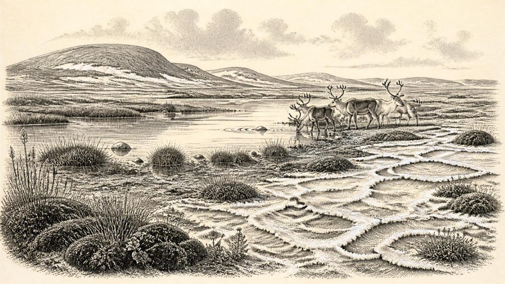
The biological remains in the Derryvree beds point to a cold, open, periglacial environment. They include plant and insect evidence associated with tundra conditions, while the overall picture is of treeless or almost treeless ground rather than forest. Mosses, sedges, grasses and low herbaceous vegetation could exploit wet soils around pools, streams and shallow basins. In summer, such places would have offered concentrated food and water; in winter, frost action, frozen ground and snow cover would have governed movement and survival. This was not an empty white wilderness, but neither was it a wooded countryside or a productive agricultural plain.
The deposit is local evidence. It cannot tell us the precise temperature in every Irish valley or prove that the whole island was simultaneously ice-free. Yet it decisively complicates the older, simpler image of Ireland as continuously buried beneath ice throughout the later Ice Age. At least in north-central Ireland, there was an interval in which freshwater habitats developed between glacial advances. Nearby organic deposits at Greenagho in Fermanagh reinforce the broader conclusion that cold, open environments survived in parts of the region before renewed ice expansion.
An Animal Landscape
Caves and fissures in southern Ireland preserve a complementary, though more difficult, record. Castlepook Cave near Doneraile in north Cork yielded an exceptionally important assemblage of Pleistocene animal bones. Dating programmes have identified remains from a succession of periods, including reindeer, giant deer, brown bear, wolf, Arctic fox, lemmings, spotted hyaena and woolly mammoth. Not all these animals need have lived together, and not every specimen belongs exactly to the Derryvree interval. The cave accumulated bones over many thousands of years, and water movement, animal activity and early excavation disturbed and mixed some deposits.
Nevertheless, the assemblage gives a persuasive impression of the kinds of faunal communities that repeatedly reached Ireland during MIS 3. Reindeer and lemmings speak to cold, open habitats; Arctic fox likewise belongs to a severe northern ecological setting. Mammoth and giant deer indicate that the available country could, in favourable phases, support very large grazing or browsing mammals. Wolves and spotted hyaenas were predators and scavengers within that food web. Brown bears could use caves as shelters or dens. Their presence should not be converted into a neat, simultaneous ‘menagerie’: the evidence establishes a long-lived and changing regional fauna, not a single perfectly dated scene.
These animals also reveal that Ireland was connected to broader ecological routes. Mammals could not have reached the landmass by magic, and their arrival depended on changing geography, sea level and climatic conditions across the Irish Sea region and the continental shelf. The evidence supports intermittent colonisation and movement, not a permanent biological isolation. Yet routes available to animals were not necessarily easy or continuous routes for people, especially as ice and water barriers shifted.
The Castlepook Question
Castlepook has particular historical importance because a reindeer femur from the old collection has been reported as bearing an incision interpreted as a cut made by a sharp stone tool during carcass processing. The bone has been presented as approximately 33,000 years old and thus as possible evidence of human activity in Ireland far earlier than the well-established post-glacial settlement record. If the interpretation is correct, it shows that at least one person or small group had access to a fresh reindeer carcass in Ireland during the Late Pleistocene.
But the claim must remain carefully framed. A cut-marked animal bone is not a house floor, hearth, stone-tool assemblage, grave or settlement. It does not identify the people involved, their language, origin, numbers, sex, season of arrival or length of stay. It does not prove a resident population, still less a continuous Irish occupation. The historic excavation of Castlepook occurred before modern stratigraphic methods, and the cave deposits were subject to reworking. The date tells us about the death of the animal represented by the bone, not automatically the exact moment, place or circumstances in which a mark was made.
The most cautious conclusion is also the most significant: the Castlepook specimen makes a Late Pleistocene human visit or episode of carcass processing plausible, perhaps even likely, but it cannot bear the weight of a detailed social history. No named hunter, clan or culture can responsibly be placed in Ireland in 31,786 BCE. There is no evidence for a political order, territorial chiefdom, diplomacy, warfare, formal religion, art tradition or system of learning on the island at this date.
Livelihood Without Settlement
If people did enter Ireland during this broad span, their economy would have depended on mobile foraging rather than farming. Reindeer were potentially valuable for meat, marrow, hide, sinew and bone, while other game could have supplied food and raw materials. Such statements are informed inferences from the animal record and from Upper Palaeolithic lifeways elsewhere in Europe, not direct proof of a particular Irish camp. No securely excavated dwelling, hearth or toolkit of this age has yet been recovered in Ireland.
That absence is meaningful but not final. Small, short-lived camps leave slight traces even in favourable conditions. In Ireland, later glacial advances eroded landscapes, buried surfaces beneath till, rearranged sediments and destroyed much evidence that might once have survived. Caves are selective archives rather than ordinary living spaces: they may preserve the remains of animals that fell in, were dragged in by predators, died while sheltering, or were washed in by water. A lack of identified settlements therefore does not prove that no person ever entered the landmass; it does mean that durable occupation remains unproven.
There can be no responsible account of trade in the usual sense. The evidence does not show exchange networks, imported objects or regular sea crossings to Ireland at this date. Nor does it support claims about kinship customs, rituals or spoken languages. The most that can be said is that any human presence would have operated within wider north-west European landscapes in which groups moved, hunted and exchanged knowledge over distances. Whether those wider connections extended to a brief Irish visit remains an archaeological question, not an established narrative.
Ice on the Horizon
The Derryvree world was also a world under pressure from climatic change. MIS 3 was marked by abrupt millennial-scale swings between colder stadials and relatively milder interstadials, strongly expressed in Greenland ice cores and North Atlantic records. Ireland stood exposed to those Atlantic shifts. A cold but habitable tundra basin could, over centuries and millennia, give way to worsening conditions, snow accumulation and glacier growth.
Recent reconstructions of the British–Irish Ice Sheet show that major ice expansion was already under way in the wider region around 32,000–31,000 years ago. By about 30,000 years ago, ice had expanded rapidly across parts of the continental shelf, although growth and maximum extent varied greatly by region. Ireland’s full last-glacial ice cover belongs chiefly to later phases, with maximum coverage broadly dated to about 27,000–23,000 calibrated years before present. The future of the Derryvree landscape was therefore burial beneath renewed ice, not gradual development into later prehistoric Ireland.
That later ice is one reason this remote episode is so difficult to recover. It sculpted drumlins, excavated basins and dispersed earlier deposits, while also sealing a few precious environmental archives. Derryvree’s roadcut and Castlepook’s cave bones are not fragments of a lost Irish kingdom. They are more fundamental: traces of a changing Ice-Age land where tundra wetlands, large mammals, predators and perhaps fleeting human visitors existed before the expanding ice sheet transformed the country again.
Primary Sources
- A Middle Midlandian Freshwater Series at Derryvree, Maguiresbridge, County Fermanagh, Northern Ireland
- The Irish Quaternary Fauna Project
- Growth and Retreat of the Last British–Irish Ice Sheet, 31,000 to 15,000 Years Ago: The BRITICE-CHRONO Reconstruction
- The IntCal20 Northern Hemisphere Radiocarbon Age Calibration Curve (0–55 cal kBP)
- Episodic Speleothem Deposition Tracks the Terrestrial Impact of Millennial-Scale Last Glacial Climate Variability in SW Ireland
- Ireland: Submerged Prehistoric Sites and Landscapes
- The Timing and Magnitude of the British–Irish Ice Sheet Between Marine Isotope Stages 5d and 2
- Early Deglaciation of the British-Irish Ice Sheet on the Atlantic Shelf Northwest of Ireland Driven by Glacioisostatic Depression and High Relative Sea Level
- A Late Pleistocene Channelized Subglacial Meltwater System on the Atlantic Continental Shelf South of Ireland
- Stratigraphic and Palaeo-Geomorphological Evidence for the Glacial-Deglacial History of the Last British-Irish Ice Sheet in the North-Western Irish Sea
- Radiocarbon Constraints on the Age of the Maximum Advance of the British-Irish Ice Sheet in the Celtic Sea
- Pattern and Timing of Retreat of the Last British-Irish Ice Sheet
- New Data for the Last Glacial Maximum in Great Britain and Ireland
- Dansgaard–Oeschger Events in Climate Models: Review and Baseline Marine Isotope Stage 3 Protocol
- Fast and Slow Components of Interstadial Warming in the North Atlantic During the Last Glacial
- The Subdivision of the Quaternary Period in Ireland
- Prehistoric Details: Mell Flint Flake
- Heritage Artefacts of County Cork
- Archaeological Heritage of County Cork
- Radiocarbon Date List IV
- Pleistocene Vertebrates in the British Isles
- New Insights on the Fauna of Ireland’s Younger Dryas
