Mammoth Cave’s Uncertain Butchery31785 BCE
Approximately 31,785 BCE lies within Marine Isotope Stage 3, when Ireland experienced fluctuating cold conditions rather than uniform ice cover. Buried deposits at Derryvree and Greenagho in Fermanagh indicate freshwater tundra environments, while Crag Cave stalagmites record warmer, wetter phases. Castlepook Cave, County Cork, contains Ice-Age fauna and a reindeer femur dated around 33,000 years ago, bearing a possible stone-tool butchery mark. If confirmed, this may represent Ireland’s earliest human activity, but not permanent settlement. Poor excavation contexts, uncertain bone accumulation and absent associated artefacts require caution. Later glaciation transformed landscapes, leaving fragmentary evidence of mobile people, animals and habitats.
Dateline
Modern calendar precision cannot responsibly be applied to Ireland in 31,785 BCE. The label is a convenient point on a much larger prehistoric timescale, roughly 33,700 calendar years before AD 1950, but neither human activity nor environmental change can be fixed to that individual year. The most useful framework is the later part of the Late Pleistocene, within Marine Isotope Stage 3 (MIS 3), an unstable interval of the last Ice Age. For Ireland, evidence is sparse, unevenly dated and often recovered by antiquarian excavators long before modern recording standards. It can illuminate a broad world of cold landscapes, caves and large animals; it cannot furnish an annual chronicle.
Dating an Ice-Age Moment
The distinction between radiocarbon years and calibrated calendar years matters especially at this depth of time. A radiocarbon result measures the remaining carbon-14 in organic material, but atmospheric carbon-14 levels have varied greatly. Researchers therefore calibrate results against internationally maintained curves such as IntCal20. At around 34,000 calendar years ago, calibration intervals can be broad, and revised laboratory pretreatment can substantially alter older results. A date written as 31,785 BCE should consequently be read as an approximate modern conversion, not as a date known to contemporaries or an exact timestamp for an archaeological layer.
In Irish terminology, this was during the Midlandian glaciation, though not at the Last Glacial Maximum. The latter, broadly between about 27,000 and 23,000 calibrated years before present, eventually covered Ireland and much of its surrounding shelf with the British–Irish Ice Sheet. Around the notional year considered here, conditions were colder than today but were not simply uniform, permanent ice. MIS 3 contained abrupt shifts between relatively milder interstadials and severe cold phases. The question is therefore not whether Ireland was ‘in the Ice Age’—it plainly was—but which districts retained exposed, ecologically active ground at particular times.
Water, Tundra and Ice-Free Ground
The clearest Irish evidence for such variation comes from buried deposits rather than settlements. At Derryvree near Maguiresbridge, County Fermanagh, roadworks exposed organic-rich silts and sands trapped between glacial tills inside a drumlin. Pollen, plant remains and beetles indicated freshwater and wet-ground environments during an interval later sealed beneath renewed ice. Calibrated ages reported for the deposit span roughly 36,900 to 31,700 years before present. That range includes the broad chronological neighbourhood of 31,785 BCE, but it does not prove that the same wetland survived unchanged throughout it.
Derryvree’s vegetation was not a lost Irish forest. The plant evidence points instead to open, treeless, cold-climate ground, with sedges, mosses, herbaceous plants and shrubs such as juniper in suitable places. Such habitats could include shallow pools, wet hollows and patches of richer grazing amid exposed mineral ground. Another buried organic deposit at Greenagho, also in Fermanagh, indicates a freshwater setting during an earlier MIS 3 amelioration. Together these sites demonstrate that parts of Ireland could support plants and animals between episodes of glaciation. They do not provide a national map of vegetation, temperature or ice margins for a single year.
Crag Cave in County Kerry supplies a different kind of climate evidence. Stalagmites grow only when water can percolate through soil and limestone and deposit calcite in a cave. Uranium-thorium dating of broken and reworked calcite shows episodic speleothem growth during MIS 3, corresponding broadly with warmer and wetter North Atlantic interstadials. This is powerful evidence for climatic fluctuation, but it must not be exaggerated: a growth phase in a Kerry cave is a local response to hydrology and climate, not proof that every Irish region was hospitable at the same moment.
Castlepook and the Human Question
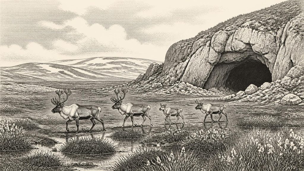
The most consequential evidence directly relevant to people is a fragment of reindeer femur from Castlepook Cave, near Doneraile in north Cork. Castlepook, long also called Mammoth Cave, was excavated between 1904 and 1913. Its old collections contain remains of an impressive Ice-Age fauna. Recent reassessment and improved radiocarbon methods have shown that some bones from the cave are substantially older than earlier dates suggested. A reindeer bone has been reported as dating to about 33,000 years ago and bears a deep linear mark interpreted by zooarchaeologist Ruth Carden as a cut or chopping mark made on fresh bone with a stone tool.
If that interpretation is sustained, it is potentially Ireland’s earliest evidence of human action: not a town, tribe or permanent population, but the processing of a reindeer carcass during MIS 3. It would place a human visit far earlier than the better-known terminal Pleistocene evidence from Alice and Gwendoline Cave in County Clare, where a butchered brown-bear kneecap dates to roughly 10,800–10,500 BCE. The Castlepook reindeer find is therefore important precisely because its implications are large.
Yet the responsible conclusion remains cautious. A marked bone is not automatically a campsite. Cave assemblages may be accumulated, moved and damaged by carnivores, water, collapse, excavation and later handling. Castlepook was worked extensively before modern stratigraphic methods, reducing confidence about the bone’s original context. Nor has a securely associated stone-tool assemblage, hearth, shelter floor, human burial or repeated occupation surface been identified for this early phase. The incision is evidence under specialist assessment; the proposition that people butchered the animal is an interpretation of that evidence. Ongoing investigation at Castlepook has sought intact deposits in parts of the cave not emptied by earlier excavators.
An Animal Landscape
Whatever the outcome of the human debate, Castlepook and other southern Irish caves establish that Ireland supported a varied mammal community during MIS 3. Re-dated faunal material indicates the presence, at different points in this broad interval, of reindeer, woolly mammoth, giant deer, brown bear, horse, wolf, mountain hare, Arctic fox, lemmings and spotted hyaena. The fauna should not be treated as a single herd encountered on one day. Cave deposits commonly combine remains accumulated over long periods, and direct dates show that species arrived, disappeared and returned on different schedules.
Spotted hyaena are particularly significant at Castlepook. Their bones, teeth and evidence of feeding help explain why caves can be bone-rich without being human homes. Hyaenas could drag carcass parts underground, chew and break bone, and leave dens that later researchers must distinguish from human activity. Mammoth and giant deer make the landscape sound spectacular, but their presence is best understood as palaeontological evidence for available habitats and routes, not as proof of large resident animal populations across every part of the island.
The likely setting was an open mosaic of herb-rich tundra, wet ground and exposed limestone rather than the familiar green, wooded Ireland of later millennia. Reindeer were suited to cold, seasonal environments and could have moved across broad ranges. Mammoths, horses and giant deer likewise required accessible forage, while predators followed prey. Their remains indicate that Ireland was not biologically empty before the maximum glaciation. They also suggest why a brief human incursion, if the Castlepook mark is anthropogenic, is plausible: mobile hunter-gatherers elsewhere in north-west Europe understood such animal landscapes and possessed stone technologies capable of carcass processing.
Mobility Without a Proven Community
That plausibility is not evidence for an Irish society in the later historical sense. There are no names, languages, territories, leaders, laws or political institutions. There is no basis for describing wars, alliances, diplomacy or an island-wide population. Nor is there direct Irish evidence from this time for ritual sites, graves, cave art, ornaments, teaching traditions or symbolic objects. Absence of evidence is partly a consequence of later glacial erosion, rising seas and the limited survival of excavated cave deposits; it is not proof that visiting people lacked culture. But historical writing must distinguish that reasonable possibility from what Irish finds actually demonstrate.
Similarly, economy and trade cannot be reconstructed as facts. Should the Castlepook mark prove human-made, it would demonstrate the use of animal resources—perhaps meat, hide, sinew or marrow—from at least one reindeer. It would not demonstrate regular hunting camps, exchange networks or a sustained seasonal round in Ireland. Any people reaching the island would probably have belonged to small, mobile hunter-gatherer groups, an inference based on contemporaneous European Upper Palaeolithic lifeways rather than a recovered Irish household. Nor can their route be confidently specified. Lower sea levels exposed extensive shelf landscapes, but the changing Irish Sea, ice limits and possible crossings require reconstruction, not assumption of a simple land bridge.
What This Date Can Mean
For 31,785 BCE, the most defensible picture is thus one of possibility bounded by evidence. Parts of Ireland had experienced ice-free interstadial landscapes within the wider MIS 3 climate cycle. Freshwater basins in Fermanagh preserved traces of tundra vegetation; caves in Cork and Waterford retained bones of animals adapted to an open, cold and changing world. At Castlepook, a dated reindeer femur may preserve the earliest sign that people briefly entered that world and processed an animal there.
It would be wrong to turn this into the first year of continuous Irish settlement. Within several millennia, advancing ice would radically transform and in many areas scour the landscape, leaving a discontinuous archaeological record. The importance of Castlepook is not that it supplies an invented origin story, but that it opens a carefully testable question: humans may have reached Ireland far earlier than once believed. At this point in prehistory, the cave, the marked bone and the sediments deserve more confidence than any tale built beyond them.
Primary Sources
- A reconsideration of the radiocarbon dating of the Marine Isotope Stage 3 fauna from southern Ireland
- The Irish quaternary fauna project
- Archaeology Research Excavation Grant 2022: Castlepook Cave Final Report
- Castlepook Cave, County Cork, Excavations 2022
- Heritage Artefacts of County Cork
- Archaeological Heritage of County Cork
- Palaeoecology: Irish Quaternary Association Field Guide
- Figure 6: The Subdivision of the Quaternary Period in Ireland
- Episodic speleothem deposition tracks the terrestrial impact of millennial-scale last glacial climate variability in SW Ireland
- Maximum extent and dynamic behaviour of the last British–Irish Ice Sheet west of Ireland
- Growth and retreat of the last British–Irish Ice Sheet, 31,000 to 15,000 years ago: the BRITICE-CHRONO reconstruction
- Pattern and timing of retreat of the last British-Irish Ice Sheet
- Ireland: Submerged Prehistoric Sites and Landscapes
- The Problem of a Late Quaternary Landbridge Between Britain and Ireland
- The Island of Ireland: Drowning the Myth of an Irish Land-Bridge?
- The IntCal20 Northern Hemisphere Radiocarbon Age Calibration Curve (0–55 cal kBP)
- The IntCal20 Approach to Radiocarbon Calibration Curve Construction: A New Methodology Using Bayesian Splines and Errors-in-Variables
- IntCal Publications
- The Mesolithic in Ireland: When Was It?
- New Insights on the Fauna of Ireland's Younger Dryas and Early Holocene from Alice & Gwendoline Cave
- Irish Cave Exploration
