
Castlepook’s Hyaena Bonebed30185 BCE
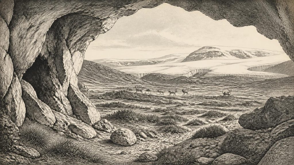
Thirty-thousand years BCE is a modern label, not a recoverable Irish historical year; evidence supports only broad Late Glacial reconstructions. Around 32,000 calibrated years BP, Ireland experienced unstable, severe cooling as the British–Irish Ice Sheet expanded, reshaping coasts, drainage and habitats. Ice-free areas, if present, held sparse tundra and steppe-tundra vegetation supporting varied fauna, documented in cave deposits including Castlepook, Cork. These assemblages include reindeer, hyaena and mammoth but may mix different periods. A possibly cut-marked Castlepook reindeer bone suggests unconfirmed early human visitation, not settlement. Secure Irish human evidence is far later. Caves and landforms preserve vital environmental evidence.
Dateline
30,185 BCE is not a date that can be recovered from Ireland’s prehistoric record in the ordinary historical sense. No community recorded it, and no excavated Irish layer can presently be assigned to that single calendar year. It is a modern chronological label, corresponding very approximately to 32,100 years before AD 1950, the conventional “present” of radiocarbon dating. At this depth of time, the responsible unit is not a year but a broad calibrated range. The relevant setting is the later part of the Last Glacial Period, conventionally Marine Isotope Stage 3, when climate around the North Atlantic was cold, unstable and capable of changing sharply over centuries or millennia.
What can be said is necessarily more modest, but still important. Ireland lay on the north-western fringe of Europe as the British–Irish Ice Sheet was growing. The island’s physical geography, animal habitats and possible routes of movement were being transformed. The evidence comes chiefly from glacial landforms, sediments, caves, fossil bones, pollen and plant remains, radiocarbon and cosmogenic dating, and regional ice-sheet reconstructions. These sources illuminate landscapes and processes. They do not reveal an Irish polity, a named people, a settlement, a battle or a religious ceremony.
A Year That Cannot Be Isolated
The numerical year should therefore not be mistaken for a historical anniversary. Even the strongest scientific dates from this era are probability ranges, and the calibration of radiocarbon determinations beyond 30,000 years ago remains sensitive to the changing amount of carbon-14 in the ancient atmosphere. IntCal20, the modern Northern Hemisphere calibration curve, extends far enough to handle such material, but it does not turn an isolated bone, seed or sediment horizon into a precise calendar-day record. In Ireland, deposits have additionally been eroded, reworked or buried beneath later ice, making exact correlation particularly difficult.
For this reason, “Ireland in 30,185 BCE” is best understood as Ireland around c. 32,000 calibrated years BP, within an interval perhaps spanning several centuries or more on either side. Scientific reconstructions of the British–Irish Ice Sheet include time slices at 31,000 and 30,000 years BP, rather than at this particular modern BCE year. They suggest rapidly expanding ice across northern and central parts of Ireland, while southern and south-western uplands may have supported separate ice masses. Those reconstructions are powerful syntheses of mapped landforms and dates, but some of their detail is inferential: researchers must connect scattered field evidence and model the likely advance between dated points.
An Island Entering Ice-Sheet Growth
This was not yet the simple image of an island uniformly entombed beneath ice. The fullest Last Glacial Maximum is usually placed later, broadly between about 26,000 and 19,000 years ago, though the timing and extent of Irish ice differed from region to region. Around 32,000 years ago, cooling had already placed severe constraints on the landscape. In the north, ice was advancing from centres associated with Ireland and western Scotland; in the south-west, evidence from mountain corries points to substantial local or regional glaciation. By around 30,000 years ago, the wider British–Irish Ice Sheet had become an increasingly marine-influenced system, feeding ice streams through surrounding seas.
That distinction matters. Ice sheets are dynamic, not static white blankets. They thicken, thin, flow, merge and retreat; their margins may be separated by cold water, glacier-fed plains, moraine belts or terrain briefly free of ice. A reconstruction of advancing ice over one district is not proof that every valley or cave in Ireland shared identical conditions at the same moment. Nor does an apparent ice-free patch automatically mean a hospitable refuge. Exposed ground near an ice margin could be wind-scoured, seasonally frozen and ecologically thin, with short growing seasons and few dependable resources.
Sea level was lower than today because water was stored in continental ice, so the outlines of Ireland and its neighbouring seas were very different. Yet lower sea level should not be converted into an easy “land bridge” story. Routes towards Britain and continental Europe were governed by changing coastlines, sea basins, rivers, ice fronts and the practical difficulty of crossing a cold, exposed landscape. For animals and any people who might have ventured into the region, access was a geographical possibility to be investigated, not an established highway.
Cold Landscapes and Fragmentary Life
The ecological evidence points towards open, cold-stage environments rather than the dense Atlantic woodland familiar from later prehistory. In suitable ice-free or lightly glaciated places, vegetation would have consisted of tundra and steppe-tundra communities: grasses, sedges, mosses, low herbs and dwarf shrubs, varying with drainage, exposure and proximity to ice. Such terrain could sustain grazing animals in particular seasons, but it was not a uniform grassland. Wet hollows, frozen ground, sparse cover and rapidly changing weather created a mosaic of habitats.
Irish cave deposits demonstrate that Late Pleistocene fauna was more varied than the modern island’s mammal population. Assemblages from caves, including Castlepook Cave near Doneraile in north Cork, have produced evidence for animals associated with Ice Age environments, among them reindeer, brown bear, mountain hare, fox, lemming, spotted hyaena and woolly mammoth. Their significance is considerable: they show that Irish landscapes or their margins could be visited by, or support, animals now absent from the island. But cave assemblages are accumulated records. Carnivores, natural deaths, water movement, collapse, excavation practices and later disturbance can mix material of different ages. A list of species is not a census from one season in 30,185 BCE.
Reindeer are especially evocative because they could have moved across broad cold-country ranges and because a reindeer femur from Castlepook has been reported as bearing a deep linear mark interpreted by zooarchaeologist Ruth Carden as possible stone-tool damage. The bone has been publicly associated with an age of roughly 33,000 years ago. If future microscopic analysis, secure dating and stratigraphic work confirm both the date and a human origin for the mark, it could indicate that someone processed a carcass in Ireland during an earlier phase of the Upper Palaeolithic. It would not, by itself, demonstrate a resident population, a camp, or activity in this exact year. At present it is best treated as important but unresolved evidence.
No Recoverable Society or Politics
There is no securely dated house, hearth, stone-tool assemblage, human burial or settlement surface in Ireland that permits a reconstruction of everyday human life around this point. Consequently, it would be fiction to describe chiefs, families, territorial boundaries, alliances, warfare, trade networks, ritual specialists or formal diplomacy. There is equally no evidence for agriculture, herding, pottery, metalworking, monuments or long-distance exchange centred in Ireland. These belong to much later chapters of Irish prehistory.
The absence of evidence should be stated carefully. It is not proof that no human ever entered the island during this broad period: glacial erosion, rising sea levels and the small scale of archaeological investigation all affect survival and discovery. But it does mean that permanent occupation cannot responsibly be claimed. The earliest published evidence generally accepted as indicating human activity in Ireland is much later: cut marks on a brown-bear patella from Alice and Gwendoline Cave, County Clare, radiocarbon dated to roughly 12,810–12,590 calibrated years BP. That find belongs to the terminal Pleistocene, after the major ice-sheet phase, and cannot be projected backwards twenty millennia.
Caves as Archives, Not Villages
Caves are central to the story because they preserve bones and sediments where open-air sites have often been stripped away. Yet they must not be mistaken for proof of habitation. A hyaena den, a bear shelter, a natural trap, a place where water redistributed bone, and a human stopping-place can all create deposits in a cave. Their signatures differ, but only careful excavation, recording, dating and taphonomic study can separate them. Castlepook’s importance lies partly in this challenge: it offers a rare archive of Pleistocene fauna in Ireland, while its complex history requires patient testing rather than dramatic certainty.
Learning in this period was not human scholarship but the environmental record preserved in landforms and deposits. Striations on bedrock, streamlined hills, tills, moraines and erratic boulders record the direction and force of former ice. Fossil insects, seeds and pollen can indicate local temperature, moisture and vegetation. Stable isotopes, ancient DNA and microscopic analysis of bone surfaces may refine knowledge further. Such techniques make the Ice Age legible, but their conclusions remain provisional where samples are few or stratigraphy has been disturbed.
The Long-Term Irish Significance
The principal development around this notional year was environmental rather than political: Ireland was moving into the severe glacial conditions that would reshape its terrain and greatly narrow the opportunities for plants, animals and people. The ice’s passage excavated basins, redirected drainage, moulded rock, laid down sediments and helped create the physical framework later occupied by post-glacial ecosystems and human societies. The familiar drumlin fields, eskers, glacial valleys and many lake basins of Ireland belong to this much longer Quaternary legacy, even where they were formed or modified at different moments.
For an Ireland year-by-year account, the honest conclusion is therefore one of scale. Around 30,185 BCE there is no Irish history of rulers or communities that can be narrated; there is a changing Ice Age world that made later Irish history possible. The strongest evidence concerns ice advance, cold-adapted landscapes and animal presence. The possibility of very early human visitation, represented most tantalisingly by the Castlepook reindeer femur, remains a research question rather than an established event. The landscape is real; the exact year is modern; and uncertainty is not a gap to fill with invention, but part of the history itself.
Primary Sources
- Growth and Retreat of the Last British–Irish Ice Sheet, 31,000 to 15,000 Years Ago: the BRITICE-CHRONO Reconstruction
- Growth and Retreat of the Last British–Irish Ice Sheet, 31,000 to 15,000 Years Ago: the BRITICE-CHRONO Reconstruction (NERC full text)
- Pattern and Timing of Retreat of the Last British-Irish Ice Sheet
- Last Glacial Maximum Cirque Glaciation in Ireland and Implications for Reconstructions of the Irish Ice Sheet
- Late Pleistocene Chronostratigraphy and Ice Sheet Limits, Southern Ireland
- The Deglaciation of the Western Sector of the Irish Ice Sheet from the Inner Continental Shelf to its Terrestrial Margin
- The Timing and Magnitude of the British–Irish Ice Sheet Between Marine Isotope Stages 5d and 2
- Dynamic Cycles, Ice Streams and Their Impact on the Extent, Chronology and Deglaciation of the British-Irish Ice Sheet
- Response of the Irish Ice Sheet to Abrupt Climate Change During the Last Deglaciation
- Quaternary
- Geology of Ireland
- Ireland Through Geological Time
- The IntCal20 Northern Hemisphere Radiocarbon Age Calibration Curve (0–55 cal kBP)
- The IntCal20 Northern Hemisphere Radiocarbon Age Calibration Curve (0–55 cal kBP) (University of Glasgow repository)
- A Stratigraphic Framework for Abrupt Climatic Changes During the Last Glacial Period Based on Three Synchronized Greenland Ice-Core Records
- First Evidence of a Late Upper Palaeolithic Human Presence in Ireland
- First Evidence of a Late Upper Palaeolithic Human Presence in Ireland (author-hosted PDF)
- New Insights on the Fauna of Ireland's Younger Dryas and Early Holocene from Alice & Gwendoline Cave
- The Colonization of Ireland: A Human Ecology Perspective
- Could Brown Bears (Ursus arctos) Have Survived in Ireland During the Last Glacial Maximum?
- The Mesolithic in Ireland: When Was It?
- Anthropogenic Changes to the Holocene Nitrogen Cycle in Ireland
- Stoats (Mustela erminea) Provide Evidence of Natural Overland Colonization of Ireland
- Ireland: Submerged Prehistoric Sites and Lands
- Ireland Under the Ice
- A Critical Review and Re-investigation of the Pleistocene Deposits
