Derryvree’s Juniper Macrofossils30169 BCE
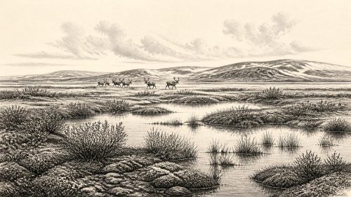
Around 30,169 BCE, Ireland’s history is reconstructed from environmental evidence rather than events. Derryvree, County Fermanagh, preserves organic sediments between glacial tills, dated approximately 30,500 radiocarbon years BP, indicating an ice-free freshwater tundra landscape with grasses, sedges, mosses, juniper and low shrubs. Climate and ice extent fluctuated during MIS 3, producing strong regional variation before the Last Glacial Maximum. Castlepook Cave, County Cork, yielded mammoth, reindeer, giant deer, hyaena and other fauna, demonstrating connections with north-west Europe. A possible tool mark suggests transient human activity, but sustained occupation remains unproven. These records reveal ecological richness, not a precise annual history.
Dateline
30,169 BCE is not a year for which Ireland can be given an event-by-event history. It is a modern calendar label, roughly 32,100 years before the conventional radiocarbon present of AD 1950, imposed on a period far beyond written records, named communities or annual archaeological resolution. No ruler, settlement, conflict, voyage or ceremony can responsibly be assigned to this particular year. The appropriate subject is Ireland in the later part of the Last Ice Age, during Marine Isotope Stage 3 (MIS 3), and the fragmentary natural evidence that illuminates conditions over broad spans of centuries or millennia.
The strongest Irish evidence relevant to this horizon comes not from a human camp but from sediments, fossils and ice-laid deposits. Their message is important precisely because it is restrained. Parts of Ireland were capable of supporting tundra vegetation and large mammals before the fullest expansion of the last Irish Ice Sheet; however, the island’s environments varied sharply by region and changed repeatedly. The evidence does not establish a permanently inhabited country, nor does it authorise a story of an Irish people in 30,169 BCE.
A Date Without Calendar Precision
Archaeologists and Quaternary scientists date this era through radiocarbon, stratigraphy, pollen, plant macrofossils, animal remains and the relationship of deposits to glacial tills. Each method has limits. Radiocarbon ages are conventionally reported in years BP, meaning before AD 1950, and are not identical to calendar years. They must be calibrated against curves that model past fluctuations in atmospheric carbon-14. At around 30,000 radiocarbon years BP, the calibrated result is a broad range rather than a pinpoint; the range may shift as calibration datasets and statistical choices improve.
Consequently, the nominal date 30,169 BCE cannot be matched to an excavated Irish layer with annual precision. It is best treated as a place on a long timeline, close enough to ask what late MIS 3 Ireland may have been like, but not close enough to claim that a particular deposit was laid down in that calendar year. The distinction matters. A radiocarbon determination dates the death of sampled organic material, within an uncertainty interval; it does not date an entire landscape, still less a historical occurrence.
The Derryvree Freshwater Record
The clearest local archive is at Derryvree near Maguiresbridge in County Fermanagh. Roadworks in 1969 exposed organic silts and fine sands caught between two substantial till sheets within a drumlin. The lower and upper tills record separate episodes in which glacier ice advanced across the area. Between them lay evidence of a different condition: a freshwater and wet-ground environment existing while this part of Fermanagh was not overridden by ice.
The organic material yielded the conventional radiocarbon age Birm-166: 30,500 years BP, with a reported uncertainty of +1,170 and −1,030 years. Calibrated with modern curves, such a measurement belongs to a multi-millennial late-MIS-3 range, not a single date; it is therefore relevant context for 30,169 BCE rather than proof of the exact conditions on that nominal year. Stratigraphy is equally significant. The deposit shows that ice-free conditions occurred locally between glacial advances, but it cannot demonstrate that all Ireland was simultaneously ice-free, nor identify the precise limits of ice elsewhere.
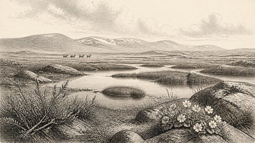
Within those limits, Derryvree gives an unusually vivid picture. Pollen, seeds, leaves, mosses and insect remains indicate open, treeless vegetation around freshwater. Grasses and sedges were prominent. Plant evidence included species suited to cold, exposed or wet conditions, such as dwarf willow, mountain avens, lesser clubmoss, juniper and water-loving plants including bogbean and alternate water-milfoil. The investigators described a full-glacial flora and fauna and interpreted the setting as tundra or muskeg-like: waterlogged hollows and pools amid sparse, frost-affected open ground.
This should not be imagined as an exact copy of a modern Arctic landscape. “Tundra” is a useful ecological comparison, not a claim that every species or process was identical to those of present-day northern Scandinavia or Greenland. Nor does the small quantity of tree pollen occasionally found in such deposits prove local woodland: pollen may travel long distances, and older material can be redeposited. The combined evidence nevertheless strongly supports an open landscape without a mature forest canopy.
Cold Ground, Moving Ice
Derryvree belonged to the Midlandian cold stage, the Irish expression of the last glacial cycle. During MIS 3, climate did not remain steadily cold or steadily mild. North Atlantic conditions fluctuated, affecting temperature, precipitation, vegetation and the growth or retreat of ice. Ireland’s later landscape bears the forceful marks of glaciers—drumlins, streamlined bedforms, moraines and thick till—but those landforms mostly reflect subsequent phases and cannot simply be projected backwards onto every moment of the cold stage.
By the Last Glacial Maximum, broadly between about 26,000 and 19,000 years ago, ice covered much of Ireland and extended offshore in several sectors. Around the nominal date considered here, that maximum still lay ahead. Reconstructions suggest that ice-sheet growth was spatially uneven and that Irish, Scottish and marine ice sectors could interact in changing ways. It follows that Ireland was neither a single uniform ice cap nor a uniformly habitable plain. Fermanagh’s buried wetland proves a local environmental window; it does not supply a national weather report.
Frost action would have been a formative everyday force in exposed areas. Seasonal freezing and thawing disturbed soils, fractured rock, shifted sediment and limited plant cover. Wet hollows, shallow lakes and meltwater channels offered particular habitats, while better-drained ground supported herbs, grasses and low shrubs. The resulting mosaic was productive enough for specialised plants and animals but vulnerable to climatic deterioration and renewed glaciation. In this sense, environmental instability—not a fixed frozen wilderness—was the defining fact of the period.
Castlepook and the Ice-Age Fauna
County Cork provides the major southern counterpart to the Fermanagh record. Castlepook Cave, near Doneraile, has produced a remarkable Late Pleistocene animal assemblage. Antiquarian excavations recovered bones of woolly mammoth, reindeer, brown bear, giant deer, hare, fox, Arctic lemming and spotted hyaena, among other animals. Direct radiocarbon dates from the cave include a mammoth at about 33,500 radiocarbon years BP and a spotted hyaena at about 34,300 radiocarbon years BP. Once calibrated, these dates likewise fall across broad late-MIS-3 ranges rather than an exact calendar year.
The animals show that Ireland was connected ecologically to the wider north-west European world at intervals before the Last Glacial Maximum. Reindeer and mammoth imply open grazing country; Arctic lemming is consistent with severe cold; hyaena and bear reveal a more complex predator and scavenger community than later Ireland possessed. Recent sedimentary ancient-DNA work at Castlepook has added further evidence of faunal connections with Eurasian populations. Yet a cave assemblage is not a simple census of animals grazing outside its entrance on one day. Carnivores may carry bones into dens, animals may die in or near cavities, water can move material, and old excavations often leave imperfect contextual records.
The cave is particularly useful for understanding what Ireland was not. It was not the familiar wooded island of later prehistory; it contained habitats in which cold-adapted grazers and formidable carnivores could occur. It also reminds us that survival depended on mobility across a wider landscape. Herds, predators and scavengers would have followed seasonal resources, open corridors and sheltered ground. There is no evidence, however, for stock-keeping, farming, managed herds, fields, trade routes or settled villages.
The Human Question
A reindeer femur from Castlepook has been interpreted as bearing a mark made by a sharp stone tool, raising the possibility that people butchered an animal in Ireland during the earlier Upper Palaeolithic. The proposal is important and deserves continued testing. If the modification is genuinely human, it would show an episode of human handling, perhaps by a short-lived hunting party, far earlier than the securely dated terminal-Pleistocene evidence from County Clare. It would not establish a resident population, a camp, a route of arrival or a continuous human presence.
Caution is essential because Castlepook’s deposits are complex and much material was recovered long before modern excavation standards. Ireland has not yet produced a securely stratified late-MIS-3 hearth, dwelling floor, diagnostic lithic assemblage or human remains associated with the relevant fauna. The responsible conclusion for around 30,169 BCE is therefore that human presence remains possible, even intriguing, but unproven as a sustained occupation. The earliest firmly documented human activity belongs much later: a butchered brown-bear bone from Alice and Gwendoline Cave, County Clare, has calibrated dates around 12,810–12,590 years BP.
No Polities, but a Real Landscape
There can be no meaningful account here of political affairs, diplomacy, law, religion, formal learning or cultural institutions. There are no names, monuments, burials, artworks or settlements from which such matters can be recovered. Nor can economy and trade be discussed as established systems. At most, the possible Castlepook cut mark permits a narrowly framed inference: people visiting or moving through the region may have sought animal resources such as meat, marrow, hide, sinew, antler and bone. Even that inference cannot be assigned to a particular group, season or method of hunting.
The history of Ireland at this point is consequently a history of evidence and restraint. Fermanagh’s organic silts preserve the trace of freshwater, sedges, mosses and low tundra vegetation beneath later ice. Cork’s caves preserve the remains of large mammals and carnivores from a changing cold-world ecosystem. Together they demonstrate that late Ice Age Ireland had episodes of ecological richness, regional variety and connection to Britain and continental Europe. They do not yield an Irish calendar year. Their value lies in showing the long environmental preconditions from which the much later human history of the island eventually emerged.
Primary Sources
- Middle Midlandian Freshwater Series at Derryvree, Maguiresbridge, County Fermanagh, Northern Ireland
- Middle Midlandian Freshwater Series at Derryvree, Maguiresbridge, County Fermanagh, Northern Ireland — Ulster University record
- The Subdivision of the Quaternary Period in Ireland
- Pleistocene Glaciations in Ireland
- Advances in Irish Quaternary Studies
- Reconstructing the Last Irish Ice Sheet 2: A Geomorphologically-Driven Model of Ice Sheet Growth, Retreat and Dynamics
- Marine Geophysical Evidence for Late Pleistocene Ice Sheet Extent and Recession off Northwest Ireland
- Dimensions and Chronology of the Last Ice Sheet in Western Ireland
- Late Pleistocene Chronostratigraphy and Ice Sheet Limits, Southern Ireland
- The IntCal20 Northern Hemisphere Radiocarbon Age Calibration Curve (0–55 cal kBP)
- Occurrence of Mammalia Relicts at Site Castlepook Cave
- The Irish Quaternary Fauna Project
- Sedimentary Ancient DNA Reveals Late Pleistocene Faunal Connectivity Between Ireland and Eurasia
- Archaeological Heritage of County Cork
- Heritage Artefacts of County Cork
- Quaternary Science Reviews: New Insights on the Fauna of Ireland’s Younger Dryas and Early Holocene from Alice & Gwendoline Cave
- First Evidence of a Late Upper Palaeolithic Human Presence in Ireland
- Palaeolithic Ireland — New Evidence Emerges from the Emerald Isle
- Quaternary — Geological Survey Ireland
- Geology of Ireland — Geological Survey Ireland