

Derryvree’s Periglacial Pool31813 BCE
Centred on roughly 33,763 calibrated years BP, the article describes Ireland during unstable Marine Isotope Stage 3, not a recoverable single year. Derryvree, County Fermanagh, preserves freshwater sediments between glacial tills, indicating locally ice-free, periglacial tundra with mosses, sedges and cold-adapted insects. Other deposits and cave calcite support fluctuating conditions before later extensive glaciation. Castlepook Cave, County Cork, records diverse cold-stage mammals, including reindeer, mammoth and hyaena, although its chronology is mixed. A modified reindeer bone may indicate human butchery, yet remains contested. Evidence supports changing habitats and animal access, not permanent human settlement or uniform island-wide conditions throughout then.
Dateline
“31,813 BCE” is a modern chronological label, not a year that can be recovered from Irish evidence at anything like calendar-year precision. Expressed in the archaeological convention of years before 1950, it falls at roughly 33,763 calibrated years BP. That places it within Marine Isotope Stage 3 (MIS 3), a long and highly unstable part of the last Ice Age. Radiocarbon measurements from this depth of time require calibration and normally yield ranges rather than a single date; environmental deposits may also represent years, centuries or longer periods of accumulation. The responsible subject, therefore, is not an invented episode in one year, but the kind of Ireland that the surviving evidence can illuminate around this broad interval.
An Ice-Age Interval, Not a National Past
There was no Ireland in the political or cultural sense familiar from later history. No state, kingdom, tribe, language, named people or boundary can be identified. Even the word “Ireland” is a geographical convenience for the landmass now occupied by the island. Nor was this an era from which historians can extract chronicles, monuments, houses or graves. It belongs to the Late Pleistocene, far before the securely documented settlement record of the island.
MIS 3 was not a single, uniform cold spell. Across the North Atlantic it was marked by abrupt alternations between colder stadials and relatively milder interstadials. These changes affected snowfall, ice margins, river flow, vegetation and animal movement. The later Last Glacial Maximum, when the British–Irish Ice Sheet expanded much more extensively, still lay ahead. Modern reconstructions increasingly show that Irish glaciation was dynamic and regionally variable, rather than a simple story in which the entire island was continuously buried beneath ice. Around the nominal date, some parts of Ireland may have offered exposed, cold environments, while other areas were shaped or constrained by nearby ice.
Freshwater Beneath a Drumlin
The most important direct environmental evidence comes from Derryvree, near Maguiresbridge in County Fermanagh. Roadworks in 1969 exposed a remarkable sequence in a drumlin: organic-rich freshwater silts and fine sands lay between two thick sheets of till, the debris deposited by glaciers. The intervening sediments demonstrate that a non-glacial freshwater environment existed there between separate ice advances. It is an unusually valuable survival because later ice sheets have removed or disturbed much of Ireland’s older Pleistocene record.
The original radiocarbon determination from Derryvree was 30,500 radiocarbon years BP, with a substantial uncertainty. In later discussion, its calibrated range has been placed broadly at about 36,900–31,700 calendar years BP. The nominal date of 31,813 BCE, roughly 33,763 cal BP, falls within that wide interval. This overlap is meaningful only in a limited sense: it allows Derryvree to illuminate the broad environmental world of the date. It does not show that a particular pool, animal or human activity existed there in that particular numbered year.
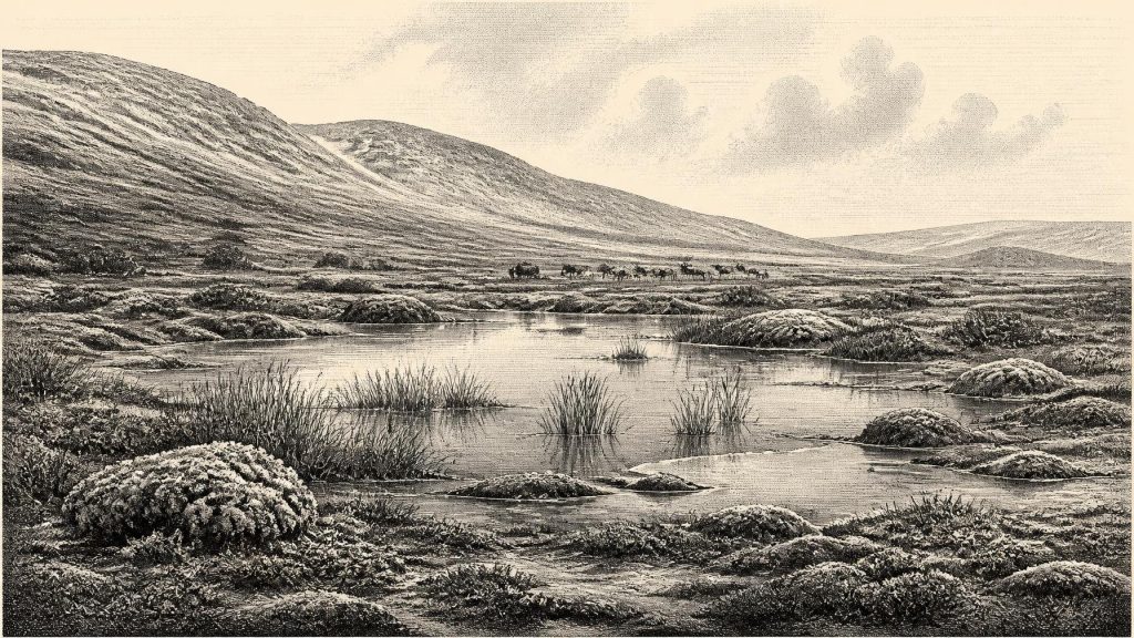
Plants and insects preserved in the Derryvree deposits point to open tundra vegetation and a periglacial climate. The evidence includes freshwater mosses and sedges, with insect fauna of cold, northern aspect. This was not the oak-and-hazel woodland, enclosed pasture or blanket bog landscape of later Ireland. It was a largely treeless terrain in which short growing seasons, frost and exposure placed strict limits on vegetation. Yet it was not necessarily a featureless expanse of snow. Wet hollows, shallow pools, stream margins and sheltered ground could sustain mosses, sedges, grasses, herbs and low shrubs. Such local mosaics mattered to insects and grazing animals, and they would also have mattered to any people who might have crossed the region.
Water, Stone and Ice
Derryvree is evidence for one locality in Fermanagh, not a complete map of the island. Nonetheless, it corrects the misleading image of an invariably ice-covered Ireland before the glacial maximum. Other northern Irish organic deposits, including those at Greenagho near Belcoo and Hollymount near Maguiresbridge, also indicate cold, open, non-forested conditions during portions of the Midlandian glaciation. In south-west Ireland, uranium-thorium dates from speleothems in Crag Cave show repeated episodes when liquid water could circulate underground during MIS 3. Cave calcite does not recreate the surface landscape, but it independently supports a picture of climatic oscillation rather than permanent deep freeze.
At the scale of the whole island, caution remains essential. A pool in Fermanagh does not prove that Cork, the west coast, the Irish Sea basin and upland areas looked alike at the same time. The exact extent of earlier Irish ice is still debated because glaciers both create deposits and destroy older ones. What is well supported is the sequence of change: parts of the landscape experienced cold, ice-free or ice-marginal conditions during MIS 3; later, ice expanded dramatically towards its Last Glacial Maximum limits, particularly after about 24,000 years ago. The familiar drumlins, streamlined hills of till, belong to that wider history of repeated ice movement and remodelling.
Sea level was lower globally during MIS 3 than today, but this should not be turned into a simple claim that people could walk freely from continental Europe into Ireland. The palaeogeography of the Irish Sea was controlled not only by sea level but by local isostatic movement, ice and changing coastlines. Scholarly work on later land-bridge proposals has stressed the uncertainty and discontinuity of any connections. For this earlier period, the safest conclusion is that animal and possible human access depended on changing routes across a glaciologically complex north-west European landscape, not on a permanently available highway.
The Castlepook Animal Record
Southern Ireland supplies a different archive. Castlepook Cave, also called Mammoth Cave, near Doneraile in north County Cork, has produced Ireland’s most important collection of mammals from the last cold stage. Its bones include reindeer, woolly mammoth, giant deer, wolf, foxes, mountain hare, lemmings, brown bear and spotted hyaena. The list signals a cold, open landscape inhabited by grazers and browsers, small northern mammals and formidable scavengers or predators. The cave was part of an animal world, not evidence of a settled human community.
Its chronology is complicated. Many bones were recovered during antiquarian excavations in the late nineteenth and early twentieth centuries, before modern standards of stratigraphic recording. Some deposits were mixed or disturbed, and improved radiocarbon pretreatment has revised the ages of several specimens. Reassessment has shown that parts of the Castlepook MIS 3 fauna are older than earlier dates suggested; it also indicates that some animals, notably giant deer and spotted hyaena, may have disappeared locally before the later glacial maximum. Consequently, the collection cannot safely be treated as a single, simultaneous scene in which every recorded species stood together outside the cave around 31,813 BCE.
Even so, Castlepook establishes an important fact. Ireland was periodically accessible to a diverse Ice-Age fauna well before the Last Glacial Maximum. Reindeer were especially well suited to open, cold country, while the presence of hyaena remains shows that Ireland’s Pleistocene ecology was far less familiar than the later historical fauna. Carnivore damage on some bones also matters methodologically: marks on bone need not have been made by people. Tooth scoring, trampling, weathering, excavation damage and sediment movement must all be separated from tool marks before claims for human action can stand.
A Possible Human Visit
This distinction is central to the most provocative evidence associated with the period. A reindeer femur from Castlepook has been reported as dating to about 33,000 years ago and as carrying a deep modification interpreted by zooarchaeologist Ruth Carden as a cut or chop made by a sharp stone tool during carcass processing. County Cork heritage material has presented it as evidence that Stone Age hunters were active in Ireland at around 31,000 BCE. If that interpretation is confirmed, it would transform the chronology of human contact with the island and would make a brief Upper Palaeolithic visit conceivable around the broad era considered here.
It must not, however, be inflated into proof of a permanent population, a camp at Castlepook, or a society occupying all Ireland. No securely associated stone-tool assemblage, hearth, built shelter, burial, art panel or undisturbed occupation surface of this age has been recovered there. Recent archaeological reporting has itself noted the historic absence of demonstrated human occupation at the cave. The National Museum of Ireland continues to describe clear Palaeolithic human evidence from the island as lacking. The cautious formulation is therefore that the marked reindeer bone is a significant but contested indication of possible human processing, rather than a settled conclusion.
Life Beyond the Evidence
If people did reach Ireland in this period, they would have been highly mobile hunter-gatherers, comparable in broad economic terms to Upper Palaeolithic groups elsewhere in north-west Europe. Reindeer could provide meat, fat, hide, sinew, bone and antler, but this is an inference from the animal and the proposed cut mark, not evidence for a specifically Irish hunting economy. There is no basis for identifying local trade, managed herds, farming, crops, pottery, metalworking or long-term territorial control. Equally, there is no evidence from Ireland for religious ceremonies, formal diplomacy, organised warfare or teaching traditions at this date. Silence here is not proof that people lacked beliefs or social ties; it is a limit imposed by what has survived and what has been found.
The principal development around 31,813 BCE was environmental. In a volatile late-Ice-Age interval, Ireland contained at least some cold but biologically active habitats: freshwater pools and sedge-moss wetlands in Fermanagh, open ground capable of supporting Pleistocene animals, and cave systems that later preserved fragments of their remains. Derryvree’s sediments give the clearest local view of that world. Castlepook shows that large mammals reached the island and preserves an unresolved possibility of human contact. Together they offer a more compelling history than a false year-by-year narrative: not kings or battles, but a changing land at the edge of ice, where water, vegetation, animals and perhaps occasional people briefly occupied landscapes later reshaped by glaciers.
Primary Sources
- Middle Midlandian Freshwater Series at Derryvree, Maguiresbridge, County Fermanagh, Northern Ireland
- Middle Midlandian Freshwater Series at Derryvree, Maguiresbridge, County Fermanagh, Northern Ireland
- Early Midlandian–Middle Midlandian, Pleistocene, Northern Ireland
- Middle Midlandian Interstadial Deposits at Greenagho, Near Belcoo, County Fermanagh, Northern Ireland
- The Irish Quaternary Fauna Project
- A Reconsideration of the Radiocarbon Dating of the Marine Isotope Stage 3 Fauna from Southern Ireland
- Spotted Hyena Skull
- Episodic Speleothem Deposition Tracks the Terrestrial Impact of Millennial-Scale Last Glacial Climate Variability in SW Ireland
- Trimlines, Blockfields and the Vertical Extent of the Last Ice Sheet in Southern Ireland
- The Timing and Magnitude of the British–Irish Ice Sheet Between Marine Isotope Stages 5d and 2
- Response of the Irish Ice Sheet to Abrupt Climate Change During the Last Deglaciation
- Maximum Extent and Dynamic Behaviour of the Last British–Irish Ice Sheet West of Ireland
- Timing and Pace of Ice-Sheet Withdrawal Across the Marine–Terrestrial Transition West of Ireland During the Last Glaciation
- The Deglaciation of the Western Sector of the Irish Ice Sheet from the Inner Continental Shelf to its Terrestrial Margin
- New Age Constraints for the Maximum Extent of the Last British-Irish Ice Sheet (NW Sector)
- The Problem of a Late Quaternary Landbridge Between Britain and Ireland
- The Island of Ireland: Drowning the Myth of an Irish Land-Bridge?
- The IntCal20 Northern Hemisphere Radiocarbon Age Calibration Curve (0–55 cal kBP)
- Dansgaard–Oeschger Events in Climate Models: Review and Baseline Marine Isotope Stage 3 Protocol
- The Marine δ18O Record Overestimates Continental Ice Volume During Marine Isotope Stage 3
- Prehistoric Details: Mell Flint Flake
- First Evidence of a Late Upper Palaeolithic Human Presence in Ireland
- 32564: Castlepook Cave, Coole, County Cork
- Heritage Artefacts of County Cork






