Derryvree’s Sedgewater Archive31829 BCE
31,829 BCE is a modern approximation within Marine Isotope Stage 3, not a precisely knowable Irish date. Evidence from Derryvree, County Fermanagh, records freshwater sediments between glacial tills, showing locally ice-free, cold, treeless wetlands before the later ice-sheet maximum. Plants, insects and southern cave deposits indicate fluctuating climates, with water and sparse vegetation persisting during severe conditions. Castlepook Cave preserves mammoth, reindeer, giant deer, predators and lemmings, though its old, disturbed collections require caution. A marked reindeer bone may indicate human activity, but cannot prove settlement. No political or cultural institutions are evidenced; environmental change defines this deep Irish prehistory.
Dateline
The modern label 31,829 BCE should not be mistaken for a date that anyone in prehistoric Ireland could have known, or that archaeology can resolve to a single year. It represents roughly 33,800 calendar years before 1950, during Marine Isotope Stage 3 of the last Ice Age. At this depth of time, radiocarbon measurements carry substantial uncertainties, must be calibrated, and date the death of sampled organisms or the formation of deposits rather than a named historical event. Ireland has no year-by-year human record here. The responsible history is therefore a reconstruction from sediments, fossils, cave deposits and ice-sheet evidence: local records that illuminate a changing island, not a calendar diary.
An Island Between Ice Advances
This was long before the Last Glacial Maximum, when the British–Irish Ice Sheet covered Ireland and extended over the surrounding continental shelf. Recent syntheses place the broad build-up of that ice sheet between about 31,000 and 26,000 years ago, with its largest overall extent reached later, around 26,000 calendar years before present. The ice did not advance as a single, uniform wall. Different sectors grew, flowed and retreated on different schedules, while climatic shifts changed the balance between snow accumulation, melting and iceberg calving. Around the notional date in question, Ireland was entering a consequential phase of that long expansion, but the available evidence does not support a simple picture of the whole island already sealed under continuous ice.
Northern Ireland provides the clearest corrective. At Derryvree near Maguiresbridge in County Fermanagh, roadworks exposed organic-rich freshwater silts and fine sands trapped between two thick beds of glacial till. The lower till records an earlier ice advance; the organic layers show that a freshwater environment subsequently developed; the upper till demonstrates that ice later returned or expanded over the locality. A conventional radiocarbon determination from the organic deposit, about 30,500 ± 1,100 radiocarbon years before present, has been discussed in calibrated terms as approximately 36,900–31,700 calendar years before present. That broad interval overlaps the numerical point represented by 31,829 BCE. It does not prove the precise condition of Derryvree in that particular year, but it securely places the site within the environmental world relevant to it.
Greenagho, also in County Fermanagh, adds an older neighbouring indication. Organic detritus in a lake deposit beneath till has been calibrated to roughly 37,200–35,700 calendar years before present. Taken with Derryvree and other northern sequences, it supports the conclusion that parts of north-central Ireland had ice-free ground during portions of Marine Isotope Stage 3 before the major late-glacial ice-sheet expansion. This is a regional conclusion, not a map of every valley and upland. Later glaciers eroded much of the earlier physical record, and deposits preserved beneath till are exceptional survivals.
Moss, Sedge and Open Water
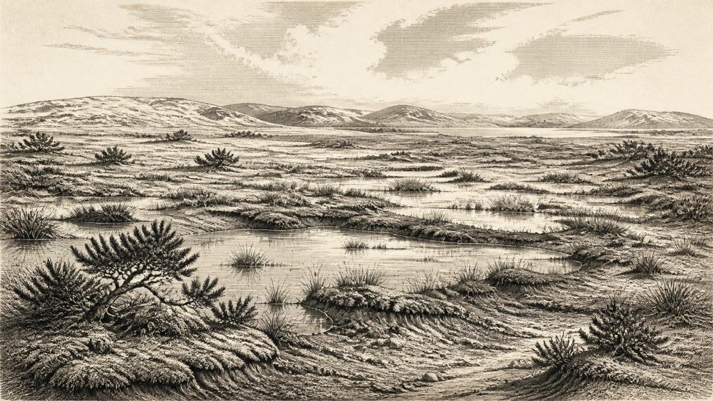
Derryvree is valuable because it preserves more than a date. Its fossil plant and insect evidence points to a cold, open and largely treeless freshwater landscape. Sedges, grasses, dwarf shrubs, herbs and mosses grew around shallow pools and wet ground; juniper pollen is among the indicators of sparse vegetation. Insects include species with northern, cold-climate affinities. Earlier researchers called the setting “muskeg”, meaning waterlogged peat-forming ground with mossy vegetation, pools and plant-rich sediment. In everyday visual terms, this was not the green, wooded Ireland familiar today: it was a harsh, seasonal mosaic of wet hollows, exposed ground and low vegetation.
Such evidence does not establish a single island-wide climate. A sediment basin has its own catchment, water chemistry and preservation history. Nor should treeless pollen diagrams be read as proof that no tree stood anywhere in Ireland. They do, however, establish that the Derryvree locality was not a temperate forest landscape, and that sufficiently unfrozen water, plants and insects existed for organic sediments to accumulate. The landscape was cold enough to favour northern species, yet locally productive enough to support wetland plant communities. That combination is important: Ice Age Ireland was environmentally severe, but not simply lifeless.
Cave minerals from farther south reinforce the picture of fluctuation rather than permanent uniform cold. At Crag Cave in County Kerry, uranium-thorium dating has shown that calcite speleothems formed episodically through Marine Isotope Stage 3. Because their growth depended on liquid water moving through soil and rock, these episodes are evidence for intervals of ameliorated cave hydrology. They cannot provide a weather report for Fermanagh, nor can an individual calcite date be tied to 31,829 BCE. Their significance is broader: Ireland’s climate repeatedly altered on millennial scales during this period, responding to the abrupt interstadial and stadial rhythms visible across the North Atlantic world.
The Castlepook Animal World
At Castlepook Cave near Doneraile in north County Cork, a very different archive survives: a large assemblage of animal bones from limestone chambers. The fauna attributed to the older, Marine Isotope Stage 3 component includes woolly mammoth, reindeer, giant deer, brown bear, wolf, Arctic fox, mountain hare, Norwegian lemming, collared lemming and spotted hyaena. The combination is striking. Reindeer and lemmings fit the cold, open environments suggested by northern deposits, while mammoth and giant deer indicate that parts of the Irish landscape could support large herbivores. Wolves, bears and hyaenas reveal a food web with formidable scavengers and predators.
Yet Castlepook must be handled with unusual care. Much of the material was excavated in the late nineteenth and early twentieth centuries, when recording standards differed markedly from modern archaeological practice. Bones came from complex passages and chambers, and could have been moved or accumulated by carnivores, flowing water, sediment disturbance and excavation itself. Later radiocarbon reassessment has shown that some earlier Irish cave dates required revision, and new work at Castlepook continues to investigate the deposits. The cave is compelling evidence that these animals occurred in Ireland during the wider interval; it is not an undisturbed snapshot of one hunt, one season or one coexisting herd.
The hyaena evidence is especially revealing. Castlepook is Ireland’s principal site for spotted hyaena, an animal now associated with Africa but then part of Late Pleistocene north-west European faunas. Chewed bones and the uneven representation of skeletal parts are consistent with a cave used by carnivores as a place to consume or transport carcasses. That interpretation makes the cave an archive of animal behaviour as well as species presence. It also warns against treating every bone mark as human work. Carnivore tooth damage, trampling, breakage and excavation damage must be separated from cuts made by stone tools.
A Possible Human Trace
The question of people is consequently both important and unresolved. A reindeer femur from Castlepook has been reported as bearing an incision interpreted as a cut or chop mark made with a sharp stone tool, and the bone has been publicised as dating to about 33,000 years ago. If that interpretation is accepted, it would constitute evidence that humans processed an animal in Ireland in the wider Marine Isotope Stage 3 period, vastly earlier than the island’s formerly accepted post-glacial evidence. It would not demonstrate a permanent settlement, a village, a named group or continuous occupation.
The limits matter as much as the possibility. The bone derives from an old cave collection rather than a freshly excavated, sealed occupation surface. No associated hearth, stone-tool assemblage, dwelling, burial, artwork or repeated camp horizon securely describes the people who may have made the mark. A single modified bone can support a cautious claim for an episode of human activity if the mark and dating withstand scrutiny; it cannot furnish a social history of a population. The most accurate description is therefore tentative human presence or visitation, not an established Irish community at this date.
No Kingdoms, No Recorded Faith
There is no evidence from Ireland around this time for political institutions, leaders, territorial states, diplomacy, formal warfare, law or organised religion. Nor is there evidence for farming, metallurgy, writing, monuments, long-distance trade systems or schools. To supply chiefs negotiating alliances, rival tribes fighting over hunting grounds, or ritual specialists directing ceremonies would be to turn gaps in the record into fiction. Even if small Upper Palaeolithic groups did reach Ireland, their language, kinship arrangements, beliefs, social identities and routes of travel remain unknown.
Economy, in the narrow sense supported by evidence, belonged overwhelmingly to wild ecosystems. Herbivores converted seasonal vegetation into animal biomass; predators and scavengers followed them; any human visitors would have depended upon foraging, hunting or scavenging and portable technologies rather than cultivated fields. Reindeer are often associated elsewhere in Upper Palaeolithic Europe with mobile hunters, but analogous continental practices cannot be simply imported into Ireland without Irish camps, tools and stratified food remains. The sea likewise cannot be assumed to have been an easy highway or a dry bridge. Lower global sea levels exposed broad shelf areas, but Ireland’s changing relation to Britain was shaped by complex topography, local ice loading and sea level.
What This Date Can Mean
The principal development around 31,829 BCE was environmental rather than political: Ireland was part of a volatile North Atlantic Ice Age landscape in which cold open ground, freshwater basins and large mammals persisted in some areas while the ice sheet that would later overwhelm the island was building towards its maximum. Derryvree offers the most appropriate local emblem of that condition—sedges and mosses accumulating in water between episodes of glaciation. Castlepook extends the view to a southern animal community and raises the consequential, still cautious possibility of human contact.
That is not a lesser history because it lacks kings and battles. It is the deep setting from which Ireland’s later inhabited landscape eventually emerged. The sediments show water and vegetation where later ice passed; the bones record animals whose Irish populations disappeared; the uncertain reindeer mark tests the outer edge of the human story. At this chronological distance, honesty about uncertainty is not an obstacle to history. It is the means by which the surviving evidence is allowed to speak.
Primary Sources
- A Middle Midlandian Freshwater Series at Derryvree, Maguiresbridge, County Fermanagh, Northern Ireland
- Early Midlandian–Middle Midlandian, Pleistocene, Northern Ireland
- The Subdivision of the Quaternary Period in Ireland
- A reconsideration of the radiocarbon dating of the Marine Isotope Stage 3 fauna from southern Ireland
- The Irish Quaternary Fauna Project
- New Insights on the Fauna of Ireland’s Younger Dryas and Earliest Holocene
- Proceedings of the Royal Irish Academy: Castlepook Cave
- Pleistocene Vertebrates in the British Isles
- Castlepook Cave, Castlepook South
- Trimlines, Blockfields and the Vertical Extent of the Last Ice Sheet in Southern Ireland
- Growth and Retreat of the Last British–Irish Ice Sheet, 31,000 to 15,000 Years Ago: the BRITICE-CHRONO Reconstruction
- The Timing and Magnitude of the British–Irish Ice Sheet Between Marine Isotope Stages 5d and 2
- Maximum Extent and Dynamic Behaviour of the Last British–Irish Ice Sheet West of Ireland
- Early Deglaciation of the British-Irish Ice Sheet on the Atlantic Shelf Northwest of Ireland Driven by Glacioisostatic Depression and High Relative Sea Level
- Episodic Speleothem Deposition Tracks the Terrestrial Impact of Millennial-Scale Last Glacial Climate Variability in SW Ireland
- Spatio-Temporal Dynamics of Speleothem Growth and Glaciation in the British Isles
- Ireland: Submerged Prehistoric Sites and Landscapes
- The Problem of a Late Quaternary Landbridge Between Britain and Ireland
- Deglaciation, Earth Crustal Behaviour and Sea-Level Changes in the Determination of Insularity: A Perspective from Ireland
- European Vegetation During Marine Oxygen Isotope Stage-3