
BIRM-166 and Castlepook31622 BCE
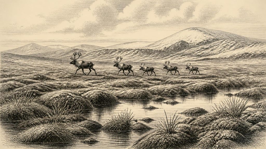
31,622 BCE is not a datable Irish historical event but an imprecise modern label within Marine Isotope Stage 3. Derryvree, County Fermanagh, records organic freshwater sediments between glacial advances, indicating locally ice-free, treeless wetlands with mosses, sedges and pools. Greenagho and Crag Cave likewise demonstrate fluctuating climates rather than continuous ice cover. Castlepook Cave, County Cork, preserves reindeer, mammoth, horse and carnivore remains, evidencing an open, cold landscape supporting large mammals. A marked reindeer femur may indicate stone-tool butchery by humans about 33,000 BCE, but lacks secure context. Subsequent ice expansion probably erased or buried landscapes and traces of visits.
Dateline
The modern label 31,622 BCE cannot be treated as an anniversary in Irish history. No calendar was in use in Ireland, no written record survives, and archaeology cannot isolate an event, community or season to that particular year. Expressed through the convention that counts radiocarbon ages back from AD 1950, it falls approximately 33,600 years before present. That apparent precision is misleading: calibrated results for so remote a period usually span centuries or millennia. The responsible subject is therefore Ireland during a broad interval of the Late Pleistocene, within Marine Isotope Stage 3, rather than a year of identifiable human action.
At this date Ireland lay in a changing north-west European world of cold climates, fluctuating ice margins, exposed continental shelves and mobile animal populations. It was well before the Last Glacial Maximum, conventionally dated to roughly 26,500–19,000 years ago, when the British–Irish Ice Sheet attained its greatest late-Pleistocene extent. The evidence does not support a picture of an island continuously smothered by ice at 31,622 BCE. Nor does it license an imagined landscape of settled Ice Age villages. What survives instead is a demanding but informative combination of buried sediments, cave bones, pollen and plant remains, insects, landforms and laboratory dates.
Dating a Changing Landscape
The most useful Irish evidence close to this broad horizon comes from Derryvree in County Fermanagh. Roadworks exposed organic-rich freshwater silts and fine sands trapped between two separate tills: deposits left by ice, then an interval without local ice cover, then later renewed glaciation. The sample known as BIRM-166 produced a conventional radiocarbon age of 30,500 ± 1,100 radiocarbon years BP. Calibration has placed it broadly between about 36,900 and 31,700 calibrated years BP. The modern date 31,622 BCE falls near the younger end of that wide range; it does not date an observed moment within the deposit.
That stratigraphic position is the crucial fact. Derryvree records a freshwater environment between episodes of glaciation. Plant and insect evidence indicates open, treeless ground, with mosses, sedges, grasses, herbs and shallow pools in a wet tundra or muskeg-like setting. Such evidence can illuminate local ecology and the presence of unfrozen ground and standing water. It cannot supply a national daily weather report, but it decisively complicates the old shorthand that imagines all of Ireland as an unbroken ice sheet throughout the Ice Age.
Other Fermanagh evidence gives the interval depth. Organic material beneath till at Greenagho, near Belcoo, has been calibrated to about 37,200–35,700 years BP. Together, Greenagho and Derryvree indicate that parts of north-central Ireland had ice-free landscapes during the earlier and middle stages of the last glaciation. Crag Cave in County Kerry adds a different kind of record. Its calcite deposits formed episodically during milder last-glacial phases, because dripping water and temperatures permitting liquid water were needed for speleothem growth. These archives show pronounced instability rather than a simple progression from warmth to cold.
Water, Moss and Open Ground
The environment around the date can therefore be described cautiously. In at least some Irish districts there were open habitats rather than closed forest, marked by strong seasonality and cold winters. Wet hollows and pools supported plant communities unlike those that dominate modern lowland Ireland. Frost action, sparse woody cover and periodically saturated ground would have shaped movement across the terrain. Rivers and meltwater channels were potentially important features, while the lower global sea level altered the outlines of the surrounding coasts and exposed areas now beneath the Atlantic and Irish Sea.
Yet Ireland was not environmentally uniform. The Derryvree sediments represent one locality in Fermanagh, and the cave sequences of the south represent another kind of archive. The spread and thickness of ice changed through time; so did the availability of vegetation and animal forage. It is safest to speak of a mosaic of local conditions, bounded by cold and influenced by the wider North Atlantic climate system. The later expansion of the last Irish Ice Sheet was beginning within this long phase, but the evidence does not allow a precise ice margin to be drawn for the calendar label 31,622 BCE.
Castlepook’s Animal Archive
In north County Cork, Castlepook Cave near Doneraile preserves the most evocative evidence for Irish life in this wider period. Excavated principally in the early twentieth century, the cave yielded bones of animals including reindeer, woolly mammoth, horse, wolf, bear and spotted hyaena. Modern redating has transformed the significance of the collection. Improved pretreatment of bone collagen showed that some specimens were thousands of radiocarbon years older than dates obtained in the 1990s. The results demonstrate that a varied large-mammal fauna occupied or reached southern Ireland during Marine Isotope Stage 3, before later ice expansion profoundly restricted suitable habitat.
A cave bone assemblage is not, however, a census of animals peacefully living beside its entrance. Carnivores could transport portions of carcasses into a den; water, collapse and sediment movement could rearrange remains; and early excavation methods did not meet modern standards of stratigraphic recording or recovery. The cave is thus a valuable archive of regional fauna, but not a sealed deposit from one episode. Reindeer are particularly important because their presence accords with open, cold-country grazing landscapes. Mammoth and horse reinforce the point that parts of Ireland could support large herbivores during favourable intervals. Individual species need not all have been present together or at precisely the date under discussion.
The Human Question
Castlepook also presents Ireland’s most provocative possible evidence for people at this depth of time. A reindeer femur in the collection has a deep surface mark interpreted by zooarchaeologist Ruth Carden as damage made with a sharp stone tool during carcass processing. The bone has been presented as dating to about 33,000 BCE. If both the date and the interpretation of the mark withstand further scrutiny, it would indicate that humans handled a reindeer in Ireland far earlier than the formerly accepted record of human activity on the island.
That proposition must remain carefully qualified. A radiocarbon measurement dates the death of the animal, not automatically the cutting of its bone, the place where it was killed, or the duration of any human visit. The specimen derives from an old collection rather than a newly excavated and securely stratified occupation surface. No associated stone-tool assemblage, hearth, dwelling, human remains, burial, art or repeatedly used processing floor of comparable age has yet been recovered at Castlepook. Recent excavation has sought to establish whether surviving Pleistocene deposits can furnish stronger contextual evidence. Until such evidence appears, the femur is a significant but limited indication of possible human activity, not proof of a resident population.
The distinction matters for all social questions. There is no evidence for a named people, language, kin group, leader, territory or lineage in Ireland around 31,622 BCE. Nor can archaeology identify political institutions, warfare, diplomacy, trade routes or a formal religious system. If people did reach Ireland, comparison with Upper Palaeolithic communities elsewhere in north-west Europe suggests small, mobile hunter-gatherer groups with sophisticated knowledge of stone, animal behaviour, weather and seasonal terrain. But that is an informed comparison, not a direct portrait of an Irish community. It cannot establish whether visitors crossed once, returned repeatedly, hunted locally, scavenged a carcass, or moved on.
Livelihood Without a Settlement Record
There was no farming, herding of domestic livestock, metalworking, village market or monument-building tradition demonstrated in Ireland at this time. Any human subsistence, if the Castlepook interpretation is accepted, would have depended on wild resources. A butchered reindeer bone could imply the recovery of meat, marrow, hide or sinew, but it cannot reveal the entire diet or seasonal economy. No Irish artefact currently proves exchange with Britain or continental Europe, even though people elsewhere in Upper Palaeolithic Europe maintained far-reaching social and material connections.
Likewise, no direct Irish evidence documents stories, ritual, music, visual art or teaching. This absence should not be mistaken for evidence that people, if present, lacked culture or belief. It marks the survival limit of the record. Caves and wet sediments preserve certain things—bones, pollen, insects, mineral deposits—far more readily than speech, clothing, wooden implements, shelters or acts of memory. The archaeological task is not to fill those silences with imaginary chiefs and ceremonies, but to distinguish securely observed material from reasonable interpretation.
Before the Major Advance
The broader importance of this interval lies in what followed. Reconstructions indicate that the last Irish Ice Sheet expanded from conditions that included substantial ice-free ground around 34,000 years ago, later growing to cover much of the island and adjoining shelves during the Last Glacial Maximum. That expansion remade drainage systems, coastlines and habitats, and probably destroyed or buried many traces of earlier landscapes and any human visits. The scarcity of evidence from 31,622 BCE is therefore partly historical and partly geological: subsequent ice was an agent of erosion as well as a subject of study.
For Ireland at this notional year, the most defensible narrative is accordingly modest but remarkable. Fermanagh preserves evidence of cold freshwater wetlands between glacial episodes. Southern caves preserve animals adapted to an open Ice Age world. Castlepook offers a potentially momentous, but not yet conclusive, sign that people may have processed reindeer there. There were no kingdoms, treaties or recorded events—only a severe, changing landscape and a handful of archives through which its lost inhabitants, animal and perhaps human, can be approached.
Primary Sources
- A Reconsideration of the Radiocarbon Dating of the Marine Isotope Stage 3 Fauna from Southern Ireland
- The Irish Quaternary Fauna Project
- Trimlines, Blockfields and the Vertical Extent of the Last Ice Sheet in Southern Ireland
- Growth and Retreat of the Last British–Irish Ice Sheet, 31,000 to 15,000 Years Ago: the BRITICE-CHRONO Reconstruction
- Late Pleistocene Chronostratigraphy and Ice Sheet Limits, Southern Ireland
- Maximum Extent and Dynamic Behaviour of the Last British–Irish Ice Sheet West of Ireland
- The Deglaciation of the Western Sector of the Irish Ice Sheet from the Inner Continental Shelf to its Terrestrial Margin
- British–Irish Ice Sheet and Polar Front History of the Goban Spur, Offshore Southwest Ireland Over the Last 250,000 Years
- Episodic Speleothem Deposition Tracks the Terrestrial Impact of Millennial-Scale Last Glacial Climate Variability in SW Ireland
- Spatio-Temporal Dynamics of Speleothem Growth and Glaciation in the British Isles
- New Insights on the Fauna of Ireland's Younger Dryas and Early Holocene from Alice & Gwendoline Cave
- 2022:564 – Castlepook Cave, Castlepook South, Cork
- Heritage Artefacts of County Cork
- Outreach and Education Resources
- Ireland and the Ice Age: Outreach Links, Events & Exhibitions
- Figure 6: The Subdivision of the Quaternary Period in Ireland
- Irish Cave Exploration
- On the Cave of Castlepook, Near Doneraile, Co. Cork
- Middle Midlandian Interstadial Deposits at Greenagho, Near Belcoo, County Fermanagh, Northern Ireland
- Early Midlandian–Middle Midlandian, Pleistocene, Northern Ireland