

Denekamp Over Doneraile31697 BCE
31,697 BCE cannot be reconstructed as a discrete Irish historical year, but belongs to unstable MIS 3 conditions near the Denekamp Interstadial. Ireland lacked known polities, settlements, farming or securely documented communities, while low sea levels and shifting ice and sea routes complicated access. Derryvree deposits in Fermanagh indicate cold, treeless freshwater and periglacial environments between glacial advances. Crag Cave speleothems record episodic thaw and climatic fluctuation. Castlepook Cave preserves diverse Ice-Age fauna, though its mixed assemblage spans long periods. A marked reindeer femur may suggest brief human butchery, but cannot establish permanent occupation. Ice erosion and excavation limit interpretation.
Dateline
31,697 BCE is not a recoverable year in Irish history. It is a modern numerical label, roughly 33,646 years before AD 1950, or about 33.6 thousand calibrated years before present (cal BP). No Irish community left a calendar, ruler list, settlement sequence or historical memory that can be assigned to this single year. At this depth of time, radiocarbon results require calibration and are best understood as probability ranges, while sediments and cave deposits can accumulate across centuries or millennia. The responsible history of this moment is therefore an account of a broad Late Pleistocene interval, not a fabricated annual chronicle.
The date falls within Marine Isotope Stage 3 (MIS 3), a climatically unstable portion of the last Ice Age, and near the beginning of the continental north-west European interval often called the Denekamp Interstadial. That latter name should not be treated as a precise Irish season or a uniform warm phase. Ireland’s surviving evidence is sparse, discontinuous and geographically uneven. It shows landscapes changing between cold open ground, freshwater basins, cave environments and advancing ice, rather than a single stable national climate.
An Island Without a Historical Polity
There was no Ireland in the political or cultural sense meant by later history. No evidence identifies chiefs, kingdoms, diplomacy, warfare, ethnic groups, religious institutions, languages, trade networks or named settlements at this date. Nor is there evidence for farming, domestic animals, pottery, metalworking, monuments or permanent villages. Those absences matter. They do not prove that every part of the island was empty at every instant, but they do mean that claims about political affairs, social hierarchy, ritual or everyday human life would exceed what the archaeology can responsibly sustain.
What can be described is a physical island at the Atlantic edge of Europe. Sea level was far lower globally than it is today, but Ireland was not simply joined to Britain by a dry land bridge. Its changing shorelines, sea passages, ice margins and surrounding shelf were shaped by the interacting effects of ice-sheet growth, sea level and crustal movement. Any people or large animals reaching Ireland had to negotiate that difficult, shifting geography.
Derryvree’s Cold Freshwater World
The clearest Irish environmental comparison comes from Derryvree near Maguiresbridge, County Fermanagh. Road works there exposed organic-rich freshwater silts and fine sands between two layers of glacial till. The deposit yielded a radiocarbon determination of 30,500 ± 1,170/1,030 radiocarbon years BP. With modern calibration, that determination represents a wide calendar range rather than a date precise enough to identify 31,697 BCE itself. Yet it securely places the Derryvree environment within the broad later MIS 3 world relevant to this article.
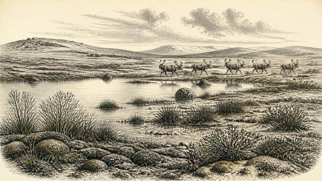
Its plant and animal traces indicate a cold, treeless, periglacial landscape. Mosses, sedges, herb pollen, aquatic and wet-ground plants, and insects of northern affinities point to shallow freshwater, saturated ground and open vegetation. The word tundra is useful if used carefully: it describes an ecological character of low vegetation and severe conditions, not a neat modern biome transplanted unchanged into Ice-Age Fermanagh. Dry ground may have supported scattered herbs and dwarf shrubs, but woodland was not the governing feature of the scene.
Derryvree also teaches a larger lesson about regional change. Its freshwater deposits were later overridden or sealed by ice-related sediments. The record is thus evidence that this locality experienced an ice-free interval between glacial advances, not proof that all Ireland was simultaneously ice-free. Nearby Fermanagh sites at Hollymount and Greenagho preserve related inter-till organic deposits, reinforcing the conclusion that ice, water, vegetation and exposed ground repeatedly reorganised the northern landscape.
Calcite, Thaw and Climate Pulses
Crag Cave, near Castleisland in County Kerry, supplies a contrasting archive. Stalagmites and other speleothems grow only when water can percolate through soil and limestone and drip within the cave. Uranium-series dates show that calcite formation occurred episodically at Crag Cave during the last glacial period, with growth phases corresponding broadly to Greenland interstadials. Interruptions in growth record colder or drier conditions in which water movement and cave deposition were reduced or stopped.
This does not give Ireland a precise temperature for 31,697 BCE, nor does one cave stand for the whole island. It does, however, rule out a simplistic vision of an island permanently entombed beneath uniform ice at all times before the Last Glacial Maximum. Around the broader period represented by this date, local environments could change sharply over millennial and shorter scales. The prospective expansion of the British–Irish Ice Sheet was one of the decisive regional forces, ultimately eroding, burying and redistributing much of the older landscape evidence on which modern reconstruction depends.
Castlepook’s Animal Archive
The most striking evidence from southern Ireland comes from Castlepook Cave, also known historically as Mammoth Cave, near Doneraile in north County Cork. Cave excavations, particularly those undertaken in the early twentieth century, recovered a remarkable assemblage including woolly mammoth, reindeer, giant deer, brown bear, wolf, foxes, mountain hare, lemmings and spotted hyaena. Geological Survey Ireland describes Castlepook as the richest Irish site for studying the country’s Ice-Age vertebrate fauna.
Those animals should not be imagined as one herd gathered outside the cave in the notional year under review. The collection was amassed across a substantial span of time, and many early excavations did not record strata to modern standards. Caves can collect bones through carnivore activity, natural deaths, water movement, collapse, later disturbance and human intervention. Newer radiocarbon pretreatment and redating have altered the chronology of several Irish cave specimens by thousands of years. In particular, reassessment of Castlepook, Foley and Shandon material indicates that giant deer and spotted hyaena may have disappeared locally before about 40,000 cal BP.
Even with that warning, Castlepook transforms the scale of the Irish story. Reindeer imply cold, open country with seasonal forage; woolly mammoth and giant deer point to productive patches of grasses, sedges and herbs; lemmings, hares and foxes belong to northern ecological conditions; and hyaenas indicate a predatory and scavenging community now entirely absent from Ireland. The cave is evidence for a succession of mobile animal populations, not for a domesticated landscape. The economy, if the word can be used at all, was ecological: energy moved through plants, herbivores, carnivores, scavengers and decomposition, rather than through farms, markets or trade.
The Reindeer Femur and Human Possibility
A reindeer femur from Castlepook has made this period especially important. It has been publicised as dating to around 33,000 years ago and bears a deep mark interpreted by zooarchaeologist Ruth Carden as a chop or cut made with a sharp stone implement during butchery. If that interpretation is accepted, it would indicate human activity in Ireland far earlier than the well-established Mesolithic settlement of the early Holocene. It would not demonstrate a town, a population of known size, a permanent camp or a continuous human occupation of the island.
Caution is essential because this is a single, consequential trace from a complicated old cave collection. A bone modification must be distinguished from carnivore scoring, sediment abrasion, trampling, weathering, excavation damage and later handling; its date must also belong securely to the marked specimen rather than merely to associated deposits. The wider archaeological record has yet to produce a securely stratified contemporary hearth, stone-tool assemblage, dwelling floor or cemetery in Ireland. The femur therefore supports a carefully framed possibility of brief Upper Palaeolithic visitation or carcass processing, not a confidently reconstructed Irish hunter community.
What Daily Life Cannot Yet Tell Us
Should people have reached Castlepook or another Irish locality around this broad period, their practical concerns would probably have involved shelter, warmth, movement, tool maintenance and access to animal food in a severe seasonal environment. That is an inference from Upper Palaeolithic lifeways elsewhere in north-west Europe, not direct evidence from Ireland. No Irish artefact assemblage currently allows the reconstruction of clothing, kinship, language, artistic practice, ritual, learning or exchange at 31,697 BCE. The only defensible cultural emphasis is methodological: Ireland’s apparent silence partly reflects genuine scarcity, but also the destructive power of later glaciers and the limitations of antiquarian recovery.
For that reason, the foremost development around this date was environmental rather than political. Ireland was a fluctuating Ice-Age terrain in which freshwater basins could sustain mosses and sedges, caves could preserve episodic evidence of a rich fauna, and ice-sheet expansion was beginning to reshape the archive itself. Derryvree, Crag Cave and Castlepook do not furnish a year-by-year narrative. Together, they offer something more durable: a disciplined picture of the changing conditions from which Ireland’s much later human history eventually emerged.
Primary Sources
- The IntCal20 Northern Hemisphere Radiocarbon Age Calibration Curve (0–55 cal kBP)
- Early Midlandian–Middle Midlandian, Pleistocene, Northern Ireland
- Palaeoecology
- Middle Midlandian Interstadial Deposits at Greenagho, Near Belcoo, County Fermanagh, Northern Ireland
- Episodic Speleothem Deposition Tracks the Terrestrial Impact of Millennial-Scale Last Glacial Climate Variability in SW Ireland
- Spatio-Temporal Dynamics of Speleothem Growth and Glaciation in the British Isles
- A Reconsideration of the Radiocarbon Dating of the Marine Isotope Stage 3 Fauna from Southern Ireland
- The Irish Quaternary Fauna Project
- Castlepook Cave
- Heritage Artefacts of County Cork
- Late Pleistocene Chronostratigraphy and Ice Sheet Limits, Southern Ireland
- The Timing and Magnitude of the British–Irish Ice Sheet Between Marine Isotope Stages 5d and 2
- Dimensions and Chronology of the Last Ice Sheet in Western Ireland
- Timing and Pace of Ice-Sheet Withdrawal Across the Marine–Terrestrial Transition West of Ireland During the Last Glaciation
- Response of the Irish Ice Sheet to Abrupt Climate Change During the Last Deglaciation
- The Colonization of Ireland: A Human Ecology Perspective
- New Insights on the Fauna of Ireland’s Younger Dryas and Early Holocene from Alice & Gwendoline Cave
- Quaternary
- Quaternary Geological Map of Ireland 1:500,000 Scale
- Release of 3 New Quaternary Maps