
Birm-166’s Sedge Record31698 BCE
31,698 BCE is a retrospective label, not a recoverable Irish year. Derryvree, County Fermanagh, provides calibrated evidence for ice-free conditions between roughly 36,900 and 31,700 years before present, preserved as freshwater organic silts between tills. Mosses, sedges, bogbean and insects indicate a cold, open periglacial wetland, amid climatically unstable MIS 3 conditions. Cave calcite and deposits elsewhere confirm episodic milder intervals and fluctuating ice. Castlepook Cave’s disturbed fauna documents diverse cold-stage mammals, while a possibly cut-marked reindeer bone suggests, but cannot prove, human activity. No settlements, polities or trade are attested. Sediments instead reveal changing wetlands, fauna and advancing ice.
Dateline
31,698 BCE cannot be treated as a recoverable year in the modern sense. No Irish written record, settlement layer, named community or datable human action belongs securely to that precise point. It is a retrospective calendar label for roughly 33,650 years before 1950, during the Late Pleistocene and broadly within Marine Isotope Stage 3 (MIS 3). The responsible evidence is therefore regional and ranged, not annual. A particularly important guide is a calibrated range of about 36,900–31,700 years before present from organic deposits at Derryvree, near Maguiresbridge in County Fermanagh: a range that encompasses this notional date, but does not turn it into an historical anniversary.
A Wetland Between Ice Advances
Derryvree was revealed in a 1969 road cutting through a drumlin. Beneath one body of glacial till and above another lay fine sands and organic-rich silts: the remains of a freshwater environment preserved between episodes of ice-sheet activity. The laboratory determination known as Birm-166 gave an age of about 30,500 radiocarbon years before present. Radiocarbon years are not calendar years, and modern calibration produces the broader range used by later researchers. That distinction matters. The deposit supplies evidence that this part of Fermanagh was ice-free during some portion of the range, not proof that conditions were identical throughout it or on every part of Ireland.
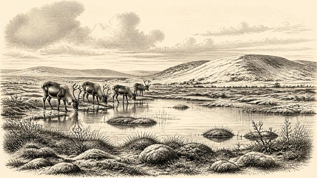
The plants and insects in the silts indicate a cold, open, periglacial setting. Freshwater mosses and sedges grew around shallow water; the assemblage also included plants such as bogbean. This was not a wooded Irish countryside of the familiar modern kind. Trees, if present locally at all, were not forming a closed forest in this exposed landscape. The word “tundra” is useful as a broad description of open, cold-climate vegetation, but it should not conjure an exact replica of present-day Arctic terrain. The deposits record a particular lowland wetland and its catchment, shaped by temperature, seasonality, sediment movement and water supply.
An Unstable Ice-Age Ireland
Around this horizon, Ireland stood before the fullest growth of the last Irish Ice Sheet, whose maximum overall expansion came later, during the Last Glacial Maximum. Yet this was no simple interval of thaw. MIS 3 was marked by abrupt climatic oscillations, and evidence from Crag Cave in County Kerry shows that calcite growth in Irish caves occurred episodically during milder intervals when water could circulate through the limestone. Such speleothems are a valuable climatic archive, but they do not provide a weather report for Maguiresbridge on a particular day or year.
Other sites reinforce the picture of uneven regional change. Organic and freshwater deposits at Greenagho near Belcoo, also in Fermanagh, have been assigned a calibrated age roughly between 37,200 and 35,700 years before present, though the limitations of older conventional radiocarbon determinations require caution. Hollymount near Maguiresbridge and Aghnadarragh in County Antrim preserve further sediment sequences between tills. Together they demonstrate that ice advances were separated by episodes in which water, plants and animals occupied exposed ground. They do not license a neat map of a single national ice margin for 31,698 BCE.
Animals, Caves and Caution
The most dramatic evidence for pre-Last Glacial Maximum Ireland comes from limestone caves in north County Cork, above all Castlepook Cave near Doneraile, also known as Mammoth Cave. Excavations from the nineteenth and early twentieth centuries recovered an exceptionally large but disturbed collection of animal remains. Work associated with the Irish Quaternary Fauna Project, and later re-dating, has shown that mammals reached Ireland during the wider period from at least about 45,000 to 20,000 years ago. Castlepook’s assemblage includes remains attributed to reindeer, brown bear, wolf, fox, hare, lemming, giant deer, woolly mammoth and spotted hyaena.
That list is evidence for a changing regional fauna across a long span, not a census of animals alive together in 31,698 BCE. Cave deposits can be mixed by water, scavenging, collapse, earlier digging and later disturbance; old collections often lack the fine-grained excavation records now expected. Re-dating has also revised the apparent ages of some southern Irish specimens substantially. The most secure conclusion is that parts of Ireland could support, or were reached by, a diverse cold-stage mammalian fauna during MIS 3. The timing, duration and precise geographical range of each species remain subjects for continued testing.
This caution is essential to the question of people. A reindeer femur from Castlepook has been interpreted as bearing a cut made by a sharp stone tool, raising the possibility of human carcass processing in Ireland around 33,000 years ago. It is an important claim, but not conclusive proof of a resident population. A bone date establishes when the animal lived; it does not automatically date a mark, identify its maker beyond doubt, or demonstrate a camp, family group or continuing occupation. New fieldwork at Castlepook has located Pleistocene bone-bearing deposits in less disturbed parts of the cave system, offering a better prospect of resolving such questions.
No Polities, No Proven Diplomacy
There is no evidence from Ireland at this date for political institutions, territories, rulers, warfare, diplomacy, religious buildings, formal burial or organised trade. It would be misleading to fill those silences with imagined Ice-Age clans. If people did reach the island or its near shores, they may have been highly mobile hunter-gatherers making brief forays rather than establishing permanent settlements. Even that is interpretation rather than settled fact. No securely associated house floor, hearth, stone-tool assemblage or human remains permits a reconstruction of everyday social life around this point.
Nor can historians responsibly infer long-distance exchange from the animal evidence. Lower global sea levels exposed large areas of the continental shelf, altering coastlines and the distances between landmasses, but sea level, glacial barriers and channels did not create a straightforward, demonstrated land bridge from Ireland to Britain or continental Europe. The routes by which animals entered Ireland are still debated. They could have depended on temporary coastal corridors, sea crossings, changing ice conditions or combinations of these. Human access, were it demonstrated, would demand its own evidence.
What Survival Required
The Derryvree record nevertheless permits a restrained picture of the non-human economy of the landscape. Wet ground supported aquatic and marginal plants; open vegetation offered seasonal grazing and browsing opportunities; lakes, streams and wet hollows created ecological variation in an otherwise sparse environment. Carnivores, scavengers and herbivores left traces in caves because caves could act as dens, traps, shelters, sediment sinks and repositories of bones washed in from outside. Their remains tell us more reliably about animal communities and environment than about human culture.
For any visitors, shelter, fuel, food and movement would have been pressing practical concerns. Wood was likely scarce in the open northern landscapes suggested by the plant evidence, while weather could shift sharply across generations or even much shorter spans. Such constraints help explain why the archaeological signal may be faint, but they cannot convert absence of evidence into evidence of a vanished settlement. The later Last Glacial Maximum would further erode, bury and rework older surfaces across much of Ireland, making survival of fragile campsites especially unlikely.
A Date Represented by Sediment
The principal historical development illuminated by 31,698 BCE is therefore environmental rather than political: Ireland contained ice-free landscapes during part of a climatically volatile Late Pleistocene interval, and those landscapes could include cold freshwater wetlands and a varied large-mammal fauna. Derryvree’s moss-rich silts, protected beneath later till, are more valuable than a fabricated event would be. They show how Irish history at such depth is assembled—from pollen and seeds, insects and bones, cave calcite, sediment layers and calibrated probability ranges.
The evidence also sets firm limits. We cannot name the inhabitants of Ireland because none are known. We cannot assign a religion, a language, a trading network or a battle because none is attested. The dated record gives a landscape in motion: wetlands forming between glaciations, animals arriving and disappearing over millennia, and ice eventually advancing again. At this remote horizon, that is not a thin version of conventional history. It is the history that the surviving Irish ground can genuinely sustain.
Primary Sources
- A Middle Midlandian Fresh-Water Series at Derryvree, Maguiresbridge, County Fermanagh, Northern Ireland
- Early Midlandian–Middle Midlandian, Pleistocene, Northern Ireland
- Middle Midlandian Interstadial Deposits at Greenagho, Near Belcoo, County Fermanagh, Northern Ireland
- The Irish Quaternary Fauna Project
- A Reconsideration of the Radiocarbon Dating of the Marine Isotope Stage 3 Fauna from Southern Ireland
- Trimlines, Blockfields and the Vertical Extent of the Last Ice Sheet in Southern Ireland
- Growth and Retreat of the Last British–Irish Ice Sheet, 31,000 to 15,000 Years Ago: the BRITICE-CHRONO Reconstruction
- Exploring Controls of the Early and Stepped Deglaciation of the Donegal Bay Ice Stream, North-West Ireland
- A Stratigraphic Investigation of the Celtic Sea Megaridges Based on Seismic and Core Data from the Irish-UK Sectors
- The Deglaciation of the Western Sector of the Irish Ice Sheet from the Inner Continental Shelf to its Terrestrial Margin
- Episodic Speleothem Deposition Tracks the Terrestrial Impact of Millennial-Scale Last Glacial Climate Variability in SW Ireland
- Freshwater Organic Deposits and Stratified Sediments Between Early and Late Midlandian (Devensian) Till Sheets, at Aghnadarragh, County Antrim, Northern Ireland
- The IntCal20 Northern Hemisphere Radiocarbon Age Calibration Curve (0–55 cal kBP)
- New Insights on the Fauna of Ireland's Younger Dryas and Early Holocene from Alice & Gwendoline Cave
- 2022:564 – Castlepook Cave, Castlepook South, Cork
- Mammoth Cave
- Ireland: Submerged Prehistoric Sites and Landscapes
- Late Pleistocene Chronostratigraphy and Ice Sheet Limits, Southern Ireland
- Dimensions and Chronology of the Last Ice Sheet in Western Ireland
- Dating Constraints on the Last British-Irish Ice Sheet: A Map and Database
