
Maguiresbridge Bogbean Pool31663 BCE
31,663 BCE is a modern label for a Middle Midlandian MIS 3 interval, not a recoverable historical year. At Derryvree, County Fermanagh, freshwater deposits between glacial tills record a cold, non-glacial wetland of sedges, mosses, bogbean, insects and open tundra vegetation, later sealed by ice. Related Fermanagh sites indicate complex regional climatic change. Castlepook Cave, County Cork, preserves bones of mammoth, giant deer, reindeer, predators and other cold-adapted fauna, though deposits span long periods. A marked reindeer bone may suggest human butchery, but cannot prove settlement. These archives reveal Ice Age environments, while political, cultural and economic history remains unknown.
Dateline
The label 31,663 BCE is a modern way of arranging a period for which Ireland has no written dates, named communities or recoverable annual events. It must not be treated as a year in the ordinary historical sense. In archaeological terms it falls roughly 33,600 calendar years before present, where “present” is conventionally AD 1950, within the later part of Marine Isotope Stage 3 (MIS 3), an unstable interval of the last Ice Age. At such depth in time, radiocarbon results require calibration and commonly produce ranges spanning many centuries or millennia. The evidence can illuminate an Irish world around this horizon; it cannot tell us what happened in one particular calendar year.
An Interval, Not an Anniversary
The appropriate framework is the Middle Midlandian, the Irish term for part of the last cold stage. This was before the fullest development of the Last Glacial Maximum, when the British–Irish Ice Sheet later covered much of Ireland. It was nevertheless an age of profound climatic severity and rapid change. Ice margins advanced and withdrew; sea level, coastlines and drainage altered; plant and animal communities expanded into favourable ground and disappeared when conditions worsened. Ireland was not simply a fixed white island beneath permanent ice, nor was it a familiar green landscape awaiting settlement. It was a shifting north-western edge of Ice Age Europe.
Modern reconstructions show why caution is needed. The British–Irish Ice Sheet was not one unchanging blanket with a single date of formation. Its centres of accumulation, outlet glaciers and margins behaved differently in different regions. Evidence from caves, sub-glacial sediments, landforms and offshore cores indicates that parts of Ireland retained ice-free or seasonally non-glacial environments during portions of MIS 3, before more extensive ice growth. Yet no available reconstruction can map the precise margin, shoreline or weather of every Irish district in 31,663 BCE. The important historical fact is variability: an environment capable of sustaining freshwater habitats and large mammals could, over geological time, be engulfed or transformed by renewed glaciation.
A Freshwater Archive Beneath Ice
The strongest Irish evidence relevant to this broad horizon comes from Derryvree near Maguiresbridge, County Fermanagh. Road construction in 1969 cut through a drumlin and revealed a sequence of freshwater silts, fine sands and organic layers trapped between two tills. Till is sediment laid down directly by glacier ice. The order of the strata therefore preserves an eloquent, if incomplete, history: an earlier glacial episode deposited the lower till; an interval of open water and wet ground followed; later ice spread across the area and buried the freshwater deposits beneath another till.
Organic material from the Derryvree sequence produced a conventional radiocarbon age of 30,500 years BP, with a substantial laboratory uncertainty. Calibration has been understood to place the deposit broadly within about 36,900–31,700 calibrated years BP. That wide range encompasses the approximate horizon represented by 31,663 BCE, but it does not establish that the pond, its plants or its insects belong to that exact numbered year. Nor should a single sampled layer be imagined as a continuous diary. What Derryvree securely demonstrates is that south Fermanagh experienced a cold, freshwater and non-glacial interval between separate phases of ice deposition.
This distinction matters because later glaciers removed, mixed or concealed much of Ireland’s earlier Pleistocene record. At Derryvree, later ice was destructive in one sense but protective in another: it sealed a fragile environmental archive below a drumlin. The deposit allows modern researchers to reconstruct a landscape through small and durable traces—pollen, plant macrofossils, mosses and insects—rather than through buildings, tools or historical testimony.
Sedges, Mosses and Open Water
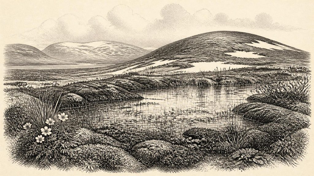
Derryvree was not a forest. Its biological remains indicate open tundra or muskeg: wet, cold ground with pools, mossy margins, sedges, grasses, herbs and low-growing shrubs. The record includes bogbean, an aquatic or wetland plant, along with water-milfoil and Arctic-alpine species such as mountain avens. Freshwater mosses and the insect assemblage reinforce the picture of shallow water, plant-rich mud and damp ground in a periglacial climate. Periglacial means shaped by intense frost and thaw close to ice, rather than necessarily lying beneath a glacier.
The word tundra should not suggest a lifeless, uniformly snowbound plain. Summers, though short, could support productive wetland edges and herb-rich patches; local shelter, drainage, soil and exposure would have created small ecological differences. But the evidence does imply severe winters, sparse dry-land vegetation and an absence of mature woodland. A few grains of tree pollen do not prove nearby trees: pollen can travel far, while the wider assemblage points firmly towards an open landscape. This was an Ireland in which water, frost, wind and seasonal light governed daily ecological rhythms.
Other Fermanagh sites strengthen the regional case while also showing the limits of chronology. At Greenagho near Belcoo, organic material beneath till has been dated to an earlier part of MIS 3, although the determination is treated cautiously. Hollymount, also near Maguiresbridge, preserves another inter-till freshwater deposit. Together these sites show that north-central Ireland had a more complicated Ice Age history than a simple advance-and-retreat narrative. They do not, however, license the claim that every part of the island was simultaneously ice-free, or that all three deposits belonged to one uninterrupted landscape.
The North Cork Animal World
Far to the south, Castlepook Cave—also called Mammoth Cave—near Doneraile in County Cork preserves a different kind of evidence. Excavations conducted in the early twentieth century recovered more than 2,000 bones from a complex limestone cave system. The assemblage includes woolly mammoth, giant deer, reindeer, brown bear and spotted hyena, as well as wolf, Arctic fox, mountain hare and lemmings. Taken together, these animals indicate that Ireland could at times support, or be reached by, a cold-adapted and open-country fauna strikingly unlike that of later historic Ireland.
Castlepook must be read carefully. It was not a neatly sealed settlement layer. Individual bones span a long interval, and the cave’s deposits were affected by water movement, carnivore activity and antiquarian excavation methods that did not meet modern standards. A spotted-hyena den or scavenging place can accumulate bones from animals brought in as food, from carcasses dying nearby, and from material moved after deposition. The cave is thus exceptionally important evidence for regional fauna, but it cannot be treated as a census of animals alive together on a single day, still less as a direct view of a human camp.
Recent re-dating has also altered the picture. Improved pretreatment and accelerator radiocarbon techniques showed that some older cave measurements were too young, pushing elements of the southern Irish MIS 3 fauna further back in time. This is a useful warning against attaching false certainty to any one date. Castlepook demonstrates a long-lived faunal archive before and around the onset of the great ice-sheet expansion; it does not supply a year-by-year chronology of Ice Age Cork.
A Possible Human Trace
A reindeer femur from Castlepook has attracted special attention because a deep surface mark has been interpreted as a cut made by a stone tool during butchery. The bone has been presented as evidence for human activity in Ireland roughly 33,000 years ago, making it broadly relevant to the era considered here. If that interpretation is confirmed, it would move the evidence for people in Ireland dramatically earlier than the well-established late Upper Palaeolithic traces known elsewhere on the island.
The claim remains important but limited. The radiocarbon determination dates the animal bone, not the moment when a mark was made or the duration of any visit. The specimen comes from an old cave collection rather than a modern excavation of an intact occupation surface. No associated hearth, secure stone-tool assemblage, dwelling, human bone, burial, artwork or repeated sequence of butchered animals has yet established a resident community in Ireland at this time. Carnivore damage, sediment abrasion and other post-depositional processes must be distinguished from tool use by specialist analysis. The responsible conclusion is therefore that Castlepook offers a potentially significant indication of Upper Palaeolithic human presence, not proof of a known population, named people or permanent settlement.
What Cannot Be Recovered
There is no evidence from 31,663 BCE for political institutions, rulers, territories, diplomacy, warfare or alliances in Ireland. Predators competed with prey and hyenas processed carcasses, but these are ecological relationships, not human conflict. Likewise, no material supports claims about religion, ceremonies, language, kinship rules, artistic traditions, teaching or formal learning. It would be misleading to fill this silence with imagined Ice Age clans, shamans or tribal boundaries.
Economy and trade are similarly beyond direct recovery. If people did reach Ireland, reindeer and other large mammals could have provided meat, hides, sinew, bone and antler, while dry vegetation or wood collected elsewhere might have served as fuel. Those are possibilities informed by wider Upper Palaeolithic practice, not demonstrated Irish facts. There is no evidence here for exchange networks, boats, campsites, seasonal routes or a settled hunting economy. Even the routes by which mammals, and perhaps people, reached the island remain difficult to reconstruct because changing sea level, glacial loading and ice cover continually reshaped the surrounding region.
Ireland’s Most Distant History
The significance of this horizon lies not in an invented event but in the survival of evidence. At Derryvree, a cold freshwater basin preserved the remains of plants and insects before a later ice advance entombed them. At Castlepook, a cave accumulated bones that reveal an unexpectedly rich Ice Age fauna and perhaps a human encounter with reindeer. At Crag Cave in County Kerry, episodes of speleothem growth indicate intervals when liquid water could percolate through the cave system during the wider last glacial cycle. These archives show a dynamic Ireland, environmentally connected to the changing North Atlantic world but archaeologically difficult to see.
Around the modern label 31,663 BCE, Ireland’s history is therefore principally environmental history: wetlands under frost, open vegetation, large grazing animals, carnivores, caves and approaching ice. The island was neither empty of life nor available to historical narration in the usual sense. Its inhabitants, if people were among them, remain unnamed and uncounted. What survives is more fragmentary but no less remarkable: sediment beneath a drumlin, a seed in ancient mud, and a marked reindeer bone whose meaning is still being tested.
Primary Sources
- A Middle Midlandian Freshwater Series at Derryvree, Maguiresbridge, County Fermanagh, Northern Ireland
- Early Midlandian–Middle Midlandian, Pleistocene, Northern Ireland
- Palaeoecology
- Irish Pleistocene Biostratigraphy
- Middle Midlandian Interstadial Deposits at Greenagho, Near Belcoo, County Fermanagh, Northern Ireland
- The Geological Heritage of County Leitrim
- BSBI: Menyanthes trifoliata
- BSBI: Dryas octopetala
- BSBI: Myriophyllum alterniflorum
- A Reconsideration of the Radiocarbon Dating of the Marine Isotope Stage 3 Fauna from Southern Ireland
- Castlepook Cave, County Geological Site Report
- Spotted Hyena Skull
- Archaeology Research Excavation Grant 2022: Final Report
- Episodic Speleothem Deposition Tracks the Terrestrial Impact of Millennial-Scale Last Glacial Climate Variability in SW Ireland
- The IntCal20 Northern Hemisphere Radiocarbon Age Calibration Curve (0–55 cal kBP)
- Growth and Retreat of the Last British–Irish Ice Sheet, 31,000 to 15,000 Years Ago: The BRITICE-CHRONO Reconstruction
- BRITICE-CHRONO Maps and GIS Data of the Last British-Irish Ice Sheet 31 to 15 ka
- Response of the Irish Ice Sheet to Abrupt Climate Change During the Last Deglaciation
- Dimensions and Chronology of the Last Ice Sheet in Western Ireland
- The Problem of a Late Quaternary Landbridge Between Britain and Ireland
- Ireland’s Last Glacial Maximum: The Island of Ireland—Drowning the Myth of an Irish Land-bridge?
- Mammoth and Musk Ox ESR-Dated to the Early Midlandian at Aghnadarragh, County Antrim, Northern Ireland, and the Age of the Fermanagh Stadial
- Anthropogenic Changes to the Holocene Nitrogen Cycle in Ireland
