
Doneraile’s Earliest Trace31436 BCE
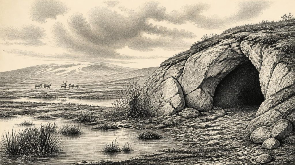
At c. 31,436 BCE, Ireland cannot be described through annual events or human history, but through uncertain Late Pleistocene environmental evidence. Derryvree, County Fermanagh, preserves freshwater sediments between glacial tills, indicating episodically ice-free, cold, treeless wetlands with tundra plants during Marine Isotope Stage 3. Castlepook Cave near Doneraile contains remains of mammoth, reindeer, horse, bear, hyaena and other cold-stage fauna, although collections span long periods. A marked reindeer bone may indicate early human butchery, but sustained occupation is unproven. Dynamic ice, changing coasts and later erosion shaped intermittently habitable landscapes, while preventing reconstruction of societies, politics, settlement, or exact chronology.
Dateline
Modern calendar-year precision is not available for Ireland in 31,436 BCE. The numbered year is a useful position on a modern timeline, not a date that any community in Ice Age Ireland could have recorded, and it cannot be matched to a particular season, journey, hunt or individual. In radiocarbon convention it falls roughly 33,386 years before AD 1950, or about 33.4 thousand calendar years before present. At this depth of time, dates are expressed as calibrated ranges and carry substantial uncertainties. The responsible subject is therefore Ireland during the later part of Marine Isotope Stage 3, a long, climatically volatile interval of the Late Pleistocene.
There are no annals, monuments, settlements, burials, named leaders or securely excavated campsites from this precise horizon in Ireland. What can be recovered is a more fragmentary history of changing environments: animal bones from caves, freshwater sediments caught between glacial deposits, plant and insect remains, landforms and the chronology of the British–Irish Ice Sheet. These sources can establish that parts of Ireland supported life in a severe Ice Age world. They cannot supply the political or social narrative that later historical periods make possible.
A Date Within Ranges
The distinction between a modern calendar label and scientific dating matters especially here. Radiocarbon years are not identical to calendar years, because the quantity of atmospheric carbon-14 has changed through time. Researchers therefore calibrate radiocarbon measurements against curves such as IntCal20. Far back in the Pleistocene, a measurement commonly produces a broad calendar interval rather than a narrow result. Stratigraphy adds another level of evidence: the order of sediments may show that a wetland formed after one advance of ice and before another, but it does not identify an annual sequence.
The most relevant Irish environmental record comes from Derryvree, near Maguiresbridge in County Fermanagh. Roadworks in 1969 exposed silts and fine sands containing organic material between two distinct bodies of till within a drumlin. The original study obtained a radiocarbon determination of 30,500 with an uncertainty of +1,170/−1,030 radiocarbon years BP. Its significance lies less in converting that figure into one preferred calendar year than in the sequence itself: ice had deposited the lower till; an ice-free freshwater environment then existed long enough to lay down sediments and preserve biological remains; later ice covered the deposit with another till sheet. The Derryvree record is thus a window onto a broad late-MIS-3 interval overlapping the chronological neighbourhood of 31,436 BCE, not an event dated to that year.
Ice, Water and Open Ground
Ireland was not a single uniform landscape. The last British–Irish Ice Sheet was dynamic, with ice centres, glaciers and margins changing across regions and over long periods. Its major maximum lay later, principally around 27,000 years ago and afterwards, but that does not mean the island at c. 33,400 cal BP was mild, wooded or stable. Nor does it justify imagining it as wholly sealed under ice. The survival of inter-till freshwater deposits at Derryvree and comparable northern sequences shows that at least some landscapes passed through episodes in which water, sediments, plants and animals could occupy ground subsequently overridden by ice.
The Derryvree flora describes a cold, largely treeless setting. Pollen was poorly preserved, but the organic beds produced remains of mosses and tundra-associated herbs, including sedges and plants such as bogbean, water-milfoil, mountain avens and dwarf willow. Such taxa point to wet ground, pools or shallow freshwater margins amid open vegetation. Their modern distributions should not be used as a simple thermometer, yet collectively they support an interpretation of periglacial conditions: prolonged cold, short growing seasons, frost-affected soils and little or no closed forest.
That was nevertheless a living landscape rather than an empty white expanse. Mosses and sedges could colonise saturated ground; low shrubs could find shelter; and freshwater invertebrates and aquatic plants occupied suitable pools. Wind, snow cover, frozen ground and seasonal meltwater would have made local conditions highly variable. The apparent flatness of a reconstructed “tundra” can be misleading. In reality, a mosaic of hollows, springs, stream margins, exposed mineral ground and sheltered limestone country offered different possibilities to plants and animals.
Caves and the Faunal Record
Cave deposits, particularly in the limestone districts of Munster, provide another essential but difficult line of evidence. Castlepook Cave near Doneraile in north County Cork is central. Collections made during early twentieth-century excavations include remains attributed to mammoth, reindeer, giant deer, horse, brown bear, spotted hyaena, Arctic fox, hares and small northern mammals. The Irish Quaternary Fauna Project demonstrated that a range of such animals occurred in Ireland before the Last Glacial Maximum, broadly between at least 45,000 and 20,000 years ago.
This does not establish that every species was present together in 31,436 BCE. A cave collection may combine bones accumulated over many millennia, moved by carnivores, water or earlier excavation, and later dating programmes have shown why individual bones need direct, modern analysis. The correct conclusion is more restrained: southern Irish cave evidence shows that Ireland was repeatedly connected to a wider north-west European cold-stage animal world during MIS 3. Reindeer and horse indicate open forage-rich country; hyaena and bear speak to a food web with large carcasses, scavenging and predation; mammoth remains belong to the wider mammoth-steppe fauna known in this period. The precise size, continuity and seasonality of Irish populations remain uncertain.
A reindeer femur from Castlepook has added a striking, contested human dimension. It has been publicly reported as about 33,000 years old and as bearing a deep mark interpreted by palaeozoologist Ruth Carden as a cut made by a sharp stone tool during butchery. If that interpretation is upheld, it would indicate a human encounter with a reindeer in Ireland during the earlier Upper Palaeolithic, long before the better evidenced terminal-Pleistocene and Mesolithic visits. Yet the object is not a settlement, and the cave’s disturbed history prevents it from becoming proof of a resident population, a named group or a single episode precisely aligned with this calendar label.
People: Possibility, Not a Population History
The wider European setting makes occasional human movement plausible. By this time Homo sapiens communities occupied parts of Britain and continental north-west Europe, adapting to highly seasonal environments through mobility, hunting knowledge, tailored clothing, fire, stone tools and social networks. Lower sea levels altered coastlines and narrowed or removed some water barriers. But Ireland’s exact geography, sea crossings and land connections varied with ice, sea level and local topography; they cannot be reduced to a simple “land bridge” story.
For Ireland itself, there is no securely dated house floor, hearth, lithic assemblage, grave, artwork or settlement surface from around 33,400 cal BP. The strongest responsible formulation is therefore that brief human visitation is possible, and the Castlepook bone may be evidence for it, but sustained occupation has not been demonstrated. The later advance of ice also matters: glaciers eroded, buried and rearranged older landscapes, so the absence of camps is not conclusive proof that people never arrived. Equally, erosion cannot be invoked as positive evidence for an established population.
No Polities, No Diplomacy
Political affairs, warfare and diplomacy cannot be reconstructed for Ireland at this date. There is no evidence for chiefs, territories, alliances, conflict between communities or institutions of rule. Nor can religion be documented in the sense of ritual sites, shrines, formal burials or images. It would be tempting to infer beliefs from the rich symbolic cultures known elsewhere in Upper Palaeolithic Europe, but Irish evidence does not warrant transferring those practices to this island.
Everyday life can only be discussed conditionally. Had people travelled in Ireland during this period, they would almost certainly have been small, mobile hunter-gatherer parties relying on portable possessions and detailed seasonal knowledge. Their immediate economy would have been based on obtaining animal foods and materials, with plant foods available only in restricted seasonal quantities. That is an inference from comparable northern European societies and environments, not direct evidence for a particular Irish camp. There is no basis for describing farms, permanent villages, trade routes or a local craft tradition.
Connections Across a Changing Region
Trade in the later historic sense cannot be shown, but ecological connection is evident. Animals reached Ireland from the broader European fauna, whether by repeated movements across exposed shelves, shifting coastal corridors or routes affected by ice and sea. Any human party that reached the island would likewise have depended on wider networks of knowledge and movement, not on isolation. Castlepook and Derryvree therefore place Ireland within the geography of Ice Age north-west Europe, while also emphasising the island’s precarious position at its oceanic edge.
The most important development around 31,436 BCE was not a political turning point but environmental instability. Freshwater wetlands could exist in parts of northern Ireland; open, cold-adapted fauna could range through other regions; and the larger glacial system was moving towards more extensive domination of the landscape. These conditions made Ireland intermittently habitable for plants and animals, and perhaps occasionally accessible to people, but vulnerable to profound disruption.
What This Year Can Mean
For a year-by-year history, the honest conclusion is necessarily modest. No event can be assigned to 31,436 BCE. Archaeology instead illuminates a long interval in which an open periglacial Ireland contained wetlands, tundra vegetation and a changing Ice Age fauna, while later ice would obscure much of the evidence. Derryvree preserves the environmental record of water between glacial advances; Castlepook preserves a difficult archive of animals and a possible humanly modified bone. Together they replace the false precision of a date on a timeline with something more valuable: a grounded picture of Ireland as a changing, cold and intermittently living landscape on the eve of deeper glaciation.
Primary Sources
- A Middle Midlandian Freshwater Series at Derryvree, Maguiresbridge, County Fermanagh, Northern Ireland
- The Irish Quaternary Fauna Project
- Irish Quaternary Vertebrates
- The IntCal20 Northern Hemisphere Radiocarbon Age Calibration Curve (0–55 cal kBP)
- A Stratigraphic Framework for Abrupt Climatic Changes During the Last Glacial Period Based on Three Synchronized Greenland Ice-Core Records
- Pattern and Timing of Retreat of the Last British–Irish Ice Sheet
- Growth and Retreat of the Last British–Irish Ice Sheet, 31,000 to 15,000 Years Ago: the BRITICE-CHRONO Reconstruction
- Extent and Timing of the Last Glacial Maximum in Britain and Ireland: a Review
- Dimensions and Chronology of the Last Ice Sheet in Western Ireland
- Cosmogenic 10Be Chronology of the Last Deglaciation of Western Ireland, and Implications for Sensitivity of the Irish Ice Sheet to Climate Change
- The Deglaciation of the Western Sector of the Irish Ice Sheet from the Inner Continental Shelf to its Terrestrial Margin
- Trimlines, Blockfields and the Vertical Extent of the Last Ice Sheet in Southern Ireland
- New Data for the Last Glacial Maximum in Great Britain and Ireland
- New Insights on the Fauna of Ireland’s Younger Dryas and Early Holocene from Alice & Gwendoline Cave
- First Evidence of a Late Upper Palaeolithic Human Presence in Ireland
- Palaeoecology: The Middle Midlandian Palaeoenvironment of South Fermanagh
- The Subdivision of the Quaternary Period in Ireland
- Aghnadarragh
- Introduction to the Glacial Sand and Gravel Landscapes of Northern Ireland
- Heritage Artefacts of County Cork