Derryvree’s Calendarless Wetland31167 BCE
Although 31,167 BCE cannot be treated as a precise experienced date, evidence from surrounding millennia depicts a fluctuating MIS 3 Ireland. At Derryvree, County Fermanagh, freshwater organic silts between glacial tills record an ice-free interval, dated broadly to 31,700–36,900 years BP. Pollen, plant remains and beetles indicate open, cold wetland with grasses, sedges, shrubs, pools and mossy ground. Crag Cave speleothems show episodic milder conditions, while Castlepook Cave fauna demonstrate mammoths, reindeer, predators and other cold-adapted animals. Ice margins shifted regionally before the later glacial maximum. No secure human evidence exists; Ireland’s recoverable history is ecological, not social or political.
Dateline
31,167 BCE is a modern chronological label, not a year that anybody in Ireland could have named, recorded or experienced as a date. At this depth in time, calendar-year precision is unavailable. Counted back from the conventional archaeological reference point of AD 1950, it lies roughly 33,100 calendar years before present, within the Late Pleistocene and Marine Isotope Stage 3 (MIS 3), a long, climatically unstable part of the last Ice Age. The responsible question is therefore not what happened in Ireland during one particular year, but what the surviving evidence can say about the island across the surrounding millennia.
The closest informative Irish record is a buried freshwater deposit at Derryvree, near Maguiresbridge in County Fermanagh. Its organic silts were preserved between two layers of glacial till in a road-cut through a drumlin. A conventional radiocarbon determination of 30,500 ± 1,100 radiocarbon years BP was obtained from the deposits. When calibrated, published estimates place the episode broadly around 31,700–36,900 calendar years BP. That wide range encompasses the notional date of 31,167 BCE, but does not identify it exactly. The deposit is evidence for an interval of ice-free ground and wetland conditions; it is not an annual diary.
A Wetland Between Ice Advances
Derryvree is important because its position in the sequence is unambiguous even where its exact age is not. Older till lay below the organic sediments and younger till above them. At some point between separate phases of glacier activity, a low hollow held fresh water, accumulating silt, plant fragments and the remains of small creatures. Later ice overrode or buried the site, sealing a fragile ecological record beneath the material that would help form the drumlin landscape of Fermanagh. This is a rare survival: much of Ireland’s earlier ground surface was eroded or reworked by the expanding ice sheet that followed.
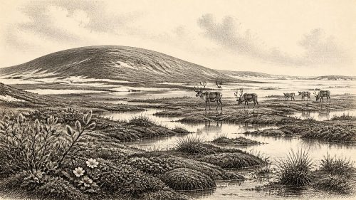
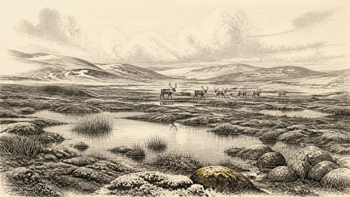
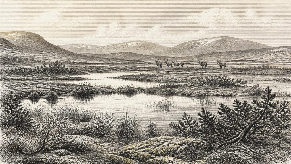
Pollen, seeds and other plant macrofossils from the Derryvree beds indicate an open, treeless landscape rather than forest. Grasses and sedges were prominent, alongside herbs and low-growing shrubs. Finds including dwarf willow, juniper, mountain-avens, bogbean and aquatic water-milfoil point to a varied tundra or muskeg environment: wet ground, mossy margins, shallow pools and patches of better-drained vegetation. Such a setting would have changed seasonally, with a short growing period, cold winters and local waterlogged ground. It was not a featureless white desert, but neither was it a mild, wooded Ireland.
Fossil insects strengthen that picture. Beetle evidence has been read as indicating plant-rich wet ground and open pools bordered by mosses. These tiny remains matter because they are locally derived and often sensitive to habitat. They support the interpretation of a cold, exposed wetland mosaic, rather than allowing a reconstruction based on pollen alone. Yet even this evidence has limits. A sediment layer represents accumulated material, possibly over centuries or longer; it cannot tell us whether a particular summer near 31,167 BCE was wet, whether a pond froze early, or where every plant grew.
Climate in Motion
Ireland at this time belonged to the Atlantic fringe of north-west Europe, where climate could shift sharply on millennial and shorter scales. The Greenland ice cores record repeated alternations between colder stadials and comparatively milder Greenland Interstadials during MIS 3. Irish evidence cannot be matched confidently to a particular ice-core year, but it does show that the island responded to such instability. The Derryvree wetland records a phase sufficiently ameliorated for standing fresh water and vegetation. It does not demonstrate a warm climate by modern standards.
Crag Cave in County Kerry offers complementary evidence. Uranium-thorium dating of calcite formations shows that speleothems in this shallow limestone cave grew episodically during MIS 3. Their formation required infiltrating liquid water and conditions in which the local mean annual temperature was plausibly above freezing. Periods when growth ceased signal harsher conditions, though cave hydrology also matters. Together, Derryvree and Crag Cave show an Ireland that alternated between habitable cold landscapes and more severe phases, well before the island became wholly engulfed during the Last Glacial Maximum.
The later maximum of the British–Irish Ice Sheet should not be projected backwards without qualification. Research places its broad maximum considerably later, around 27,000–23,000 years ago in the Irish sector, with ice reaching the continental shelf around much of the island. Around the Derryvree interval, ice margins and ice-free terrain probably varied regionally and through time. The older and younger tills at Derryvree demonstrate glacial activity on either side of its wetland phase, but they do not provide a map of Ireland for 31,167 BCE. The correct image is one of change, not a single fixed ice boundary.
Animals and the Cave Record
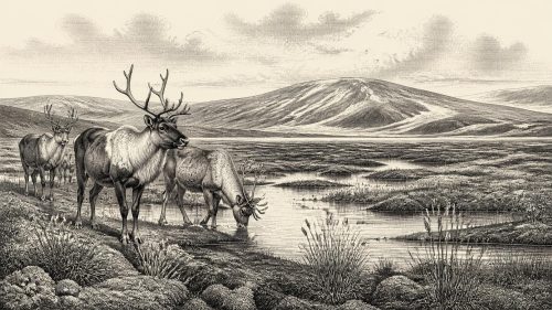
Caves in southern Ireland preserve a second, very different archive. Castlepook Cave near Doneraile, County Cork, has yielded remains of woolly mammoth, reindeer, giant deer, brown bear, wolf, Arctic fox, lemmings and spotted hyaena. This is striking evidence that parts of Ireland supported, at different times within MIS 3, a cold-climate mammal community with large herbivores, predators and scavengers. Reindeer and mammoth evoke open country; lemmings and Arctic fox underline the northern character of the fauna. The cave itself may have served as a den, shelter or trap, rather than a cross-section of the living countryside.
The dates and associations require care. Much Castlepook material was collected during early excavations, before modern recording standards, and later work has shown that some older radiocarbon results needed reconsideration. Improved pretreatment and redating place parts of the assemblage earlier within MIS 3 than once thought. Individual bones may differ markedly in age, and an animal found in a cave need not have died nearby or during the same season as another. The assemblage therefore illuminates the kinds of animals able to reach and use Ireland in this broad phase, not a guaranteed animal census for 31,167 BCE.
Predators shaped this animal world. Spotted hyaenas could accumulate bones through hunting, scavenging and denning, while bears, wolves and natural processes also altered carcasses. Tooth marks, breakage and the cave setting complicate any simple story of prey and predator. The wider inference is nevertheless secure: Ireland was not biologically empty throughout MIS 3. At intervals, substantial mammals crossed or occupied its changing landscapes. Lower sea levels altered coastlines and exposed large areas of continental shelf, although the precise routes and periods of access remain matters for geological reconstruction rather than assumptions about an uninterrupted land bridge.
No Recoverable Human Society
There is no securely dated settlement, hearth, stone-tool assemblage, human burial or built structure from Ireland that can be assigned to this period. Consequently, political affairs, diplomacy, warfare, law, languages, named communities and institutions cannot responsibly be described. There is likewise no basis for reconstructing an Irish religion, art tradition, teaching system, domestic routine or exchange network in 31,167 BCE. Absence of evidence is not proof that no person ever reached the island during the wider Upper Palaeolithic; it is a statement about what the surviving Irish record currently demonstrates.
The earliest published direct evidence interpreted as human activity in Ireland is vastly later: cut marks on a brown-bear patella from Alice and Gwendoline Cave, County Clare, radiocarbon dated to roughly 12,800–12,600 calendar years BP. That important Late Upper Palaeolithic find concerns a different landscape after the Last Glacial Maximum and cannot be used to populate MIS 3 Ireland retrospectively. Claims based on apparently marked animal bones from much older deposits demand especially stringent tests, including secure dating, microscopic analysis and archaeological context. A cut or scrape alone cannot establish a settlement.
For that reason, there can be no human economy to describe at this date. The wetland’s primary productivity supported insects and perhaps grazing animals; carnivores and scavengers participated in food webs visible through bone accumulations. But hunting, trade, seasonal camps, clothing, boats and social relations belong to hypothetical visitors unless direct evidence appears. The archaeology is stronger when it reconstructs ecosystems than when it invents people to inhabit them.
An Island Before History
The most meaningful development around 31,167 BCE was environmental, not political. Ireland lay in a fluctuating Late Pleistocene world where ice advanced and retreated regionally, freshwater wetlands briefly developed, caves received animal remains and open vegetation colonised cold ground. Derryvree preserves the clearest local testimony: a living wetland existed between glacial episodes in Fermanagh across a calibrated range that includes this notional year. Castlepook and Crag Cave broaden the scene into one of mobile fauna and episodic climatic improvement.
This is not yet Ireland as a society, kingdom or nation. It is Ireland as terrain, water, plants, animals and shifting ice: a landscape repeatedly made available, transformed and partly erased by climatic change. Its sparse evidence deserves precision precisely because it is so old. Around 31,167 BCE, the island’s recoverable past is a palaeoecological record, and its most eloquent witnesses are buried silts, pollen grains, beetle fragments, calcite and bone.
Primary Sources
- A Middle Midlandian Freshwater Series at Derryvree, Maguiresbridge, County Fermanagh, Northern Ireland
- Episodic Speleothem Deposition Tracks the Terrestrial Impact of Millennial-Scale Last Glacial Climate Variability in SW Ireland
- A Reconsideration of the Radiocarbon Dating of the Marine Isotope Stage 3 Fauna from Southern Ireland
- The Irish Quaternary Fauna Project
- Occurrence of Mammalia Relicts at Site Castlepook Cave
- Archaeological Heritage of County Cork
- Outreach and Education Resources
- Late Pleistocene Chronostratigraphy and Ice Sheet Limits, Southern Ireland
- Pattern and Timing of Retreat of the Last British-Irish Ice Sheet
- Maximum Extent and Dynamic Behaviour of the Last British-Irish Ice Sheet West of Ireland
- The Deglaciation of the Western Sector of the Irish Ice Sheet from the Inner Continental Shelf to its Terrestrial Margin
- Trimlines, Blockfields and the Vertical Extent of the Last Ice Sheet in Southern Ireland
- New Age Constraints for the Maximum Extent of the Last British-Irish Ice Sheet (NW Sector)
- Stratigraphic and Palaeo-Geomorphological Evidence for the Glacial-Deglacial History of the Last British-Irish Ice Sheet in the North-Western Irish Sea
- Dimensions and Chronology of the Last Ice Sheet in Western Ireland
- First Evidence of a Late Upper Palaeolithic Human Presence in Ireland
- First Evidence of a Late Upper Palaeolithic Human Presence in Ireland
- New Insights on the Fauna of Ireland's Younger Dryas and Early Holocene from Alice & Gwendoline Cave
- The Colonization of Ireland: A Human Ecology Perspective
- The IntCal20 Northern Hemisphere Radiocarbon Age Calibration Curve (0–55 cal kBP)
- A Stratigraphic Framework for Abrupt Climatic Changes During the Last Glacial Period Based on Three Synchronized Greenland Ice-Core Records
- Spatio-Temporal Dynamics of Speleothem Growth and Glaciation in the British Isles