

Fermanagh’s Last Open Wetland31168 BCE
Around 31,168 BCE, Ireland’s history is reconstructed from environmental rather than human evidence. At Derryvree, County Fermanagh, freshwater silts and organic deposits, trapped between glacial tills, record a temporary ice-free interval within MIS 3. Mosses, pollen, sedges and insects reveal cold, open tundra with local pools and marshes, before renewed ice advance buried the wetland. Cave bones show that mammoth, reindeer, giant deer, bear and hyaena formed part of the wider Ice Age fauna, although not necessarily contemporaneously. Possible human cutmarks at Castlepook Cave suggest visits, but sustained occupation remains unproven. Expanding ice reshaped Ireland towards the Last Glacial Maximum.
Dateline
The label 31,168 BCE cannot identify an Irish event, ruler, battle or community in the way a later historical year can. It is a modern conversion, roughly 33,100 calendar years before the 1950 baseline used by radiocarbon specialists. At this depth of time, modern calendar-year precision is unavailable. The responsible subject is a broad Late Pleistocene interval, within Marine Isotope Stage 3 (MIS 3), reconstructed from sediments, pollen, plant and insect remains, animal bones, caves and the landforms made by ice.
The closest unusually informative Irish record comes from Derryvree townland, near Maguiresbridge in present-day County Fermanagh. It does not date a single year. Organic freshwater silts and fine sands there produced the radiocarbon determination BIRM-166, conventionally reported as 30,500 radiocarbon years before present, with a substantial uncertainty. Published calibration places it broadly between about 36,900 and 31,700 calibrated years before present: approximately 34,950–29,750 BCE. The requested year falls inside that broad range, but not at a point science can isolate. Derryvree therefore illuminates conditions around this era, rather than proving that a particular pool, animal or human action occurred in 31,168 BCE.
A Wetland Between Two Glaciers
The value of Derryvree lies first in its physical sequence. Roadworks in 1969 cut through a drumlin and revealed freshwater deposits enclosed between two thick tills, the unsorted debris laid down directly by glacier ice. The order of layers is decisive evidence. Ice had earlier crossed the locality; ice-free or at least locally glacier-free conditions then allowed water, silt, sand and organic material to accumulate; later ice buried the wetland beneath a fresh sheet of till. This is not a picturesque hypothesis but an observed stratigraphy. It also explains why the site matters: a short-lived and fragile environmental archive was sealed beneath the landscape created by a later glacial advance.
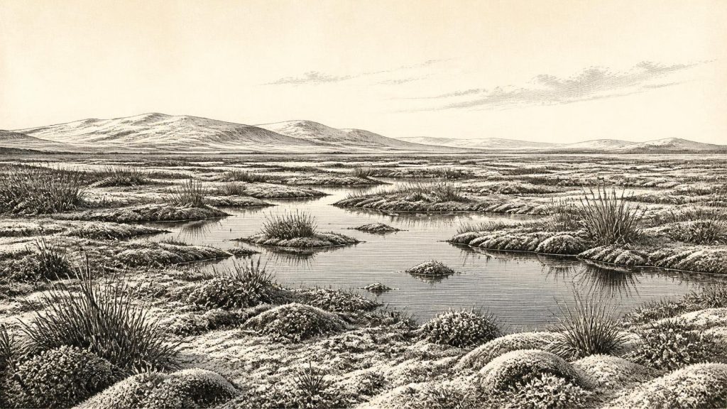
The Derryvree flora and fauna indicate a cold, periglacial setting with open tundra vegetation. Moss macrofossils, herb pollen, sedges and wetland plants point to waterlogged ground and shallow fresh water amid largely treeless country. The original investigators found botanical evidence of exceptional importance because it offered a direct glimpse of Irish Ice Age vegetation, rather than relying only on broad analogy with Britain or continental Europe. The landscape was not a continuous white desert. In favourable hollows, meltwater and groundwater could sustain pools, marshy margins and moss-rich ground during a brief growing season, while exposed terrain beyond them was sparse, windy and subject to frost.
That reconstruction must remain local. Derryvree shows what existed near Maguiresbridge during part of an interval; it cannot furnish a weather report for the entire island, let alone a map for a single year. Still, it fits wider evidence that much of Ireland was not yet covered by the fully developed last Irish Ice Sheet at the beginning of its major expansion. Other Fermanagh deposits, including organic material at Greenagho, and evidence from the western seaboard indicate ice-free phases before the ice sheet grew dramatically. Later, the Last Glacial Maximum transformed the situation: ice extended across almost all low ground, and in several sectors reached far offshore. The Ireland of the early thirties of millennia BCE was thus a landscape in transition towards much more extensive glaciation, not simply ‘before the Ice Age’.
Animals and Their Limits
Animal remains provide a second, unevenly distributed line of evidence. Castlepook Cave, near Doneraile in County Cork, is Ireland’s richest known repository of vertebrate remains from the period leading towards the Last Glacial Maximum. Its deposits have produced bones attributed to woolly mammoth, giant deer, reindeer, brown bear and spotted hyaena, while later Ice Age layers contain lemmings, Arctic fox and wolf. These species demonstrate that, during parts of the Middle and Late Pleistocene, Ireland could sustain or receive animals adapted to open, cold environments as well as larger herbivores and their predators.
Yet Castlepook is a cave repository accumulated over many millennia, not a census of animals alive together in one valley. Bones were introduced by carnivores, water, natural deaths and earlier excavations; parts of the deposit were disturbed. Individual radiocarbon dates span a very long period. It is therefore sound to say that reindeer, mammoth, giant deer and hyaena belong to the wider Irish Ice Age faunal record, but unsound to assemble them into a single, precise herd scene for 31,168 BCE. The same caution applies to routes of animal movement. Lower global sea levels altered coastlines and exposed areas now underwater, but present evidence cannot reconstruct one certain crossing route into Ireland at this date.
The ecological implications are nevertheless substantial. Reindeer favour open ground and could exploit lichens, herbs and grasses; large herbivores required extensive feeding ranges; predators and scavengers followed different opportunities. The Derryvree wetland, meanwhile, was a small but productive refuge for plants, insects and freshwater life. Such mosaics mattered in a cold world. They supplied forage, water and shelter at a local scale, while the severe seasonality inferred from the plants and periglacial setting imposed hard limits on population sizes and permanence. Ireland was not an agricultural landscape, nor one divided into fields, estates or tribal territories visible to us.
The Human Question
There are no securely excavated settlements, hearths, burials, stone-tool assemblages or written traces that permit a history of an Irish population at this time. Accordingly, there is no evidential basis for political affairs, diplomacy, warfare, formal religion, teaching institutions, trade networks or named cultural groups in 31,168 BCE. These absences are not minor gaps in an otherwise familiar story: they define the story. No state, kingdom, language community or ancestral people can responsibly be projected backwards from later Irish history into this period.
One claim deserves careful notice because it lies close to the requested date. A reindeer femur from Castlepook has been publicly reported as bearing an incision interpreted as a sharp stone-tool cutmark, with the bone described as about 33,000 years old. If the surface mark is confirmed as human-made and contemporary with the animal’s death, it may represent an exceptionally early sign of carcass processing in Ireland. It would suggest a brief visit by hunter-gatherers, not a settled society. A cut on one bone cannot show whether people hunted the animal, scavenged it, travelled regularly to the island, exchanged goods, made a camp nearby or left descendants.
The qualification is essential. The cave’s old and disturbed collections lack the securely associated hearth, tools and occupation surface that would turn an isolated modified bone into a well-contextualised site. National cultural guidance has long stated that clear evidence for human presence in Ireland during the Palaeolithic has not emerged, while recent archaeological discussions treat possible Upper Palaeolithic evidence as intriguing but limited. The prudent conclusion is therefore twofold: humans may have reached Ireland during the wider period, but sustained occupation at 31,168 BCE is unproven. The far better-attested Mesolithic settlement belongs tens of millennia later, after the final great ice retreat.
Society Without a Chronicle
If people did visit, their everyday economy would have depended on immediate access to animal, plant and mineral resources: meat, fat, marrow, hides, sinew, bone, fuel and perhaps workable stone. That is an inference from hunter-gatherer lifeways and the available fauna, not direct evidence of a particular Irish camp. There is no basis for estimating population, household form, gender roles, ritual practice, art, language or learning. Nor should the sophisticated Upper Palaeolithic cultures known elsewhere in Europe be treated as automatically present in Ireland. Similar age is not proof of contact, migration or shared custom.
What can be said is that environmental change was the dominant historical force. Across the wider British–Irish Ice Sheet system, ice expanded asynchronously between roughly 30,000 and 22,000 years ago, before reaching a maximum volume around 23,000 years ago. Derryvree’s wetland belongs to the earlier, unstable part of that long transformation. Subsequent glacial advance erased, reworked or entombed many older surfaces and any fragile traces people might have left. This helps explain why the archaeological record is so scant, though it cannot turn missing evidence into proof of people.
For Ireland around this notional year, then, the central development was neither a human deed nor a political change. It was an interval of cold, open, locally wet country between glacial episodes: a Fermanagh freshwater habitat later sealed beneath ice, set within an island-scale shift towards the Last Glacial Maximum. Its legacy is a handful of silts, seeds, mosses, pollen grains, insects, bones and landforms. They provide a real history, but one whose authority depends on resisting the tempting invention of an exact annual past.
Primary Sources
- A Middle Midlandian Freshwater Series at Derryvree, Maguiresbridge, County Fermanagh, Northern Ireland
- Palaeoecology
- Trimlines, Blockfields and the Vertical Extent of the Last Ice Sheet in Southern Ireland
- Growth and Retreat of the Last British–Irish Ice Sheet, 31,000 to 15,000 Years Ago: The BRITICE-CHRONO Reconstruction
- Late Pleistocene Chronostratigraphy and Ice Sheet Limits, Southern Ireland
- Exploring Controls of the Early and Stepped Deglaciation on the Western Margin of the British Irish Ice Sheet
- Dimensions and Chronology of the Last Ice Sheet in Western Ireland
- Extent and Deglacial Chronology of the Last British–Irish Ice Sheet: Implications of Exposure Dating Using Cosmogenic Isotopes
- The Irish Quaternary Fauna Project
- Castlepook Cave: County Geological Site Report
- The Exploration of Castlepook Cave, Co. Cork
- Quaternary Site Descriptions
- Quaternary
- Prehistoric Details: Mell Flint Flake
- First Evidence of a Late Upper Palaeolithic Human Presence in Ireland
- Revisiting Alice and Gwendoline Cave, Co. Clare: New Light on the 1902 Excavations
- New Insights on the Fauna of Ireland’s Younger Dryas and Early Holocene from Alice & Gwendoline Cave
- Ireland: Submerged Prehistoric Sites and Landscapes
- The IntCal20 Northern Hemisphere Radiocarbon Age Calibration Curve (0–55 cal kBP)
- IntCal Publications
- Stratigraphic and Palaeo-Geomorphological Evidence for the Glacial-Deglacial History of the Last British-Irish Ice Sheet in the North-Western Irish Sea
- Radiocarbon Constraints on the Age of the Maximum Advance of the British-Irish Ice Sheet in the Celtic Sea
- Archaeology Research Excavation Grant 2022: Final Report





