

Derryvree’s Willow Marsh31190 BCE
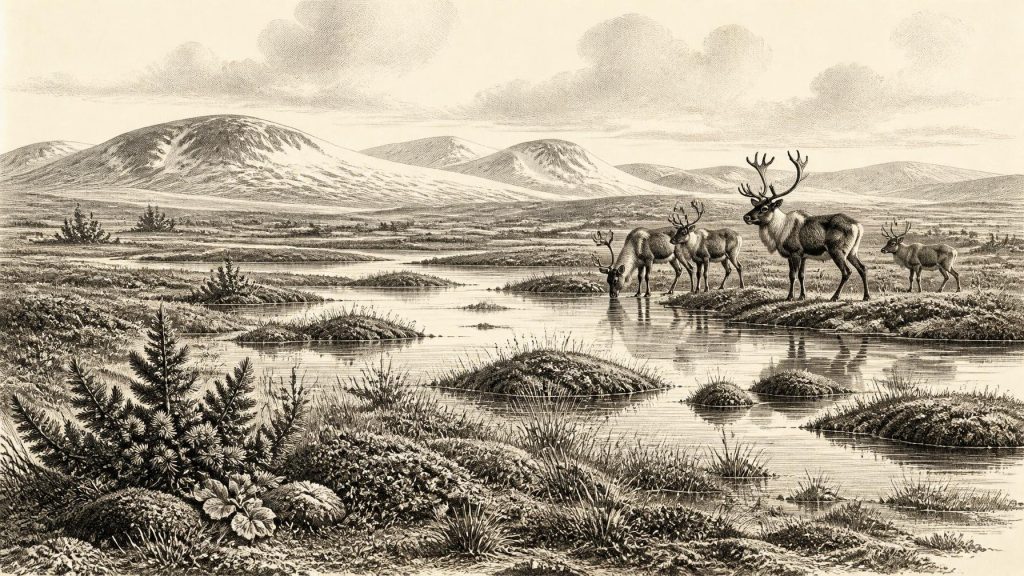
31,190 BCE is a modern label within a broad Late Pleistocene range, not a recoverable Irish year. At Derryvree, County Fermanagh, organic freshwater sediments between two tills demonstrate a local ice-free interval, supporting a treeless, periglacial wetland of sedges, grasses, mosses, herbs, juniper and insects. Castlepook Cave, County Cork, preserves mixed remains of cold-stage mammals, including mammoth, reindeer and hyaena, but cannot reconstruct a contemporary fauna. A potentially cut-marked reindeer bone suggests, without proving, brief human presence. No settlements, polities or trade are evidenced. Advancing ice later reshaped Ireland and erased much evidence from this remote period across the island.
Dateline
The label 31,190 BCE is a modern chronological convenience, not a year that can be recovered from an Irish record. Nobody on the island used this calendar; no written source, settlement layer or dated event can identify a particular season, journey or death at that precision. In radiocarbon convention it falls about 33,139 years before AD 1950, within the Late Pleistocene and Marine Isotope Stage 3, a long, climatically volatile part of the last Ice Age. The responsible history of Ireland at this point is therefore one of calibrated ranges, buried sediments, fossil animals and changing ice, rather than rulers, wars or institutions.
The closest securely relevant Irish chronological anchor comes from Derryvree near Maguiresbridge, County Fermanagh. Organic freshwater silts and fine sands there produced a radiocarbon age of 30,500 ± roughly 1,100 radiocarbon years BP. Older published calibrations place this deposit broadly between about 36,900 and 31,700 calibrated years BP, equivalent to approximately 34,950–29,750 BCE. The notional date considered here lies within that wide range. It does not mean that the entire deposit, still less an identifiable human action, belongs to 31,190 BCE. Calibration curves translate radiocarbon measurements into calendar ranges because atmospheric carbon-14 has varied over time; at this antiquity, ranges remain broad and must be treated as such.
Freshwater Between the Ice
Derryvree is important because its stratigraphy preserves a sequence of environmental transformation. Roadworks exposed a drumlin cut by two deposits of till, the unsorted sediment left by glacier ice. Between them lay the organic freshwater bed. The order of these layers is direct evidence that ice had covered the locality, then retreated or ceased to occupy it long enough for water, plants, insects and fine sediment to accumulate, before ice returned and sealed the record beneath renewed glacial material. This is not a picture of all Ireland at one time, but it is unusually strong evidence for local ice-free conditions in north-central Ireland during a cold interval.
The plant and animal traces in the Derryvree sediments point to a treeless, periglacial wetland rather than a forested landscape. Pollen, plant macrofossils, mosses and beetles indicate grasses, sedges, herbs, juniper and cold-adapted aquatic and marsh vegetation. The old term muskeg is useful if used carefully: it conveys waterlogged ground rich in moss and plant matter, with pools and wet hollows, not a modern peat bog copied unchanged into the past. Open water must have persisted seasonally or locally for freshwater organisms and sediment to accumulate. Yet the surrounding country was severe, exposed and without the closed woodland familiar from later Irish prehistory.
At this date Ireland should not be imagined as a fixed white wilderness. The island’s climate and glacier margins changed over long spans and differed between regions. Derryvree demonstrates that a locality now in Fermanagh could sustain a cold freshwater ecosystem during an interval framed by glaciation. Greenagho, also in Fermanagh, preserves another organic deposit beneath till whose dates show that ice-free phases occurred in the wider region. Cave calcite records, glacial landforms and later dating programmes add to the picture of a landscape repeatedly reorganised by cold, water and ice. They do not support a simple claim that every part of Ireland was either wholly ice-covered or wholly habitable at the same moment.
An Open Northern Landscape
The evidence permits a restrained reconstruction of everyday ecology. Around wetland pools at Derryvree, sedges and other low plants could root in saturated ground; mosses and shallow-water species occupied suitable niches; beetles moved among decaying vegetation and exposed soil. Beyond the wetter places, wind and frost would have favoured short, discontinuous plant cover. Juniper pollen does not prove a dense juniper scrub, but it suggests that woody plants could survive somewhere in the local or regional landscape. There is no basis for portraying the area as productive farmland, thick woodland or a settled lakeside community.
Seasonality probably shaped everything. Long cold winters, frozen or waterlogged ground, snow cover and strong winds would have restricted plant growth. Brighter summers could nevertheless produce brief bursts of vegetation and insect activity, and wetland corridors could be more biologically productive than exposed ground. Such variation mattered to grazing animals and any travelling people. It also explains why sediments like Derryvree’s are so valuable: a small basin could retain evidence of life that later ice advances stripped from hillsides and valley floors.
Caves and Cold-Stage Animals
County Cork’s Castlepook Cave, near Doneraile, supplies a second, very different archive. Its old collections include remains attributed to mammoth, reindeer, giant deer, brown bear, wolf, Arctic fox, mountain hare, lemmings and spotted hyaena. Direct radiocarbon dating undertaken through the Irish Quaternary Fauna Project showed that a wide range of mammals reached Ireland between at least about 45,000 and 20,000 years ago. Some Castlepook specimens belong to the broad pre-Last Glacial Maximum span relevant to 31,190 BCE. Reindeer, mammoth and spotted hyaena are especially evocative evidence that Ireland was connected ecologically to the wider north-west European cold-stage world.
But a cave-bone assemblage is not a census of animals standing together on one day. Castlepook was investigated largely in the late nineteenth and early twentieth centuries, when excavation and recording standards were very different; collections were later reduced, moved and reassessed. Water action mixed bones of different ages, while carnivores, natural traps and other processes may have contributed to their accumulation. Hyaenas may have used parts of the cave as dens. Thus, the fossils prove that these species occurred in Ireland across a long period, but cannot safely establish the exact composition of a 31,190 BCE herd, hunting ground or predator community.
The Human Question
The most provocative item is a reindeer femur from Castlepook, examined by the zooarchaeologist Ruth Carden. A deep surface mark has been interpreted as consistent with cutting by a sharp stone tool during carcass processing, and Cork heritage material has associated the bone broadly with about 31,000 BCE. If that interpretation and dating are sustained, it would indicate that people reached Ireland far earlier than the formerly secure evidence for terminal-Pleistocene human activity. It would be an important sign of a brief Upper Palaeolithic presence in a cold, animal-rich landscape.
It remains essential, however, to state what this single bone cannot show. No securely associated hearth, stone-tool assemblage, dwelling floor, burial, art panel, human bone or intact occupation surface of comparable age has been identified in Ireland. The cave’s disturbed, time-mixed deposits make association difficult. A cut mark on a reindeer limb, even if human-made, demonstrates a limited act of carcass processing, not permanent residence, population size, language, ancestry or social organisation. It cannot tell us whether visitors arrived repeatedly, followed migrating prey, crossed during a particular season, or left descendants. The National Museum of Ireland’s cautious public account still notes the absence of clear Palaeolithic evidence for humankind on the island.
No Polities, No Proven Trade
Accordingly, political affairs, diplomacy and warfare cannot be reconstructed for Ireland in this period. There is no evidence for chiefs, kingdoms, tribal names, territorial boundaries, treaties or organised conflict. Nor is there Irish evidence at this date for farming, domesticated animals, pottery, monuments, metalworking, formal religion or writing. If people were present, the most defensible inference is of very small, mobile foraging parties with a capacity to use stone cutting edges and exploit animal resources. Even that is conditional on the Castlepook incision being confirmed as a human cut mark.
Trade is equally unproven. Ireland’s fauna demonstrates that animals could reach the island or its then-changing margins from the wider British and European world, but animal movement is not evidence of human exchange. Low sea levels altered coastlines substantially, and later rising seas submerged many potential routes and coastal sites. Yet neither a route nor a land connection should be presumed for a particular year. The mechanisms by which animals, and perhaps people, moved to and from Ireland remain questions of palaeogeography and chronology rather than established travel history.
The Approach of Greater Ice
Although 31,190 BCE preceded the fullest expansion of the Last Glacial Maximum, it belongs to the longer build-up towards it. Modern reconstructions of the British–Irish Ice Sheet show that its sectors advanced asynchronously, with major growth between roughly 30,000 and 22,000 years ago and maximum ice volume around 23,000 years ago. Later ice profoundly reshaped Ireland: it eroded surfaces, displaced sediments, buried organic beds and removed much of the archaeological evidence that a less glaciated landscape might have retained. Derryvree survived precisely because its wetland deposit was sealed between tills.
For this reason, Ireland around 31,190 BCE is not a blank page, but neither is it an annual chronicle. Derryvree’s willow-and-sedge wetland, Castlepook’s cold-stage animals and the approaching expansion of ice provide a grounded picture: a sparsely evidenced, open and seasonally demanding landscape, intermittently capable of supporting freshwater life and large mammals. A possible human trace invites investigation, not certainty. The central historical fact is environmental change on a scale that would determine what evidence endured at all.
Primary Sources
- A Middle Midlandian Freshwater Series at Derryvree, Maguiresbridge, County Fermanagh, Northern Ireland
- The Quaternary History of Ireland: A Field Guide
- The Subdivision of the Quaternary Period in Ireland
- Prehistoric Details: Stone Age
- The Irish Quaternary Fauna Project
- The Irish Quaternary Fauna Project
- Trimlines, Blockfields and the Vertical Extent of the Last Ice Sheet in Southern Ireland
- Growth and Retreat of the Last British–Irish Ice Sheet, 31,000 to 15,000 Years Ago: the BRITICE-CHRONO Reconstruction
- Last Glacial Maximum Cirque Glaciation in Ireland and Implications for Reconstructions of the Irish Ice Sheet
- New Data for the Last Glacial Maximum in Great Britain and Ireland
- Phylogeographic, Ancient DNA, Fossil and Morphometric Analyses Reveal Ancient and Modern Introductions of a Large Mammal: the Complex Case of Red Deer (Cervus elaphus) in Ireland
- Origin of British and Irish Mammals: Disparate Post-Glacial Colonisation and Species Introductions
- New Insights on the Fauna of Ireland’s Younger Dryas and Early Holocene from Alice & Gwendoline Cave
- New Insights on the Fauna of Ireland’s Younger Dryas and Early Holocene from Alice & Gwendoline Cave
- The IntCal20 Northern Hemisphere Radiocarbon Age Calibration Curve (0–55 cal kBP)
- The IntCal20 Northern Hemisphere Radiocarbon Age Calibration Curve (0–55 cal kBP)
- The Last Glacial Maximum
- A Critical Review and Re-Investigation of the Pleistocene Deposits of Northern Ireland
- A Palaeo-Glaciological Reconstruction of the Irish Ice Sheet
- The Quaternary History of Ireland
- Heritage Artefacts of County Cork
- Outreach and Education Resources