
Maguirebridge’s Tundra Reedbed30984 BCE
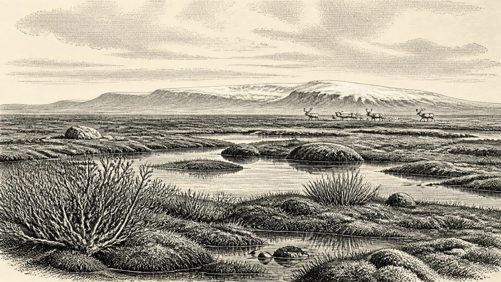
Around 30,984 BCE, Ireland lay within the climatically unstable later Marine Isotope Stage 3, without written history or securely dated human settlement. At Derryvree near Maguiresbridge, organic silts between till sheets record an ice-free interval with shallow water, wetlands and open, tundra-like vegetation. Cave deposits, especially Castlepook, preserve evidence of reindeer, deer and other mammals, though their dates and associations remain uncertain. A possibly butchered reindeer bone suggests transient human activity, but cannot prove occupation. As the British–Irish Ice Sheet expanded, shifting ice margins and lower sea levels reshaped habitats and access to Ireland. The evidence supports cautious environmental reconstruction.
Dateline
“30,984 BCE” is a useful modern label, but it cannot describe a dated Irish event in the way that a later historical year can. No written record, settlement sequence or scientific chronology can resolve one particular calendar year at this depth of time. In calendar terms it falls roughly 32,900 years before AD 1950, within the later part of Marine Isotope Stage 3 (MIS 3), a long and climatically unstable phase of the last Ice Age. The responsible approach is therefore to examine dated ranges and stratified evidence that illuminate Ireland around this broad interval, rather than inventing a happening for the numbered year.
A Landscape Without Annals
Ireland at this time had no known kingdoms, borders, leaders, diplomacy or historical communities in the usual sense. There was no agriculture, metalwork, pottery, monument building or writing. There is also no securely identified house, hearth, burial ground or tool-making floor in Ireland that can be assigned to 30,984 BCE. Political history is consequently silent, not because prehistoric people necessarily lacked social relationships, but because the surviving evidence does not reveal institutions or named groups.
What survives instead is a difficult archive of cave bone, freshwater silt, fossil plants, insects, glacial sediment and landforms. Each preserves a different part of the past. A bone may demonstrate that an animal lived in Ireland, but not that every species found in the same cave lived together. A bed of silt can record shallow water and vegetation near one former pool, but not the weather of the whole island. Ice-scoured hills and offshore moraines show that ice moved across large regions, but their dates commonly constrain intervals rather than a single season or generation. Around 30,984 BCE, this distinction between evidence and interpretation is fundamental.
The Derryvree Evidence
The most informative Irish environmental record for the broader period lies at Derryvree, near Maguiresbridge in County Fermanagh. Road works there exposed organic silts and fine sands trapped between two thick sheets of till within a drumlin. This sequence matters because it records a non-glacial interval: after one episode of ice deposition and before another advance sealed the deposits beneath fresh till, open water and wet ground existed at the site.
The original radiocarbon determination from the Derryvree organic beds was 30,500 radiocarbon years before present, with a substantial uncertainty of +1,170 and −1,030 years. That is not the same thing as a precise calendar age, and it cannot identify 30,984 BCE itself. Radiocarbon ages of this antiquity need calibration and carry broad ranges. Yet the stratigraphy securely establishes the important point: at some stage during the Middle Midlandian, broadly within MIS 3, part of Fermanagh was ice-free long enough for freshwater sediment and organic matter to accumulate, before later ice overrode it.
The fossil assemblage gives that interval its character. Mosses, sedges and other wetland plants, alongside bogbean, water-milfoil, dwarf willow and mountain-avens, indicate shallow water, saturated ground and open, largely treeless vegetation. Insects and plant remains point to a cold periglacial regime rather than woodland or temperate pasture. The best picture is not of a uniformly blank, snow-covered island, but of a local mosaic: pools, marshy margins, sedge-rich ground and low tundra-like vegetation exposed to severe winters and short growing seasons.
Derryvree should not be made to stand for all Ireland. It is a small, local archive in northern Ireland, and its preservation between tills tells a story of changing ice margins rather than long-term stability. Still, it is one of the clearest demonstrations that late Pleistocene Ireland contained ecologically productive refuges or intervals of open ground amid a broader world becoming increasingly glacial.
Fauna at the Atlantic Edge
Irish cave deposits show that large mammals and carnivores reached the island during MIS 3, although the dates and associations of older collections must be handled carefully. Castlepook Cave near Doneraile in north Cork is especially important. Excavated largely in the late nineteenth and early twentieth centuries, it produced an exceptional collection of bones attributed to animals including reindeer, wolf, fox, hare, spotted hyaena, mammoth and giant deer. The cave was used and disturbed over long periods; many specimens lack the fine stratigraphic context expected of modern excavation.
Recent reappraisal has sharpened this warning. Improved pretreatment and radiocarbon methods have shown that some older determinations for southern Irish MIS 3 fauna are unreliable or require revision. The result is not that the animals vanish from the record, but that apparent single “assemblages” cannot automatically be treated as one living community. Mammoth, hyaena, reindeer and giant deer remains may represent different episodes, conditions and routes into Ireland. The presence of carnivore bones can reflect denning, scavenging or the transport of prey into caves, rather than an ordinary view of the open landscape.
There are, however, securely dated indications of large deer in Ireland close to the broad time under discussion. A study of Irish red deer remains identified two pre-Last Glacial Maximum samples from County Waterford caves calibrated to 32,930–31,280 and 30,297–29,594 calendar years before present. These ranges are much more useful than a nominal year: they demonstrate that deer occurred in south-eastern Ireland during late MIS 3, while also making clear that the precise relationship of any one animal to Derryvree, Castlepook or 30,984 BCE cannot be known.
Reindeer are particularly compatible with the open-country setting suggested by Derryvree. They were adapted to cold, sparsely wooded environments and could have ranged across broad tracts of grass-, herb- and shrub-rich terrain. Their fossil presence does not prove regular migration routes through every Irish region, but it confirms that Ireland was connected, at least intermittently, to the wider animal world of north-west Europe. Lower sea levels altered coastlines and passages, while advancing and retreating ice repeatedly changed accessible terrain. It would be unsafe, however, to claim a known land bridge or a specific crossing route for this date.
The Human Question
The possibility of people in Ireland during this period rests chiefly on a much-debated reindeer bone from Castlepook. A modified reindeer femur has been reported to carry marks consistent with butchery by a stone tool and to date to roughly 33,000 years ago. If the marks are demonstrably human-made and contemporary with the animal’s death, the specimen would push evidence for human activity in Ireland far earlier than the long-accepted post-glacial record.
That conditional language matters. One marked bone, recovered from an old cave collection without a modern excavation context, is not evidence for a settled population, a camp, a family group or a continuous Irish Palaeolithic tradition. No associated hearth, lithic assemblage, dwelling surface, human bone or burial currently supplies that missing context. Nor can this evidence identify the language, identity, beliefs or social organisation of any visitors. It supports, at most, a cautious possibility that people handled and butchered a reindeer in Ireland during a late MIS 3 episode.
If humans were present, comparison with Upper Palaeolithic groups elsewhere in north-west Europe suggests highly mobile hunter-gatherers able to exploit animal carcasses, hides, marrow and sinew, and to move through seasonally demanding landscapes. This is an informed analogy, not direct Irish proof. It cannot establish whether people hunted the animal, found it dead, arrived by boat, crossed temporary terrestrial connections, or stayed for days rather than years. For this period, “economy” means animal and plant resources visible in the environmental record, not a demonstrable Irish trading system or settled livelihood.
Ice Sheet Build-Up
By the time represented by the modern year 30,984 BCE, Ireland was moving towards the major glacial conditions of the Last Glacial Maximum. The British–Irish Ice Sheet did not expand everywhere at once, and later ice margins were highly asynchronous. Modern reconstructions show major Irish and British ice growth during the interval after about 31,000 years ago, with maximum Irish extent achieved much later, around 27,000–26,000 years ago in several western and south-western sectors. Ice subsequently reached the continental shelf edge west of Ireland, while fast-flowing outlet systems developed in places.
Those later reconstructions should not be projected too mechanically backwards. They do show why Derryvree’s position between two tills is so valuable: its wetland was part of a changing glacial landscape, not an isolated curiosity. Farther west, mountain evidence and offshore sediment cores reveal the scale eventually reached by Irish ice. Yet the precise extent of ice on any particular Irish coast or upland at 30,984 BCE remains unresolved. Regional variation was considerable, and dated evidence is much denser for the maximum and retreat than for the preceding build-up.
What Cannot Be Recovered
Religion, art, language and learning leave no secure Irish trace for this moment. A living human group may have carried stories, technical knowledge and ritual practices, but neither Derryvree’s plants nor Castlepook’s bones can recover them. Equally, there is no basis for imagining tribal territories, conflict, diplomacy or trade networks. The absence of evidence is especially acute because later glaciation eroded landscapes, buried deposits and repeatedly reshaped coasts.
The enduring historical significance of this period is therefore environmental and evidential. Around 30,984 BCE, Ireland was not an empty stage awaiting recognisable history. It was a cold, dynamic Atlantic landscape inhabited by plants and animals whose remains survive in rare pockets, while ice expanded and the routes through north-west Europe changed. The Derryvree freshwater beds demonstrate local wetland life; cave fauna demonstrate shifting ecological links; the Castlepook bone poses an important but still limited human question. Together, they permit a disciplined reconstruction of possibility, while refusing the false certainty of a year-by-year event narrative.
Primary Sources
- A Middle Midlandian Freshwater Series at Derryvree, Maguiresbridge, County Fermanagh, Northern Ireland
- A Reconsideration of the Radiocarbon Dating of the Marine Isotope Stage 3 Fauna from Southern Ireland
- The Irish Quaternary Fauna Project
- Phylogeographic, Ancient DNA, Fossil and Morphometric Analyses Reveal Ancient and Modern Introductions of a Large Mammal: the Complex Case of Red Deer (Cervus elaphus) in Ireland
- Growth and Retreat of the Last British–Irish Ice Sheet, 31,000 to 15,000 Years Ago: the BRITICE-CHRONO Reconstruction
- Maximum Extent and Dynamic Behaviour of the Last British–Irish Ice Sheet West of Ireland
- Timing and Pace of Ice-Sheet Withdrawal Across the Marine–Terrestrial Transition West of Ireland During the Last Glaciation
- The Deglaciation of the Western Sector of the Irish Ice Sheet from the Inner Continental Shelf to its Terrestrial Margin
- Exploring Controls of the Early and Stepped Deglaciation on the Western Margin of the British Irish Ice Sheet
- Oscillating Retreat of the Last British-Irish Ice Sheet on the Continental Shelf Offshore Galway Bay, Western Ireland
- Dimensions and Chronology of the Last Ice Sheet in Western Ireland
- Trimlines, Blockfields and the Vertical Extent of the Last Ice Sheet in Southern Ireland
- Deglaciation Chronology of the Donegal Ice Centre, North-West Ireland
- Reconstructing the Last Irish Ice Sheet 2: a Geomorphologically-Driven Model of Ice Sheet Growth, Retreat and Dynamics
- Radiocarbon Constraints on the Age of the Maximum Advance of the British–Irish Ice Sheet in the Celtic Sea
- Freshwater Organic Deposits and Stratified Sediments Between Early and Late Midlandian (Devensian) Till Sheets, at Aghnadarragh, County Antrim, Northern Ireland
- Mammoth and Musk Ox ESR-Dated to the Early Midlandian at Aghnadarragh, County Antrim, Northern Ireland, and the Age of the Fermanagh Stadial
- The Timing and Magnitude of the British–Irish Ice Sheet Between Marine Isotope Stages 5d and 2: Implications for Glacio-Isostatic Adjustment, High Relative Sea Levels and ‘Giant Erratic’ Emplacement
- Irish Quaternary Association: Figure 6—The Subdivision of the Quaternary Period in Ireland
- New Insights on the Fauna of Ireland’s Younger Dryas and Early Holocene from Alice & Gwendoline Cave
