

Ussher’s Reindeer Femur30985 BCE
Around 30,985 BCE, Ireland was a climatically unstable Late Pleistocene landscape, not a setting for dated historical events. Inter-till deposits at Derryvree, County Fermanagh, record a cold, treeless wetland of freshwater pools, tundra vegetation and shifting conditions between glacier advances. Southern cave deposits, especially Castlepook in County Cork, indicate fauna including reindeer, mammoth, giant deer, bears, wolves and hyaenas, although their dates and associations remain uncertain. A cut-marked reindeer femur from Castlepook may suggest human butchery, but cannot prove settlement or identify its makers. No evidence exists for Irish polities, farming, ritual or permanent communities; environmental change dominates the record.
Dateline
A Year Beyond the Calendar
30,985 BCE cannot be treated as a year in the ordinary historical sense. No written records, named individuals, political events or securely dated occupations allow an annal for this point in Ireland’s past. Modern calendar precision is unavailable. The date is best understood as a convenient position within the Late Pleistocene, during Marine Isotope Stage 3 (MIS 3), a long and climatically unstable phase of the last Ice Age.
In calendar terms, 30,985 BCE lies about 32,934 years before AD 1950, the conventional “present” used in radiocarbon reporting. Yet a radiocarbon determination does not translate into a single historical date. Carbon-14 levels in the atmosphere changed through time, samples may carry their own uncertainties, and calibration produces ranges rather than exact points. The responsible history of Ireland at this notional date is therefore an account of landscapes, animals, sediments and the extremely limited possibility of human activity, not a claim that a particular event occurred in this particular year.
The strongest Irish environmental evidence close to this horizon comes from Derryvree, near Maguiresbridge in County Fermanagh. There, roadworks exposed a remarkable deposit sealed inside a drumlin: freshwater silts, sands and organic material lay between two tills, the unsorted debris left by separate glacier advances. The sequence shows that ice had occupied the district, then withdrew or ceased to cover the immediate site long enough for water, sediment and plants to accumulate, before a later ice advance buried the deposit.
Organic material from Derryvree produced the radiocarbon determination BIRM-166, conventionally dated to about 30,500 radiocarbon years before present, with a substantial uncertainty. Later discussion places the deposit broadly around 36,900–31,700 calibrated years before present, approximately 34,950–29,750 BCE. This is a wide span, not a timestamp for a pond, a plant or an animal. It nevertheless makes Derryvree one of the best windows onto the kind of Irish environment that may have existed around 30,985 BCE.
Fresh Water Between Ice Advances
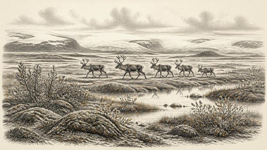
Derryvree was not a green, wooded Ireland. Pollen, plant macrofossils and insect evidence from the inter-till deposits indicate a treeless, cold environment, with open vegetation and wet ground. Mosses, sedges, dwarf shrubs and hardy arctic-alpine plants could survive around shallow pools, marshes and sluggish watercourses. Bogbean, water-milfoil and other aquatic or waterside plants show that fresh water was present; mountain-avens, dwarf willow and clubmoss point towards exposed, tundra-like ground nearby.
This should not be imagined as a uniform white wilderness. Even in severe climates, sheltered hollows, streams, thawed margins and wet basins could sustain different plant communities from the surrounding drier ground. The word “tundra” is useful only if it conveys this patchiness. Derryvree records a cold, open wetland mosaic, not an exact photograph of all Ireland. Conditions varied with altitude, distance from ice, drainage and the changing North Atlantic climate.
The two tills are equally important. They demonstrate that this landscape was precarious in geological time. An ice-free or lightly glaciated interval could be replaced by renewed ice cover, grinding, transporting and sealing sediments beneath fresh debris. Around this date the British–Irish Ice Sheet had not yet reached its later maximum extent, generally placed between roughly 26,000 and 20,000 years ago, but ice-sheet growth and regional glacier activity were already transforming the island and its surrounding seas. Ireland’s surface was a shifting frontier between ice, periglacial ground and locally habitable open country.
Animals of an Open Landscape
Southern Irish cave deposits provide a complementary, if less neatly stratified, record. Castlepook Cave, also known as Mammoth Cave, near Doneraile in north County Cork, produced bones recovered during excavations led by Richard J. Ussher in the early twentieth century. The collections include remains associated with a markedly different Ice Age fauna: reindeer, woolly mammoth, giant deer, brown bear, wolf and spotted hyaena are among the animals discussed in research on Ireland’s MIS 3 caves.
Such animals were not all necessarily present together on one day, in one valley, or even in the same climatic phase. Cave deposits are often accumulations made over long periods, disturbed by burrowing, water, collapse, scavengers and earlier excavation. Re-dating work has also shown why old bone dates must be revisited as laboratory methods improve. Castlepook therefore offers a regional faunal archive, not a census for 30,985 BCE.
Even so, its evidence makes the Derryvree landscape more intelligible. Reindeer are well suited to open, cold country and could have exploited seasonal vegetation over wide ranges. Mammoths and giant deer needed substantial forage, though their exact habitat preferences and movements differed. Carnivores and scavengers, including hyaenas, were part of the same food web. Their presence cautions against sentimental visions of an empty Ice Age. Ireland contained dangerous competitors as well as potential prey, and caves may often have been carnivore shelters or bone accumulators rather than human dwellings.
Sea level was lower globally than it is now because great volumes of water were stored in ice sheets. The outlines of Ireland, Britain and the Irish Sea were consequently unlike those of the modern map. But lowered sea level did not automatically create an easy, continuous walking route from continental Europe to Ireland. The channels, shelves, glaciers and shorelines of the western archipelago changed repeatedly. Any movement of animals or people must be considered in that dynamic geographical setting rather than assumed from a modern atlas.
The Castlepook Human Question
The closest possible evidence for people in Ireland at this depth of time is also the most controversial in historical terms: a reindeer femur from Castlepook reported to bear a deep mark interpreted as a stone-tool cut made during butchery. Public presentations describe the bone as Palaeolithic and approximately 31,000 BCE. If the mark is securely anthropogenic, it would indicate that somebody used a sharp tool on a reindeer in Ireland during the later Ice Age, thousands of years before the better-established Late Upper Palaeolithic evidence from a butchered brown-bear bone at Alice and Gwendoline Cave in County Clare.
That possibility deserves attention, but not exaggeration. The Castlepook femur is not accompanied by a securely associated hearth, stone-tool assemblage, house floor, burial, food store or occupation surface of comparable age. Nor does one modified bone identify its maker as a Neanderthal or a modern human, establish a permanent population, or prove repeated settlement. It may represent a brief visit by a small mobile group, the processing of a carcass elsewhere, and later transport of bone into the cave by carnivores. It remains possible evidence of human action, rather than proof of an Irish community.
This distinction matters especially for society and everyday life. If people reached Ireland during MIS 3, the most cautious inference is that they would have been highly mobile hunter-gatherers, dependent on sophisticated knowledge of animal behaviour, weather, terrain and stone tools. Such a party could have hunted, scavenged or butchered an animal and departed without leaving the kinds of remains archaeologists usually recognise as a settlement. But inference must not replace evidence. We cannot responsibly describe their language, kinship, clothing, leadership, beliefs or route to Ireland.
No Polities, No Proven Ritual
There were no known Irish states, kings, tribes, treaties or diplomatic relations at this date. There is likewise no evidence for warfare, territorial boundaries, formal religion, shrines, burial practice, art, writing or teaching institutions in Ireland around 30,985 BCE. The silence is not evidence that people lacked beliefs, social bonds or customs; all human societies have them. It means that Irish archaeology currently cannot recover them for this period.
Nor is there evidence for farming, herding, metallurgy, pottery, long-distance trade or settled village life. The economy visible in the record is ecological rather than commercial: plants growing in cold wet ground; herbivores grazing and moving across open country; carnivores hunting or scavenging; glaciers advancing, melting and reshaping drainage. If people were present, they would have entered this animal world as occasional foragers, not as farmers transforming it.
Learning, in the literal sense, can only be inferred as practical skill: recognising safe crossings, finding stone suitable for cutting edges, reading tracks, anticipating seasonal change and surviving exposure in a harsh climate. Yet no Irish artefact from this exact horizon demonstrates those skills directly. The potential cut-marked bone is significant precisely because it may preserve a tiny trace of such knowledge, but it cannot carry the weight of an entire lost culture.
An Archive, Not an Annal
The most meaningful development around 30,985 BCE was not a dated human event but a changing environment. Derryvree records freshwater life and open vegetation in an interval between glacial episodes. Castlepook preserves evidence that large mammals ranged through parts of southern Ireland during MIS 3, while its reindeer femur raises an unresolved question about early human presence. Together they show that Ireland was neither simply an ice-covered blank nor a settled prehistoric homeland. It was a climatically severe, ecologically varied and repeatedly disrupted land.
That is the proper scale for this year. Modern historical chronology asks what happened next; Pleistocene evidence asks what survived to be found. At Derryvree, sediment, pollen and plant remains survived beneath a drumlin. At Castlepook, animal bones survived in a cave archive shaped by scavengers, water and antiquarian excavation. They offer no annual narrative, but they illuminate the deep conditions from which Ireland’s much later human history eventually emerged.
Primary Sources
- A Middle Midlandian Freshwater Series at Derryvree, Maguiresbridge, County Fermanagh, Northern Ireland
- The Subdivision of the Quaternary Period in Ireland
- A Reconsideration of the Radiocarbon Dating of the Marine Isotope Stage 3 Fauna from Southern Ireland
- The Irish Quaternary Fauna Project
- Heritage Artefacts of County Cork
- Archaeology Research Excavation Grant 2022: Final Report
- New Insights on the Fauna of Ireland’s Younger Dryas and Early Holocene from Alice & Gwendoline Cave
- First Evidence of a Late Upper Palaeolithic Human Presence in Ireland
- Dimensions and Chronology of the Last Ice Sheet in Western Ireland
- Late Pleistocene Chronostratigraphy and Ice Sheet Limits, Southern Ireland
- Last Glacial Maximum Cirque Glaciation in Ireland and Implications for Reconstructions of the Irish Ice Sheet
- Oscillating Retreat of the Last British-Irish Ice Sheet on the Continental Shelf Offshore Galway Bay, Western Ireland
- A 10Be-Dated Record of Glacial Retreat in Connemara, Ireland, Following the Last Glacial Maximum and Implications for Regional Climate
- Radiocarbon Constraints on the Age of the Maximum Advance of the British-Irish Ice Sheet in the Celtic Sea
- Exposure-Age Constraints on the Extent, Timing and Rate of Retreat of the Last Irish Sea Ice Stream
- New Data for the Last Glacial Maximum in Great Britain and Ireland
- IntCal20 Northern Hemisphere Radiocarbon Age Calibration Curve (0–55 cal kBP)
- Freshwater Organic Deposits and Stratified Sediments Between Early and Late Midlandian (Devensian) Till Sheets, at Aghnadarragh, County Antrim, Northern Ireland
- Maximum Extent and Dynamic Behaviour of the Last British-Irish Ice Sheet West of Ireland
- Vertical Dimensions and Age of the Wicklow Mountains Ice Dome, Eastern Ireland, and Implications for the Extent of the Last Irish Ice Sheet





