
Mosses, Tills and Reindeer30949 BCE
30,949 BCE is a modern label within a broad Late Pleistocene range, not a precisely recoverable Irish date. At Derryvree, County Fermanagh, freshwater silts between glacial tills reveal an interval without local ice cover, supporting cold, open, wet tundra with mosses, sedges, herbs and insects rather than woodland. Castlepook Cave, County Cork, preserves complex evidence of reindeer, giant deer, mammoth and hyaena, although its deposits span long periods. A marked reindeer femur may indicate human butchery, but no secure Palaeolithic settlement is known. Changing sea levels and advancing ice shaped uncertain routes and later obscured evidence across Ireland from view.
Dateline
30,949 BCE is a modern numerical label, not a date that can be recovered with calendar-year precision from Irish evidence. It falls roughly 32,900 years before AD 1950, within the later Pleistocene and Marine Isotope Stage 3 (MIS 3), a prolonged but highly unstable phase of the last Ice Age. No written record, settlement sequence, ruler, battle or ceremonial event can be assigned to this particular year. Ireland’s history at this depth in time is reconstructed instead from layers of mud and till, pollen and moss fragments, insect remains, animal bones, cave sediments and the changing results of radiocarbon dating.
The most responsible account is therefore one of ranges rather than anniversaries. The closest dated Irish environmental archive, at Derryvree near Maguiresbridge in County Fermanagh, belongs broadly to this part of the Late Pleistocene. Its conventional radiocarbon result of 30,500 +1,170/−1,030 radiocarbon years BP calibrates to a wide interval, commonly placed at approximately 36,900–31,700 calibrated years BP. The modern label 30,949 BCE sits within that broad range; it does not identify a particular day, season or episode in the deposit.
A Freshwater Interval at Derryvree
Derryvree provides the clearest direct evidence for conditions in part of Ireland around this remote period. Roadworks in 1969 cut through a drumlin, exposing an unusual sequence. A lower sheet of glacial till lay beneath silts and fine sands deposited in freshwater, while another thick till sheet sealed the organic sediments above. Till is the unsorted mixture of clay, stones and debris laid down directly by ice. The sequence demonstrates, at minimum, that glacier ice affected the district before the freshwater beds formed and returned afterwards.
Between those ice advances, however, this part of Fermanagh was not buried beneath an ice sheet. Water collected in a shallow basin or wetland, fine sediment accumulated, and plants and small animals left traces capable of preservation. This is important negative evidence as much as positive evidence: it disproves any simple picture of Ireland as continuously and uniformly ice-covered throughout the later Ice Age. It does not, however, furnish an island-wide map. A waterlogged hollow near Maguiresbridge recorded its own local conditions, shaped by drainage, shelter, seasonality and sediment supply. Other regions may have differed greatly in altitude, exposure, ice cover and access to the sea.
The Derryvree layers are also a lesson in archaeological timekeeping. Radiocarbon years are not identical to calendar years because the concentration of carbon-14 in the atmosphere has changed. Results must be calibrated, and the further back in time one goes, the broader and more contingent the calendar ranges become. Later ice furthermore eroded or buried much of the older land surface. Consequently, even a well-known deposit cannot be made to speak for one named year in the way a medieval annal might.
Wet Tundra, Not Woodland
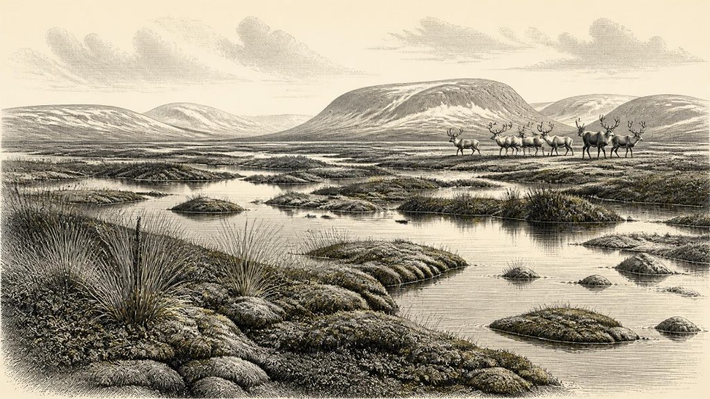
The biological evidence from Derryvree points to a cold, open and largely treeless environment. Herb pollen, plant macrofossils, mosses and insect remains indicate tundra or muskeg: waterlogged ground, sedges and grasses, low-growing herbs, moss-rich margins and shallow pools. Some plants had northern or alpine affinities. Seasonal thaw was plainly sufficient to maintain fresh water and wet ground, but the broader climate was periglacial, with long severe winters and short growing seasons.
This was no empty white wilderness. The freshwater deposit preserves a living ecological mosaic: standing or slowly moving water, muddy margins, damp vegetation and exposed ground beyond. Yet it was not a forested Irish landscape, and there is no evidence for agricultural clearances, fields, livestock, cereal cultivation or permanent villages. Occasional pollen grains from trees do not overturn that conclusion; such grains can travel long distances or be reworked from older deposits. The local evidence overwhelmingly favours sparse, low vegetation.
In everyday ecological terms, plants had to exploit a brief summer, animals had to find food across a fragmented terrain, and freeze-thaw processes continually disturbed soils and slopes. Rivers and lakes were likely seasonally variable, while snow cover, frozen ground and meltwater governed movement. These processes, more than human engineering, were then remaking the routes, basins and surfaces from which later Irish landscapes would develop.
Castlepook and the Faunal Record
In southern Ireland, Castlepook Cave near Doneraile, County Cork, is another major source of evidence, although of a different kind. Cave deposits and collections from older excavations have yielded remains attributed to animals including reindeer, giant deer, mammoth and spotted hyaena. Such finds establish that Ireland was reached by a varied cold-stage fauna during parts of MIS 3. They also suggest food chains in which large herbivores, scavengers and predators used open country and caves.
But the cave fauna must not be compressed into a single imagined herd wandering past the entrance in 30,949 BCE. A cave collection can accumulate over many millennia. Carnivores may carry bones into a den; water, disturbance and nineteenth- or early twentieth-century excavation can mix materials; and individual bones can receive revised dates when laboratories apply improved methods. Re-dating published in 2020 showed that several Castlepook and other southern Irish cave determinations were substantially older than earlier results had indicated. The secure conclusion is a long and complex animal history, not a single frozen scene.
Reindeer are particularly evocative because they suit an open, cold landscape and are central to the question of human activity. Their presence demonstrates neither annual migration on a known route nor a stable resident herd in every part of Ireland. Mammoth and giant deer similarly show that large mammals could reach or inhabit suitable Irish environments, but their remains cannot tell us how numerous they were at one time, nor whether they occupied every county simultaneously.
The Reindeer Femur Question
A reindeer femur from Castlepook has made this period exceptionally important for Irish prehistory. Zooarchaeologist Ruth Carden has interpreted a deep mark on the bone as a cut or chop made by a sharp stone tool during carcass processing. County Cork heritage material places the object at about 31,000 BC. If that reading of the modification is sustained, it may be evidence that people handled a reindeer in Ireland during the Upper Palaeolithic, far earlier than the well-established post-glacial settlement record.
The qualification matters. One marked bone is not a camp. Ireland has not produced a securely associated stone-tool assemblage, hearth, dwelling floor, burial, human bone, repeated butchery area or durable settlement of comparable antiquity. The femur cannot reveal whether people killed the animal, found it dead, removed meat or sinew elsewhere, or left the limb where carnivores later carried it into the cave. Nor can it establish the size, identity, language, kinship or duration of any visiting group. The National Museum of Ireland accordingly continues to stress that clear evidence for human presence in Palaeolithic Ireland has not yet emerged.
The prudent interpretation is that the femur presents a significant, debated indication of possible human butchery, not proof of an established Irish population. It is evidence for an action if the mark is anthropogenic; settlement, seasonal return and social organisation remain inferences that the present record cannot securely support.
No Polities, but a Changing Geography
There were no demonstrable Irish kingdoms, diplomatic communities, borders or political institutions at this date. There is likewise no recoverable religion, art tradition, language, system of learning or trade network specific to Ireland around 30,949 BCE. If people did make brief visits, they would have belonged to wider Upper Palaeolithic worlds known elsewhere in Europe, but importing those societies wholesale into Ireland would exceed the evidence.
What can be said is that geography and climate created the setting in which animal and perhaps human movement occurred. Global sea level was lower during the glacial period, while ice sheets and changing coastlines altered the shape of the Irish Sea region. This did not automatically create one simple, permanently usable land bridge between Ireland and Britain: ice, water, sea ice, changing channels and local topography all mattered. Routes could open, close or become hazardous over long intervals. The evidence supports connectivity as a problem to investigate, rather than a fixed corridor to assume.
The period also preceded the later Last Glacial Maximum, when the British–Irish Ice Sheet reached its greatest Late Pleistocene extent. Current syntheses place widespread maximum ice expansion broadly between about 27,000 and 23,000 calibrated years BP, after the interval represented at Derryvree. The approaching growth and reorganisation of ice would transform drainage, scour older deposits and leave the patchy survival record on which modern reconstruction depends.
An Environmental History Before History
The defining development for Ireland around this notional year was therefore neither a named human event nor a political turning point. It was the existence, in at least some places, of cold but viable ice-age habitats: freshwater pools in Fermanagh, open vegetated ground, large herbivores and carnivores in the wider landscape, and landscapes subject to abrupt climatic and glacial change. Derryvree gives direct local evidence for that world; Castlepook gives a powerful but chronologically complicated faunal archive; the marked reindeer femur raises a potentially transformative question about people.
These sources make Ireland’s deep past vivid precisely because they require restraint. Mosses, silts, a reindeer bone and glacial debris do not furnish a yearly chronicle. They instead record a landscape in motion, inhabited certainly by plants and animals, and perhaps touched by people, shortly before later ice-sheet expansion concealed or destroyed much of the evidence. That is the most defensible history available for 30,949 BCE.
Primary Sources
- A Middle Midlandian Freshwater Series at Derryvree, Maguiresbridge, County Fermanagh, Northern Ireland
- Middle Midlandian Interstadial Deposits at Greenagho, Near Belcoo, County Fermanagh, Northern Ireland
- Palaeoecology
- Irish Pleistocene Biostratigraphy
- The Irish Quaternary Fauna Project
- A Reconsideration of the Radiocarbon Dating of the Marine Isotope Stage 3 Fauna from Southern Ireland
- New Insights on the Fauna of Ireland's Younger Dryas and Early Holocene from Alice & Gwendoline Cave
- Heritage Artefacts of County Cork
- Prehistoric Details: Mell Flint Flake
- Growth and Retreat of the Last British–Irish Ice Sheet, 31,000 to 15,000 Years Ago: The BRITICE-CHRONO Reconstruction
- BRITICE-CHRONO Maps and GIS Data of the Last British-Irish Ice Sheet 31 to 15 ka
- Pattern and Timing of Retreat of the Last British–Irish Ice Sheet
- Response of the Irish Ice Sheet to Abrupt Climate Change During the Last Deglaciation
- Maximum Extent and Dynamic Behaviour of the Last British–Irish Ice Sheet West of Ireland
- Dimensions and Chronology of the Last Ice Sheet in Western Ireland
- The Timing and Magnitude of the British–Irish Ice Sheet Between Marine Isotope Stages 5d and 2
- Exploring Controls of the Early and Stepped Deglaciation on the Western Margin of the British Irish Ice Sheet
- Trimlines, Blockfields and the Vertical Extent of the Last Ice Sheet in Southern Ireland
- Ireland: Submerged Prehistoric Sites and Landscapes
- A Critical Review and Re-Investigation of the Pleistocene Deposits Between Cranfield Point and Kilkeel, Northern Ireland
