

Doneraile’s Pre-Ice Reindeer30444 BCE
Around 30,444 BCE, Ireland lay in a climatically unstable pre-Last Glacial Maximum landscape, although the date itself cannot identify a specific event. Derryvree, County Fermanagh, preserves radiocarbon-dated wetland sediments indicating locally ice-free, treeless, cold conditions within broad calibrated margins. Castlepook Cave, County Cork, contains remains of reindeer, mammoth, giant deer and predators, demonstrating a diverse open-country Pleistocene fauna, but disturbed cave deposits cannot provide a single-time picture. A cut-marked reindeer femur may indicate Upper Palaeolithic butchery, yet lacks secure archaeological context. No evidence supports settlement, institutions, religion or continuous occupation. Later ice expansion probably destroyed or obscured much surviving evidence.
Dateline
“30,444 BCE” is a modern calendar label, not a date that can be matched to a recorded Irish event. No writing, named community, ruler, battle, treaty or monument belongs to this point in Ireland’s past. At such depth of time, even the calendar conversion is necessarily approximate: 30,444 BCE is roughly 32,394 years before AD 1950, the conventional reference point for radiocarbon chronology. The responsible approach is therefore to place the year within broad calibrated ranges, and to distinguish securely observed evidence from interpretations built around it.
A Date Within Wide Margins
The relevant period is the later part of the Pleistocene, within the Upper Palaeolithic era elsewhere in Europe and before the Last Glacial Maximum reached its fullest extent over Ireland. A key Irish radiocarbon determination comes from Derryvree near Maguiresbridge, County Fermanagh: organic freshwater silts, later sealed between tills, produced the conventional result BIRM-166, 30,500 ± 1,100 radiocarbon years BP. Later modelling places its central calendar estimate at about 33,500 ± 1,200 calibrated years BP. That is a broad window, not a pinpoint. It can responsibly illuminate conditions around 30,444 BCE, but it cannot demonstrate what happened in that individual year.
This uncertainty matters because radiocarbon years are not identical to calendar years. The amount of radiocarbon in the atmosphere changed through time, especially during the climatically unstable later Ice Age. Calibration curves such as IntCal20 translate laboratory measurements into probability ranges, while preserving uncertainty rather than concealing it. Old excavations add another difficulty: many Irish deposits and cave collections lack the tightly recorded layers, samples and laboratory standards expected today. The evidence is valuable, but its limits must remain visible.
Derryvree’s Cold Wetland
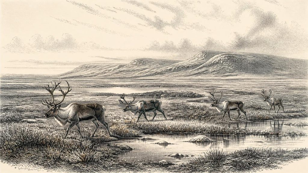
Derryvree is the strongest direct environmental guide to this broad interval. Its freshwater sands and organic silts lay between two deposits of glacial till. The sequence shows that the locality experienced open-water or wetland conditions after one phase of ice and before another advance buried the evidence. The Irish Quaternary record describes the environment as treeless muskeg: a cold, wet, open landscape rather than the wooded island familiar today. Plant macrofossils, mosses and other biological traces preserve a local ecological assemblage far better than a general image of an undifferentiated frozen waste.
Such evidence supports a landscape of shallow water, sedgy or mossy margins and exposed ground shaped by frost, seasonal thaw and sediment movement. It does not prove that every part of Ireland looked identical. In a glacial world, altitude, exposure, drainage and proximity to ice made large regional differences. Fermanagh’s enclosed basin could preserve wetland deposits while higher ground, open coasts and areas nearer expanding ice were harsher. Pollen can also travel far; traces of trees need not mean that woodland stood beside the pool. The prudent conclusion is cold, largely open vegetation with local wetlands, not a mapped forest boundary or a fixed annual weather forecast.
The Derryvree interval is especially important because it records a living landscape before later ice covered it. It also demonstrates that parts of north-central Ireland were ice-free during a portion of Marine Isotope Stage 3, before the major expansion of the British-Irish Ice Sheet. By roughly 27,000–23,000 calibrated years BP, the ice sheet reached a far more extensive maximum and covered Ireland and much of its shelf. In the time represented by 30,444 BCE, that later engulfment lay ahead rather than behind.
Castlepook and the Faunal Record
In north County Cork, Castlepook Cave near Doneraile—also known as Mammoth Cave—provides a complementary, though complicated, view. Antiquarian excavations recovered an important collection of Pleistocene animal remains. Work on Irish Quaternary fauna associates the wider pre-Last-Glacial-Maximum cave record with animals suited to cold and open country, including reindeer, woolly mammoth, giant deer, brown bear, wolf, fox, mountain hare, lemmings and spotted hyaena. These animals make clear that Ice Age Ireland could sustain a much richer mammal community than the later island fauna might suggest.
Yet Castlepook must not be treated as a single photograph of one day or one season. A cave bone collection can accumulate through repeated episodes and through many agents. Carnivores may drag carcass parts underground; hyaenas and wolves can chew, scatter and concentrate bones; water and later disturbance can move material; early excavation methods may have lost the original context. The presence of mammoth or hyaena remains therefore establishes their inclusion in Ireland’s Pleistocene fauna, but not that every species met at the cave entrance in 30,444 BCE.
Reindeer are particularly apt symbols of the wider landscape. They favour open, cold environments and could exploit seasonal plant growth across tundra-like terrain. Their presence suggests grazing corridors rather than dense woodland. Large herbivores would have been important to predators and scavengers; carnivores, in turn, could turn caves into dens and bone traps. This was an ecological web of movement, feeding and seasonal risk, not a settled pastoral economy. Reindeer were wild animals, not herded livestock.
The Reindeer Femur Question
Castlepook has also produced the most provocative possible human trace for this broad era: a reindeer femur carrying a deep linear mark interpreted by zooarchaeologist Ruth Carden as a cut made with a sharp stone tool during butchery. County Cork heritage material places the specimen broadly at about 31,000 BCE, close to the modern date used here. If that reading of the mark and its chronological association withstand further scrutiny, it would indicate that people processed a reindeer in Ireland during the Upper Palaeolithic—far earlier than the long-established evidence for post-glacial settlement.
That conditional wording is essential. The femur is not a sealed campsite. No securely associated stone-tool assemblage, hearth, dwelling, burial, human skeleton or substantial contemporary scatter of butchered remains has been recovered. The bone cannot tell us whether people killed the animal, found it after another predator’s attack, processed it at the cave, or left the limb elsewhere before carnivores carried it underground. It cannot establish the size of a visiting party, the length of a stay, a language, ancestry or a continuous population. It is a potentially momentous clue, not a complete chapter of human history.
No Polities, No Proven Religion
There is no evidence for political institutions, diplomacy, territorial states or organised warfare in Ireland at this date. Likewise, no Irish material supports claims about religious belief, ritual, art, storytelling or formal learning. Caves later acquired great cultural significance in Ireland, but that much later history must not be projected backwards onto Castlepook. Nor should the sophistication of contemporary Upper Palaeolithic peoples elsewhere in Europe be converted into an Irish fact. Comparison may suggest what a short-lived hunting party could have known—stone-working, hide-working, fire use and close knowledge of animals—but it cannot supply missing Irish evidence.
For the same reason, there is no demonstrable trade network or domestic economy. If people were present, their most plausible interaction with the landscape was small-scale and mobile: obtaining animal resources and moving through a cold, exposed terrain. But this remains interpretation. Ireland has yielded neither the artefacts nor the settlement traces needed to describe households, exchange, food-sharing rules or social rank. The absence partly reflects genuine scarcity and partly the destructive force of later glaciation, erosion, sea-level change and nineteenth- and early twentieth-century collecting practices.
An Uncertain Edge of Europe
Lower global sea levels altered the shape of the Irish Sea world, but they did not automatically create an easy land route to Ireland. Relative sea level depended on both ocean volume and the loading and movement of nearby ice; the palaeogeography was changing and remains debated. Any human arrival would have required crossing a difficult northern seaway, negotiating ice margins, or both. That geographical uncertainty strengthens rather than weakens the importance of a possible Castlepook cut mark: it would imply a rare incursion to a peripheral and demanding landscape.
For 30,444 BCE, then, Ireland is best understood through its environments and its fragmentary faunal archive. Derryvree records an ice-free cold wetland within a wide calibrated interval; Castlepook preserves animals of open Pleistocene country and a single possible sign of human butchery. Together they show an Ireland not yet swallowed by the later glacial maximum, but already poised within a rapidly changing Ice Age world. The evidence does not yield a year-by-year narrative. It yields something more cautious and more remarkable: a fleeting view of tundra, wet ground, large mammals and the possibility of human footsteps before the ice advanced again.
Primary Sources
- New Insights on the Fauna of Ireland's Younger Dryas and Early Holocene from Alice & Gwendoline Cave
- First Evidence of a Late Upper Palaeolithic Human Presence in Ireland
- The Irish Quaternary Fauna Project
- Growth and Retreat of the Last British–Irish Ice Sheet, 31,000 to 15,000 Years Ago: the BRITICE-CHRONO Reconstruction
- Exploring Controls of the Early and Stepped Deglaciation on the Western Margin of the British Irish Ice Sheet
- Dimensions and Chronology of the Last Ice Sheet in Western Ireland
- Trimlines, Blockfields and the Vertical Extent of the Last Ice Sheet in Southern Ireland
- The Timing and Magnitude of the British–Irish Ice Sheet Between Marine Isotope Stages 5d and 2
- Figure 6.— The Subdivision of the Quaternary Period in Ireland
- The Problem of a Late Quaternary Landbridge Between Britain and Ireland
- Ireland: Submerged Prehistoric Sites and Landscapes
- The IntCal20 Northern Hemisphere Radiocarbon Age Calibration Curve (0–55 cal kBP)
- Heritage Artefacts of County Cork
- The Archaeology of Caves in Ireland
- Mammals: National Museum of Ireland Natural History Collections
- Learn About: The Ice Age
- The Mesolithic in Ireland: When Was It?
- Deglaciation, Earth Crustal Behaviour and Sea-Level Changes in the Determination of Insularity: A Perspective from Ireland
- A Critical Review and Re-Investigation of the Pleistocene Deposits Between Cranfield Point and Kilkeel, Northern Ireland
- Cenozoic: Tertiary and Quaternary






