

Bogbean Under Drumlin Ice30861 BCE
30,861 BCE is not a precisely datable Irish event but falls within MIS 3, before the Last Glacial Maximum. At Derryvree, County Fermanagh, organic sediments between glacial tills record an ice-free interval, broadly dated to 34,950–29,750 BCE. Plant and beetle remains reveal cold, treeless, tundra-like wetlands with shallow water, sedges, mosses and hardy flora. Castlepook Cave in County Cork preserves mixed remains of mammoth, reindeer, giant deer and predators, demonstrating suitable cold open habitats. A marked reindeer bone may indicate brief human butchery, but not settlement. Lower sea levels altered coasts; later ice buried or destroyed most evidence across Ireland.
Dateline
“30,861 BCE” is a useful modern label, not a date at which an Irish event can be placed. No written record, settlement sequence or annual archaeological chronology exists for Ireland at this depth of time. Indeed, calendar-year precision is unavailable. The responsible setting is the later part of Marine Isotope Stage 3 (MIS 3), within the Midlandian cold stage of the Irish Pleistocene: a long and climatically unstable Ice Age interval before the Last Glacial Maximum. What can be investigated is a broad landscape history, assembled from buried sediments, cave bones, plant fossils, insects, geological layers and radiocarbon measurements.
The numbered year falls within the broad calibrated range associated with one of Ireland’s most important pre-Last Glacial Maximum environmental records, at Derryvree near Maguiresbridge in County Fermanagh. That does not mean that a particular pool, plant, animal or human action at Derryvree can be assigned to 30,861 BCE. It means only that the evidence illuminates an extended period encompassing this notional date. For Ireland, that distinction is essential.
A Date Without an Event
At Derryvree, roadworks exposed organic freshwater silts and fine sands enclosed between two bodies of till: unsorted debris deposited directly or indirectly by glacier ice. The sequence provides a powerful relative history. Ice had first occupied the locality and left a lower till. Later, water, vegetation and small animals accumulated organic sediment in ground that was not then under glacier ice. A renewed advance eventually buried that freshwater deposit beneath an upper till.
A conventional radiocarbon determination from the organic layer, Birm-166, was reported as about 30,500 ± 1,170 radiocarbon years before present. Such a measurement is not a calendar age. Radiocarbon ages require calibration against changing atmospheric carbon-14 levels, and uncertainty widens substantially this far back in time. Published discussion places the deposit broadly at roughly 36,900–31,700 calibrated years before present, approximately 34,950–29,750 BCE. Thus 30,861 BCE lies within the range, but cannot be treated as a precisely dated moment in the deposit’s formation.
This caution matters because Ireland’s Ice Age chronology has repeatedly been revised as dating techniques, glacial models and palaeoenvironmental methods improve. Labels such as the Derryvree Cold Phase are useful shorthand for a body of evidence; they are not proof that weather, ice cover or habitats were identical throughout the island, or throughout every century of the phase.
Derryvree’s Open Wetland
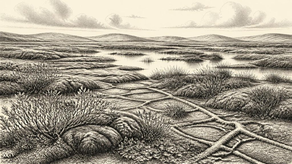
The fossils from Derryvree offer the clearest local picture. They indicate a treeless, open and cold landscape, rather than the familiar Ireland of woodland, fields and enclosed farms. Mosses, sedges, grasses and hardy herbs grew around shallow freshwater and saturated ground. Fossil evidence includes bogbean, mountain-avens, dwarf willow and clubmosses: plants capable of surviving short growing seasons, exposed ground and severe winter conditions. Beetles likewise point to a cold northern environment.
Researchers have described the setting as a tundra or muskeg-like wetland: a patchwork of sedgy, mossy and waterlogged ground, open pools and mineral sediment, shaped by frost and seasonal thaw. That is an interpretation grounded in the combined botanical and insect assemblages; it should not be imagined as a single uninterrupted bog stretching across Ireland. The deposit records one locality in Fermanagh, protected by later glacial burial. Its importance is precisely that so little of Ireland’s fragile surface record from this age survived later ice erosion.
Liquid water was present when these sediments formed. So too, at intervals during MIS 3, was enough unfrozen ground for vegetation and soil processes to operate. Speleothems in Crag Cave, County Kerry, provide an independent but different line of evidence for episodic milder phases during the last glacial period: calcite can form only when water moves through the cave system. Neither Crag Cave nor Derryvree demonstrates a warm Irish climate. Together they show that the long Ice Age was punctuated by significant climatic shifts, rather than being a featureless age of permanent, uniform freezing.
Animals at Castlepook
County Cork supplies Ireland’s richest broadly comparable animal archive. Castlepook Cave, also known as Mammoth Cave, near Doneraile produced more than 2,000 bones during excavations from the early twentieth century onwards. Its Pleistocene fauna includes woolly mammoth, reindeer, giant deer, brown bear, wolf and spotted hyaena, with Arctic fox and lemmings represented in later Ice Age deposits. Individual bones from the cave fall across a very long span, and the site was affected by carnivore activity, water movement, disturbance and early excavation methods. It is therefore a repository of remains accumulated over millennia, not a neatly sealed picture of one hunting episode or one community.
Nevertheless, Castlepook establishes that Ireland, or at least its southern landscapes in suitable phases of MIS 3, could support a cold-adapted large-mammal fauna before the maximum expansion of the last ice sheet. Mammoths, reindeer and giant deer evoke open grassland and herb-rich steppe-tundra more readily than dense forest. Hyaenas and wolves indicate predators and scavengers within that food web. The faunal evidence is stronger for the presence of animals than for exact population sizes, migration routes or the season in which any particular bone entered the cave.
A reindeer femur from Castlepook has attracted particular attention because a deep mark has been interpreted as a fresh-bone incision made with a stone tool during butchery. If that assessment is upheld, it may be Ireland’s earliest known indication that people handled an animal, conventionally described as about 33,000 years ago. Yet it cannot establish a settlement at 30,861 BCE. No securely associated hearth, stone-tool assemblage, house floor, burial, food store or occupation surface has been recovered from the cave. The bone’s date concerns the animal and its broad context, while the cave’s deposits are mixed. The proper conclusion is cautious: a possible fleeting Upper Palaeolithic human visit is suggested, not a demonstrated resident population.
People Beyond the Evidence
There can be no responsible account of political affairs, warfare, diplomacy, rulers, communities, religion, language, art or learning in Ireland in this year. None is evidenced. Even if people briefly reached the island or its then-expanded coastal hinterland during a favourable interval, the available record does not reveal their identity, numbers, social organisation or beliefs. They should not be labelled Celtic, Irish in an ethnic sense, or members of a named archaeological culture on the basis of this isolated and contested evidence.
By the same standard, there is no evidence for farming, stock-keeping, permanent villages, exchange networks, seafaring routes or institutional authority. The economy most plausibly available to any visitors would have been mobile foraging and hunting, using animals and seasonal resources, but that is an inference from the wider European Upper Palaeolithic world rather than a directly excavated Irish livelihood. It should not be converted into a claim about a known camp in Fermanagh or Cork.
An Island in Transition
At this time sea level was far lower than today because much water was held in continental ice sheets. Ireland’s present coastline did not exist: coastal plains and parts of the surrounding shelf were exposed. Yet the changing geography of the Irish Sea, and any possible routes used by animals or people, remain complex questions. Exposed land does not automatically prove a continuous dry crossing from Britain or continental Europe, and no route should be assumed from the presence of a bone in a cave.
The larger development was deterioration towards the Last Glacial Maximum, when the Irish Ice Sheet ultimately covered almost all of the island and extended onto the continental shelf. That later ice remoulded the land, deposited tills, created and modified drumlin landscapes, and destroyed or deeply buried many older surfaces. The exceptional evidence at Derryvree and Castlepook has survived because it was sealed in unusually protective settings: between tills or inside karst caves. Their survival also explains the imbalance in the record. We know far more about plants, animals, water and ice than about people.
Ireland around the notional date of 30,861 BCE was therefore not a country of named peoples or recorded events. It was a changing Ice Age environment: locally ice-free in some documented intervals, cold and open, with wetlands in Fermanagh and large mammals in southern cave landscapes. The evidence is fragmentary, but it is sufficient to replace the old image of a wholly lifeless, permanently frozen island with a more precise one—an ecologically active, severely cold land on the threshold of much more extensive glaciation.
Primary Sources
- Early Midlandian–Middle Midlandian, Pleistocene, Northern Ireland
- The glacial deposits of the Maguiresbridge area, County Fermanagh, Northern Ireland
- The Stratigraphic Position and Age of the Gortian
- The subdivision of the Quaternary Period in Ireland
- The Irish Quaternary Fauna Project
- Quaternary deposits and glacial stratigraphy in Ireland
- Episodic speleothem deposition tracks the terrestrial impact of millennial-scale last glacial climate variability in SW Ireland
- Castlepook Cave
- Archaeological Heritage of County Cork
- Karst of Ireland
- New insights on the fauna of Ireland's Younger Dryas and Early Holocene from Alice & Gwendoline Cave
- Last Glacial Maximum cirque glaciation in Ireland and implications for reconstructions of the Irish Ice Sheet
- Dimensions and chronology of the last ice sheet in Western Ireland
- A critical review and re-investigation of the Pleistocene deposits between Cranfield Point and Kilkeel, Northern Ireland
- Bedform patterns, subglacial meltwater events, and Late Devensian ice sheet dynamics in north-central Ireland
- Sub-ice shelf deposition during the late Devensian glaciation in western Ireland
- The Tolsta Interstadial, Scotland: correlation with D–O cycles GI-8 to GI-5?
- The IntCal20 Northern Hemisphere Radiocarbon Age Calibration Curve (0–55 cal kBP)
- IntCal
- BSBI: Menyanthes trifoliata
- BSBI: Dryas octopetala
- Landscapes and environments of the last glacial-interglacial transition: a time of amazingly rapid change in Ireland