Muskeg and Mammoth Cave30805 BCE
Ireland around 30,805 BCE lay in unstable MIS 3, before maximum British-Irish glaciation, rather than a date permitting annual historical precision. Derryvree, County Fermanagh, records an ice-free interval between till layers, with freshwater muskeg, tundra plants and periglacial conditions; its radiocarbon date is broad and requires calibration. Castlepook Cave, County Cork, preserves a time-averaged fauna including reindeer, mammoth, giant deer, predators and scavengers, demonstrating intermittent open habitats and wider European ecological links. A marked reindeer femur may indicate human butchery, but cannot alone prove settlement there. Ireland’s history was chiefly environmental: shifting ice, landscapes, animals and possibly brief human visits.
Dateline
The label 30,805 BCE gives a useful position on a modern chronological scale, but it cannot identify an event that happened in a particular Irish year. No written record, annual settlement sequence or securely dated human activity can be resolved to that precision so far back. The most responsible subject is Ireland during the later part of Marine Isotope Stage 3 (MIS 3), an unstable interval of the last Ice Age before the Last Glacial Maximum. The numbered date falls about 32,755 years before the radiocarbon convention of AD 1950, but radiocarbon ages and calendar years are not interchangeable. Results must be calibrated and are normally expressed as probability ranges, often broad ones at this depth of time.
A Landscape Without an Annual Record
Around this broad horizon, Ireland was not the familiar island of woodland, farms and coast roads. It was part of a changing north-west European cold-stage world. Sea level was far lower than today, although precisely reconstructing routes between Ireland, Britain and continental Europe is difficult: exposed land, shallow seas, ice and shifting shorelines did not produce a simple, permanent land bridge. The island’s geography and access changed over long periods, as did the extent of glacier ice. It is therefore misleading to imagine either an entirely ice-covered Ireland or a wholly open, habitable island in 30,805 BCE. Different districts could have had very different conditions, and evidence from one site cannot serve as a weather report for all.
The relevant climatic backdrop is MIS 3, conventionally dated to roughly 57,000–29,000 years ago. It was cold, but not uniform. Abrupt climatic oscillations affected the North Atlantic world, allowing ice margins and ecological zones to advance or retreat over centuries and millennia. Ireland’s later Last Glacial Maximum lay ahead: reconstructions place the greatest expansion of the British–Irish Ice Sheet principally between about 27,000 and 23,000 calendar years ago, varying by sector. Thus the date considered here belongs to a pre-maximum phase, when some Irish localities preserved evidence of ice-free or ice-marginal conditions, yet the overall trend was towards harsher glacial circumstances.
Derryvree’s Buried Wetland
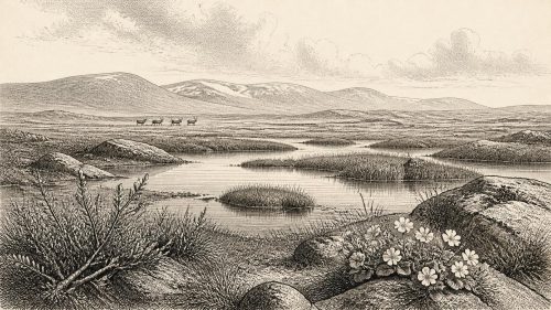
The clearest Irish environmental evidence relevant to this time comes from Derryvree townland, near Maguiresbridge in County Fermanagh. Roadworks in 1969 cut through a drumlin and exposed fine sands, silts and organic freshwater deposits trapped between two separate layers of till, the unsorted sediment laid down by glacier ice. The sequence provides a powerful relative history: ice deposited the lower till; then, during an interval when ice no longer overrode that spot, water and organic matter accumulated; a subsequent glacial advance laid the upper till and sealed the deposit.
Organic material from the Derryvree freshwater series returned a conventional radiocarbon determination of 30,500 +1,170/−1,030 radiocarbon years BP. That is an important measurement, not an exact calendar date. Its uncertainty alone spans more than two millennia in radiocarbon years, while calibration adds further complexity. The date nonetheless places the deposit broadly in the Middle Midlandian, the Irish term often used for this part of the last glacial cycle, and makes it highly relevant to the world around 30,805 BCE. It demonstrates an ice-free interval at Derryvree, not the simultaneous condition of the whole island.
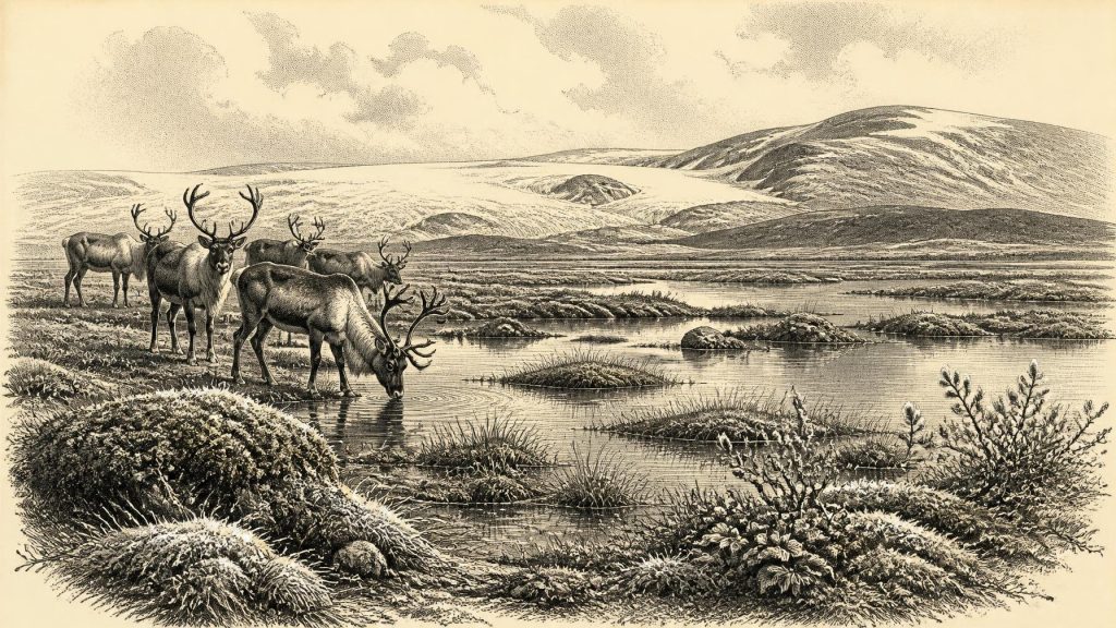
Plant and animal remains in those sediments indicate open tundra vegetation and a periglacial regime. Mosses, sedges and cold-tolerant herbs occupied wet ground and shallow freshwater. Fossil evidence includes plants such as dwarf willow, mountain-avens and bogbean, species suited to exposed, short-season environments rather than closed forest. The original investigators compared the setting to muskeg: waterlogged, moss-rich ground, interspersed with pools and shaped by frost. It was a productive habitat in its own terms, but one in which winter cold, frozen ground and limited woody fuel would have imposed severe constraints.
Castlepook’s Animal Archive
County Cork supplies a contrasting, though equally qualified, archive. Castlepook Cave, also known as Mammoth Cave, near Doneraile, produced one of Ireland’s richest collections of Pleistocene animal remains. Its deposits and old collections include bones attributed to reindeer, woolly mammoth, giant deer, brown bear, wolf, Arctic fox, mountain hare, lemmings and spotted hyaena. Modern re-dating has strengthened the case that important parts of the southern Irish cave fauna belong to MIS 3. In particular, a 2020 reassessment found that several older radiocarbon determinations had underestimated the age of Castlepook material, and suggested that giant deer and spotted hyaena may have disappeared locally before the Last Glacial Maximum, around 40,000 calibrated years BP.
That list must not be converted into a single imagined herd moving through Cork in 30,805 BCE. Cave assemblages accumulate over time and through several processes. Hyaenas may have carried prey remains into dens; predators and scavengers may have died there; water can redeposit sediment and bone; and nineteenth- and early twentieth-century excavations did not record every layer to modern standards. Castlepook is evidence for a changing Ice Age fauna over a long interval, rather than a neatly sealed snapshot. Yet it decisively broadens the picture of prehistoric Ireland. At suitable times, open landscapes supported large grazers and browsers, while carnivores and scavengers followed the opportunities they created.
Reindeer are especially instructive. Their remains fit cold, open country and imply ecological connections with the wider north-west European faunal world. Mammoths and giant deer indicate extensive plant resources, though not necessarily in the same places or years. Wolves and hyaenas point to an animal landscape in which carcasses were contested and caves could become dens, shelters or bone traps. None of this provides a political history. There were no known Irish kingdoms, borders, rulers, diplomatic missions or organised wars that can responsibly be assigned to this date. The evidence concerns mobile animals, ice, water and terrain, not states.
The Reindeer Femur Question
One Castlepook specimen has potential importance for human history. A fragment of reindeer femur from the cave’s historic collection has been reported as about 33,000 years old and bears a deep mark interpreted by zooarchaeologist Ruth Carden as damage made with a sharp stone tool during carcass processing. If that interpretation is confirmed, it would provide remarkable evidence of Upper Palaeolithic people handling a reindeer in Ireland during the wider period represented by this article, many millennia earlier than Ireland’s well-established post-glacial occupation record.
However, the conditional wording is essential. The bone was not recovered from a modern excavation of an intact occupation floor. No securely associated hearth, dwelling, stone-tool assemblage, burial or concentrated butchery area of comparable age has yet been demonstrated at Castlepook. A radiocarbon measurement dates the animal’s surviving organic material, not independently the incision, the place where the animal died or the length of any human visit. Identifying a cut mark also requires specialist taphonomic assessment, because carnivore damage, trampling, breakage and later handling can alter bone surfaces. The femur is best described as potentially crucial evidence of human butchery, rather than proof of a permanent population or a named hunting community.
Life, Culture and Exchange
If people did reach Ireland in this phase, the evidence supports only a modest inference: small, highly mobile Upper Palaeolithic parties may have made brief incursions into a difficult landscape. They may have followed game, exploited a carcass, surveyed new ground or travelled along wider seasonal routes. A reindeer could offer meat, fat, hide, sinew, antler and bone, but the single marked femur does not demonstrate which resources were taken, whether people hunted the animal, or whether they brought it to the cave. Nor does it reveal family structure, language, ritual, artistic practice or learning. There is no evidence for buildings, villages, farming, pottery, metalworking, monuments, formal religion or trade networks in Ireland at this date.
“Economy” must therefore be used carefully. The relevant economy was ecological: the seasonal availability of game, edible plants, freshwater, shelter and raw materials, set against the risks of cold and ice. Any human subsistence would have depended on knowledge carried by individuals and small groups—animal behaviour, weather, safe routes, stone sources and the treatment of skins and food—but such knowledge is inferred from the demands of Upper Palaeolithic life elsewhere, not directly documented in Ireland. The same caution applies to conflict and diplomacy. Competition among predators, including humans if present, is plausible; evidence for organised human violence or inter-group negotiation is absent.
What Can Be Said Responsibly
Ireland around 30,805 BCE was a regional mosaic within an unsettled Ice Age world. Derryvree preserves an interval of treeless tundra wetland between glacial advances in Fermanagh. Castlepook preserves a long and complicated record of cold-stage mammals in Cork, and perhaps a tantalising sign of human carcass processing. Together they show that Ireland was neither empty of life nor archaeologically legible in the way later prehistoric Ireland is. The major historical development was environmental: fluctuating ice, open cold-country habitats and shifting opportunities for animals—and possibly occasional people—before the far more extensive glaciation that would reshape and obscure much of the island’s earlier record.
Primary Sources
- A Middle Midlandian Freshwater Series at Derryvree, Maguiresbridge, County Fermanagh, Northern Ireland
- A reconsideration of the radiocarbon dating of the Marine Isotope Stage 3 fauna from southern Ireland
- The Exploration of Castlepook Cave, Co. Cork
- Archaeology Research Excavation Grant 2022: Final Report
- 32564 – Castlepook Cave, Castlepook South, Cork
- Prehistoric Details
- The Quaternary Period in Ireland: An Overview
- Quaternary Site Descriptions
- BRITICE Glacial Map, version 2: a map and GIS database of glacial landforms of the last British–Irish Ice Sheet
- Growth and retreat of the last British–Irish Ice Sheet, 31,000 to 15,000 years ago: the BRITICE-CHRONO reconstruction
- New data for the Last Glacial Maximum in Great Britain and Ireland
- Last Glacial Maximum cirque glaciation in Ireland and implications for reconstructions of the Irish Ice Sheet
- Late Pleistocene chronostratigraphy and ice sheet limits, southern Ireland
- Deglaciation chronology of the Donegal Ice Centre, north-west Ireland
- The IntCal20 Northern Hemisphere Radiocarbon Age Calibration Curve (0–55 cal kBP)
- The IntCal20 approach to radiocarbon calibration curve construction: a new methodology using Bayesian splines and errors-in-variables
- Pleistocene Vertebrates in the British Isles
- Occurrence of mammalia relicts at site Castlepook Cave
- New insights on the fauna of Ireland's Younger Dryas and Early Holocene from Alice & Gwendoline Cave
- Introduction to the Late Quaternary and Holocene of Northern Ireland
- BSBI: Menyanthes trifoliata
- BSBI: Salix herbacea