Fermanagh Mosaic30742 BCE
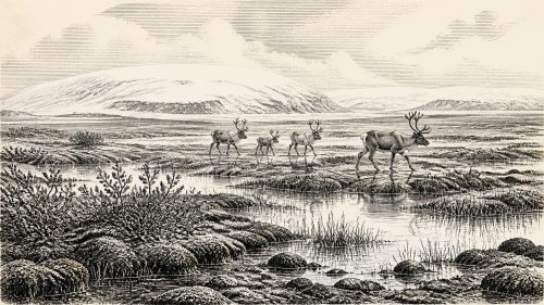
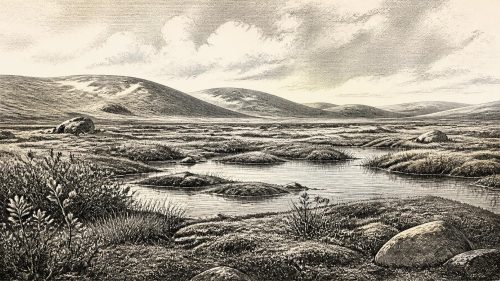
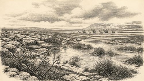
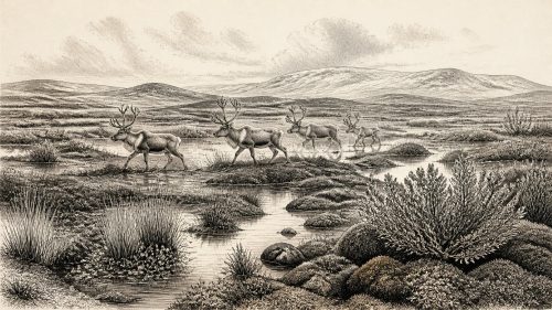
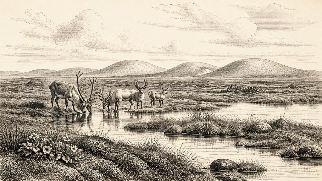
Around 30,742 BCE, Ireland’s evidence is environmental rather than historical. Derryvree, County Fermanagh, dated broadly to 36,900–31,700 cal BP, preserves freshwater silts and organic deposits between glacial tills, demonstrating local wetland conditions between ice advances. Plants, mosses and insects indicate a treeless, cold periglacial mosaic of pools, sedges and sparse vegetation. Crag Cave records wider climatic instability during MIS 3. Castlepook Cave fauna show cold-adapted mammals occupied Ireland during this period, though collections span long intervals. A possibly cut-marked reindeer bone suggests unresolved human activity. Later glaciation buried or destroyed much evidence, leaving no record of settlement, politics or monuments.
Dateline
“30,742 BCE” is a modern calendar label, not a date that can be recovered as a particular year from Ireland’s Ice Age past. No calendar, written record, named individual or datable historical event survives from this depth of time. In archaeological terms, the point falls about 32,700 calendar years before AD 1950, within the Late Pleistocene and Marine Isotope Stage 3 (MIS 3), a climatically unstable part of the last glacial period. The responsible account is therefore one of calibrated date ranges, buried sediments, fossil remains and carefully bounded interpretation rather than a conventional annual chronicle.
The closest Irish environmental evidence is the Derryvree deposit near Maguiresbridge in County Fermanagh. Its key radiocarbon determination, BIRM-166, was 30,500 radiocarbon years BP, with a substantial laboratory uncertainty. Subsequent calibration places the deposit broadly at about 36,900–31,700 cal BP. The requested year lies within that wide interval, but this does not mean that the layer records one particular season, person or event in 30,742 BCE. The range is the evidence; the numbered year is simply a useful point from which to view it.
A Freshwater World Beneath Till
Derryvree was revealed by road works in 1969, when a cutting through a drumlin exposed a remarkable sequence. Fine sands, freshwater silts and organic deposits lay between two tills: stony sediments left by separate episodes of glacial ice. This order of layers is important. It shows that an earlier ice advance had been followed locally by conditions in which water and living communities occupied the ground, before a later advance buried the landscape beneath fresh glacial debris. The deposit is a rare survival because later ice, meltwater and erosion destroyed or concealed so much older evidence across Ireland.
This is not proof that all Ireland was ice-free at once. Derryvree records one part of Fermanagh, and glacial margins, drainage and vegetation could differ sharply from region to region. Nor is a drumlin cutting a picture of an entire island. Yet the sequence decisively challenges any simple image of Ireland as continuously smothered by ice throughout the later Ice Age. At least during part of its dated span, this northern locality contained standing or slow-moving freshwater, wet ground and a functioning cold-climate ecosystem.
Open Ground and Cold Water
The biological evidence from Derryvree indicates a treeless, periglacial landscape. Periglacial means shaped by severe cold and seasonal freezing near glacial conditions; it does not mean that the site itself lay under ice. Pollen was poorly preserved, but plant macrofossils, mosses and insect remains are more informative. Grasses, sedges, herbs and juniper signal open ground. Mountain-avens, an Arctic-alpine plant, and lesser clubmoss belong to a flora suited to exposed cold conditions. A fossil seed of bogbean, alongside aquatic plant evidence, points to freshwater and marshy margins. The best-supported reconstruction is not a barren white wilderness, but a mosaic of pools, sedge-rich wet ground, mossy banks and sparse vegetation beyond them.
Such a place had a short growing season and hard winters. Frost, snow cover, frozen ground and spring melt would have governed the movement of water and sediment. Insects found in the deposit have likewise been interpreted as evidence for a cold muskeg-like wetland with open pools and abundant decaying plant matter. These remains illuminate everyday ecological processes: roots growing in silt, plants shedding seeds, insects living around water and organic material accumulating on a basin floor. They do not reveal cultivated fields, permanent houses or a settled farming landscape. Agriculture lay tens of millennia in the future.
An Unstable Atlantic Climate
MIS 3 was not a single uniform climate. Greenland ice-core records show repeated, abrupt shifts between colder stadials and relatively milder interstadials, often over timescales of centuries or millennia. Ireland’s fragmentary terrestrial record cannot translate those shifts into a day-by-day forecast for Derryvree, but it makes clear that environmental change was recurrent. The freshwater interval at Derryvree was eventually sealed by a later ice advance. Its stratigraphy is consequently a local record of change: ice, then wetland, then ice again.
Evidence from Crag Cave in County Kerry provides an independent indication of this wider instability. Uranium-series dates from broken and reworked stalagmites show episodic calcite growth during parts of MIS 3. In a shallow cave, calcite formation required liquid water to penetrate soil and limestone, so the growth phases indicate intervals less persistently frozen than the coldest stages. They do not establish modern warmth, dense woodland or benign conditions; nor can they be assumed to be contemporary with every Derryvree deposit. Together, however, the Fermanagh silts and Kerry speleothems show an island of strong local variation within a rapidly fluctuating North Atlantic world.
Animals on the Western Margin
Southern Irish caves supply a second, different archive. Castlepook Cave near Doneraile in County Cork has yielded an important assemblage of Late Pleistocene animal remains, including material attributed to reindeer, mammoth, giant deer, wolf, Arctic fox, brown bear, lemmings and spotted hyaena. Modern re-dating has demonstrated that several Castlepook bones are substantially older than earlier measurements suggested, placing significant elements of the collection in MIS 3. It follows that large and small cold-adapted mammals reached Ireland during this broad period.
That conclusion needs a crucial qualification. A cave bone collection is not a census from one year. Remains may have accumulated over thousands of years, been brought in by predators, moved by water, mixed by animal activity or disturbed during early excavations. Recent work suggests that giant deer and spotted hyaena may have disappeared locally before about 40,000 cal BP, so they should not automatically be placed beside Derryvree’s wetland at the requested date. Castlepook instead demonstrates changing animal presence across a long pre-maximum glacial interval. It offers context, not a precise scene.
The Human Question
A reindeer femur from Castlepook has been presented in County Cork heritage publications as bearing a cut mark made by a sharp stone tool and as dating to roughly 31,000 BC. If that interpretation is ultimately confirmed, it would suggest that people processed a reindeer in Ireland in the general period considered here. It would be an exceptionally important indication of Upper Palaeolithic activity. But it is one bone from an old cave collection, not a securely excavated occupation floor. No associated stone-tool assemblage, hearth, dwelling, burial, artwork or repeated scatter of butchered remains has established a resident human community in Ireland at this date.
The careful conclusion is therefore that human visits are possible, not that Ireland was continuously settled. Any visitors would probably have belonged to mobile hunter-gatherer populations known elsewhere in north-west Europe, but applying their precise technologies, languages, rituals or social arrangements to Ireland would be inference, not evidence. Reindeer could have supplied meat, marrow, fat, hide, sinew and bone; that is a plausible economic potential, not a demonstrated Irish subsistence system. Routes to the island, the scale of movement and the duration of any stay remain unknown.
No Polities, No Chronicle
There is no evidence for political affairs, diplomacy, organised warfare, territorial rule or named peoples in Ireland around 30,742 BCE. Equally, there is no secure evidence for religious sites, graves, ceremonial monuments, formal learning, trade networks, pottery, metalwork or architecture. These are not blank spaces that can responsibly be filled with later Irish traditions, Gaelic ancestry or images borrowed from Upper Palaeolithic France. The island’s surviving record is environmental first: water, sediment, plants, animals, frost and ice.
Conflict, if it occurred among people, is archaeologically invisible here. Competition between carnivores and humans for carcasses or shelter is conceivable, but cannot be reconstructed as a historical episode. The strongest regional development was climatic and glacial. Over the following millennia the British–Irish Ice Sheet expanded towards its Last Glacial Maximum, profoundly remodelling the island and eliminating or entombing many older traces. Derryvree matters because its brief freshwater world escaped total destruction, preserved between tills.
The Evidence’s Proper Scale
Ireland at this point was neither a timeless frozen void nor a known human homeland. It was a changing western landscape in which cold-stage wetlands could support plants and insects, and in which mammals intermittently occupied suitable terrain. Derryvree provides the clearest local evidence near this modernly numbered year: a cold, open freshwater environment that existed between glacial episodes. Castlepook shows that the broader island supported a varied Ice Age fauna during MIS 3, while the marked reindeer bone raises a serious but unresolved question about human activity.
That modest conclusion is also the most revealing. Around 30,742 BCE, the history of Ireland is not a story of kings, battles or monuments. It is a story of a wet hollow near present-day Maguiresbridge, where life left seeds, mosses, insect remains and organic silt before ice returned. Their survival allows a rare, responsibly limited glimpse of an Ireland more than thirty-two millennia beyond written history.
Source References
Hover over a number to see the source. Select it to open the source.

- [1] A Middle Midlandian Freshwater Series at Derryvree, Maguiresbridge, County Fermanagh, Northern Ireland
- [2] Palaeoecology: Guide Book for Excursion 16, Ireland
- [3] Early Midlandian–Middle Midlandian, Pleistocene, Northern Ireland
- [4] Dryas octopetala L. — Mountain Avens
- [5] Menyanthes trifoliata L. — Bogbean
- [6] Irish Pleistocene Biostratigraphy
- [7] A Reconsideration of the Radiocarbon Dating of the Marine Isotope Stage 3 Fauna from Southern Ireland
- [8] The Irish Quaternary Fauna Project
- [9] 2022:564 — Castlepook Cave, Castlepook South, Cork
- [10] Heritage Artefacts of County Cork
- [11] The Archaeological Heritage of County Cork
- [12] Episodic Speleothem Deposition Tracks the Terrestrial Impact of Millennial-Scale Last Glacial Climate Variability in SW Ireland
- [13] Spatio-Temporal Dynamics of Speleothem Growth and Glaciation in the British Isles
- [14] Growth and Retreat of the Last British–Irish Ice Sheet, 31,000 to 15,000 Years Ago: the BRITICE-CHRONO Reconstruction
- [15] Late Pleistocene Chronostratigraphy and Ice Sheet Limits, Southern Ireland
- [16] Trimlines, Blockfields and the Vertical Extent of the Last Ice Sheet in Southern Ireland
- [17] Dating Constraints on the Last British-Irish Ice Sheet: A Map and Database
- [18] Exploring Changing Landscapes of Ireland and Britain Since the Last Glacial Maximum
- [19] Soils of County Waterford
- [20] First Evidence of a Late Upper Palaeolithic Human Presence in Ireland
- [21] New Insights on the Fauna of Ireland’s Younger Dryas and Early Holocene from Alice & Gwendoline Cave
- [22] Radiocarbon Dates from the Oxford AMS System: Archaeometry Datelist 31
Primary Sources
- A Middle Midlandian Freshwater Series at Derryvree, Maguiresbridge, County Fermanagh, Northern Ireland
- Palaeoecology: Guide Book for Excursion 16, Ireland
- Early Midlandian–Middle Midlandian, Pleistocene, Northern Ireland
- Dryas octopetala L. — Mountain Avens
- Menyanthes trifoliata L. — Bogbean
- Irish Pleistocene Biostratigraphy
- A Reconsideration of the Radiocarbon Dating of the Marine Isotope Stage 3 Fauna from Southern Ireland
- The Irish Quaternary Fauna Project
- 2022:564 — Castlepook Cave, Castlepook South, Cork
- Heritage Artefacts of County Cork
- The Archaeological Heritage of County Cork
- Episodic Speleothem Deposition Tracks the Terrestrial Impact of Millennial-Scale Last Glacial Climate Variability in SW Ireland
- Spatio-Temporal Dynamics of Speleothem Growth and Glaciation in the British Isles
- Growth and Retreat of the Last British–Irish Ice Sheet, 31,000 to 15,000 Years Ago: the BRITICE-CHRONO Reconstruction
- Late Pleistocene Chronostratigraphy and Ice Sheet Limits, Southern Ireland
- Trimlines, Blockfields and the Vertical Extent of the Last Ice Sheet in Southern Ireland
- Dating Constraints on the Last British-Irish Ice Sheet: A Map and Database
- Exploring Changing Landscapes of Ireland and Britain Since the Last Glacial Maximum
- Soils of County Waterford
- First Evidence of a Late Upper Palaeolithic Human Presence in Ireland
- New Insights on the Fauna of Ireland’s Younger Dryas and Early Holocene from Alice & Gwendoline Cave
- Radiocarbon Dates from the Oxford AMS System: Archaeometry Datelist 31