
Maguiresbridge’s Buried Herbarium30727 BCE
30,727 BCE is a modern label within Marine Isotope Stage 3, not a precisely recoverable Irish year. At Derryvree near Maguiresbridge, roadworks exposed freshwater organic sands and silts between glacial tills, demonstrating an ice-free local wetland before renewed glaciation. Radiocarbon dates provide broad calibrated ranges, not annual certainty. Pollen, plants, mosses and insects indicate treeless, periglacial terrain with shallow water, sedges, grasses, aquatic plants and cold-adapted vegetation. Castlepook Cave’s mixed fauna, including mammoth, reindeer and predators, attests episodic open habitats. A marked reindeer femur may suggest human butchery, but neither permanent occupation nor settled society is securely proven anywhere yet.
Dateline
“30,727 BCE” is a modern calendar label, not a recoverable year in Ireland’s prehistoric record. No Irish event, individual or community can be assigned to it with calendar-year precision. In archaeological terms, it falls about 32,676 years before AD 1950, within Marine Isotope Stage 3 (MIS 3), a long and climatically unstable portion of the Late Pleistocene. The most responsible approach is therefore to use dated environmental intervals rather than invent an annual narrative. The strongest Irish evidence relevant to this point comes from a freshwater deposit buried beneath a drumlin at Derryvree, near Maguiresbridge in County Fermanagh, and from cave-bone assemblages in County Cork.
The Derryvree evidence is particularly important because its conventional radiocarbon determination, 30,500 +1,170/−1,030 radiocarbon years BP, calibrates to a broad range rather than one exact year. Published treatments have placed it roughly between 36,900 and 31,700 calibrated years BP. The requested modern date lies within that wide span, but it cannot be said that every plant remain, insect fragment or sediment layer at Derryvree was deposited in 30,727 BCE. Radiocarbon dates measure samples, calibration converts radiocarbon years into probability ranges, and a deposit may have accumulated over a considerable time. The year is useful as a point of orientation; it is not an anniversary in an Irish historical chronicle.
A Wetland Between Ice Advances
In 1969, roadworks cut through a drumlin at Derryvree, two kilometres north-east of Maguiresbridge. The exposure revealed a remarkably informative sequence: a lower glacial till, freshwater sands and silts with organic material, and a further till above. Till is the unsorted mixture of clay, stones and debris deposited directly by glacier ice. The order of the layers is decisive. Ice had occupied the locality; later, the ground was sufficiently free of ice for water, sediment, plants and small animals to accumulate; finally, ice returned or expanded across the site and sealed the record below another glacial deposit.
This does not prove that all Ireland was ice-free at once. It does, however, firmly rule out a simple picture of the island as continuously and uniformly entombed beneath ice throughout the later Ice Age. Derryvree records an ice-free local basin in south Fermanagh during MIS 3. Other Fermanagh sites, including Greenagho near Belcoo, also suggest that north-central districts could preserve terrestrial or freshwater environments before the principal expansion of the last British–Irish Ice Sheet. The timing and extent of early ice growth remain debated, because later glaciers eroded, rearranged or buried much of the evidence. Yet the buried wetland shows that an interval of exposed land and liquid water existed where later generations would see only drumlin country.
Plants of the Cold Ground
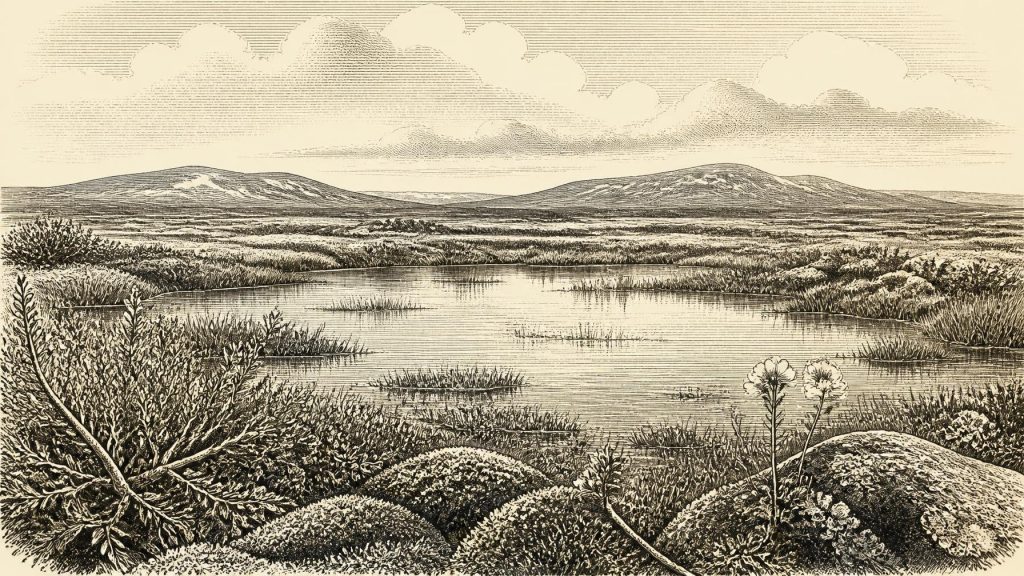
The Derryvree silts preserve pollen, plant macrofossils, mosses and insects. Their combined significance is more valuable than any one species. They point to an open, treeless, periglacial landscape: ground affected by severe frost and seasonal freezing, but not necessarily covered by glacier ice. The older descriptive term muskeg has often been used for the locality, evoking wet, organic-rich ground, mossy margins and pools rather than a continuous forest or a dry steppe.
Fossil evidence includes sedges and grasses, mosses and cold-tolerant plants associated with wet ground, shallow water or sparsely vegetated terrain. Bogbean and water-milfoil attest freshwater conditions; mountain-avens, dwarf willow and lesser clubmoss indicate vegetation able to survive cold, exposed circumstances. Such remains should not be turned into a photograph of the whole island. A seed or moss fragment identifies a habitat close to the deposit, not the precise view from every Fermanagh hill. Nevertheless, the responsible reconstruction is vivid enough: shallow water in hollows, damp mossy ground, low herbaceous cover and scattered shrubs, with little or no woodland.
For people familiar with modern Ireland, the absence of forest is one of the greatest contrasts. There were no oak woods, hedged fields, pasture farms or settled villages. The vegetation recorded at Derryvree instead belongs to an environment with short growing seasons, frozen or waterlogged soils and strong seasonality. Summer light could bring rapid growth in sheltered wet places, while winter cold and wind would make exposed ground austere. This landscape was neither lifeless nor stable. It was a changing ecological margin, shaped by water, frost, plants and the approach or retreat of ice.
An Island in a Changing Ice-Age World
Ireland’s geography was also unlike that of the present. Much water was held in continental ice sheets, lowering global sea level and enlarging coastal plains. Yet low sea level did not automatically create a permanent, simple land bridge between Ireland and Britain. Ice, changing coastlines, river systems and marine channels made connections variable and difficult. Any animal or person reaching Ireland did so within a changing north-west European landscape, not across a timeless dry corridor.
The broader glacial context matters because the date precedes the maximum extent of the last British–Irish Ice Sheet. That maximum was later, broadly around 24,000–23,000 years ago in many reconstructions, and its advance was regionally uneven. Around the Derryvree interval, parts of Ireland could contain open terrestrial environments while ice built up elsewhere or later advanced over them. The surviving record is therefore one of repeated transformation: ice deposition, wetland formation, renewed glaciation and widespread destruction of earlier land surfaces.
Castlepook and the Animal World
County Cork provides a different, though more complicated, window onto this world. Castlepook Cave, near Doneraile and also known as Mammoth Cave, produced one of Ireland’s richest collections of Late Pleistocene animal remains. Excavations in the early twentieth century recovered bones of woolly mammoth, reindeer, giant deer, brown bear, wolf, Arctic fox, hare, lemmings and spotted hyaena. It is compelling evidence that cold-adapted and large grazing animals, together with predators and scavengers, reached southern Ireland during phases of the Late Pleistocene.
But a cave collection is not a census from one afternoon. Bones could have been carried in by hyaenas or other carnivores, washed or fallen into cavities, disturbed during early excavations, and accumulated over thousands of years. Modern radiocarbon reassessment has improved the chronology but has also underlined that Castlepook’s fauna represents more than one episode. It cannot responsibly be claimed that every animal listed above stood together near Doneraile in 30,727 BCE. What it establishes is a broader Irish mammoth-steppe or tundra-associated fauna, sustained at intervals by open landscapes capable of supporting herbivores and their predators.
A Possible Human Trace
One Castlepook reindeer femur gives this period exceptional archaeological importance. County Cork heritage work has presented it as dating to about 31,000 BCE and bearing a deep linear mark interpreted by zooarchaeologist Ruth Carden as the result of a sharp stone tool used while a fresh carcass was processed. If that interpretation is confirmed, it would be evidence of human action in Ireland far earlier than the formerly accepted terminal-Pleistocene evidence.
Its limits must be stated just as plainly. The bone derives from an old cave collection rather than a modernly excavated occupation floor. A date on the femur estimates when the reindeer died, not automatically the exact moment the mark was made. Nor has a securely associated hearth, stone-tool assemblage, dwelling, human burial or intact butchered-animal concentration of this age been identified in Ireland. The femur may indicate a brief hunting or scavenging encounter, perhaps by mobile Upper Palaeolithic visitors. It does not demonstrate a settled population, an Irish tribe, or continuous occupation.
No Kingdoms, Farms or Known Rituals
Accordingly, political affairs, diplomacy and warfare cannot be reconstructed for Ireland at this date. There are no rulers, territories, alliances, forts or monuments in the evidence. Nor is there proof of agriculture, herding, trade networks, permanent houses, formal religion or artistic traditions within Ireland. It would be misleading to fill those silences with familiar prehistoric scenes. If people were present, they may have possessed sophisticated social knowledge, hunting skills, languages and beliefs, as Upper Palaeolithic communities elsewhere in Europe certainly did; but those qualities cannot be assigned specifically to Ireland from a single marked bone.
The economy that can be discussed securely is ecological rather than social. Wetland plants grew where water persisted; grazing animals moved through suitable open habitats; predators and scavengers exploited them; and frost, sediment and ice continually altered the available ground. For any human visitors, animal carcasses would have offered meat, fat, hide, sinew and bone, but this is an inference from wider hunter-gatherer practice, not a demonstrated Irish economy. No evidence supports farming, long-distance commerce or a permanent settlement at Derryvree or Castlepook.
What the Buried Record Means
Ireland around this notional year was not the green, wooded island of later prehistory. It was a climatically unstable northern landscape in which local wetlands could flourish temporarily between glacial episodes. Derryvree’s buried herbarium is the clearest evidence: a freshwater refuge of mosses, sedges, aquatic plants and tundra vegetation, preserved because later ice sealed it away. Castlepook adds the animal world and a tantalising, still limited possibility of human contact. Together they reveal not a year of named events, but a fragile interval of life on ground that the next advance of ice would profoundly remake.
Primary Sources
- A Middle Midlandian Freshwater Series at Derryvree, Maguiresbridge, County Fermanagh, Northern Ireland
- Palaeoecology
- Figure 6.— The Subdivision of the Quaternary Period in Ireland
- The Irish Quaternary Fauna Project
- A Reconsideration of the Radiocarbon Dating of the Marine Isotope Stage 3 Fauna from Southern Ireland
- Castlepook Cave: Cork County Geological Site Report
- Heritage Artefacts of County Cork
- The Archaeological Heritage of County Cork
- Trimlines, Blockfields and the Vertical Extent of the Last Ice Sheet in Southern Ireland
- Growth and Retreat of the Last British–Irish Ice Sheet, 31,000 to 15,000 Years Ago: the BRITICE-CHRONO Reconstruction
- BRITICE-CHRONO Maps and GIS Data of the Last British-Irish Ice Sheet 31 to 15 ka
- Late Pleistocene Chronostratigraphy and Ice Sheet Limits, Southern Ireland
- Deglaciation Chronology of the Donegal Ice Centre, North-West Ireland
- Exploring Controls of the Early and Stepped Deglaciation on the Western Margin of the British–Irish Ice Sheet
- The IntCal20 Northern Hemisphere Radiocarbon Age Calibration Curve (0–55 cal kBP)
- New Insights on the Fauna of Ireland's Younger Dryas and Early Holocene from Alice & Gwendoline Cave
- Middle Midlandian Interstadial Deposits at Greenagho, Near Belcoo, County Fermanagh, Northern Ireland
- The Exploration of Castlepook Cave, County Cork
- Irish Pleistocene Biostratigraphy
- Ireland's Palaeolithic Archaeology – Fleeting Footprints in a Frozen Land
