
Maguiresbridge’s Frostwater Basin30219 BCE
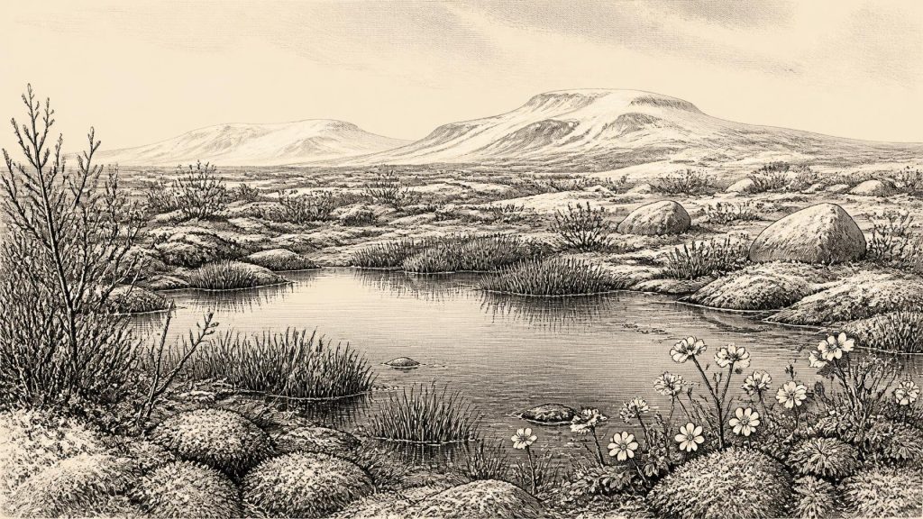
Around 30,219 BCE, Ireland has no recoverable annual history, but Derryvree near Maguiresbridge, County Fermanagh, preserves important environmental evidence. Organic freshwater sediments, radiocarbon dated broadly between about 34,950 and 29,750 BCE, lie between tills, demonstrating a local ice-free interval before renewed glaciation. Plant and insect remains indicate shallow water, wet margins and open, treeless, Arctic-alpine vegetation under severe periglacial conditions. Other sites suggest Ice-Age mammals occupied parts of Ireland, though dates and assemblages require caution. No secure evidence establishes human settlement, society or activity then. Derryvree instead records a temporary cold wetland later buried by advancing ice during later glaciation.
Dateline
30,219 BCE is not a year that can be recovered from Ireland’s prehistoric record in the manner of a later annalistic date. No Irish event, ruler, battle, journey or settlement can responsibly be assigned to it. The appropriate setting is the Late Pleistocene, within Marine Isotope Stage 3, when climate in north-west Europe shifted repeatedly between severe cold phases and less extreme intervals. The closest important Irish evidence is environmental rather than historical: a buried freshwater deposit at Derryvree, near Maguiresbridge in County Fermanagh.
Even that evidence cannot deliver calendar-year precision. Organic material from the Derryvree beds produced the radiocarbon determination BIRM-166, conventionally dated to 30,500 radiocarbon years before present, with a substantial uncertainty of +1,170 and −1,030 years. Later discussion has placed its calibrated age broadly at about 36,900–31,700 calibrated years before present, or approximately 34,950–29,750 BCE. The nominal year 30,219 BCE falls within that wide range, but it would be false precision to claim that any particular plant, pool or animal at Derryvree existed in that numbered year.
A Freshwater Layer Between Ice Sheets
Derryvree’s importance lies in its stratigraphy. Roadworks in 1969 cut through a drumlin, exposing silts and fine sands containing organic material between two thick tills. Till is the unsorted mixture of clay, stones and other debris laid down directly by glacier ice. The lower till records an earlier episode when ice overrode the locality. The organic sediments show that, afterwards, a freshwater environment formed there. The upper till demonstrates that glacier ice later returned and sealed the deposit beneath it.
This sequence is firm evidence for changing conditions at one place in Fermanagh. It does not prove that all of Ireland was ice-free at once, nor that the island had a single uniform climate. Nonetheless, it is a powerful corrective to the image of an Ireland wholly and continuously entombed beneath ice. At least during the interval represented by the sediments, the Derryvree hollow held water, accumulated silt and plant debris, and supported a community of cold-adapted organisms before a later glacial advance buried its record.
Open Ground and Shallow Water
The Derryvree flora and fauna were described by its excavators as having a full-glacial aspect. Pollen was poorly preserved, but plant macrofossils, mosses and insect remains are informative. Grasses, sedges, mosses, herbs and low-growing woody plants indicate open, treeless vegetation. Recorded plants include dwarf willow, mountain avens, lesser clubmoss, bogbean and alternate-leaved water-milfoil. These remains do not depict modern Fermanagh transported backwards in time. They indicate a cold Pleistocene landscape of wet ground, mineral-rich mud, pools and sparse vegetation, shaped by long winters, short growing seasons and recurrent freezing and thawing.
Bogbean and water-milfoil are especially useful evidence because they require fresh water or saturated ground. Their presence shows that the Derryvree site was neither a barren snowfield nor simply an expanse of exposed gravel. Mosses and sedges suggest wet margins, while the Arctic-alpine character of some plants supports the interpretation of exposed, largely treeless terrain beyond the water. Fossil insects reinforce the picture of a mossy, plant-rich wetland mosaic with open pools. This is direct local evidence; the broader reconstruction of surrounding tundra-like country is an interpretation supported by that evidence, not a detailed map of every Fermanagh valley.
Before the Greatest Ice Expansion
The Derryvree date belongs before the fullest development of the last British–Irish Ice Sheet. Modern reconstructions indicate that major shelf-edge glaciation on Ireland’s western margin occurred around 27,000 years ago, with the subsequent maximum and retreat differing considerably from sector to sector. At roughly 30,219 BCE, therefore, Ireland was entering a particularly unstable climatic and glacial chapter rather than occupying a single, settled “Ice Age” state. Ice masses, sea level, rivers, permafrost and vegetation were changing on regional and millennial scales.
The drumlin that preserved Derryvree’s sediments is itself a reminder of that later transformation. Its shape was produced beneath moving ice, but the buried organic layer records a prior local respite from direct glaciation. Glaciers could erase, redeposit or conceal earlier landscapes and their traces. This explains both why the Derryvree exposure is so valuable and why the Irish record for this period is frustratingly incomplete. The survival of one wetland horizon should not be mistaken for a continuous narrative of the whole island.
Animals in a Cold-Stage Ireland
Other Irish sites broaden the environmental picture, although their evidence must not be forced into the same narrow date range. Cave deposits, especially at Castlepook Cave near Doneraile in County Cork, have yielded remains attributed to animals including mammoth, reindeer, giant deer, brown bear, wolf, fox, hare and lemmings. Taken together, Irish Quaternary faunal research shows that a varied large-mammal fauna occupied parts of the island during intervals between at least about 45,000 and 20,000 years ago. Such animals point to landscapes unlike later wooded Ireland: open habitats capable of sustaining grazing and browsing mammals, together with predators and scavengers.
But cave bone assemblages are not simple snapshots. They may have accumulated through carnivore activity, natural deaths, water movement and excavation practices separated by long periods. Recent reassessment of radiocarbon dates for southern Irish Marine Isotope Stage 3 fauna has also shown that some older determinations need caution because laboratory methods and bone pretreatment have improved. Castlepook is consequently crucial evidence for Ice-Age fauna, but it cannot securely tell us that every listed species lived there in 30,219 BCE, or that they shared one habitat at one moment.
People: Possibility Is Not Proof
The same caution is essential for human history. Ireland has no securely documented settlement, hearth, tool-making floor, burial or substantial artefact assemblage dated to this period. A reindeer femur from Castlepook has been reported as bearing a possible human-made incision and as being roughly 33,000 years old. If confirmed through fuller contextual and microscopic study, it could indicate brief carcass processing by people during the wider period. It cannot, however, establish a permanent population, an Irish Upper Palaeolithic culture or a specific human presence in 30,219 BCE.
The National Museum of Ireland has rightly stressed the wider problem: clear evidence for Palaeolithic human occupation of Ireland remains elusive. The better-established cut-marked brown-bear patella from Alice and Gwendoline Cave in County Clare is much later, dating to the terminal Pleistocene, around 10,860–10,641 BCE. It proves neither continuity from the earlier cold stage nor the identity of any people who may have crossed Irish landscapes tens of millennia before. The apparent gap is a historical fact in itself, produced partly by sparse occupation if it occurred, but also by the destructive power of later glaciers and the uneven survival and discovery of sites.
No Polities, No Recorded Exchange
There is no evidence for political institutions, named communities, diplomacy, organised warfare, religious monuments, ritual sites, farming, pottery, metalwork or trade networks in Ireland at this time. It would be misleading to fill these categories with assumptions drawn from much later Mesolithic, Neolithic or Celtic-period Ireland. There are likewise no grounds for describing houses, clothing, kinship systems, languages or beliefs as specifically Irish in 30,219 BCE.
If people did reach the island during a milder or more navigable interval, they would most plausibly have been highly mobile hunter-gatherers operating on a small scale, as Upper Palaeolithic groups did elsewhere in north-west Europe. That is a comparative possibility, not evidence of an Irish camp. The available Irish record instead speaks most clearly of animal movement, changing habitats, fresh water and ice. Human social life remains unknown.
A Landscape Preserved by Its Destruction
Derryvree’s buried basin is therefore the best guide to Ireland around this notional date. It preserves a brief environmental window: shallow fresh water bordered by sedges and mosses, low tundra vegetation, exposed ground and a severe periglacial climate. Later ice destroyed the surface landscape but also entombed enough sediment to allow its recovery. The result is not an annual chronicle, but a rare and tangible chapter in the deep history of Ireland: a cold, living wetland between glacial advances, before the last ice sheet remade much of the island.
Primary Sources
- A Middle Midlandian Freshwater Series at Derryvree, Maguiresbridge, County Fermanagh, Northern Ireland
- Middle Midlandian Freshwater Series at Derryvree, Maguiresbridge, County Fermanagh, Northern Ireland
- The Geology of Ireland: Cenozoic, Tertiary and Quaternary
- Trimlines, Blockfields and the Vertical Extent of the Last Ice Sheet in Southern Ireland
- Extent and Timing of the Last Glacial Maximum (LGM) in Britain and Ireland: A Review
- Growth and Retreat of the Last British–Irish Ice Sheet, 31,000 to 15,000 Years Ago: The BRITICE-CHRONO Reconstruction
- Exploring Controls of the Early and Stepped Deglaciation on the Western Margin of the British Irish Ice Sheet
- Exploring Controls of the Early and Stepped Deglaciation on the Western Margin of the British Irish Ice Sheet
- Irish Pleistocene Biostratigraphy
- The Irish Quaternary Fauna Project
- A Reconsideration of the Radiocarbon Dating of the Marine Isotope Stage 3 Fauna from Southern Ireland
- First Evidence of a Late Upper Palaeolithic Human Presence in Ireland
- New Insights on the Fauna of Ireland's Younger Dryas and Early Holocene from Alice & Gwendoline Cave
- Prehistoric Details
- The Mesolithic in Ireland: When Was It?
- Ireland’s Earliest Settlers: Evidence for an Irish Palaeolithic
- The Archaeological Heritage of County Cork
- Heritage Artefacts of County Cork
- Palaeoecology: Irish Quaternary Association Field Guide No. 16
- Introduction to the Late Quaternary and Holocene of Northern Ireland
