Fermanagh’s Bogbean Horizon30719 BCE
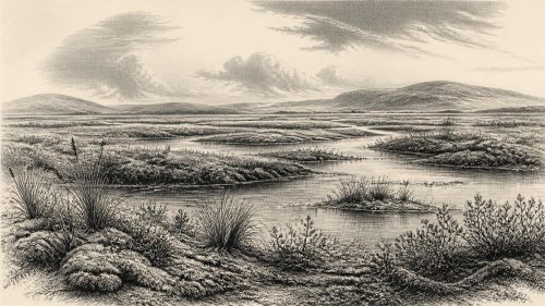
30,719 BCE is a modern filing date within later Marine Isotope Stage 3, not a recoverable Irish year. At Derryvree, County Fermanagh, freshwater sediments dated broadly to this interval lay between glacial tills, proving a local ice-free phase before renewed glaciation. Fossils indicate an open, treeless periglacial wetland of sedges, bogbean, dwarf willow and mountain avens. Ireland’s conditions varied regionally as the British-Irish Ice Sheet expanded. Castlepook Cave, County Cork, preserves reindeer, mammoth, giant deer and hyaena remains, plus a possibly tool-marked reindeer bone. This may indicate human activity, but no settlement, tools, hearths or permanent population are securely demonstrated.
Dateline
The modern label 30,719 BCE is a useful filing point, not a recoverable year in an Irish chronicle. It corresponds roughly to 32,668 years before AD 1950, the conventional “present” used in radiocarbon dating. No person in Ireland recorded a calendar, no excavation has isolated a settlement from that single year, and the chronological margins of Late Pleistocene evidence are measured in centuries or millennia. The responsible subject is therefore Ireland during a broader climatic interval: the later part of Marine Isotope Stage 3 (MIS 3), within the last Ice Age.
The closest Irish environmental archive is at Derryvree, near Maguiresbridge in County Fermanagh. Organic freshwater sediments there produced the conventional radiocarbon determination BIRM-166, 30,500 radiocarbon years BP, with substantial uncertainty. When calibrated, it falls broadly between about 36,900 and 31,700 calibrated years BP. The notional date of 30,719 BCE lies within that wide range. This does not mean that the Derryvree wetland existed unchanged throughout it, or that its plants and animals can be assigned to one particular year. It means that this extraordinary deposit is Ireland’s best direct window onto conditions near this point in deep time.
A Wetland Between Glaciers
In 1969, roadworks cut through a drumlin at Derryvree and revealed a sequence with unusual historical force. Beneath and above the freshwater silts and fine sands lay thick tills: unsorted sediment deposited by glacier ice. Between them was a layer formed when the immediate locality was free enough of ice for water, mud, vegetation and small animal remains to accumulate. A later ice advance sealed that fragile archive. The order of deposits is firmer evidence than any picturesque reconstruction: ice had occupied the district; an ice-free or locally deglaciated interval followed; and ice later returned.
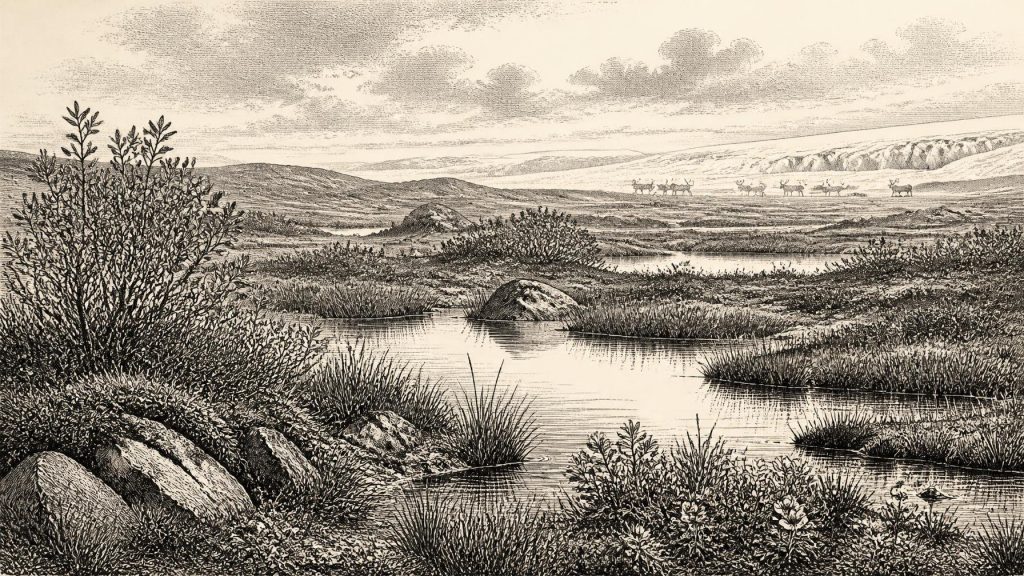
The organic beds contain pollen, plant macrofossils, mosses and invertebrate remains. Together they indicate an open, treeless, periglacial wetland or muskeg, with shallow pools and waterlogged ground rather than woodland or a settled pastoral landscape. Sedges and grasses were important, while the identified plants include bogbean, dwarf willow and mountain avens. These are not merely modern botanical names projected backwards: they are based on identifiable fossil material. Their combination suggests short growing seasons, cold winters and exposed ground, though it cannot give a precise temperature or a weather forecast for 30,719 BCE.
The Derryvree horizon also guards against a simple image of Ireland as either entirely ice-covered or entirely hospitable. A pond or fen could survive locally amid a wider cold-stage landscape. Its sediments show liquid freshwater and plant growth; the tills show that glacier ice was a recurrent and ultimately destructive force. Different parts of the island need not have shared identical conditions. South-west Irish cave records, including speleothem evidence from Crag Cave in County Kerry, demonstrate that moisture, cave-water flow and climatic amelioration could vary across MIS 3. Neither Fermanagh nor Kerry can stand for the whole island.
Approaching an Expanding Ice Sheet
At this date Ireland lay within the climatic world of the British–Irish Ice Sheet, but its exact ice extent remains a research question rather than a settled map. Recent reconstructions begin their detailed treatment around 31,000 years ago, when ice was expanding rapidly in northern sectors of the British–Irish region. They also acknowledge sparse and uneven evidence for earlier growth. The Derryvree organic layer is therefore especially valuable as evidence of ice-free conditions in north-central Ireland before later glaciation, not as proof that all Ireland was open country at once.
Ice-sheet growth altered more than the view. It reshaped drainage, buried soils and wetlands, ground down exposed rock and repeatedly erased the places where camps, tracks or animal deaths might otherwise have survived. This destruction is one reason the Irish record is so discontinuous. Absence of a settlement, hearth or tool scatter cannot automatically prove that people never visited. Equally, erosion cannot be used to turn possibility into fact. The surviving evidence securely documents changing environments and animals; it offers only limited and debated evidence for human presence.
Sea level was lower globally than it is today, but that does not justify drawing a simple, permanent land bridge between Ireland and Britain. Relative shorelines depended on sea level, local crustal depression under ice, changing coastlines and the shape of the Irish Sea basin. The precise routes available to animals or people varied through time. Ireland was geographically connected to the larger north-west European environmental zone, yet whether a particular crossing could be made on foot, across seasonal ice, by watercraft or not at all is not demonstrated by the Derryvree deposit.
Cork’s Cave Fauna
Southern cave assemblages provide a second, more dramatic but more complicated source. Castlepook Cave, near Doneraile in County Cork, has yielded remains of cold-stage mammals including reindeer, woolly mammoth, giant deer and spotted hyaena, alongside other fauna recorded by the Irish Quaternary Fauna Project. These finds establish that, during parts of MIS 3, Ireland could support or receive animals associated with the wider mammoth-steppe and tundra environments of northern Europe. Reindeer in particular fit an open, mobile grazing landscape rather than dense forest.
Caves are not straightforward census sites. Carnivores may drag prey inside; animals can die naturally in fissures; floods, digging and older excavations can mix deposits. Direct radiocarbon reassessment has shown that some southern Irish faunal material is older than formerly assumed, and that cave collections require specimen-by-specimen scrutiny. Accordingly, Castlepook should not be presented as a single momentary herd, a hunting ground used in one season, or a direct illustration of Fermanagh on the same day. Its great value is regional: it confirms that Pleistocene Ireland contained a varied animal world during the broad interval surrounding the date.
The Human Question
The most consequential possible evidence for people is a reindeer bone from Castlepook reported as bearing a deep modification interpreted as a stone-tool cut or chop mark. Public discussion has associated it with an age of around 33,000 years. If that interpretation is sustained by full analysis and independent scrutiny, it would indicate that Upper Palaeolithic hunter-gatherers reached Ireland far earlier than the formerly accepted record of post-glacial settlement. It would be an important sign of human activity, not evidence for an established Ice Age population.
One modified bone cannot demonstrate a village, recurring seasonal base, family group, language community or route of migration. No securely associated stone-tool assemblage, hearth, dwelling, burial, occupation surface or stratified food waste of comparable age has been identified at Castlepook. It is also possible that a bone was moved within a cave after the animal’s death. The best wording is therefore deliberately narrow: people may have processed a reindeer in Ireland during MIS 3; permanent residence and the scale of any visit remain unknown.
This limitation determines what can responsibly be said about political affairs, conflict and diplomacy. There are no named communities, rulers, territories, alliances, raids or negotiations. There is no evidence for organised warfare, and no material basis for assigning religious rites or formal learning to this date. A hunter-gatherer visit, if confirmed, would imply knowledge, cooperation and practical skill: reading animal movements, producing sharp stone edges, sharing food and navigating a severe landscape. But those are archaeological inferences from the wider Upper Palaeolithic world, not documented institutions in Ireland.
Life Without an Annual Chronicle
The economic picture is likewise ecological rather than political. The Derryvree plants point to seasonal productivity in sedge-rich, mossy wet ground; the cave fauna point to mobile large mammals and predators. For any humans present, meat, fat, hides, sinew, bone and antler would have been valuable resources, as elsewhere in Ice Age Europe. Yet no Irish site of this age provides the tools, structures or refuse needed to reconstruct a local economy. There is no evidence for farming, herding, pottery, metalworking, long-distance exchange networks or permanent built settlement.
Culture survives here chiefly as the culture of evidence: pollen grains, seeds, beetle fragments, cave bones, limestone passages and glacier-laid sediments. Their survival is accidental and uneven. Derryvree’s bogbean seed says something secure about a freshwater plant; it does not reveal who saw it, whether anyone named it, or what stories people may have told. Castlepook’s fauna shows that animals entered the Irish landscape; it does not tell us whether people followed them regularly. The distinction between evidence and interpretation is not a weakness. It is what allows this very early chapter of Irish history to be both vivid and honest.
Around 30,719 BCE, then, Ireland was not a country of kingdoms or monuments but a changing Ice Age terrain. In Fermanagh, at some point within a wide calibrated interval, shallow freshwater and tundra vegetation occupied ground between glacial advances. Across the island, environments varied with ice, water, relief and season. In Cork, cave deposits preserve traces of a cold-adapted fauna and a tantalising possible human intervention. What can be securely recovered is a landscape in motion: briefly green at the margins of ice, inhabited by hardy plants and roaming mammals, then vulnerable to the next advance that would bury much of its history.
Primary Sources
- A Middle Midlandian Freshwater Series at Derryvree, Maguiresbridge, County Fermanagh, Northern Ireland
- A reconsideration of the radiocarbon dating of the Marine Isotope Stage 3 fauna from southern Ireland
- The Irish Quaternary Fauna Project
- Growth and retreat of the last British–Irish Ice Sheet, 31,000 to 15,000 years ago: the BRITICE-CHRONO reconstruction
- The timing and magnitude of the British–Irish Ice Sheet between Marine Isotope Stages 5d and 2: implications for glacio-isostatic adjustment, high relative sea levels and ‘giant erratic’ emplacement
- Episodic speleothem deposition tracks the terrestrial impact of millennial-scale last glacial climate variability in SW Ireland
- New insights on the fauna of Ireland’s Younger Dryas and Early Holocene from Alice & Gwendoline Cave
- The IntCal20 Northern Hemisphere Radiocarbon Age Calibration Curve (0–55 cal kBP)
- Figure 6: The Subdivision of the Quaternary Period in Ireland
- BSBI: Menyanthes trifoliata
- BSBI: Salix herbacea
- BSBI: Dryas octopetala
- 2022:564 – Castlepook Cave, Castlepook South, Cork
- Occurrence of mammalia relicts at site Castlepook Cave
- Growth and Retreat of the Last British-Irish Ice Sheet, 31,000 to 15,000 Years Ago: the BRITICE-CHRONO Reconstruction
- Dating Constraints on the Last British-Irish Ice Sheet: a Map and Database
- Radiocarbon Constraints on the Age of the Maximum Advance of the British–Irish Ice Sheet in the Celtic Sea
- Maximum Extent and Dynamic Behaviour of the Last British–Irish Ice Sheet West of Ireland
- Exploring Controls of the Early and Stepped Deglaciation on the Western Margin of the British-Irish Ice Sheet
- Irish Caves Database