Maguirebridge’s Freshwater Bed30580 BCE
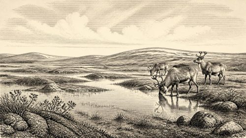
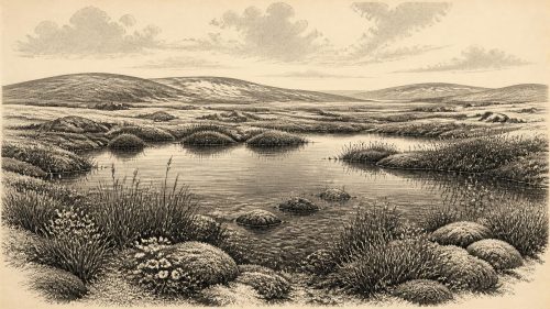
Although 30,580 BCE cannot denote a recorded Irish event, it lies within a later Pleistocene interval documented by deposits and fauna. At Derryvree, County Fermanagh, freshwater organic sediments between glacial tills, radiocarbon dated broadly to 36,900–31,700 calibrated BP, record an ice-free phase of tundra-steppe, wetlands and severe periglacial conditions. Castlepook Cave, County Cork, preserves diverse cold-stage mammals, including mammoth, reindeer, giant deer, predators and lemmings, accumulated over extended periods. A possibly cut-marked reindeer bone suggests, but cannot prove, Upper Palaeolithic human activity. No evidence establishes settlement, institutions or economy; changing ice, habitats and animal movements define this uncertain Irish landscape.
Dateline
The label “30,580 BCE” is useful for a year-by-year chronology, but it must not be mistaken for a date that can be observed at annual resolution in Ireland’s archaeological record. No writing, calendar, settlement sequence or historical tradition can identify an Irish event in this particular year. In scientific terms, the nominal year falls about 32,529 years before the 1950 reference point used for “BP” dating, during the later Pleistocene and broadly within Marine Isotope Stage 3. The responsible evidence consists instead of deposits and bones dated across long ranges. It can describe an Ice Age Ireland of cold landscapes, changing ice margins and mobile animals; it cannot furnish an annal of named people or happenings.
A Date Range, Not a Moment
The best local environmental window is at Derryvree, near Maguiresbridge in County Fermanagh. Roadworks in 1969 cut through a drumlin and revealed an exceptional sequence: a lower layer of glacial till, freshwater silts and fine sands with organic material, and a second till above. This order matters. Moving ice had first deposited debris; then, for an interval, water, sediment and living things accumulated in a hollow; later glacial action buried that record. Organic material from the middle deposit, laboratory determination BIRM-166, produced a conventional radiocarbon age of 30,500 years BP, with a sizeable uncertainty.
Radiocarbon years are not calendar years. Because atmospheric carbon-14 concentrations have varied, laboratory results must be calibrated against independently dated records. Published discussion places the Derryvree age broadly around 36,900–31,700 calibrated years BP. The notional date of 30,580 BCE therefore falls within the wider chronological world represented by the deposit, but it is not the date of a particular layer, season or episode at Derryvree. Nor can the sediment be used to claim that all of Ireland looked alike at one time. It is a securely relevant local archive, not a time machine or a national map.
Water Between the Ice Advances
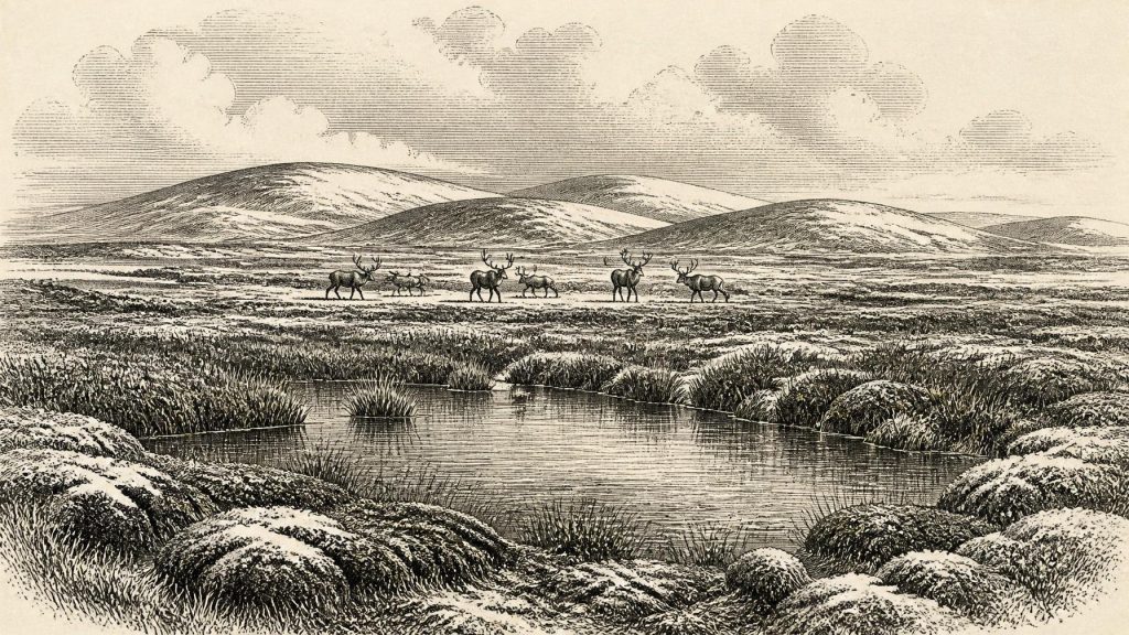
Derryvree’s organic freshwater bed gives unusually direct evidence for an ice-free interval in south Fermanagh before the fullest expansion of the last British–Irish Ice Sheet. The fossil assemblage points to severe periglacial conditions: a landscape shaped by frost, prolonged winter cold and short summers, rather than the temperate, wooded island familiar today. Freshwater silts and fine sands suggest a pond, slow water or marshy basin. Moss-rich mud, pollen, plant macrofossils and small animal remains preserve traces of a wet habitat that existed long enough for organic matter to gather.
The vegetation was predominantly open and treeless. Herbaceous pollen, cold-adapted mosses and plant remains support an interpretation of tundra or tundra-steppe conditions, with wet hollows set among sparsely vegetated ground. Sedges and mosses could thrive around shallow water even where drier slopes offered only patchy cover. This was not necessarily an empty, uniform white plain. A single locality might have included exposed mineral ground, frost-heaved soils, snowbeds, damp margins and open water, each supporting a different small community of plants. Yet pollen is not a simple census: wind can carry grains far from their source, preservation is uneven, and a rare pine or hazel grain does not demonstrate a local woodland. The robust conclusion rests on the whole assemblage, which indicates open cold-country vegetation rather than forest.
An Island in a Changing Ice World
Ireland’s geography at this depth of time was not fixed. Global sea levels were lower than today because immense quantities of water were stored in northern ice sheets, while local land levels and coastlines were affected by the weight and movement of ice. The Irish Sea basin and its surrounding shelves were being transformed by glacial processes. Reconstructions disagree in detail about land connections and routes at different stages of the last glacial cycle. It would therefore be rash to describe a simple, permanent land bridge or to prescribe a particular path into Ireland around 30,580 BCE.
What can be said is that the island lay within a wider north-west European zone whose accessibility changed with sea level, ice extent and exposed shelf land. The Derryvree sequence demonstrates that north-central Ireland was not continuously buried beneath ice during its dated interval. It does not prove that every coast, mountain or lowland was ice-free simultaneously. Subsequent glaciers were powerful agents of erasure: they scoured surfaces, mixed sediments and sealed older landscapes beneath till. That destruction is one reason why the surviving evidence is so geographically uneven and why Irish reconstructions depend heavily on a handful of caves, road cuttings and buried deposits.
Castlepook’s Mammal Landscape
County Cork provides the other great body of evidence relevant to this broad period. Castlepook Cave, near Doneraile and sometimes called Mammoth Cave, yielded Ireland’s richest assemblage of pre-Last Glacial Maximum vertebrate remains. The cave deposits and their early excavations have complicated histories, and their animals did not necessarily live together or die in a single episode. Nevertheless, direct dates and species identifications show that Ireland intermittently supported a striking cold-stage fauna during Marine Isotope Stage 3.
Its known inhabitants included woolly mammoth, reindeer, giant deer, brown bear, wolf, Arctic fox, lemmings and spotted hyaena. Such a list should not be converted into an illustrated parade marching across Cork on one day in 30,580 BCE. Individual remains come from different parts of the cave system and can span millennia. The assemblage does, however, establish that suitable habitats existed in Ireland for sizeable grazing animals and their predators or scavengers during portions of the wider interval. Reindeer and giant deer imply available forage; mammoth indicates the possibility of extensive open country; Arctic foxes and lemmings reinforce the evidence for cold conditions. Hyaena activity may also help explain why certain bones accumulated in caves, rather than representing a human hunting camp.
The Reindeer Bone Question
The most intriguing possible human evidence is also from Castlepook: a reindeer femur bearing a deep linear mark interpreted by zooarchaeologist Ruth Carden as damage made by a sharp stone implement during butchery. Public heritage accounts have associated the bone with an age of roughly 33,000 years. If both the identification of the mark and its chronological relationship to the bone are sustained, it would point to a human encounter with a reindeer carcass in Ireland during the Upper Palaeolithic, far earlier than the island’s well-established post-glacial settlement record.
That conditional language is essential. A modified bone is not a settlement, and a radiocarbon result dates the bone rather than the instant a surface mark was made. Castlepook has not provided a securely associated hearth, stone-tool assemblage, house floor, burial, art panel or repeated butchered animal concentration of this age. Nor does one possible cut mark reveal whether people arrived by boat, crossed exposed terrain, stayed for hours or weeks, travelled in a group of two or twenty, or returned in later generations. The evidence supports a question of possible human activity, not a story of permanent colonisation.
No Polities, No Proven Communities
Accordingly, there is no evidence from Ireland around this point for political authority, territories, diplomacy, warfare, leaders, law or collective institutions. It would be equally unfounded to assign a language, ancestry, ethnic name or religious system to any possible visitors. No shrine, grave, figurative image, musical instrument or ritual deposit can be tied to this interval on the island. Silence on these subjects is not an omission in the record to be repaired with imagination; it is a defining fact of the record.
If people did reach Ireland in this broader period, comparison with Upper Palaeolithic groups elsewhere in north-west Europe suggests highly mobile foraging lifeways and expertise in stone technology, animal behaviour and seasonal landscapes. But that is an interpretation from neighbouring regions, not a demonstrated Irish social profile. A sharp implement capable of making a butchery cut would imply technical knowledge; it does not supply an Irish toolkit, camp plan or tradition of teaching. The safest description of everyday life remains environmental: cold, exposure, difficult travel, limited daylight in winter and a landscape in which water, shelter and animal movements would have mattered profoundly.
Economy Before Settlement
There is likewise no direct evidence for farming, herding, pottery, metalworking, exchange networks or permanent settlement in Ireland at 30,580 BCE. The economy visible in the evidence is ecological rather than human: wetland plants growing in a Fermanagh basin; herbivores ranging through available open habitats; carnivores and scavengers using caves or exploiting carcasses; ice repeatedly altering the ground on which all depended. Any human processing of reindeer meat, if the Castlepook interpretation is confirmed, would represent a brief episode of hunting or scavenging rather than proof of a resident economy.
The great historical development was therefore not political change but environmental instability. Derryvree records living freshwater conditions caught between glacial deposits. Castlepook preserves animals adapted to, or able to endure, a cold and open world. Together they show that Pleistocene Ireland was neither permanently frozen nor securely settled: it was a changing Atlantic-edge landscape, intermittently accessible to fauna and perhaps to people, before later ice reshaped much of the evidence. For this nominal year, that is the most precise and most compelling history the sources allow.
Primary Sources
- A Middle Midlandian Freshwater Series at Derryvree, Maguiresbridge, County Fermanagh, Northern Ireland
- Palaeoecology: The Middle Midlandian Palaeoenvironment of South Fermanagh
- Figure 6: The Subdivision of the Quaternary Period in Ireland
- Exploring Controls of the Early and Stepped Deglaciation on the Western Margin of the British-Irish Ice Sheet
- Trimlines, Blockfields and the Vertical Extent of the Last Ice Sheet in Southern Ireland
- Pattern and Timing of Retreat of the Last British-Irish Ice Sheet
- The Irish Quaternary Fauna Project
- A Reconsideration of the Radiocarbon Dating of the Marine Isotope Stage 3 Fauna from Southern Ireland
- The Exploration of Castlepook Cave, County Cork
- Castlepook Cave: County Geological Site Report
- Occurrence of Mammalia Relicts at Site Castlepook Cave
- Castlepook Cave, Co. Cork: 2022 Excavation Report
- Heritage Artefacts of County Cork
- Archaeological Heritage of County Cork
- Quaternary Site Descriptions
- New Insights on the Fauna of Ireland’s Younger Dryas and Early Holocene from Alice & Gwendoline Cave
- First Evidence of a Late Upper Palaeolithic Human Presence in Ireland
- The Archaeology of Caves in Ireland
- Ireland: Submerged Prehistoric Sites and Landscapes
- The Island of Ireland: Drowning the Myth of an Irish Land-Bridge?
- The Problem of a Late Quaternary Landbridge Between Britain and Ireland
- A Critical Review and Re-Investigation of the Pleistocene Deposits Between Cranfield Point and Kilkeel, Northern Ireland
- Irish Quaternary Association: Outreach and Education Resources
- Palaeolithic Ireland: New Evidence Emerges from the Emerald Isle